

Limestone escarpment near World’s End
We went in search of the World’s End! At least that what the map called it, and the British Ordnance Survey maps are respected world-wide for their accuracy and information. So, as we approached World’s End, why was our first view of the Dolomites?

The Welsh Dolomites ….?
…. or the Pennine Moors?
Well, perhaps a comparison with the Dolomites is a tad fanciful, but I hadn’t expected to see limestone cliffs like these soaring above a Welsh valley, nor did I expect a moor reminiscent of the Mid-Pennines when we got out on the ground.
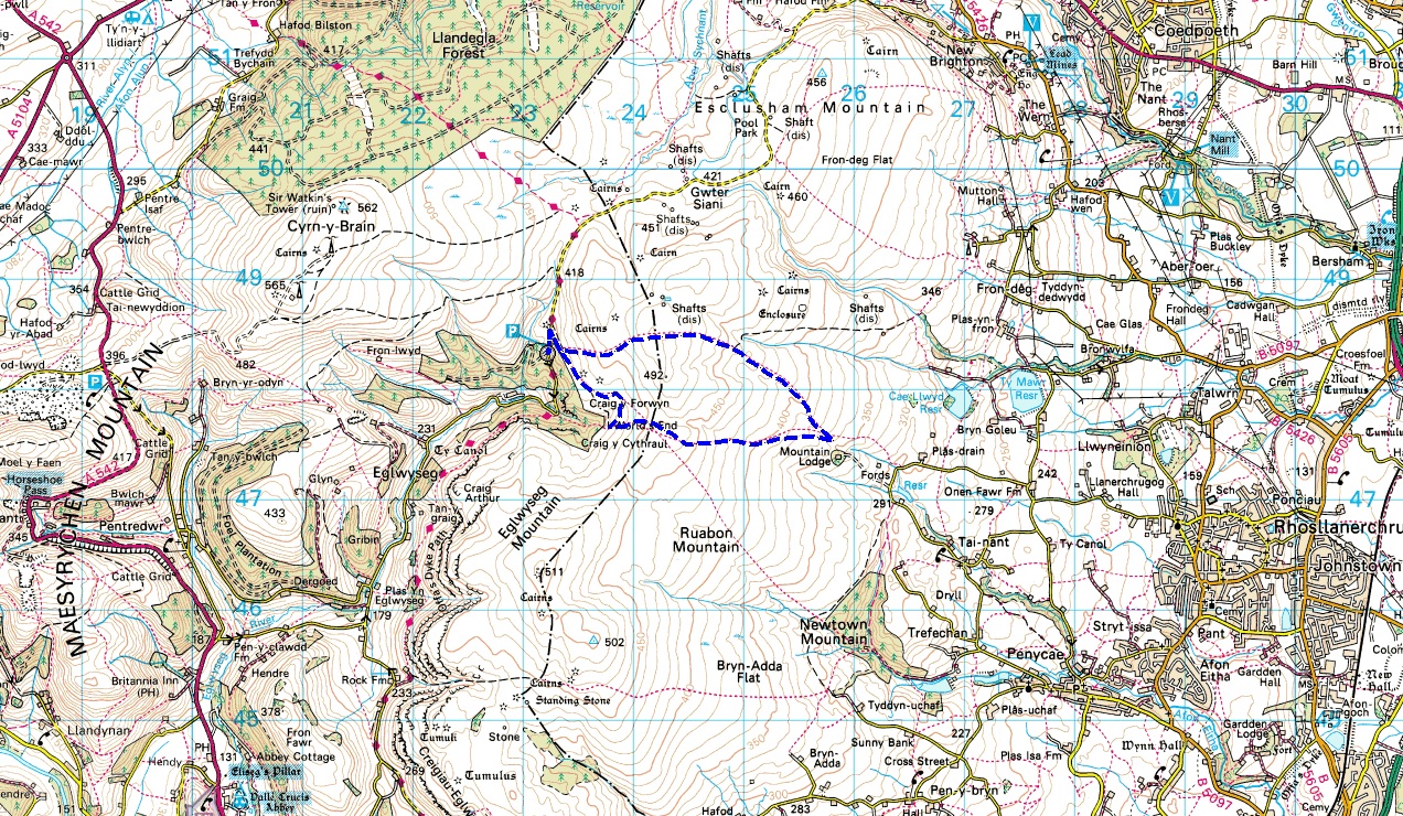
Our route from World’s End (click for a close-up view)
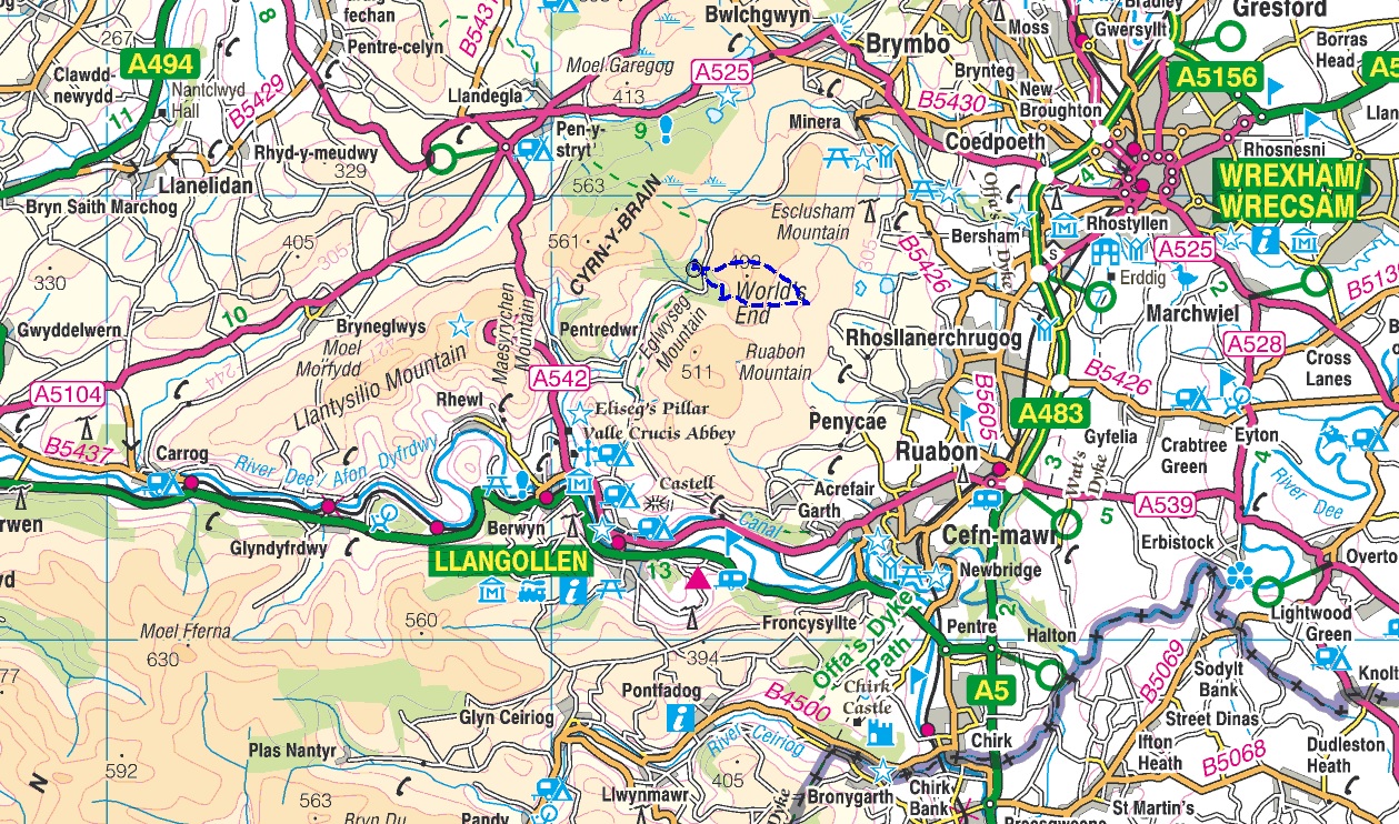
Where to find the route – between Llangollen and Wrexham
I had never been here before, in fact before we moved to Wales 1½ years ago I hadn’t even heard of these small hills nestling between Llangollen and Wrexham, and I’m prepared to bet that not many reading this will know them either.

The limestone cliffs of Eglwyseg Mountain
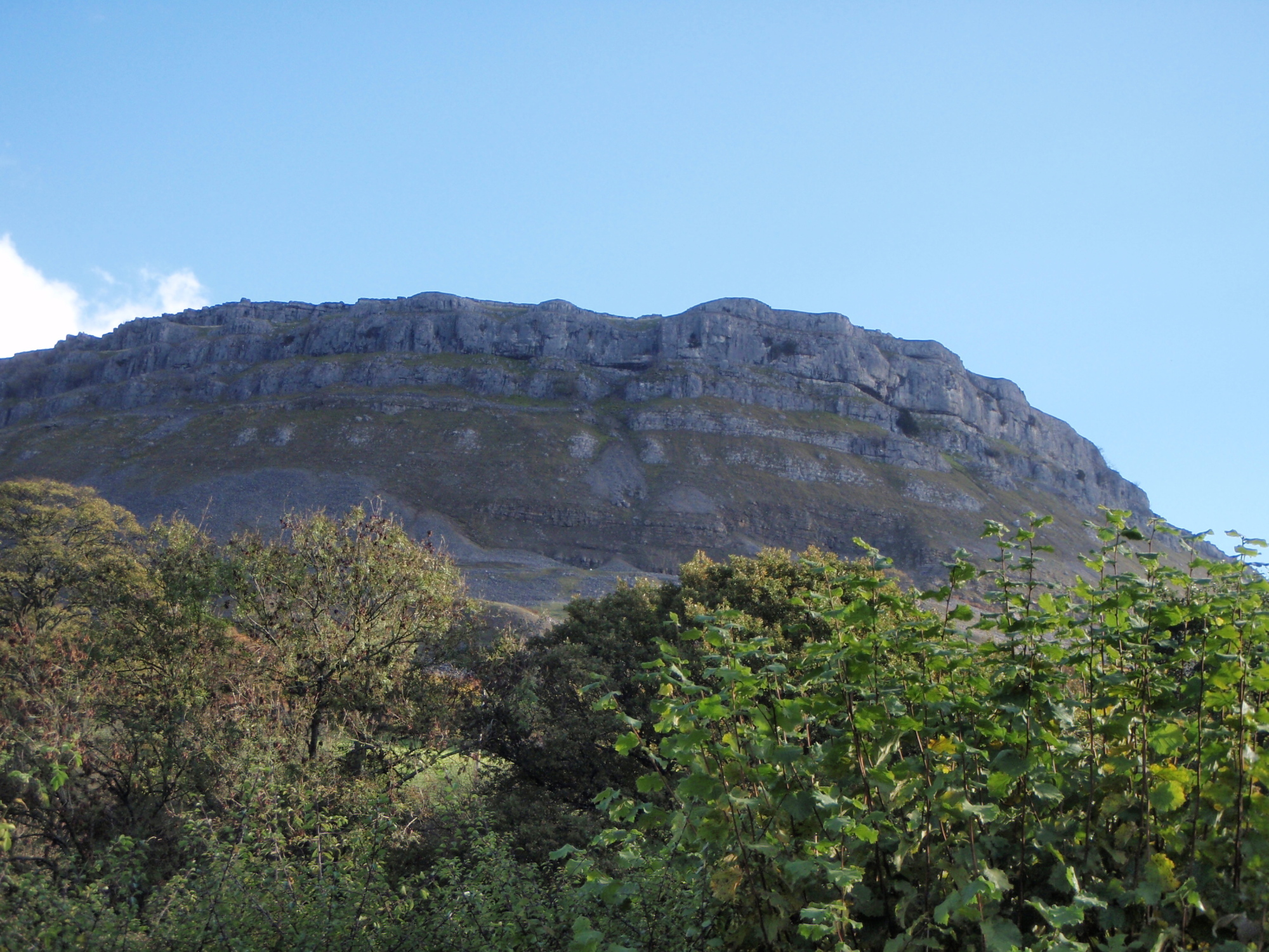
More limestone cliffs

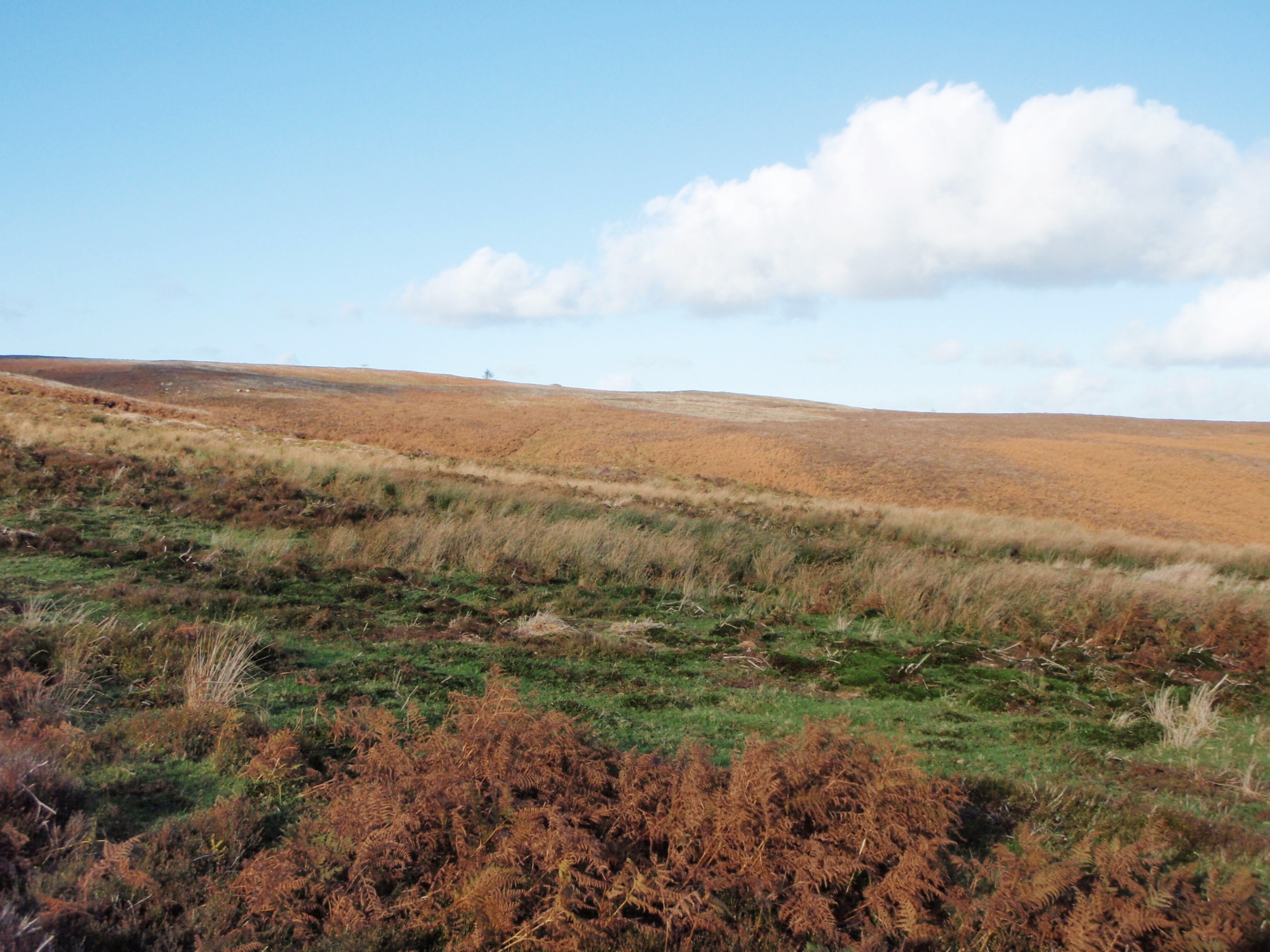
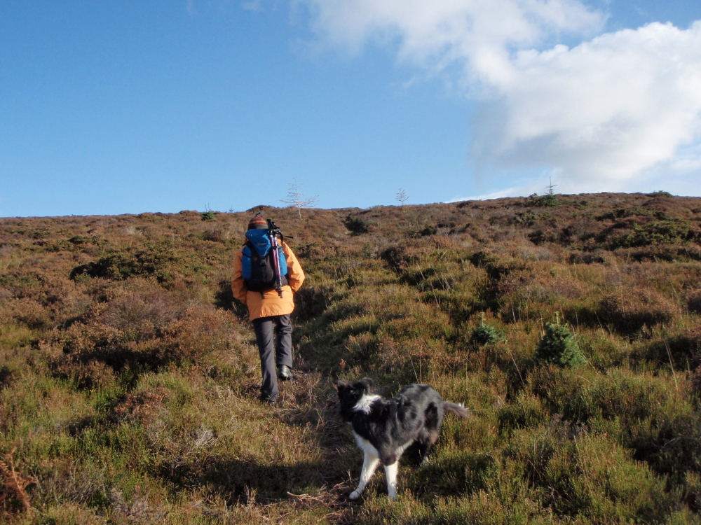
On the moor, looking towards World’s End ….

…. and looking towards Llantysilio Mountain
The limestone was a bit of a surprise, but shouldn’t have been – limestone outcrops abound on the Welsh side of the border with England, but these crags had an air of grandeur about them, enough to make me stop the car for a photo or two. Heading up over the moor we had great autumnal views towards World’s End and Llantysilio Mountain (see post #122)
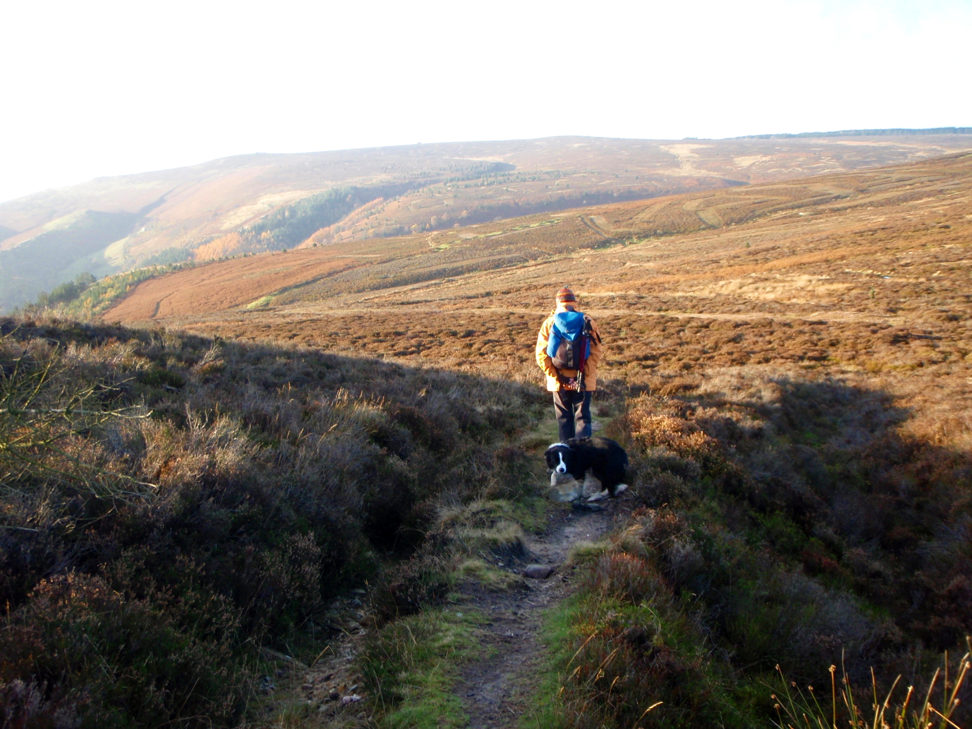
Gaining height on the moor ….

…. only to lose it again

‘Mountain Lodge’ – time to turn back
This was never intended to be a long ‘hill day’ – in the event it was no more than an extended dog walk. A short height gain was followed by the inevitable loss of altitude towards ‘Mountain Lodge’, where it was time to head back. The moor was reminiscent of the Mid-Pennines, in both appearance and in the bogs, but we managed to keep reasonably dry.

Stone cross on the return route

Another view of the stone cross
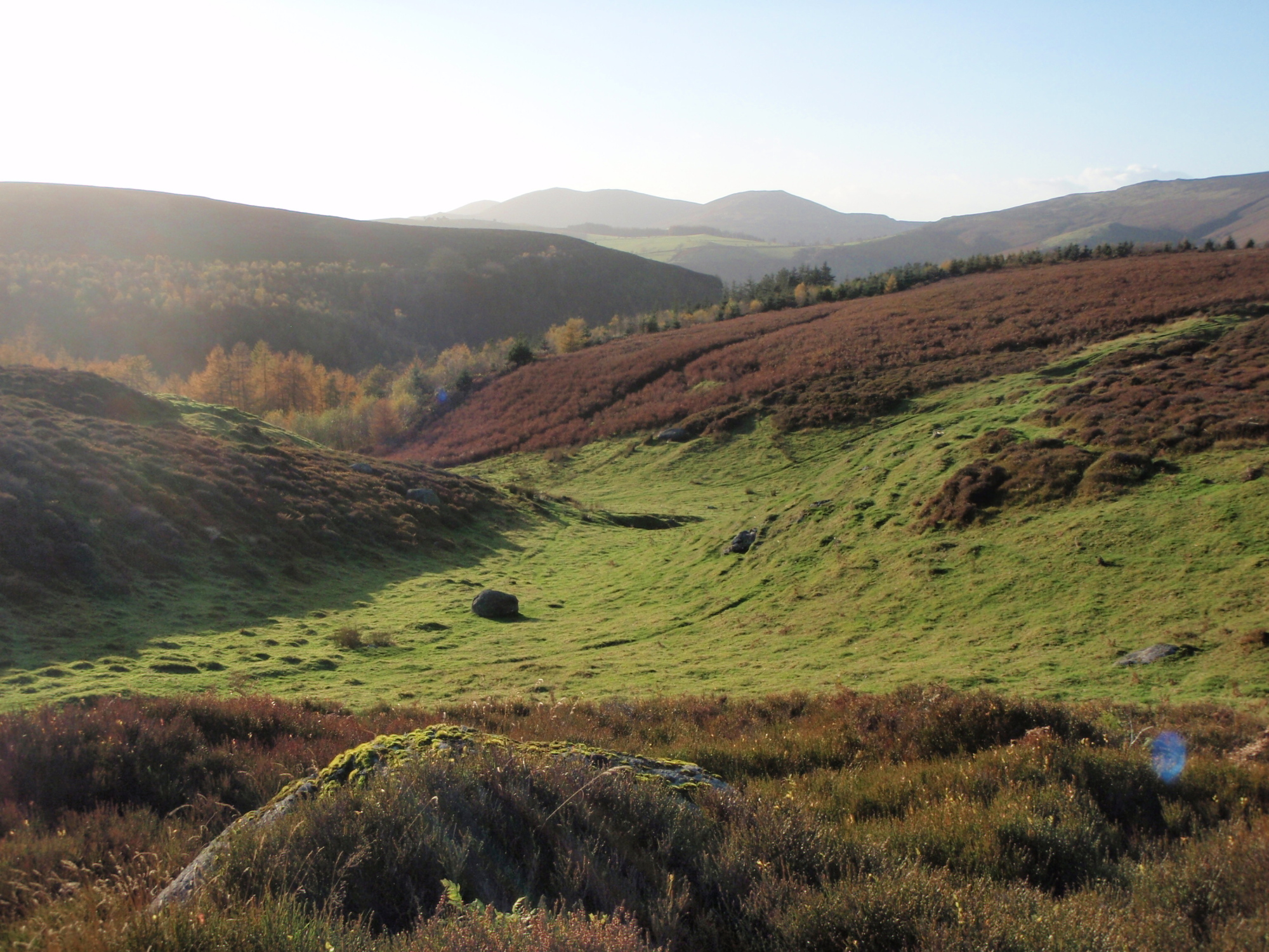
Heading down towards World’s End
Start of the gully that becomes ‘World’s End’
On the return we bumped into a large cross formed out of stones, with no clues as to who made it or why, but the occasional remains of old mines near here probably hold a clue. Then, it was downhill all the way, crossing over the head of the small valley that becomes World’s End. We left that descent for another day – we’ll be back for another look at these surprising little hills.

Heading back
Text and images © Paul Shorrock


I did a long walk along the top of those cliffs once when I was on a club meet at Llangollen Youth Hostel – I think I started off up Castell Dinas Bran but I’d have to study the map. I was in deep heartbreak at the time – almost suicidal – but the beautiful hills there soothed me for the day. A stunning area. Don’t think I’ve been down to World’s End though – doesn’t the name come from something similar-sounding in Welsh? I’m not sure…
LikeLike
Not sure where the name comes from Carol, but I don’t think it’s mangled, anglicised Welsh. The re-entrant that forms World’s End looks pretty steep on the map, going by the contours, so I guess it looks as if you are going to step off the end of the world!
That’s my theory anyway. I’ll have to go back and check out the re-entrant – the Offa’s Dyke Path cuts right along the bottom of it.
Glad to hear that these hills brought a bit of solace when you needed it.
LikeLike
that’s what hills are for 🙂 amongst other things of course
LikeLike
How true 🙂
Just checked out the Welsh name for World’s End – it’s ‘Pen Draw’r Byd’ which translates (very roughly!!) as ‘The top of the beyond world’ or ‘World’s End’!
LikeLike
Very dramatic the Welsh! 😉
LikeLike
Certainly looks like the mid Pennines Paul, and maybe the cross is the site of a downed airplane? An interesting detective story (maybe Google would know)..
LikeLike
Very Mid-Pennines SP, and quite attractive in autumn colours.
Looking at JimmyKranke’s reply here, it looks as though an aircraft crash site may be one answer – see my comments to him.
LikeLike
Airplane Crash in WW2. I’ve been up there in the past with friends who always comment on it. I believe they also used to light fires up there to confuse german bombers en-route to Liverpool. Quick google search:
“The stone cross that marks the scene of a WW2 plane crash (a Bristol Beaufighter with a Polish pilot). War records show, only too clearly, the grim death toll of young inexperienced pilots on this mountain, with four Spitfires and nine other crashes. Allied wartime activity on the mountain included building the World’s End – Minera road by American servicemen and the installation of searchlights.”
LikeLike
Thanks for that JK – I’ve checked the grid reference from ‘Aircraft Wrecks – the Walker’s Guide’, and the crash site position is about 6-700 metres away from the cross, but in the absence of any more info I’ll go along with your idea.
We found several ‘crater like’ holes on the moor, bearing out your decoy theory – the other site used for a similar purpose in WW2 was at Halkyn (Helygain) in Flintshire. Must have been ‘exciting’ living next to it, to say the least 😀
LikeLike
In fact one local song sung in the pubs starts ” There was 40 German Bombers over Rhos, There was 40 German Bombers over Rhos…….”Lol
LikeLike
Which pub is that JK? Good to see a bit of history hanging on there!
LikeLike
That looks like a really beautiful place to hike! As I looked at the photos, they reminded me of our state of Montana. There are many limestone columns and many colorful layers of earth to check out in that state. Thanks for sharing!
LikeLike
Thanks for that Ilex – one thing about living in a small country like ours is that the beauty often gets compressed into a small area, but none the worse for that!
Liked the Border Collie pic on your recent post – more please 🙂
Didn’t know you had Spam in the US – looks like your husband does a good breakfast 🙂
LikeLike
Fascinating set of comments on this rather photogenic little hill. Another place I’ve never heard of although I’ve driven through on the A5 enough times over the years. This doesn’t sound an obvious place for planes to be in WW2 but history says they were here.
LikeLike
Thanks for that Andy. The book I mention above records over 90 aircraft crashes in Wales, most of these being WW2 – the Cadair Berwyn area alone has 5 crash sites!
Sadly there were few survivors in most of the crashes, though one of the Berwyn accidents had a poignant outcome – the French pilot of a Spitfire survived the crash only to die of exposure before being rescued. A Lysander aircraft sent to search for the Spitfire also crashed shortly after locating the first accident, killing the pilot. Sad times.
LikeLike
It reminds me very much of Pen-y-Ghent. Am I allowed to include links? Photo taken in Feb this year.
http://www.ipernity.com/doc/camerabag/22211433
The colours on your photos are stunning – is it my imagination or is the autumn colour lasting longer than usual? Even the grass on the fells here is bright and beautiful.
LikeLike
We still have quite a few trees with leaves, but there’s a cold wind today that will probably finish ’em off – here comes winter!
LikeLike
Nice post Paul… it’s quite fascinating the limestone country around there. Llantisilio Mountain and the Offa’s Dyke path are worth a go too.
LikeLike
Cheers Pete – lots to go at, so I’m in no danger of getting bored with this part of the world.
LikeLike
Pingback: #147 – Ring out the old … 2013 hill memories | Paul Shorrock – One Man's Mountains AKA One Pillock's Hillocks
Pingback: #157 – Cyrn y Brain on the Ruabon Moors | Paul Shorrock – One Man's Mountains AKA One Pillock's Hillocks
Paul, stone cross on Rhos Mountain is said to be a memorial to pilots who died during WW2.
LikeLike
Thanks for the update David ☺️
LikeLike
Hi just dropped on your article. The stone cross was built for a polish pilot that crashed nearby during the war. When we were children it was custom to place a rock on the cross out of respect.
Towards Cae Llwyd reservoir there is an observational post used by the home guard.
The song mentioned :
There were 40 German bombers over Rhos, (repeated several times)
And RAF from Ponciau shot them down, (repeated)
The miners from the Hafod buried them, (repeated)
And the Vicar from Bethania said a prayer, (repeated)
And the Tai Nant choir sang a hymn. (Sung like a Welsh choir…including harmonies- depending on how much alcahol consumed.)
LikeLike
Thanks for that Shaun, great to hear a bit of local history!
LikeLike
Pingback: #333 – The Eglwyseg escarpment – a day amongst the limestone | Paul Shorrock – One Man's Mountains AKA One Pillock's Hillocks