

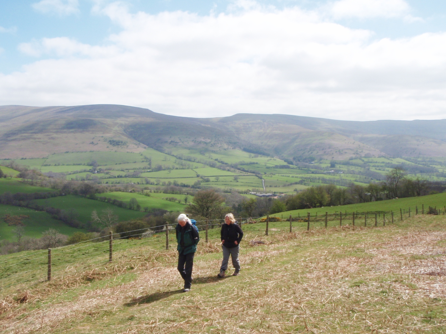
Descending Mynydd Troed to the southeast
Mynydd Troed – Between the Brecon Beacons and the Black Mountains
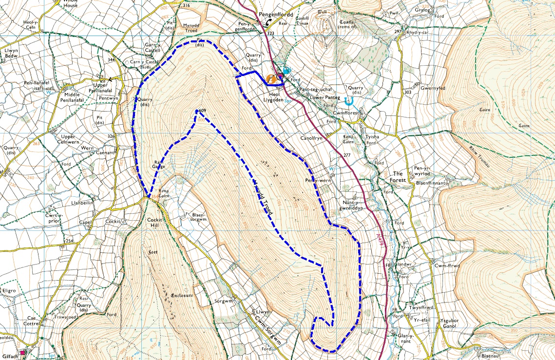
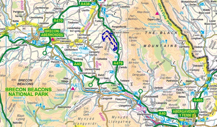
Our Mynydd Troed route
Living on the edge of the Clwydian Hills in North East Wales, with the glories of Snowdonia just an hours drive away, you might wonder that we bother going to other mountain areas in Wales. The thing is, the country is so hilly that a trip anywhere involves new mountain scenery, so a visit to friends in Mid-Wales usually turns up some new delight.

Setting out for Mynydd Troed (‘Foot Mountain’)

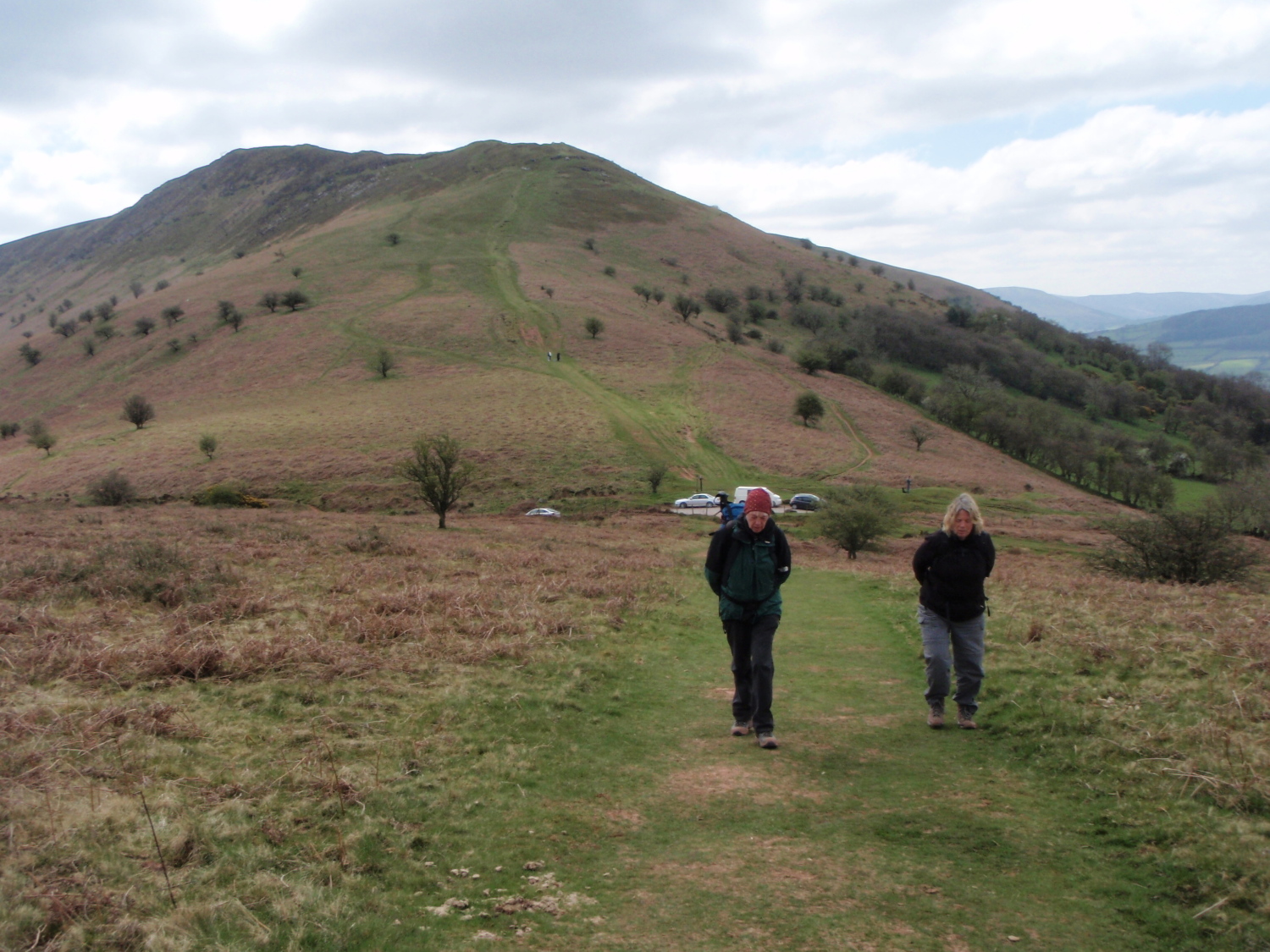
Looking up towards our summit – Mynydd Troed, looking nothing like a foot from this angle
Our friend Barbara usually chucks a map at me and suggests that I pick the route for the day, but on our last trip she already had the hill in mind, Mynydd Troed, which translates as ‘Foot Mountain’ – view it from a distance and the reason for the name becomes obvious. Barbara drives past the hill on a regular basis, and wondered what it was like on top – there was only one way to find out!
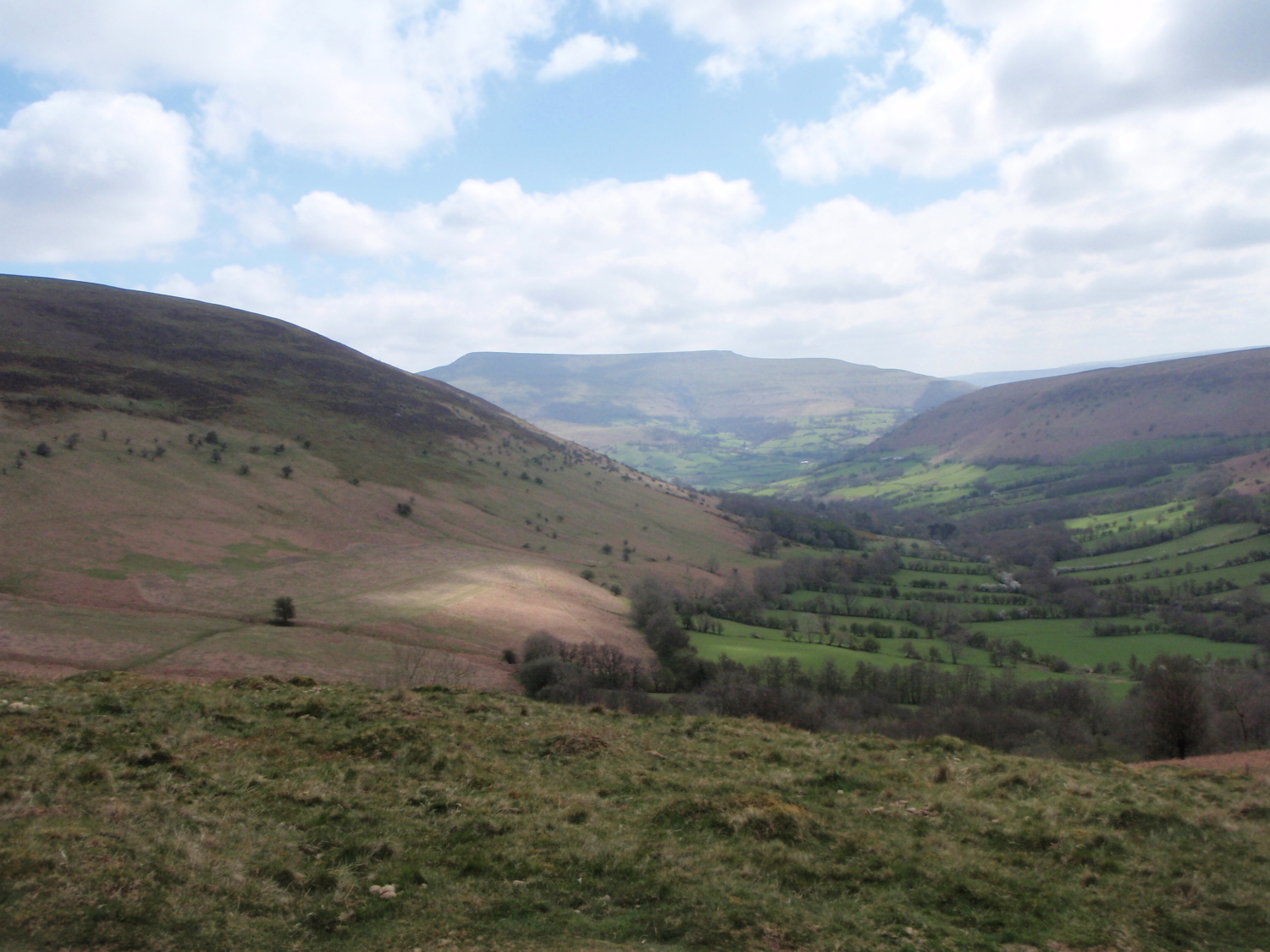
The hills of Y Mynyddoedd Duon (The Black Mountains) making a backdrop to the east

The northern edge of Y Mynyddoedd Duon

The Brecon Beacons in the distance to the west
Mynydd Troed sits neatly between Y Mynyddoedd Duon (The Black Mountains) to the east, and the Brecon Beacons to the west, and the hill stands alone at a height of 609 metres, which translates as 1998ft. In the classic guide to the mountains of England and Wales written by John and Anne Nuttall, the definition of a mountain is something higher than 2000ft (610 metres) above sea level – Mynydd Troed fails to make the grade by one metre!

The South West Ridge of Mynydd Troed
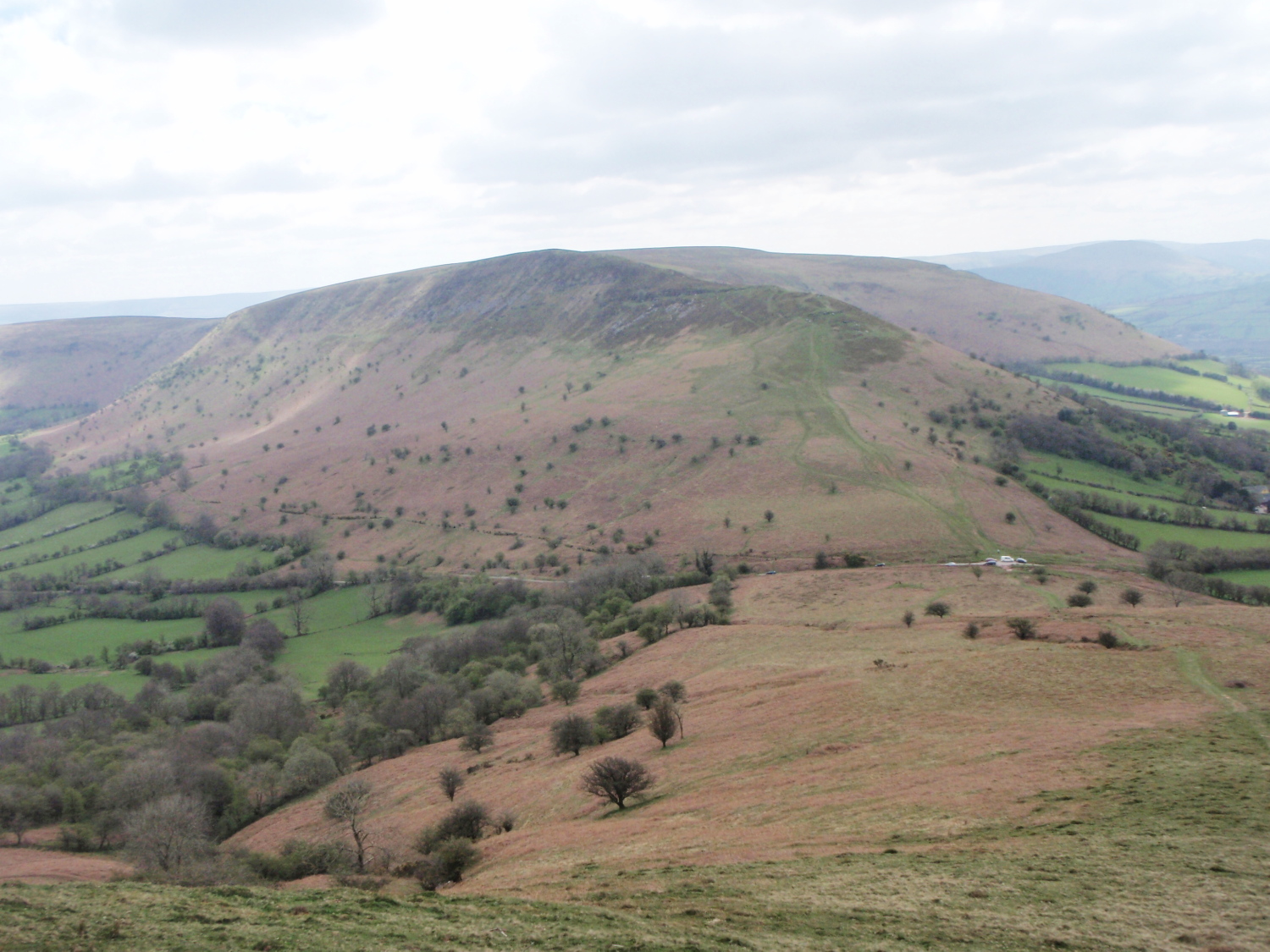
Looking back to Mynydd Llangorse behind

Llangorse Lake with the Brecon Beacons beyond
The valley of Cwm Sorgwm with Pen Allt Mawr beyond
The problem is, nobody seems to have told Mynydd Troed that it isn’t a mountain, so it puts on a good act to convince people otherwise. We started our trip from the Castle Inn near Pengenffordd, where the landlord offers car parking for £1, with the money going to charity. Looking at the map, the most interesting way up the hill seemed to be via the South-West Ridge – as the pub is on the east side of the hill, we started out by walking round Mynydd Troed to the other side.
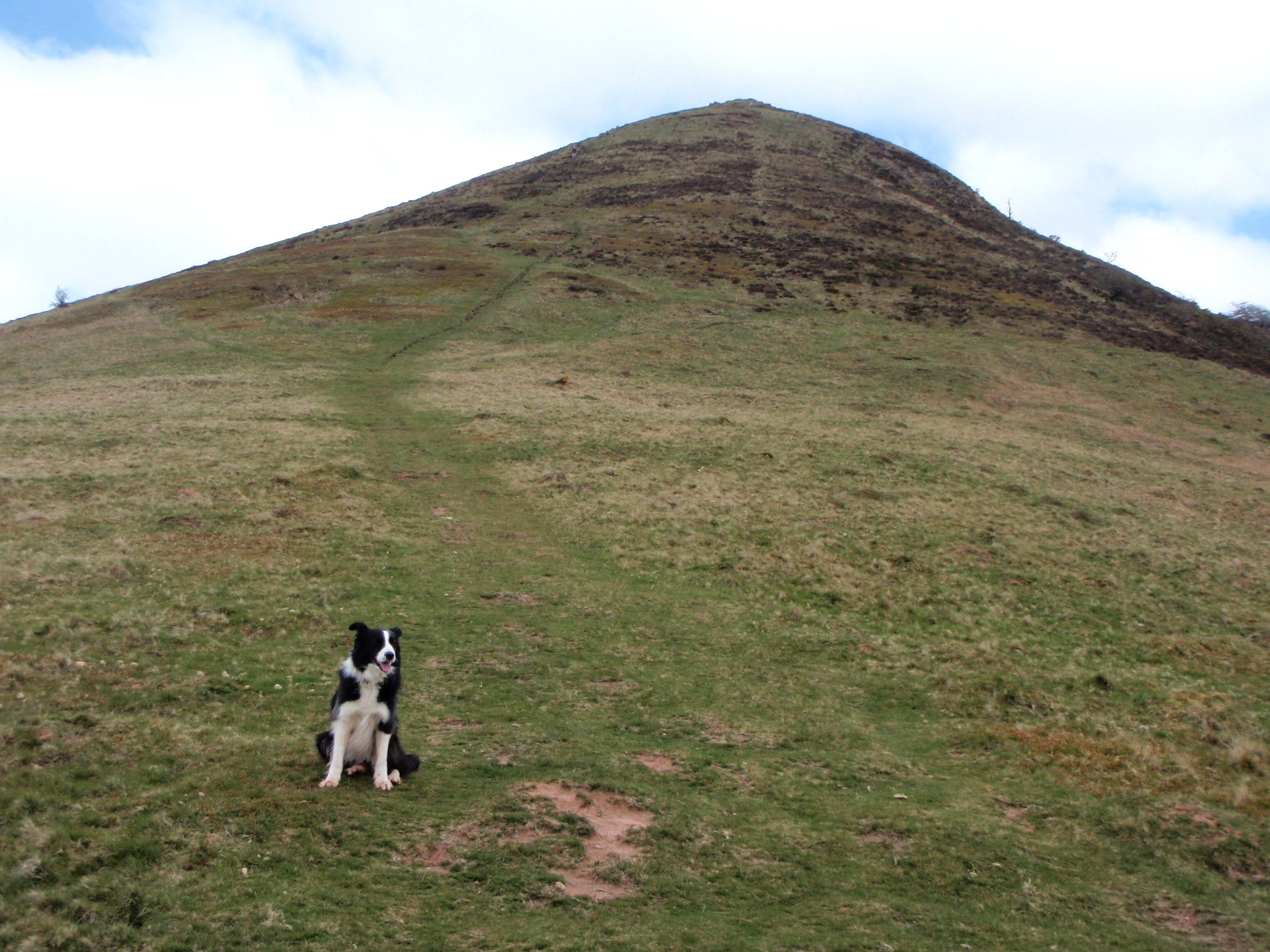
Impatient Border Collie ‘Mist’ can’t wait to get to the top!
Mynydd Llangorse beckoning, but we are going the other way

Contouring round below the summit

Looking towards the South East Ridge

Just below the summit
‘South West Ridge’ sounds rather grand, with images of rocky precipices – not in this case I’m afraid, though the sudden steepening comes as a contrast to the level walking at the start. As we gained height the view back towards Mynydd Llangorse became more interesting, and I began to wonder if we shouldn’t have gone there instead – serious ‘Nuttall’ fans wouldn’t even have broken step, as Mynydd Llangorse is a mere 508 metres, but from our view point it looked good – another one for the tick list then.
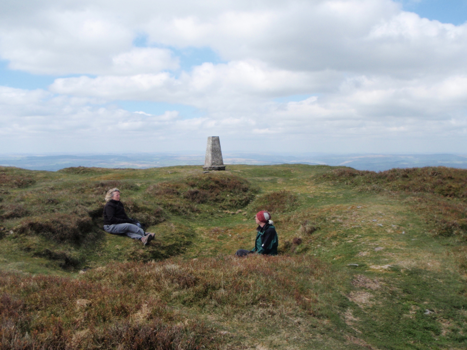
Coffee break at the top ….

…. before the descent
Although at a modest height, the summit was ideally placed for great views in every direction, a bit like Yr Aran in Snowdonia (see post #129). After taking in the scenery and having a brew it was time to get down again, via the broad ridge descending to the southeast – I used some crafty zig-zagging to avoid the steepest bits towards the bottom, and when we reached more level ground I thought it was all over.

Things started to get a bit crowded!

Open slopes to finish on
Not quite – the path around the base of the hill became rather crowded with dense vegetation and tree branches dislodged in the winter storms. We would have been much better contouring on the pathless slopes above, but some bushwhacking got us back on to more open ground. At 12 kms (7½ miles) and 530 metres (1740ft) this wasn’t a major expedition, but the hill has a ‘mountain’ feel to it – pity about that missing metre! To finish a perfect day, the path took us back to the pub. Did we go in? Well, it would have been rude not to!

The Castle Inn, now renamed the Dragons Back
Text and images © Paul Shorrock, except the image of the Castle Inn which is taken from the Geograph Project, © Copyright ‘Miss Steel’ and licensed for reuse under this Creative Commons Licence.


Looks like a great hike!
LikeLike
We have to look that bit harder to find wild places in a crowded little island like ours, but they are there 🙂
LikeLike
I haven’t done anything in the Black Mountains yet – looks lovely though 🙂
Speaking of Border Collies, I’ve fallen out with my friend’s dog… it ran off with one of my hiking boots yesterday to eat it! – luckily I noticed pretty quickly! 😮
Carol.
LikeLike
Carol, I think that must be the first area I’ve written about that you haven’t already been to 😉 It is good, doesn’t have the excitement of North Wales.
Glad you got your boot back – you’ll be needing that for your Corbetts 😉
LikeLike
I’m definitely not doing Corbetts – I’ve decided I’m going back to easier stuff when I’ve done the Munro Tops
LikeLike
I’ll wait and see 😉
LikeLike
Looks a nice area – reminds me a bit of the Berwyns and around Bala but I havn’t really ventured to the Black Mountains yet. Very guilty of many visits to Snowdon and the Ogwen areas!
LikeLike
Haha … I’m likewise guilty Pete, but who wouldn’t!!
LikeLike
The outliers are often just as much fun as the main peaks, Paul.
LikeLike
Very true Andy.
LikeLike