
Mam Tor from the Great Ridge
Living in North Wales, there really isn’t any need to go far for a good day out in the mountains, but sometimes it’s good to have a change. A Peak District trip was on the cards, and one walk I never tire of is the Great Ridge from Mam Tor (also known as The Shivering Mountain) – OK, so Mam Tor might not have the wildness of the Carneddau (see post #208) but the Great Ridge is said to be one of the best walks in the Peak, and who am I to disagree.

Castleton, Mam Tor and the Great Ridge
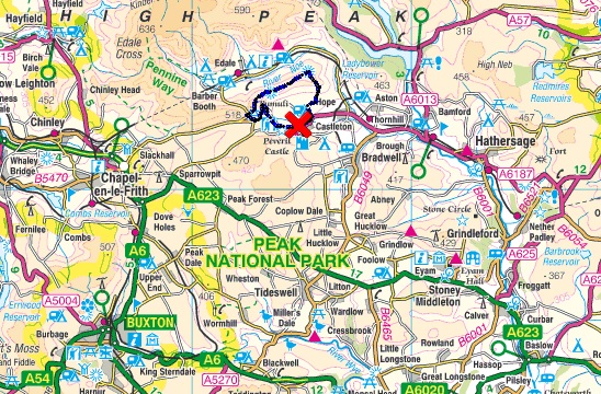
The Peak District around Castleton, Mam Tor and the Great Ridge

Setting out from Castleton, Mam Tor in the distance (centre)
I’m not a great fan of road-walking – roads are for cars, and it’s good to get away from the ‘infernal combustion engine’, but this time we actually chose to follow a road. This is a road with a difference though, it’s the ill-fated Sheffield Turnpike road built in 1819, later renamed as the A625 road from Sheffield to Stockport.
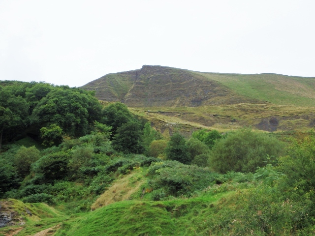
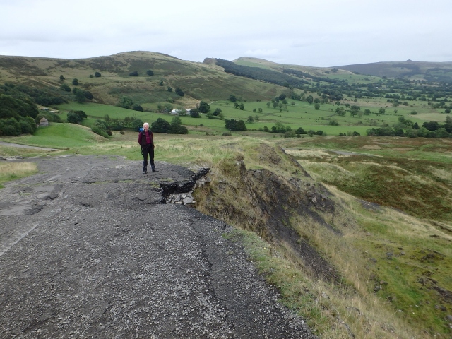
The East Face of Mam Tor, which gives the hill the title ‘The Shivering Mountain’
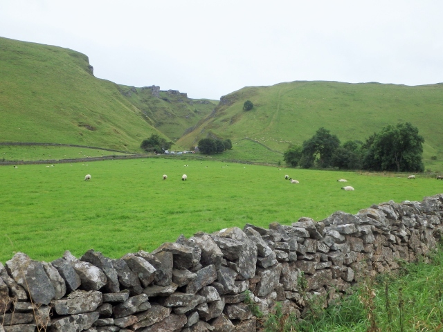
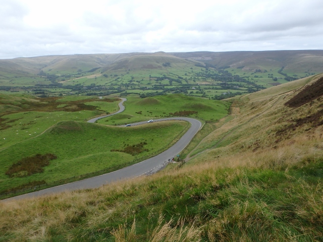
Looking across to Winnats Pass, the route taken by the present road ….
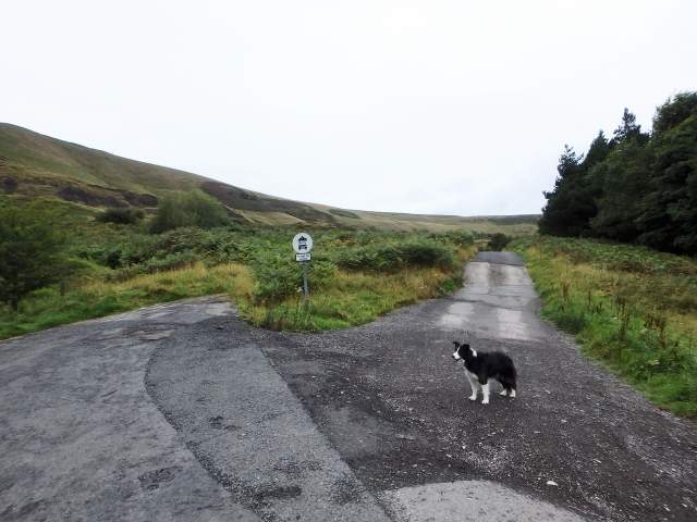
…. and the start of what remains of the old turnpike road!
Before the Turnpike was built, the road was a packhorse route using a breach in the escarpment at Winnats Pass to pass between Chapel en le Frith and Castleton. The newly built turnpike crossed the East Face of Mam Tor, taking a much easier gradient than the Winnats Pass trail. Unfortunately, the surveyors and builders seemed to have ignored the fact that the East Face of Mam Tor is in a perpetual state of landslide.
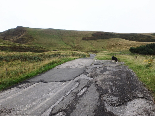
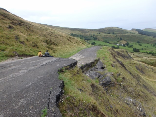
The old road heading towards Mam Tor

Once the A625 main road from Stockport to Sheffield ….
…. now a route only passable to walkers and mountain bikers
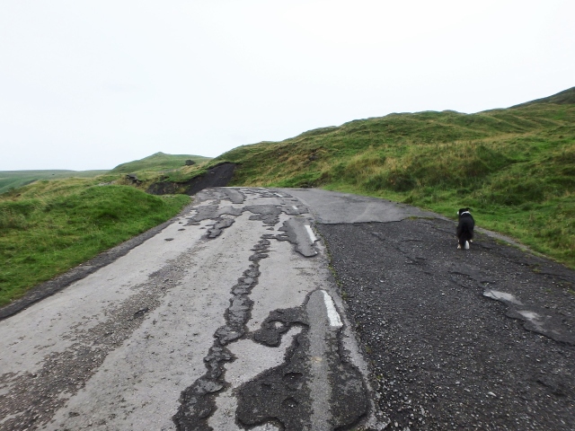
It’s all down to geology. The hill is composed of bands of gritstone and shale – water gets between the rock layers, and in winter causes even more damage through freeze-thaw action. In effect, the hill is constantly moving, not in a dramatic avalanche style, more of a relentless, slow-speed grinding down.

The road is completely swept away in places ….
…. with the layers up to two metres thick in places

So relentless is that movement that the history of the road is a history of puny human efforts to hold back nature. Major road works were carried out in 1912, 1933, 1946, 1952 and 1966 when the road was closed for 6 weeks. In 1974 large parts of the Mam Tor section collapsed during a massive landslip, and additional road works were subsequently carried out when wet years led to further landslips – the road was finally abandoned in 1979. Light traffic is now routed through Winnats Pass, following the line of the original packhorse trail.
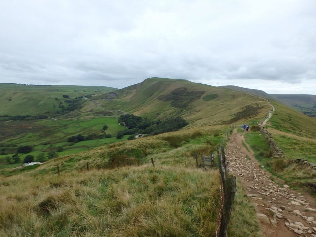
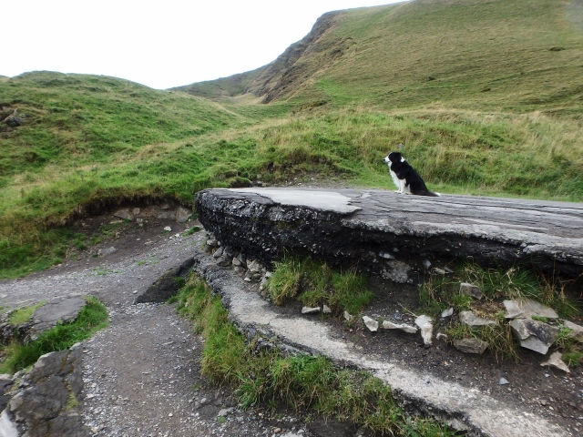
The Great Ridge in the background

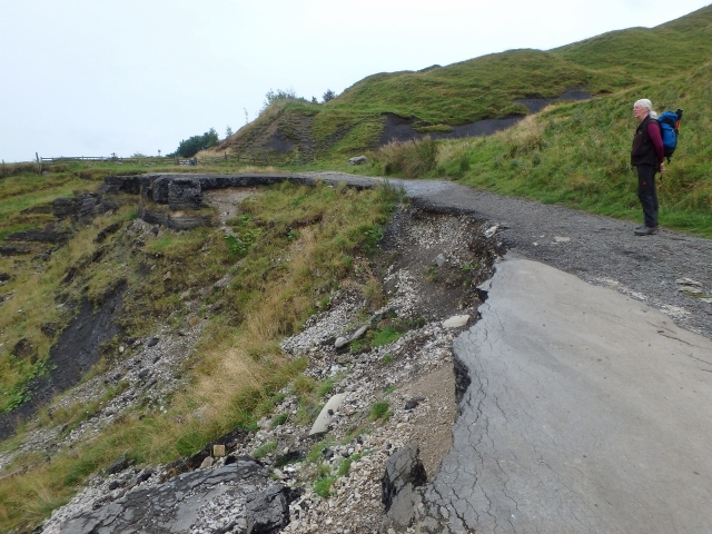
The road almost completely swept away at this point
The road is still used and enjoyed, but now it’s by walkers and cyclists instead of motorists. It has been estimated that the hillside will continue its slow progress downwards until the angle of the slope is about 30° – this will take about another 1500 years, so I guess we can still enjoy the dramatic side of Mam Tor for a while longer.
Mam Tor, looking from the southeast
The road down to Edale
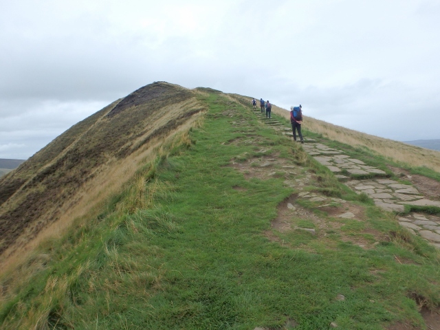
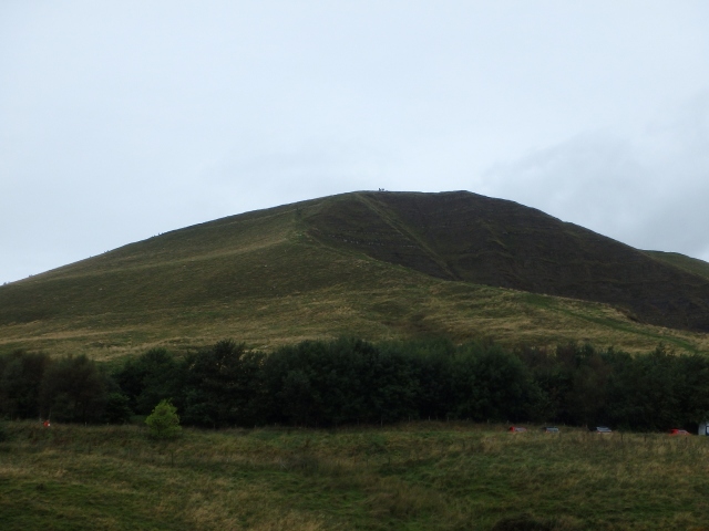
The path to the summit of Mam Tor
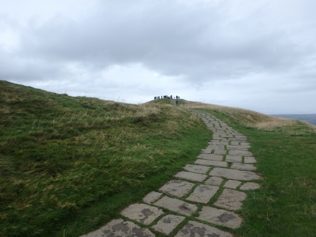
The summit – not really the place for solitude
After leaving the road near to where it joins the Winnats Pass road, we headed uphill to the summit of Mam Tor. The road to Edale crosses the ridge before diving off downhill to the Edale valley and a paved path heads up to the summit – love ‘em or hate ‘em, paved paths in popular areas save a lot of wear and tear and cut down the amount of erosion by people and water. The path up to the summit has a conveniently sited car park nearby, and most visitors to the top probably walk less than 1.5 kms.

Past the summit, heading for the Great Ridge ….
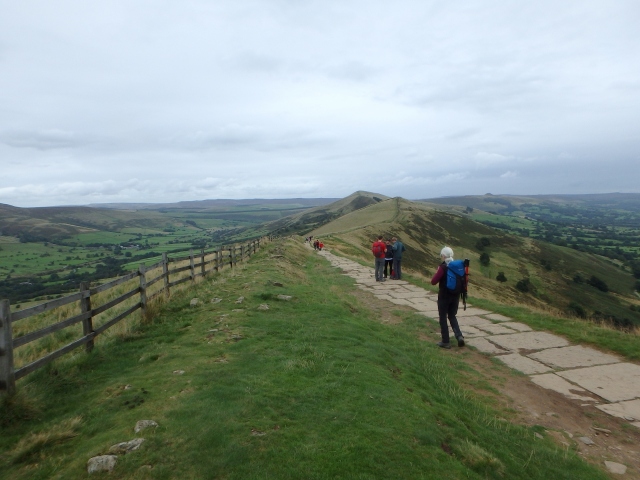
…. and on to Hollins Cross
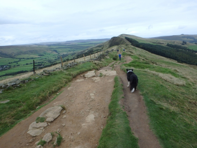
Back Tor ahead
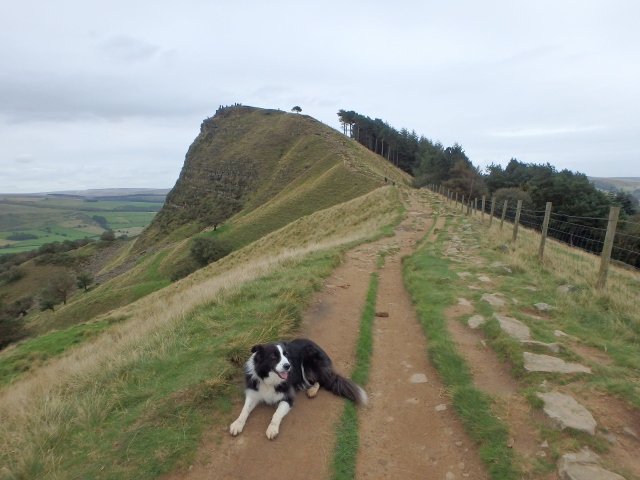
Border Collie ‘Mist’ chilling out just before Back Tor
Looking back to Mam Tor from Back Tor

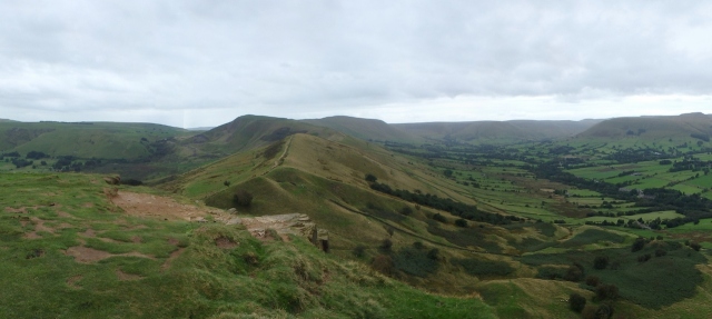
Lose Hill ahead
The path descending northeast from the summit heads away from the crowds, though it will be a rare occasion when it is completely deserted. Mam Tor is a mere 517 metres in altitude, and the majority of the Great Ridge is only a little over 400 metres, but size isn’t everything and the continuation of the ridge is almost a mountain route in character. When the end of the ridge is reached at Lose Hill, an easy walk back to Castleton brings you back to a choice of welcoming pubs – could this be the real reason that this is one of the best walks in the Peak?
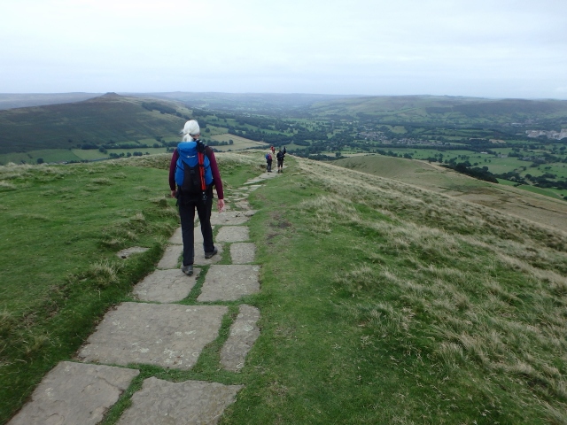
Heading for home
Text and images © Paul Shorrock


Some of the clearest evidence of repeated landslip that I have seen in this country. The ridge reminds me of the Malvern Hills a little. Looks like a lovely walk. How long did it take you to get there from N Wales?
LikeLike
A great walk indeed Andy. It takes us about two hours if we don’t go anywhere near Manchester at peak times!
LikeLike
That road and Back Tor looks great. And I don’t mind paths being fixed – it prevents further erosion so it’s good in my book.
LikeLike
It’s a cracking little ridge Carol! Back Tor does look good, doesn’t it – when we passed there was some idiot hurling big rocks down the crag – I was hoping that he might follow them, but then someone would have to sort out the mess. I haven’t seen that sort of stupidity for years!
LikeLike
Last time I saw an idiot hurling rocks down a mountainside, it was down the face of Snowdon from the café – above the little tarns on the north? side (haven’t got a map handy). It was kids and their parents were there but taking not a blind bit of notice. I really felt like hurling their darlings off after the rocks!
LikeLike
One of my favourite walks. Love it there.
LikeLike
Totally agree, an absolute classic!
LikeLike