
The Pennine Way near Bleaklow
I’m not saying that I’ve turned into a ‘fair weather walker’, but It’s good to be able to pick and choose hill days according to the conditions. It doesn’t always work that way though – I had to taxi Chris to an event in Stockport and was looking for a short-ish day out for me and Border Collie ‘Mist’. The Pennine Way National Trail passes nearby, crossing the A57 Snake Pass road, so that was an easy decision – the harder decision was whether I should bother on a damp misty afternoon.
Setting out from Snake Pass, with Higher Shelf Stones in the distance
The Snake Pass gets its name, not from the winding nature of the road (or even the presence of snakes!) but from the Snake Inn on the east side of the high point of the road. The road was completed by Thomas Telford in 1821 as the Glossop to Sheffield Turnpike, and with a high point of 512 metres it was the highest turnpike road in the country – the Romans were here first though, and built their slightly higher road about 1,500 years earlier.
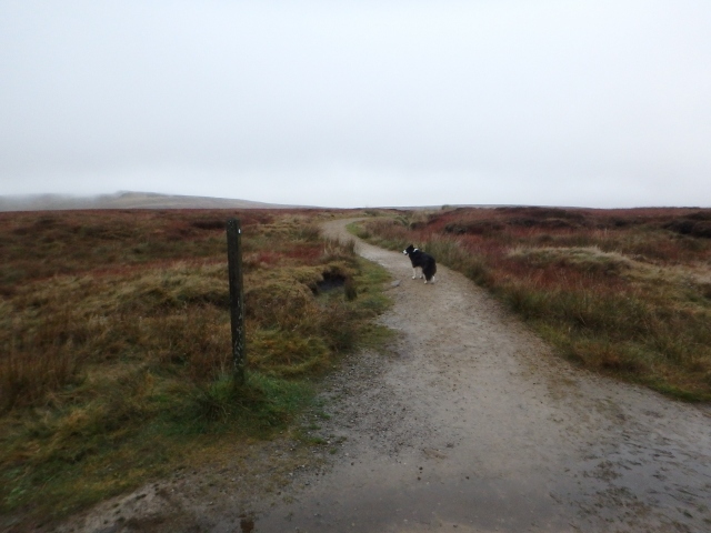
The Pennine Way starts off as a well-made path ….
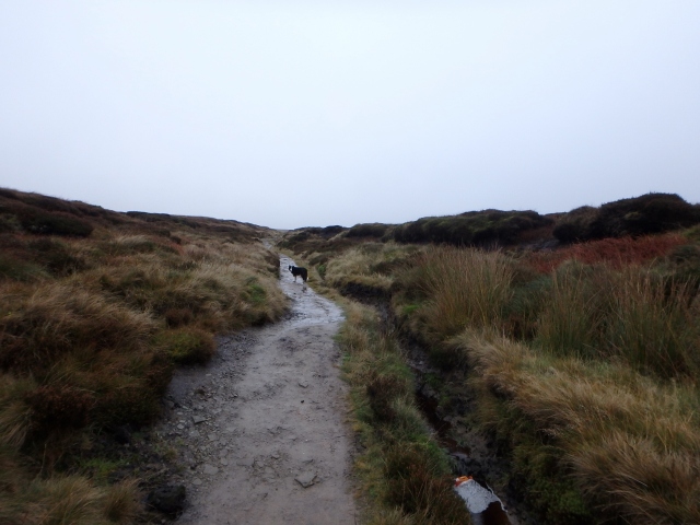
…. but slowly starts to merge in with the moors
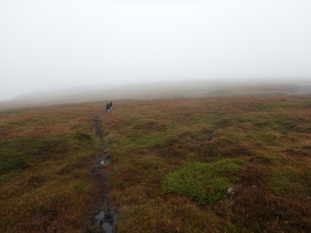
The one thing that both Telford and the Romans would have recognised would have been the bleak weather, and the nearby summit plateau of Bleaklow is well named. On my visit the mist was swirling round Higher Shelf Stones, which was exactly where I was heading. I took the Pennine Way heading north, which starts out as a well-made path, but it isn’t long before the moor starts to take charge.
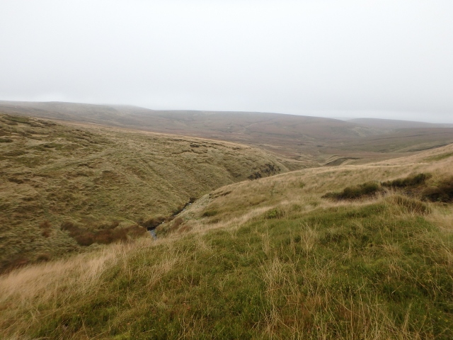
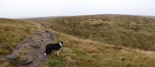
Looking east, down to Hern Clough, the visibility not too bad ….
…. but me and Border Collie ‘Mist’ are heading west towards Higher Shelf Stones!
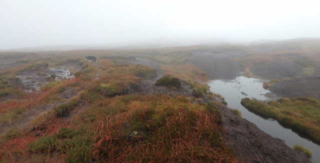
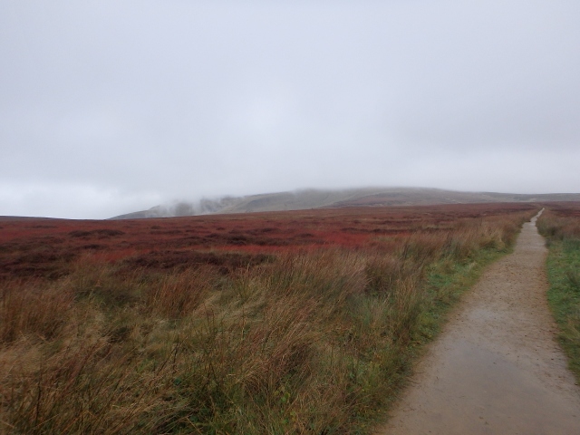
The moor becomes more Pennine in character
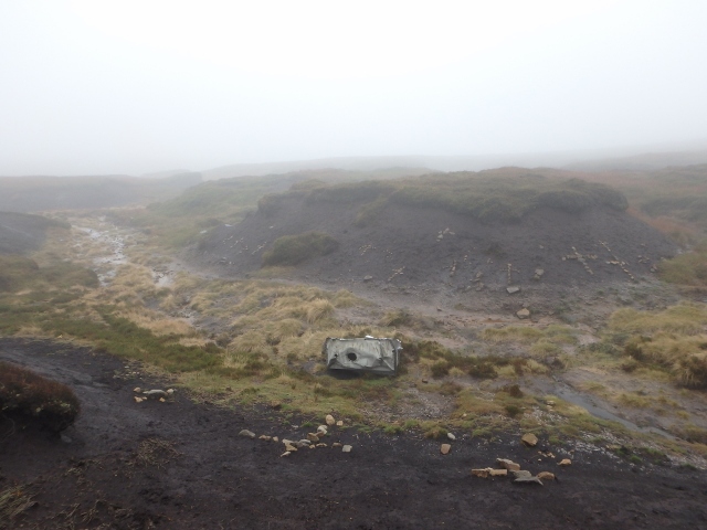
First signs of the crash site
Before long it was time to leave the Pennine Way trail to head off into the mist. This wasn’t just an aimless wander though, I was on a mini-pilgrimage to visit the site of a modern tragedy. On the 3rd November 1948, a Boeing B-29 Superfortress bomber of the United States Air Force was on a routine flight from RAF Scampton in Lincolnshire to the US base at Burtonwood near Warrington – the aircraft never reached its destination.
* * * * *
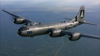
B-29 Superfortress

B-29 Superfortress, “Overexposed”
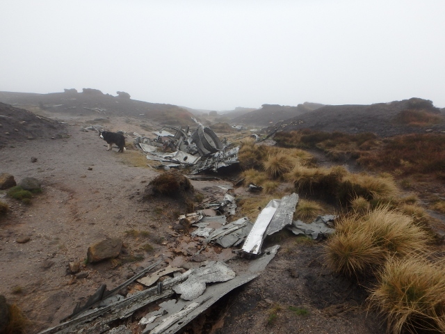
The Crash site
The B-29 Superfortress was one of the largest aircraft used during WW2 – it was certainly the most sophisticated. It was designed as a high-altitude bomber, with a pressurised cabin and remote control gun turrets, able to fly higher than the enemy fighters of the time. The type only saw service in the far east against Japan, but after the war the B-29 stayed in use until the advent of the modern jet fighter made it obsolete.
One task at which the B-29 excelled was photo-reconnaissance, and the B-29 involved in the Bleaklow accident was one of these variants. Nicknamed “Overexposed”, the aircraft had flown photographic missions in 1946 at the atomic weapons tests at Bikini Atoll, and afterwards flew in Europe during the Berlin Airlift in 1948.
On the day of the accident, “Overexposed” was on a routine ‘milk-run’ to collect mail and pay from Burtonwood. Scampton was a much smaller airbase, lacking the comforts that US aircrews took for granted, so instead of just the basic crew needed to fly the aircraft the whole crew turned out for some serious R&R and leisure time at Burtonwood.
It isn’t certain what happened to cause the aircraft to crash on a routine 30-minute flight, but it is known that the high ground was hidden by low cloud. The Captain would have been aware of this, and should have maintained height longer – instead it appears that he commenced his descent to Burtonwood on the planned schedule, but a strong headwind meant that the B-29 had not cleared the high ground.
“Overexposed” struck the ground at an altitude of 612 metres; nearby Higher Shelf Stones was the highest ground on the planned route at 621 metres altitude. Had the B-29 had been a mere 10 metres (33 ft) higher the accident may never have happened. First on the scene was the RAF Mountain Rescue Team from Harpur Hill – team members had been training on the moors nearby and secured the scene before the recovery of the victims the next day.
The US officer in charge of the operation had requested (more like demanded) that helicopters be provided to assist the operation, but these were still few in number and had a low payload. The officer then demanded (more like insisted) that a road be built to the site – anyone who knows the Pennine moors will appreciate how impossible a task this would have been. In the end, it was the RAF team who set off across the moor with general-issue folding stretchers.
A contemporary account makes harrowing reading – it was obvious from the injuries sustained that all the crew had died instantly. In the event, the stretchers were not needed as the Americans provided body bags, making the recovery operation much easier. No one knew about PTSD in those days, so the RAF lads simply ‘got on with the job’ – it is recorded though that they were very grateful for the containers of hot stew provided by the Americans, a rare treat as food rationing was still in force in the UK
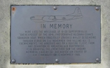
The memorial plaque © Geotek
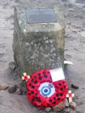
© Anthony Parkes
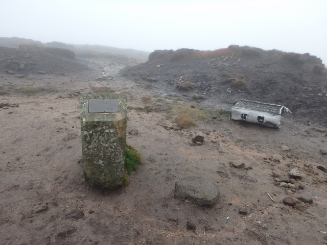
The memorial
* * * * *
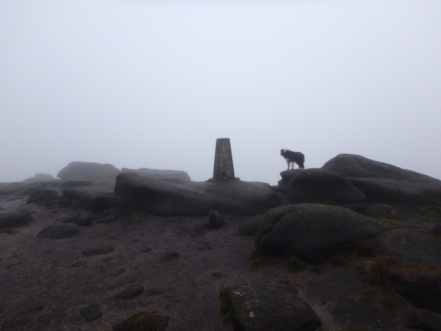
The Trig Point at Higher Shelf Stones (621 metres)
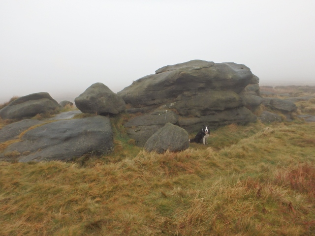
Border Collie “Mist” at Hern Stones
The site had a melancholy feel on my visit, though a dank mist did nothing to lighten the mood. Some argue that the aircraft wrecks are unsightly or even gruesome, and should be cleared from the mountains and moors, but I disagree – they are part of the history of these lands, in the same way that the old abandoned mines and quarries are, and in some cases the sites are classed as war graves.
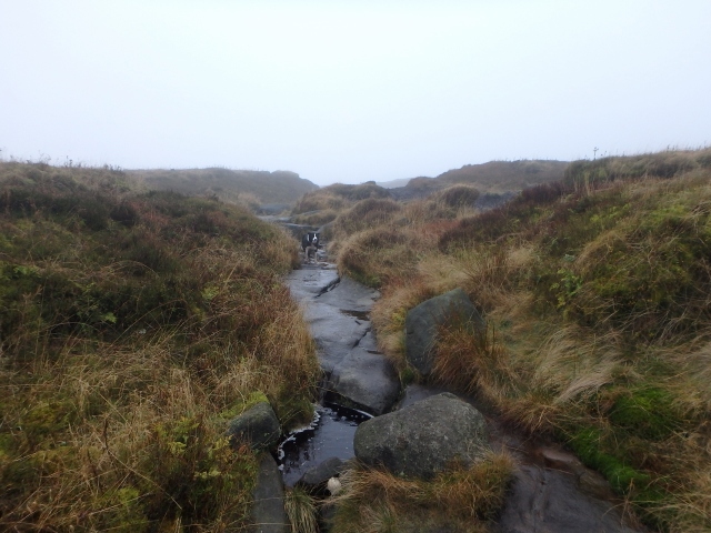
Near Hern Stones, the Pennine Way follows the stream leading to Hern Clough
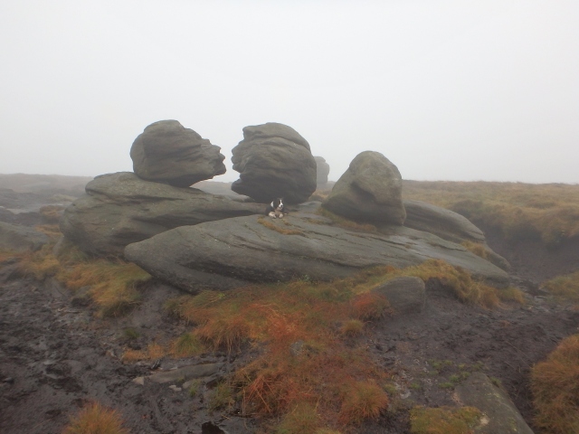
The Wain Stones
The weather wasn’t getting any better, and I had to complete my duties as taxi driver, so a brief visit to the trig point at Higher Shelf Stones was followed by an even shorter visit to Hern Stones and the famous Wain Stones (see post #19). Then it was a quick yomp back down the Pennine Way to the Snake Pass road, leaving the moors to the ghosts of the past.
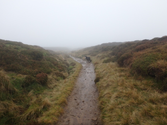
Back on the Pennine Way, heading for home
Text and images © Paul Shorrock except where indicated – these images are reproduced under a Creative Commons Licence
p.s. unknown to me at the time, my mates Richie and Babs Boardwell were just a bit further down the Snake Pass, having their own Peak District day – a pity I didn’t know, as Babs is a much better photographer than I am!


That wreck site’s haunted, you know. Been lots of sightings of airmen documented there – especially on misty days…….
LikeLike
I’m not at all surprised to read that Chrissie – the place has a bleak feel about it!
LikeLike
I always find crash sites unbearably sad – that one looks a horror – so much wreckage! Mind you, I’d love to see some of the haunting apparently going on.
I went to that area for the first time this year when I visited a friend who lives at Glossop. We did Kinder the first day which I loved but I can’t say I liked Bleaklow – mind you, it was very cold and miserable and I was feeling cold and wanting to get back. It was also full of very slippery and wet peat holes – big ones!
Carol.
LikeLike
Although I started my walking on the moors of the Northcountry, I would rather be up in the mountains anyday! Still, it makes a change. Like you Carol, I could fancy being up there when the ghosts return.
LikeLike
Those are great photos of the crash site, I wild camped up there last month (not really allowed I know, bit of a misjudgement 😉 ) and when I blog about that I’ll link to these pics if I may, it will take a while to get round to it though as I’ve only just finished my summer PW journal http://www.oldieoutdoors.com
Totally new to blogging, sorry.
bw Andrew
LikeLike
Cheers Andrew, feel free to use the pics – a link to my blog would be appreciated but it doesn’t really matter.
Hope you enjoy blogging your trip – it’s a good way of enjoying it twice! Happy days.
LikeLike
Thanks Paul! 😃 bw
LikeLike
Haven’t ascended Bleaklow yet from that side – will have to have a go next year. Looks as bleak as always!
LikeLike
Bleak as a bleak thing from Bleaklow!!
LikeLike
In a good way though, of course. Bleak = atmospheric!
LikeLike
Pingback: #215 – A dogs life! (in 2016) | Paul Shorrock – One Man's Mountains AKA One Pillock's Hillocks