

Coire Gabhail, otherwise known as ‘The Lost Valley’
(Left click all images for expanded view, use browser return arrow to go back)
In May 2016 Chris and I had enjoyed a great two-week trip to the Scottish Highlands, and had enjoyed settled weather that had made mountain days a genuine pleasure (see posts #201, #202 and #203). May in the Highlands is usually a good bet for settled weather without the curse of the Scottish midge, but would we be pushing our look to try for the same again in 2017? There was only one way to find out ….

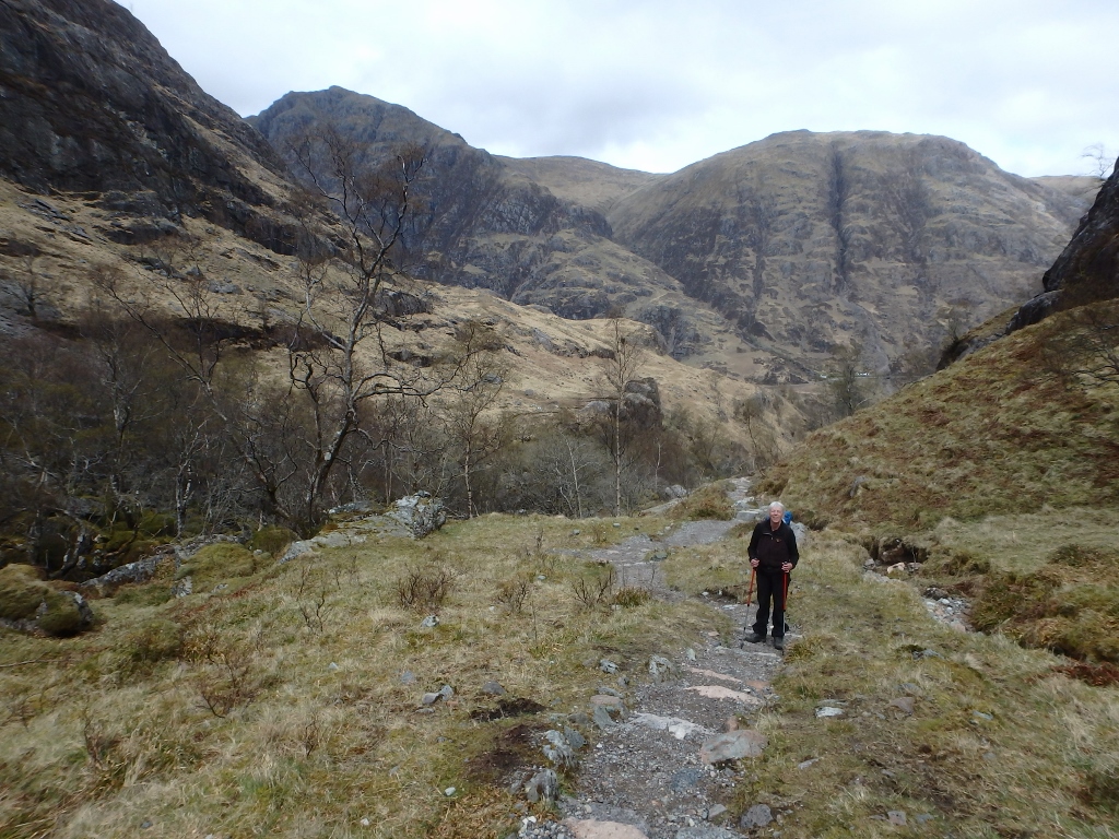
Setting out for the Lost Valley
I’ll admit to being a creature of habit – for me there’s only one way to drive to the North West Highlands and that’s the way I first drove up many years ago, via Stirling, Crianlarich, Tyndrum and Glencoe. We arrived in Glencoe around midday, and rather than waste good weather we decided to have a wander up the Lost Valley – it’s a great short walk, with a feel of being in the mountains.
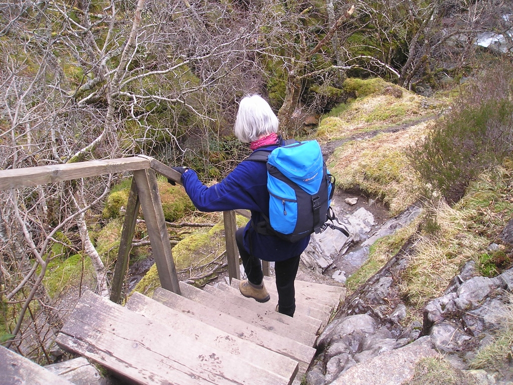
The old wooden steps (photo 2002) ….

…. now replaced by these
After the steps ….

…. comes the bridge over the River Coe
The valley is a high, wide glen, hidden from the main valley below by the remains of a huge, ancient landslip, and the route is full of surprises. The first obstacle is the gorge of the River Coe – this would be completely impassable at this point without a set of steps leading down to a narrow bridge. The steps used to be wooden, but thousands of pairs of boots took their toll and the wooden steps have been replaced by a substantial metal staircase.

Looking down the protected section of path after the bridge (© Mick Garratt)
The fenced conservation area beyond the bridge ….

…. with an impression of what the mountains would be like with no grazing

The deer fence and gate
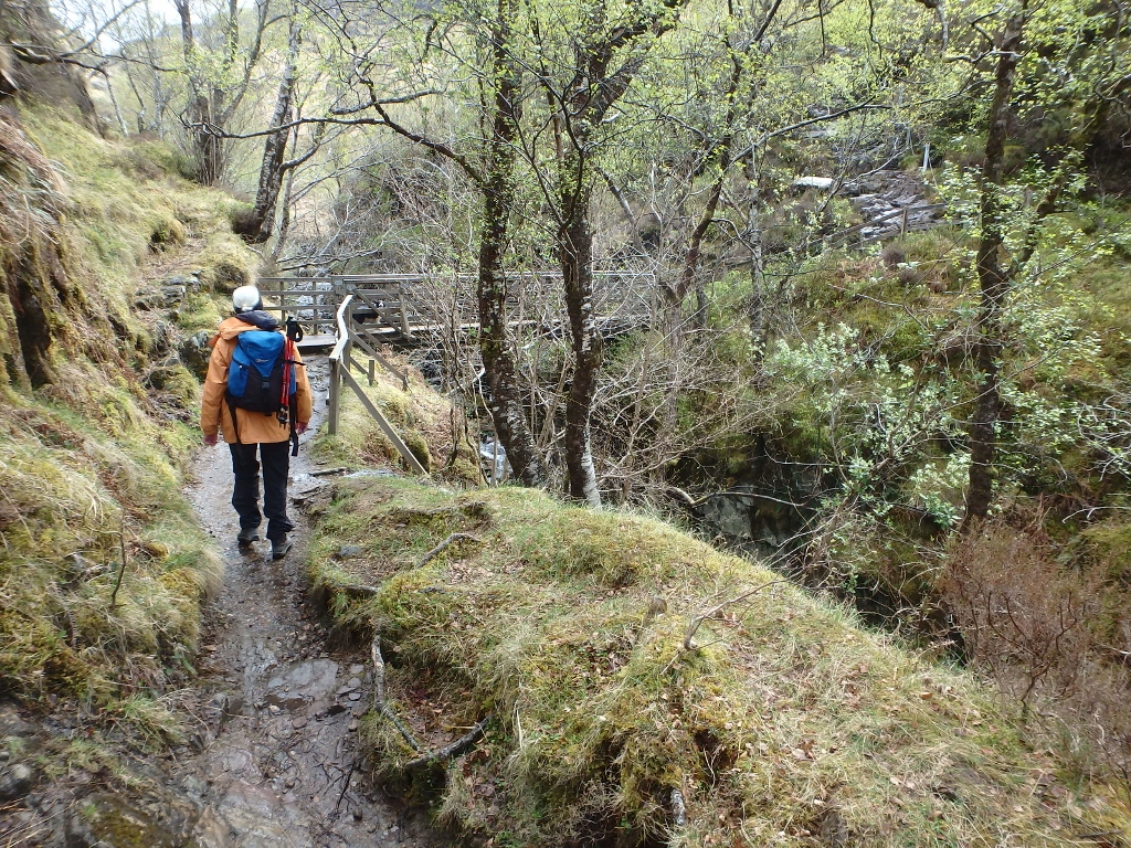
Immediately after the bridge, a short rock step is now protected by a steel cable following several fatal accidents. Beyond the rocky bit comes a conservation area surrounded by a high deer fence. As deer and sheep cannot graze there, the land has reverted to what most of the Highlands would look like without grazing, and pioneer tree species such as silver birch have started to re-assert themselves.
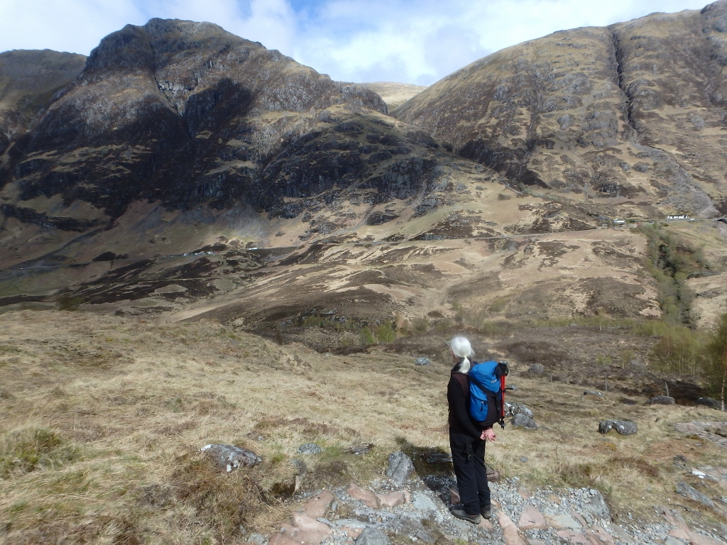
Looking across the glen to Am Bodach
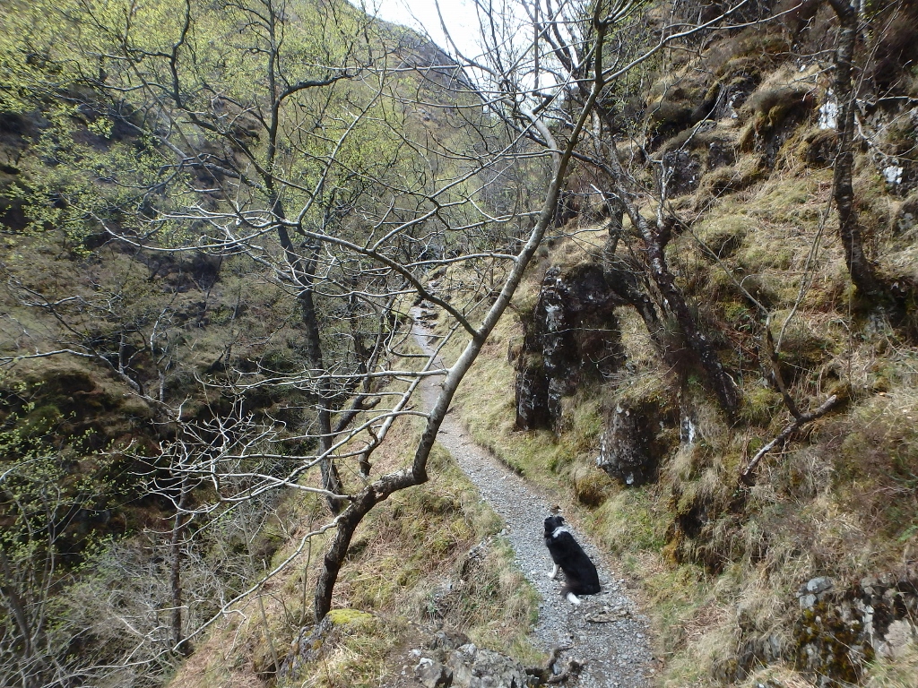
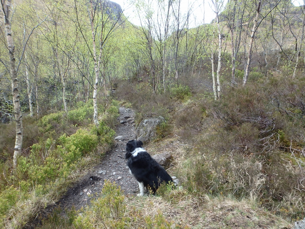
The path alongside the ravine

The path after the stream crossing
Nearly there!
Once beyond the birch trees, the view opens up across the glen looking towards Am Bodach and the start of the Aonach Eagach (see post #52). Heading southwest away from the road below, the walls of the ravine start to close in, leaving a narrow path with a big drop down to the stream below – the route is in no way technically difficult, but a slip here could be serious or even terminal. After an easy stream crossing the ravine opens out a little on the last bit of ascent.
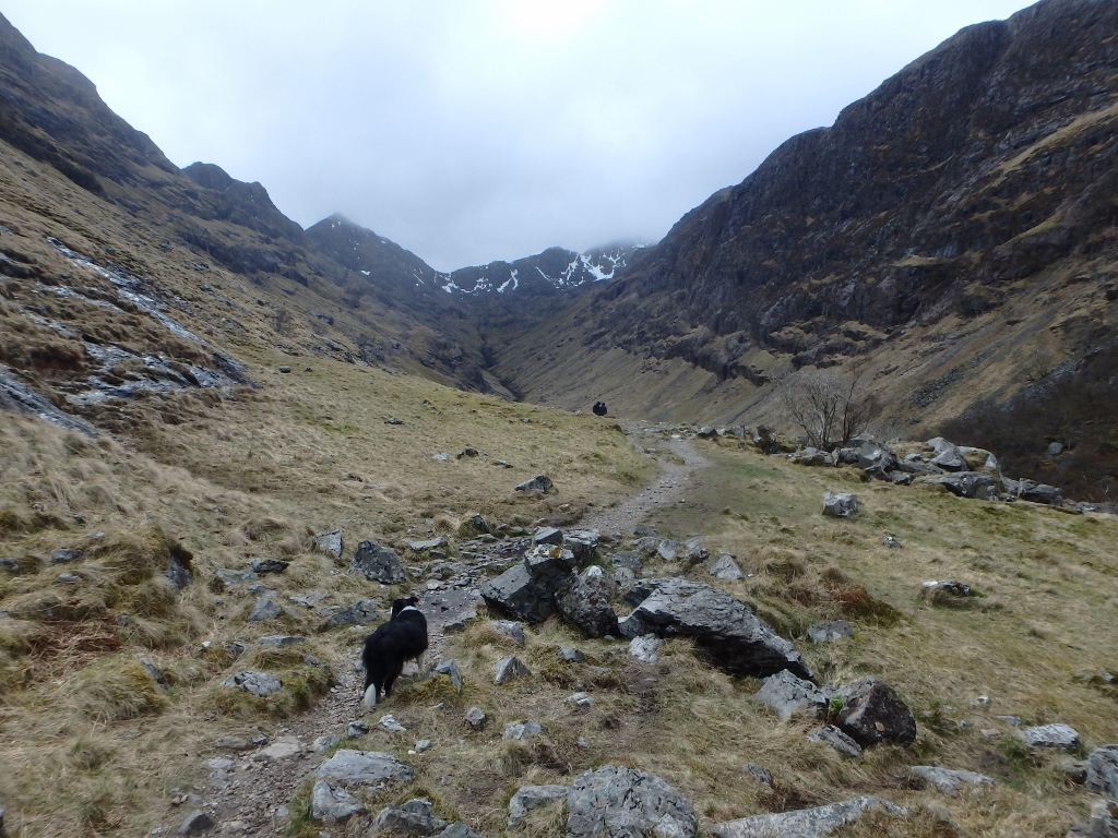
The first view into the Lost Valley

The short descent to the Lost Valley
The first view into the Lost Valley comes as a surprise to those who haven’t seen it before – the landslip which blocked the valley entrance formed a lake which gradually silted up. The water eventually found an underground route through the rocks left by the landslip, leaving a wide, flat valley that looks Himalayan in character.

Coire Gabhail – ‘The Lost Valley’ (photo 2008)
The Gaelic name for the valley is Coire Gabhail which means ‘Hollow of the bounty’ or ‘Hollow of capture’, due to its historic use by the local MacDonald clan as a place to hide cattle stolen from their neighbours, usually the Campbells. It was also one of the routes by which the MacDonalds fled during the infamous Glencoe Massacre in February 1692. Campbell clansmen wearing the uniforms of the King (William of Orange) turned on the MacDonalds, who had offered them hospitality, and murdered 39 men, women and children. Another 40 died fleeing in a blizzard, and Coire Gabhail was one of the escape routes taken that night.

Boulders as big as houses (photo 2002)

The return route is the same as the way up
The valley is a quiet, peaceful place now. It would be possible to spend half a day wandering up the valley or scrambling on the huge boulders, some as big as houses, but we were on a mission – we still had to find a place to park the camper for the night, so it was time to head back, following the route we had taken up.

Time to head for home (with a big drop to one side!) ….

…. but with the metal steps still to negotiate
Border Collie ‘Mist’ is safe and sure-footed in the hills, though I still keep a careful eye on her near big drops. She romped along the narrow path above the ravine, but the low point in the day for the dog was the metal staircase – it was the only time in the day I had to put her on the lead, to persuade her that she wouldn’t drop through the one-inch gaps in the steps. Funny animals, dogs!

Not the best part of the day for Border Collie ‘Mist’!
Text and images © Paul Shorrock except image tagged ‘© Mick Garratt’ which is taken from the Geograph Project and reproduced under a Creative Commons Licence
p.s. apologies to regular readers for a long gap between posts – the trip to Scotland was full of surprises, including 4G internet on the phone at times, but getting out on the hills soon became more important than writing about them! I’ll be putting more posts up about the trip over the next few weeks.


I like that phrase – ‘Creature of Habit’ – there is always something special abut re-visiting, and following familiar routes. It brings back a whole bunch of memories. And I share with you the pleasure of those routes that get us off the main trails into the vastness of the wilderness where there is no-one else in sight. Did you avoid the midges?
LikeLiked by 1 person
Cheers Andy. And yes, we totally avoided the midge misery – we were too early for the little blighters!
LikeLiked by 1 person
Haven’t been there for many years now – in fact, so many, I couldn’t remember anything about that path at all – just the huge boulder in the entraceway. How did they supposedly get cattle up and down into that valley with such a difficult route?
LikeLiked by 1 person
Wonderful impressions from you path, Paul. This is a magice landscape.
We visited twice earlier this year and luckily we had no encounters with the midges either. 🙂
Have a great weekend, Dina & co
LikeLike
Thanks for the comment Dina, and thanks for reading. I’ve just been enjoying your Scottish road trip blog posts – some wonderful images! Best wishes to you, the Master and the Bookfayries.
LikeLike
Pingback: #226 – Coire na Creiche and the Fairy Pools | Paul Shorrock – One Man's Mountains AKA One Pillock's Hillocks