

Y Garn above the lake of Llyn Idwal
Why do the British talk about weather so much? It’s a topic that never fails to kick-start a conversation, probably because we get so much of it! Things never stay constant for long, but the last couple of weeks have featured day after day of high winds, the kind of winds that make walking in the hills unpleasant if not dangerous. So, as there wasn’t much hill activity this week, I decided to delve into the archives to see what I was doing in April 2009.

Y Garn
Although living in West Yorkshire at the time, I had laid siege on Tryfan in North Wales, with the intention of writing up a route for Walkingworld.com – the problem was, every time I arrived in the Ogwen Valley the mist came down. Photos are quite important for Walking World, but after several wasted journeys Tryfan was still hidden in the clouds – Y Garn wasn’t though, so I took the opportunity to snatch a consolation prize.

The classic view of Llyn Idwal looking towards the cliffs of the Devil’s kitchen, or Twll Du in Welsh (JB)
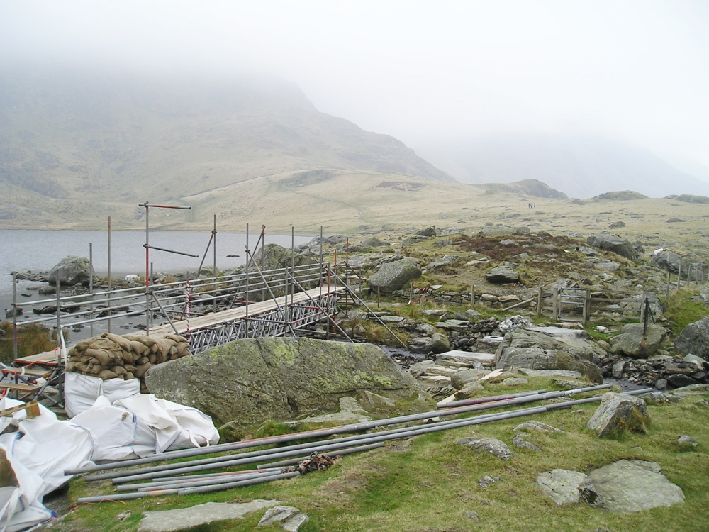
The bridge at Llyn Idwal under reconstruction in 2009

The bridge as it is now in 2013
As Y Garn on its own is a short day, my plan was to zoom round the route in quick time, recording the route and taking photographs – I decided on an ascent by the lake of Llyn Idwal, then up Twll Du (the ‘Black Hole’ or Devil’s Kitchen as we English have it) before descending from Y Garn by the North East Ridge. If I thought I was in for an uncomplicated trip, the mist had other ideas.

Twll Du – truly a ‘Black Hole’!

‘Brew stop’ at the big Boulder

Visibility still grey and somewhat damp

The cliffs of the Devil’s Kitchen in winter conditions 2013
Anyone reading this who has the slightest interest in photography would probably agree that a grey, damp, misty day does not bode well for photos. Nor did it on this trip – my ascent of Twll Du was based on memory rather than on the extensive views. I had a coffee break under the big boulder on the way up, where I had to make the decision to carry on or bail out.

Group at the path junction on the southern flank of Y Garn in 2009
In 2012 the views were more like this ….
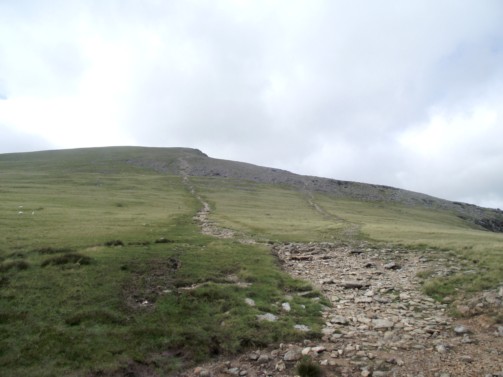
…. and the same path junction on Y Garn looked like this
I didn’t bail out, and managed to record a route that was eventually published as Walk 5125 on the Walking World website. However, in 2012 I was back with camera, GPS and voice recorder, describing a route on Elidir Fawr for Discovery Walking Guides – the visibility was so good that I ended up writing one route for DWG whilst recording new photos for the Walking World route at the same time, but in reverse!
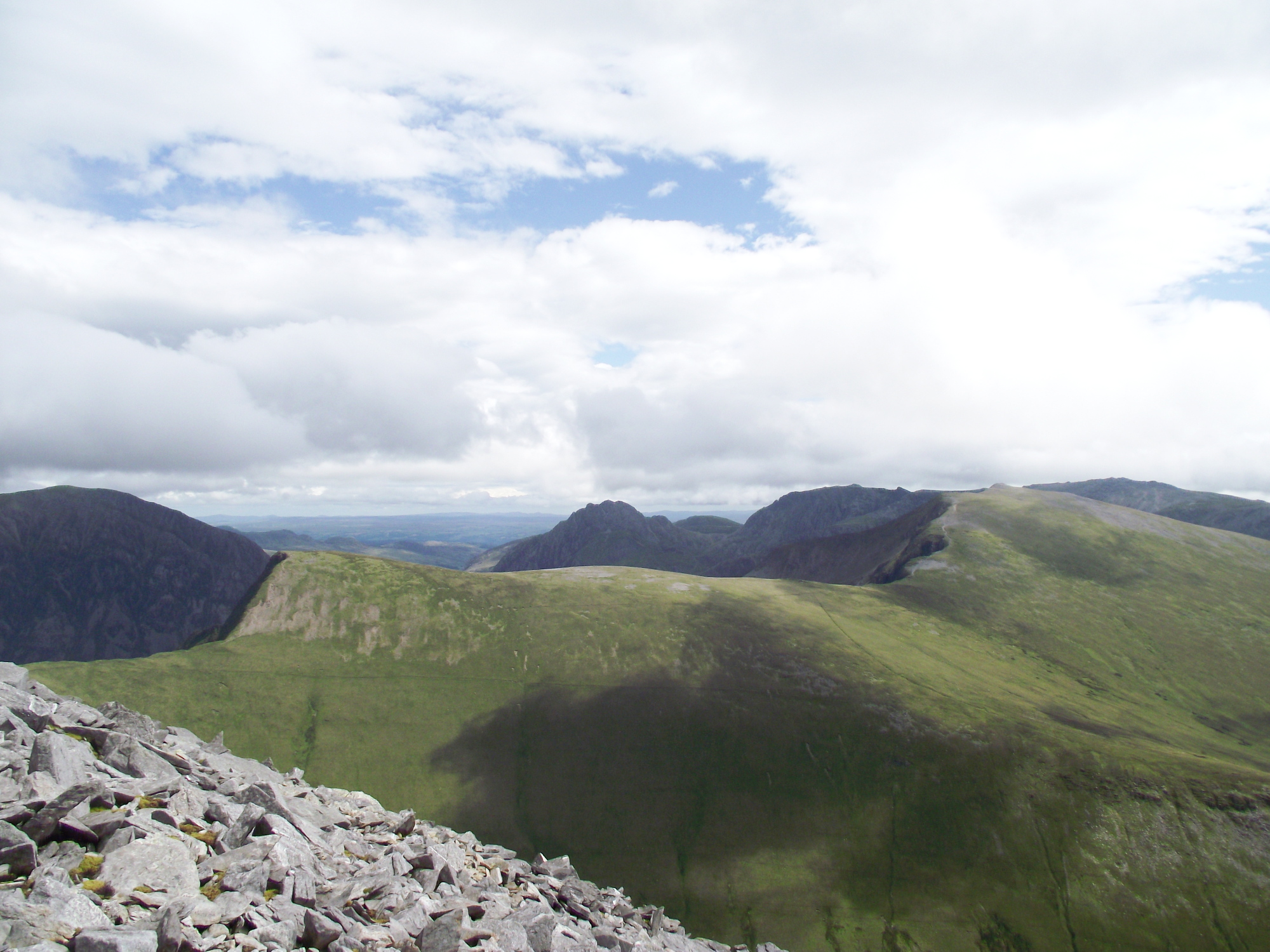
Y Garn on a good day – on the far right, seen from the north

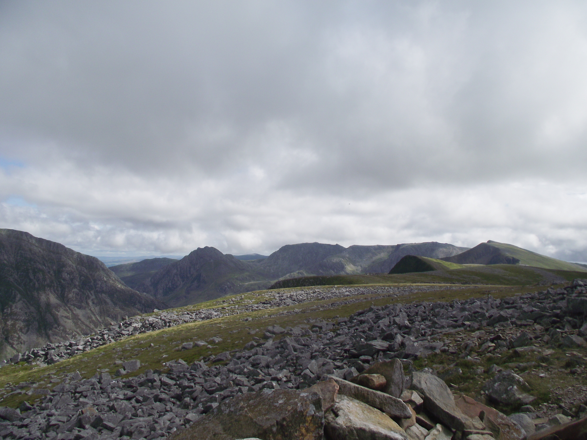
The summit of Y Garn as seen in 2009 ….
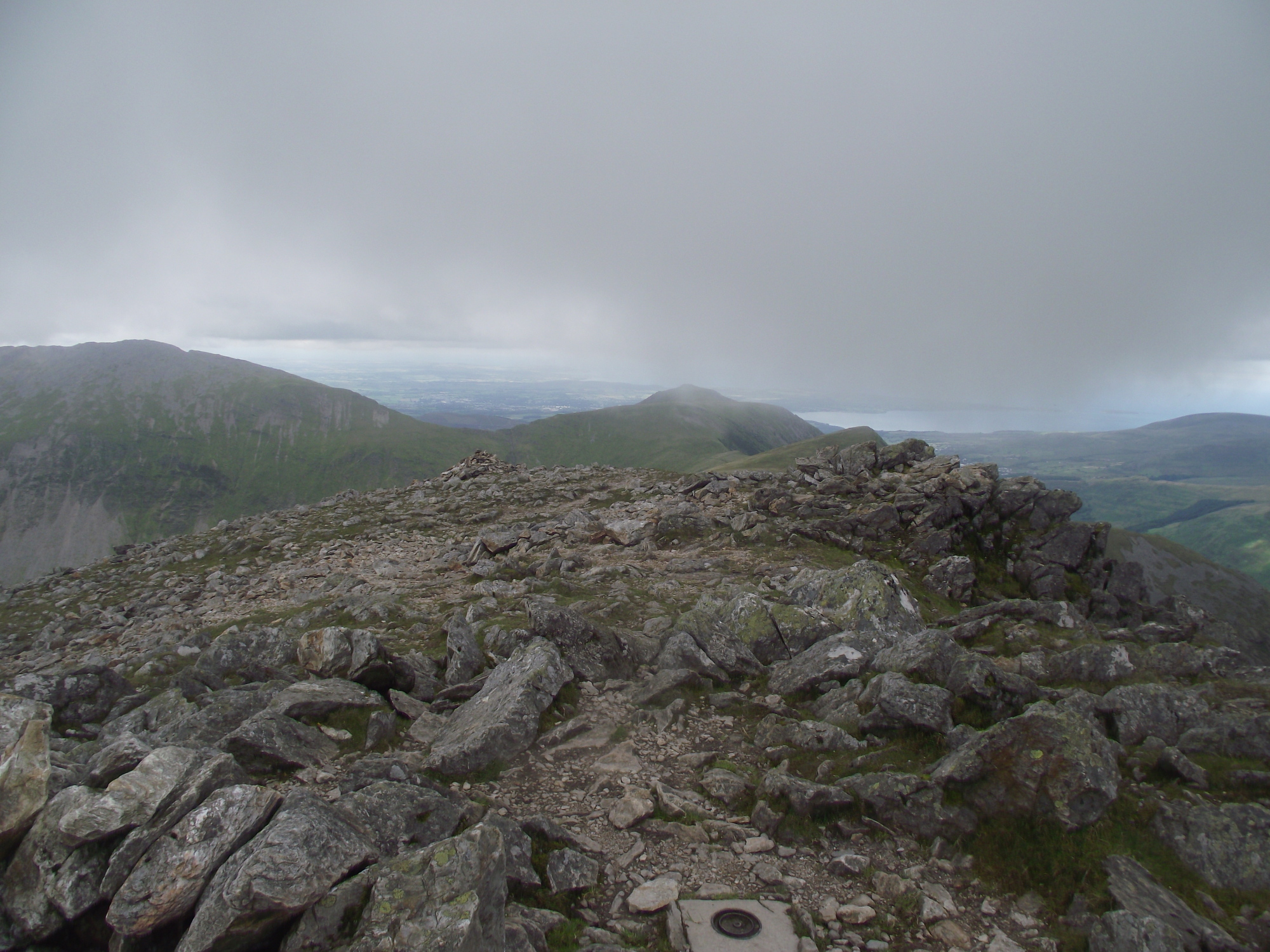
…. and as captured in 2012, almost clouded over again!
The Elidir Fawr trip went really well, with excellent visibility all the way round … until the summit of Y Garn! I couldn’t believe it as the cloud started to swirl round the summit, but I did manage to grab a shot that, whilst not exactly stunning, was a good representation of the view from the top looking north.

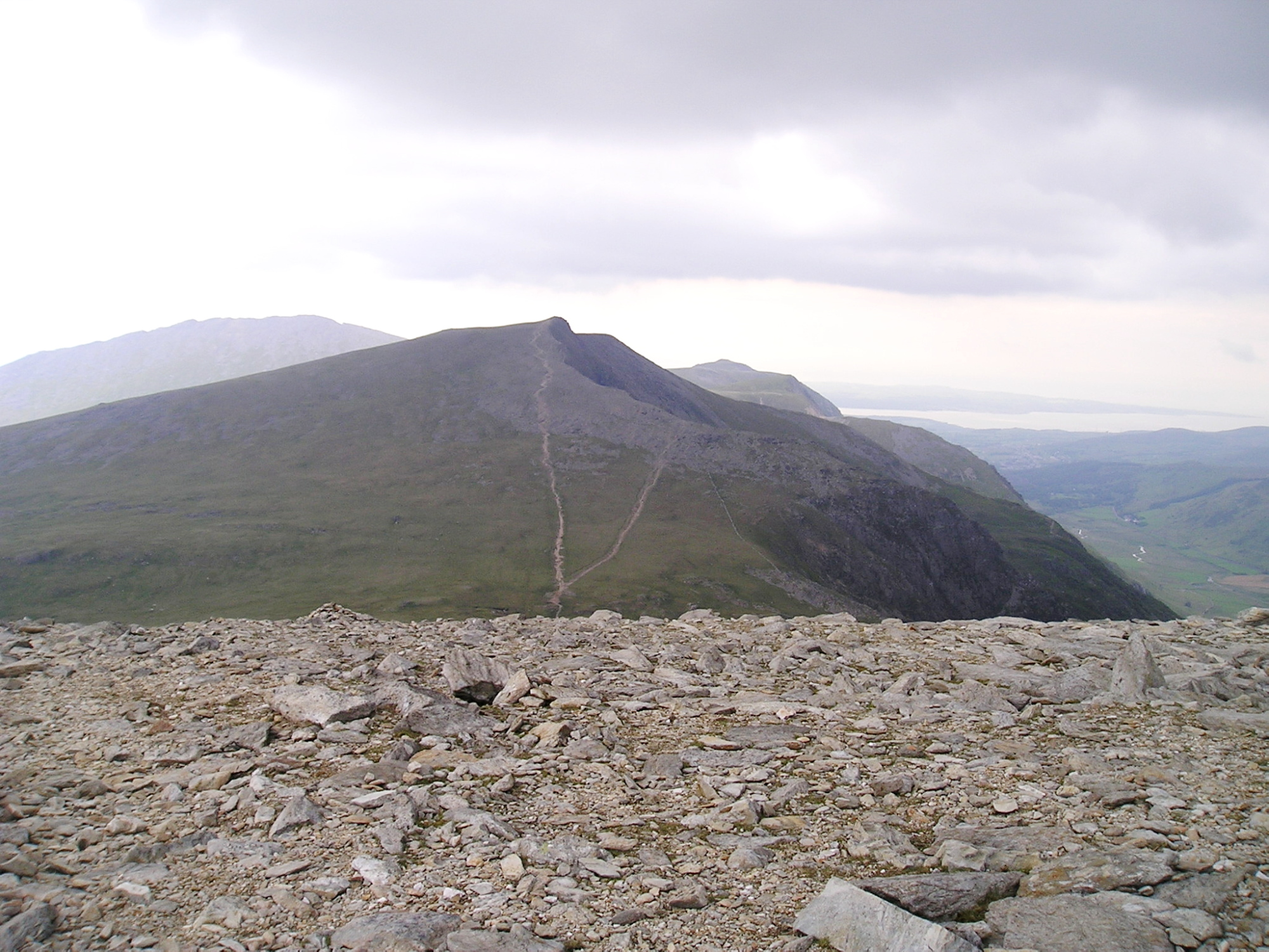
The start of the descent down the North East Ridge as seen in 2012

What the visibility was like in 2009 – just starting to clear on the descent
I’ve not quite become a ‘fair weather’ walker yet, but our fickle British weather does have an impact on the hill trips. Having said that, I’ve got another job waiting at home that needs to be completed before any more trips out – putting away the ice axe, crampons, skis, etc for another year. Oh well, there’s always the summer to look forward to……
Y Garn from Glyder Fawr
Text and images © Paul Shorrock, except image tagged (JB) © John Bamber


It’s interesting seeing lots of photos of an area showing its many differing moods!
LikeLike
You certainly don’t have to wait long Chrissie – give it a few hours in the UK, and you will often see all four seasons in the course of one walk 🙂
LikeLike
I see a gaping hole in your walking life in 2009, it was border collie shaped! Inspiration for Mists name from these photos?
LikeLike
Haha …. well spotted Craig! Mist entered our lives in 2010, and she has rarely missed a blog since 🙂
LikeLike
Never walked that ridge out to Elidir Fawr. Visited the link you posted to Discovery Walking Guides but couldn’t see where this walk was posted – in fact there didn’t seem to be any guide to Wales at all. Am I missing something!?
LikeLike
You might say that the world of walking is missing something Andy 🙂
I am currently working on a walking guide to Snowdonia for DWG, but I sometimes give them a plug for their existing titles.
LikeLike
(That) Y Garn is my favourite-shaped mountain in the whole of Snowdonia – if not Wales – I think it’s a really beautiful looking hill from the Ogwen Valley. I’d say it’s easily my favourite peak in that valley.
I think misty photos look very atmospheric so I quite like them. Of course, I’d far rather walk in clear, sunny weather though 😉
LikeLike
I would put it second to Tryfan Carol, but Y Garn is a fine looking mountain.
LikeLike
I have to say that Tryfan is my very least favourite mountain in Wales! Maybe ‘cos I like to go the opposite way to everyone else, I’m not sure, but I’ve never really liked it. I just think it’s aggressive and nasty. I know everyone else loves it though so I’ll leave it to them and keep on plodding up my old favourite Snowdon via the quieter western routes. I could do that daily and never get bored I think.
LikeLike