
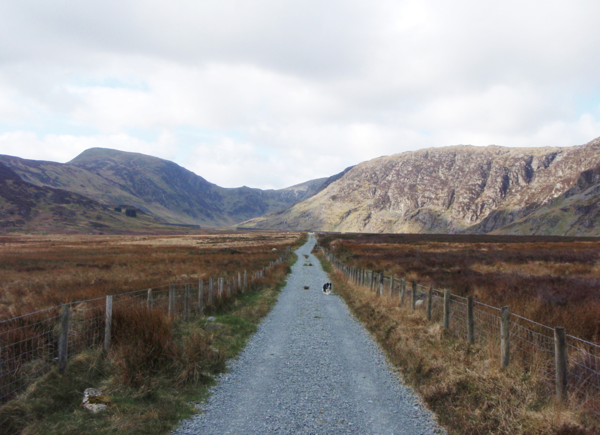
The walk in to Cwm Eigiau and Craig yr Ysfa
It was a strange kind of winter in North Wales this year. We ‘hardy mountain types’ 🙂 like to get out to play in the snow, but the snow was erratic, never hanging around for long – when it did hang around, it was usually ‘blowing a hoolie’, and on one trip out I could barely stand upright. Then, one April day, the wind dropped.
Heading into the valley of Cwm Eigiau, with Pen yr Helgi Du ahead
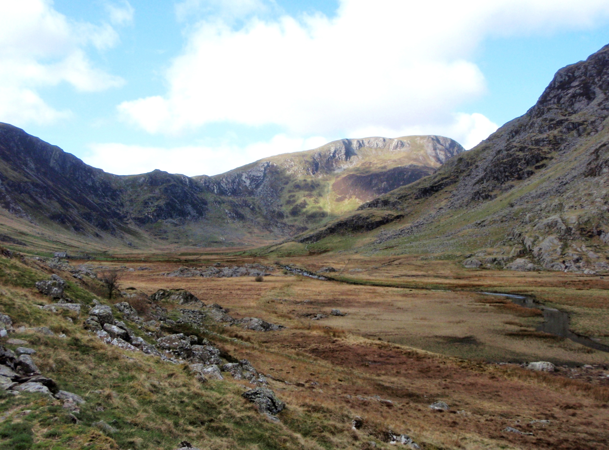
A little further on, with Craig yr Ysfa coming into view on the right
I’ve developed a bit of an obsession with the mountains of the Carneddau. In my younger days when a trip to the Welsh mountains was a rare treat, I used to go for the classic routes such as the Snowdon Horseshoe or the North Ridge of Tryfan with the continuation up Bristly Ridge. Now I live just an hour away, I have time to explore a bit more off the beaten track.

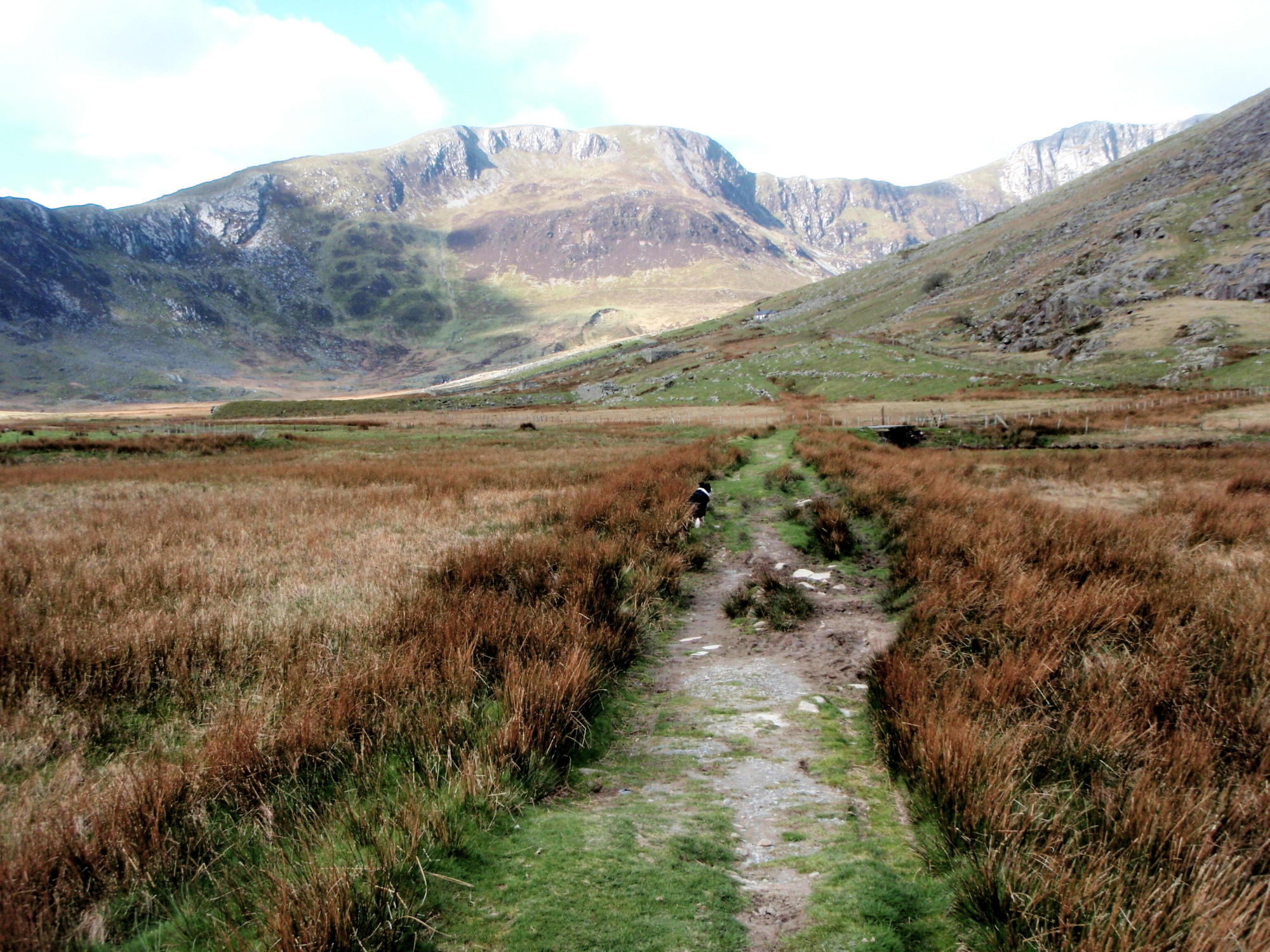
Heading for Craig yr Ysfa
Off the beaten track sums it up nicely – the mountains of the Carneddau are like a miniature version of the Cairngorms in the Scottish Highlands. They are wild and untamed, and often a navigation trap for the unwary. Just the kind of place where you can wander and explore freely.

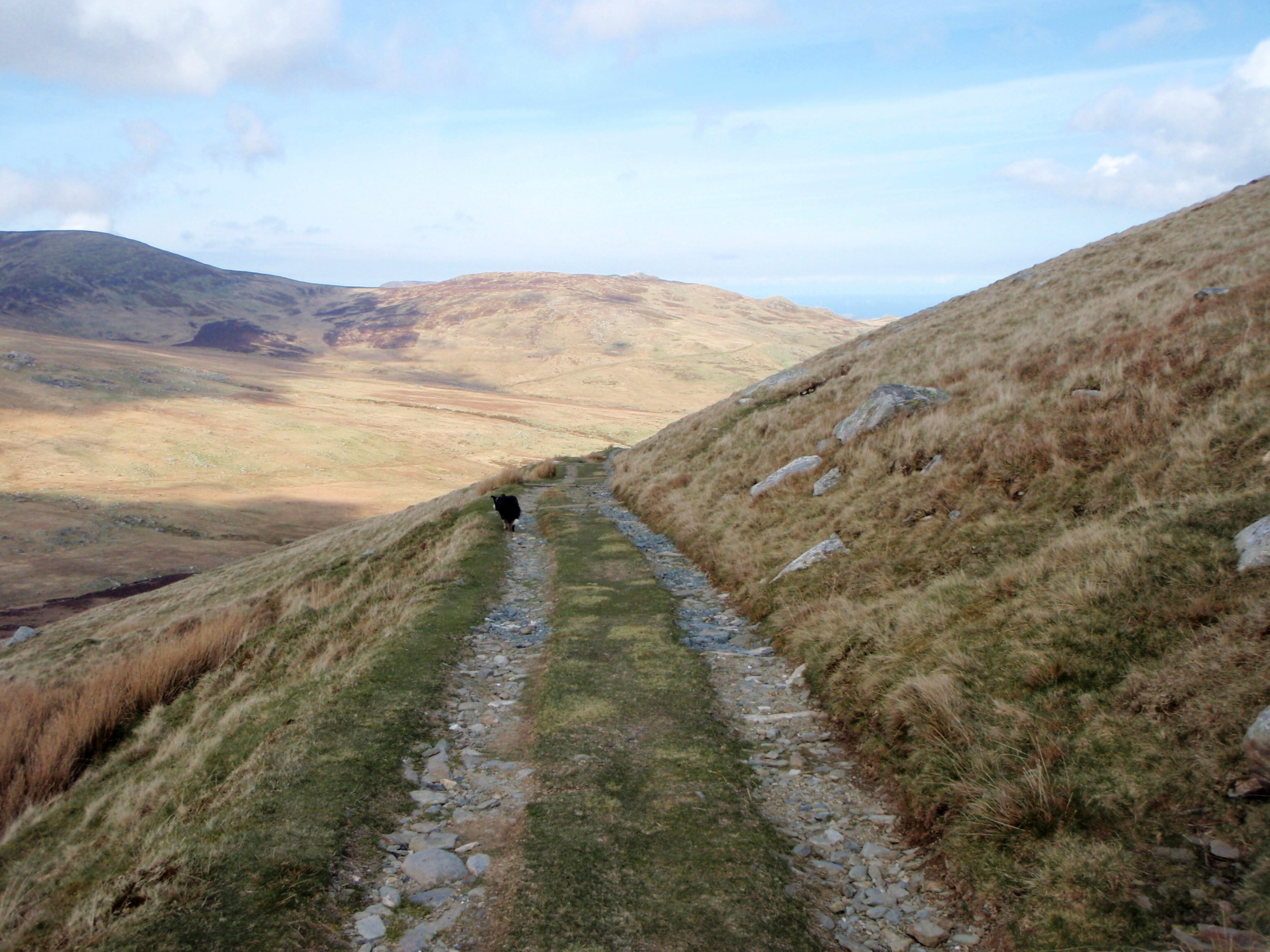
The intended route to Bwlch Eryl Farchog
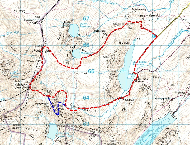
My route (with the original Bwlch Eryl Farchog option shown in blue)
 I had a plan, sort of …. I would follow the quiet valley of Cwm Eigiau, then try to find the airy path on the left side of Craig yr Ysfa, that works its way up to the col of Bwlch Eryl Farchog. From there I would head for Carnedd Llewelyn and Foel Grach before heading back to the car. That was the plan ….

Engine from the Blenheim crash, April 1940
I had read about a wartime air-crash on Craig yr Ysfa, and decided that, as I was in the right area, I would look for one of the engines. Although the colours of the metal are starting to blend in with the rocks, it didn’t take much effort to find it, and as I looked at this relic of almost 75 years ago, I thought of the young men who had died in the crash.
* * *

Bristol Blenheim aircraft
On 8th April 1940, three Blenheim aircraft left RAF Bicester on a cross-country training flight to RAF Ronaldsway on the Isle of Man. On the approach to the mountains of the Carneddau, Blenheim L9039 broke from the formation in cloud, and at 1120hrs crashed into the top of Craig yr Ysfa. A search commenced, and the wreckage of the aircraft was found the next day – the four man crew, all in their early 20’s, were killed in the accident. A subsequent enquiry concluded that the pilot had probably been dazzled by the sun as the aircraft emerged from the low cloud.
* * *

The area where the aircraft engines ended up ….

…. and the view uphill to where they came from
The impact must have been catastrophic. The impact point was at an altitude of 880 metres (2900 ft) and the engines had fallen 360 metres (1200 ft) to their final positions at an altitude of 520 metres (1700 ft). In between, at 750 metres (2460 ft) there was said to be more wreckage on a small plateau above the engines and immediately below the crash site.

The plateau above the engines, with the crash site central just below the skyline

‘Mist’ on the plateau next to part of the aircraft undercarriage
The story of the air-crash and the young men who died there replaced the intended Bwlch Eryl Farchog trip, and the original plan was left for another day. Border Collie ‘Mist’ wasn’t particularly bothered where we went so long as she got a good walk out, and was happy to pose next to bits of wreckage to give an idea of scale.

Looking up to the crash site

More aircraft wreckage in the gully
The account of the crash I had read previously had mentioned that the point of impact had been in a gully heading up to the ridge above. I ignored the advice not to approach the site via the gully itself, on the grounds that I’m a grown-up and experienced enough in the hills to make my own decisions. The gully was steep, but with no technical difficulties, and I passed more aircraft wreckage on the way up.

The top of the second gully, with the last remnants of the winter snow
Above the gully there was a boulder field with no trace of any wreckage, and next to the gully I had ascended there was a second gully with the last remnants of the winter snow. There was little doubt that the aircraft had impacted in one of the gullies, but the small snowfield prevented any further exploration. I spent a few moments thinking about the loss of four young lives, but time was passing and it was soon time to go.

Above the crash site, heading for Carnedd Llewelyn

…. and soon the mist came down
I joined the main path heading towards Carnedd Llewelyn, but the fine weather wasn’t going to hang around any longer and soon the mist came down. From the summit I descended north, heading towards Foel Grach and its small stone refuge (see post #134).

Looking back towards Craig yr Ysfa- the snow patch on the left is the crash site
Heading southeast from Foel Grach, I descended out of the cloud. Looking back towards Craig yr Ysfa, it was easy to pick out the crash site by locating the small patch of snow in the gully. From this angle it was apparent that another 30 metres (100ft) of altitude would have saved the aircraft and the airmen on board.

Our way home

The small reservoir of Melynllyn

Dulyn reservoir
Looking in the opposite direction towards Conwy on the coast, the weather was starting to improve, with the cloud breaking up. A bit of ‘off-piste’ wandering took me past the two small reservoirs of Melynllyn and Dulyn, to pick up a good track heading back to the car park. Once on the track I made good speed with a good Royal Marine ‘Yomp’ pace, but the dog clearly wasn’t impressed – Situation normal, as they say!
Text and images © Paul Shorrock


Great (sad) story Paul. I think we started off from the same spot on our bothy hunt in March – been wondering ever since if the car park could be abused for an overnighter…..? 😉
LikeLike
Well, the car park IS on a very quiet road …. 😉
LikeLike
Great post Paul – I often come across remains of these crash sites and it is very poignant to think of the young brave men who gave everything to save us from tyranny. And it is also sad that many don’t have markers – just bits of old engines and rusty metal to remind us that a tragedy occurred long ago.
LikeLike
Thanks SP. As you say, it’s sad that many have no memorial. There was even a ‘tidy up’ campaign in Snowdonia some years ago, with some sites being virtually cleared as if nothing had ever happened there. I can understand that to some extent, but a small memorial instead would be appropriate – Buckden Pike comes to mind as a good example.
LikeLike
Great comeback post Paul 🙂
Very sad about the aircrew – just hope it was instant for them. I’ve been up the route you intended to take and didn’t know there was any wreckage in the area – I’ll have to look harder. I did have a huge argument (partly in Welsh) with 2 yobbos rampaging around in a 4×4 unnecessarily and disturbing the peace!
Carol.
LikeLike
Cheers Carol. Let me know if you are going back sometime, and I will let you have GRs of some of the locations.
LikeLike
I thought you were going to offer to come with me then 😉
LikeLike
Haha … I’ll come along with you if you promise to deal with the 4X4 boys 🙂
LikeLike
I rather like visiting air crash sites – there are so many around the Peak District you almost can’t help taking an interest. They all make you think though; they all have their stories.
LikeLike
Absolutely Chrissie – although often involving tragedy they are every bit as fascinating as stone circles, etc.
LikeLike
Good to see a new post from you Paul. I’ve certainly walked up from the A5, passing just East of the Ffynnon LLugwy reservoir and then reaching Bwlch Eryl Farchog via quite a steep rising traverse on a narrow path which I’m sure is the section you were originally thinking of walking. I carried on over the two main summits and on to Pen yr Ole Wen and then dropped down the very steep descent to Ogwen. The slog back to the car along the A5 seemed rather a long way!
LikeLike
Cheers Andy. I think a lot of walking in and around the Carneddau seems to involve a ‘long slog’!
LikeLike
Once got involved in a rescue near Melynllyn – pretty much near where your photo was taken. The Carneddau is one of my favorite areas of Wales though and I agree with the Cairngorm comparison – you can walk for hours and see more wild ponies than other hikers!
LikeLike
Pingback: #155 – The Southern Peaks of the Carneddau, North Wales | Paul Shorrock – One Man's Mountains AKA One Pillock's Hillocks