
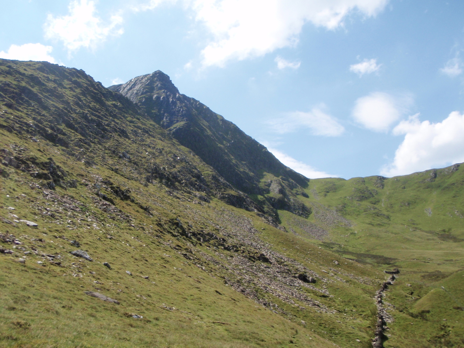
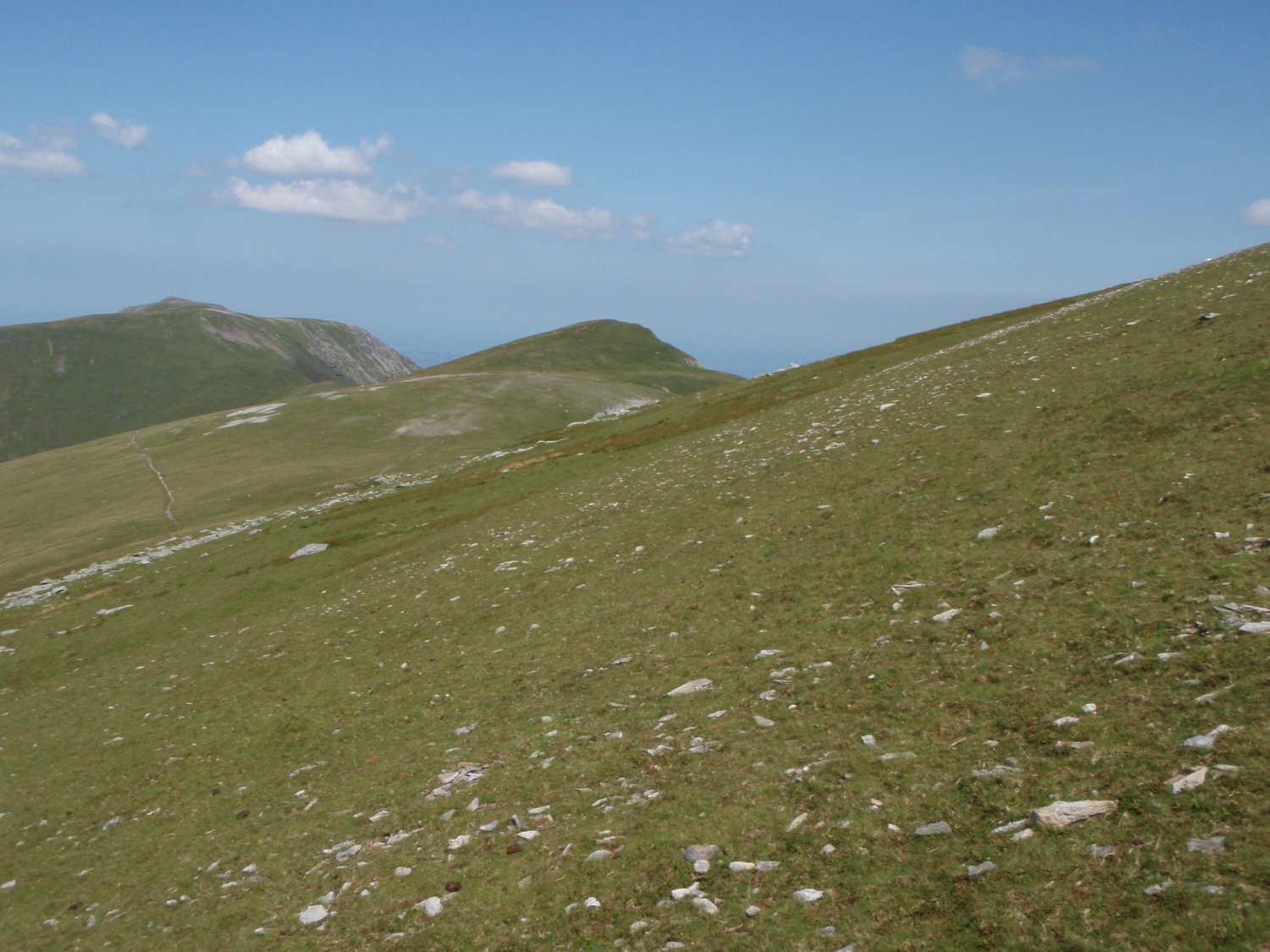
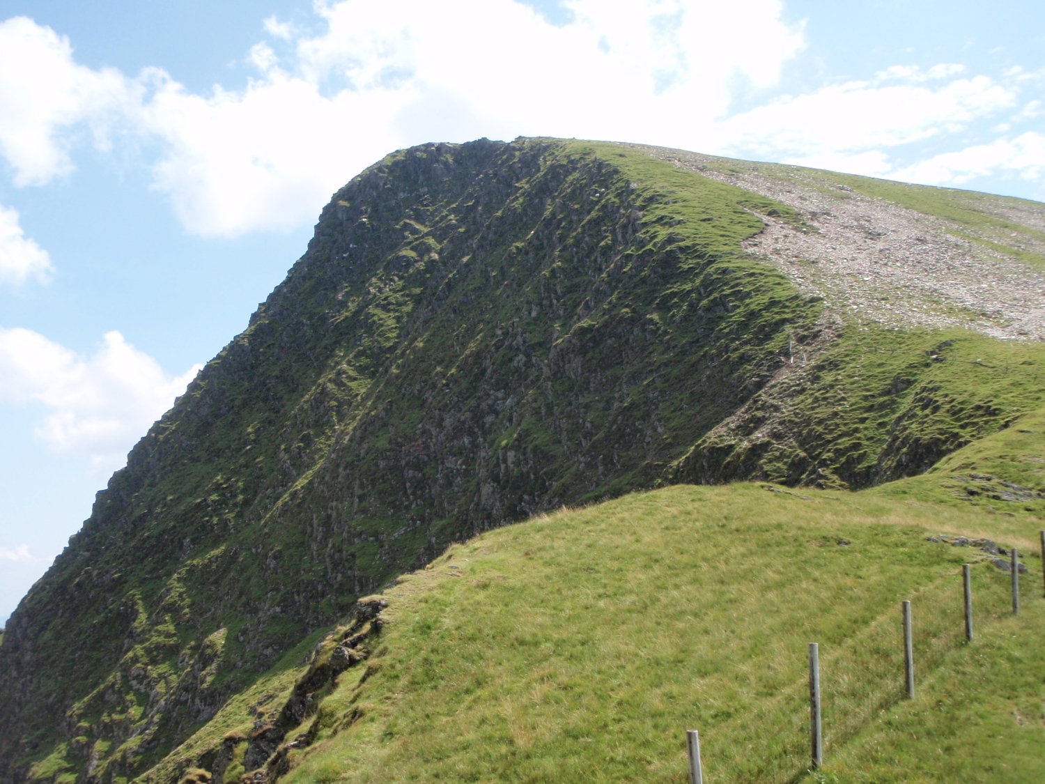
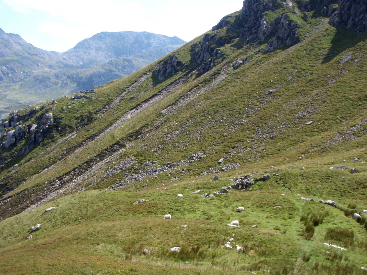
Foel Goch from the High Level path above Nant Ffrancon
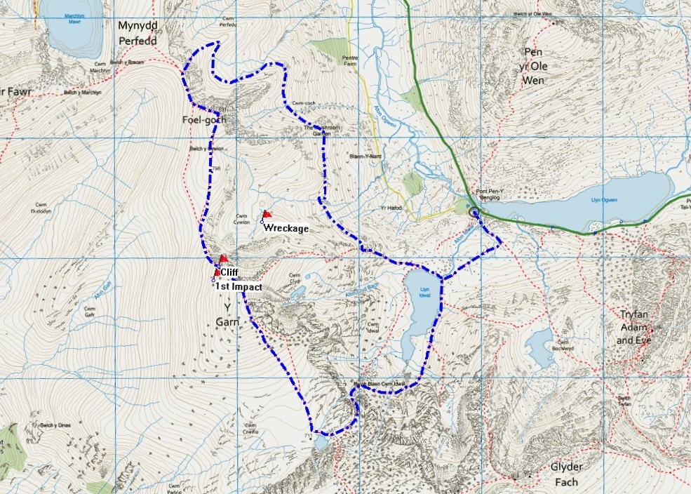
Map showing my route, and the site of the aircrash of February 1945
After my recent Carneddau trip (see post #155) I had checked the map and realised that I had passed close to several aircraft crash sites on the route – most of these date back to WW2, when training flights sometimes ended in tragedy in the mountains of Snowdonia. This time I’d decided on a day out in the Glyderau, mainly to check out a path I had read about running below the slopes of Y Garn and Foel Goch. Whilst checking the route I came across the story of a flying accident in 1945 – a bit of history with the walk seemed like a good idea.
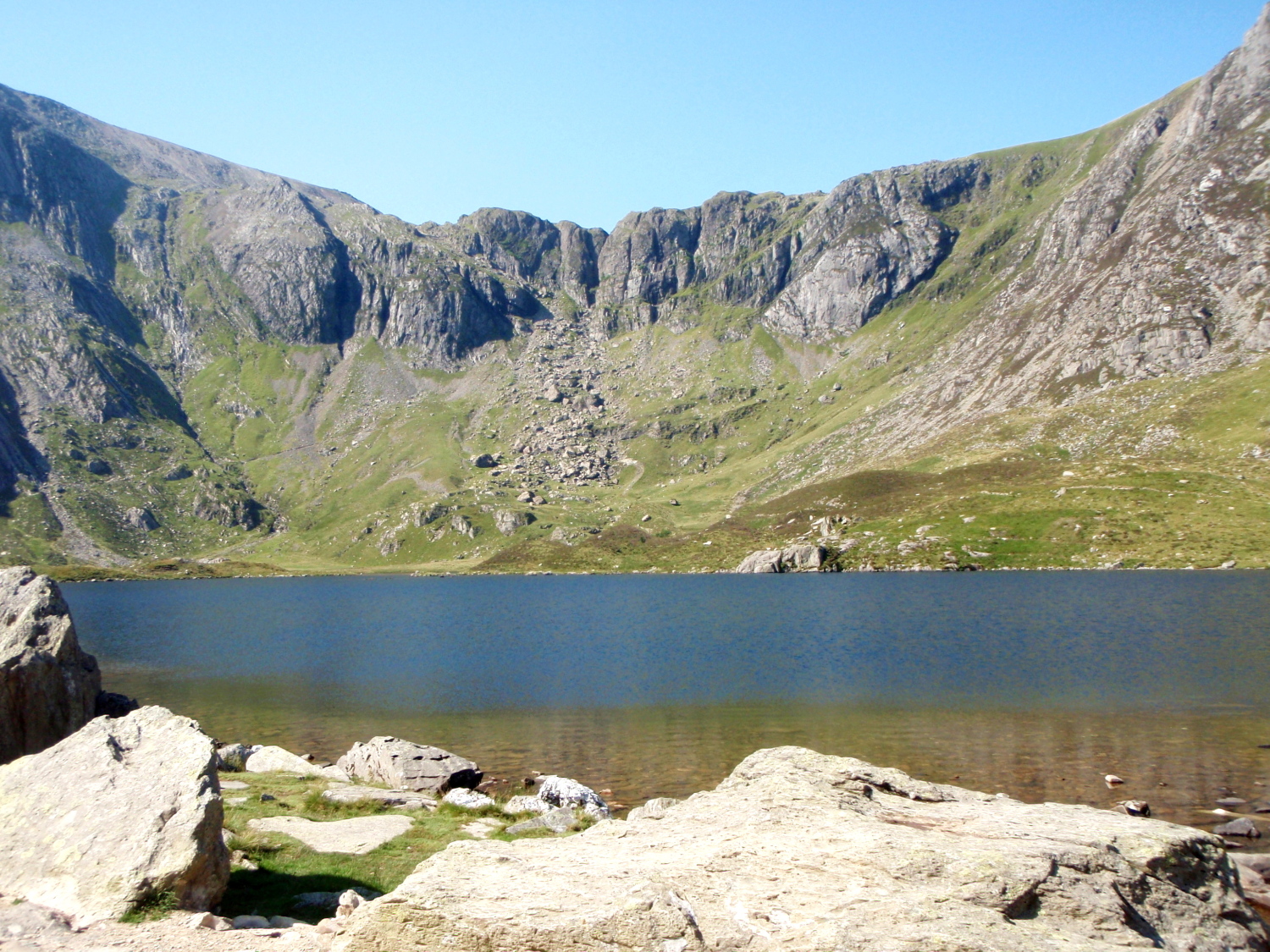
Llyn Idwal with Twll Du (The Devil’s Kitchen) behind
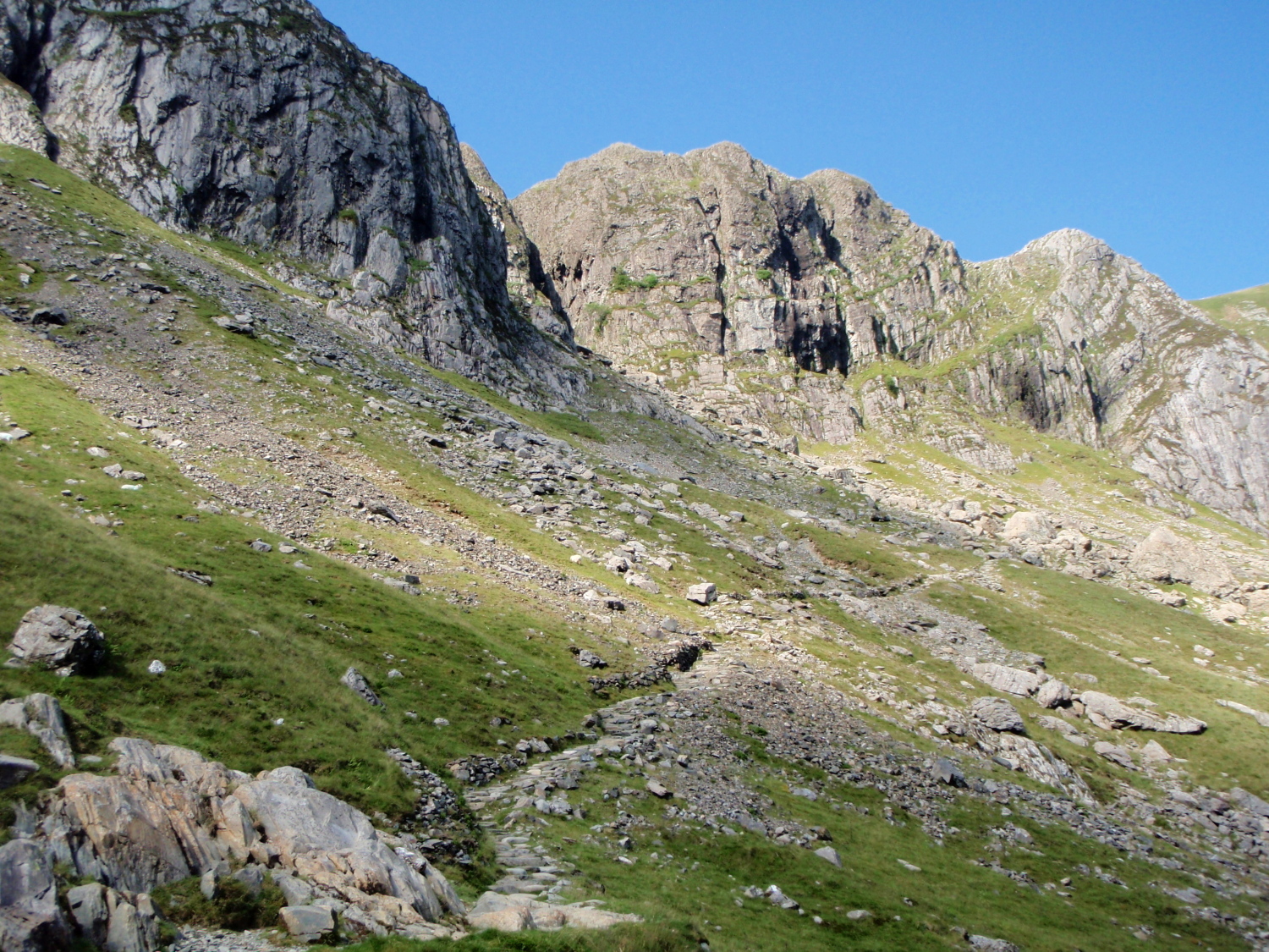
The path from Idwal slabs to Twll Du
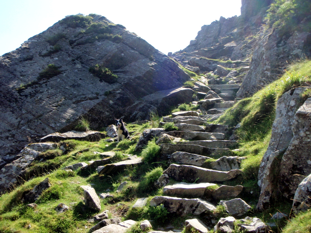
The well maintained path below Twll Du
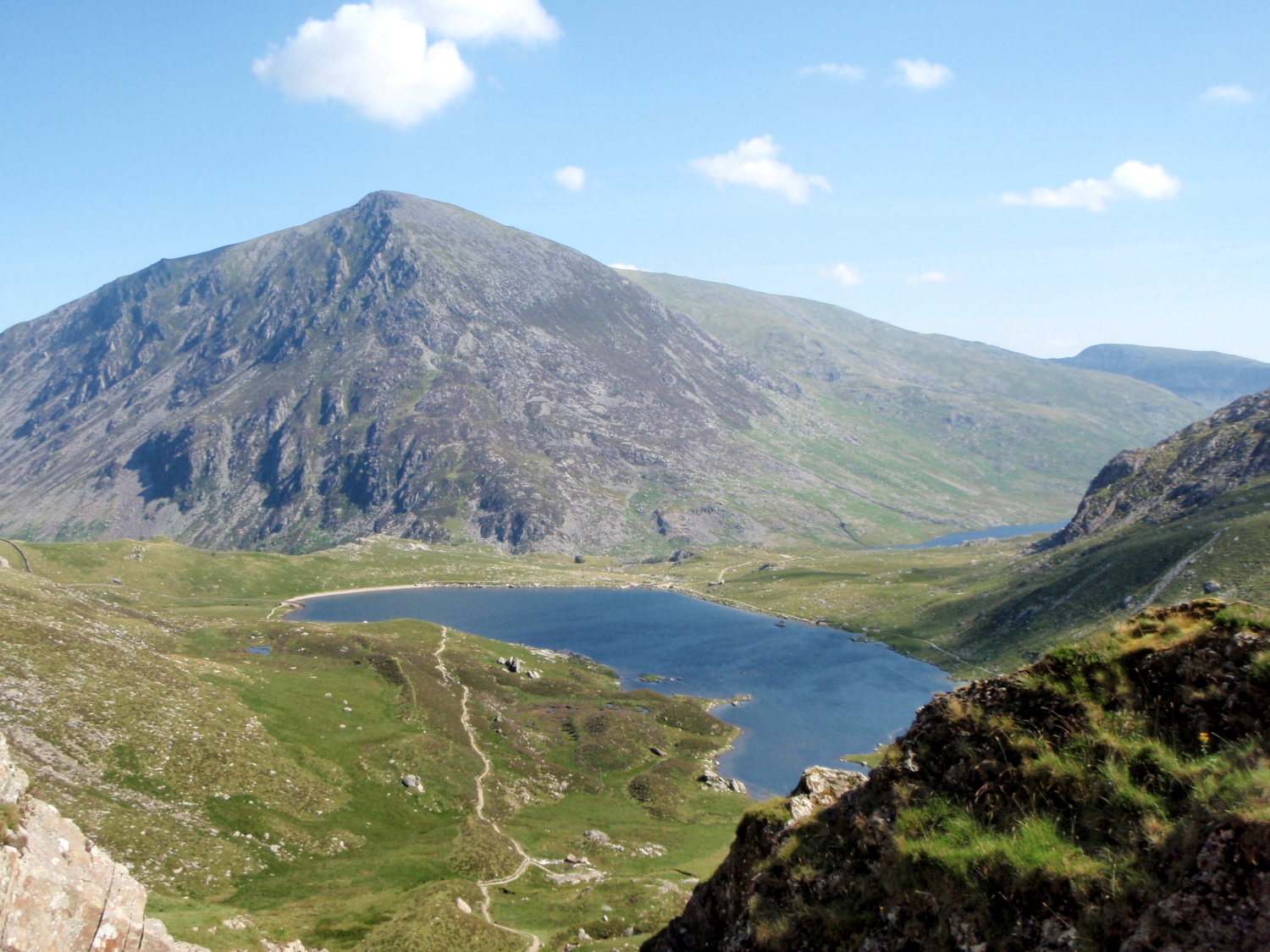
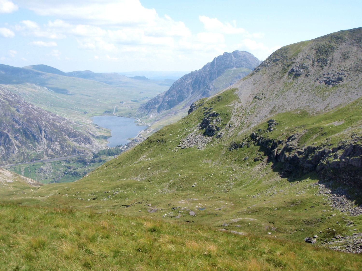
Looking back towards the lake of Llyn Idwal with Pen yr Ole Wen beyond
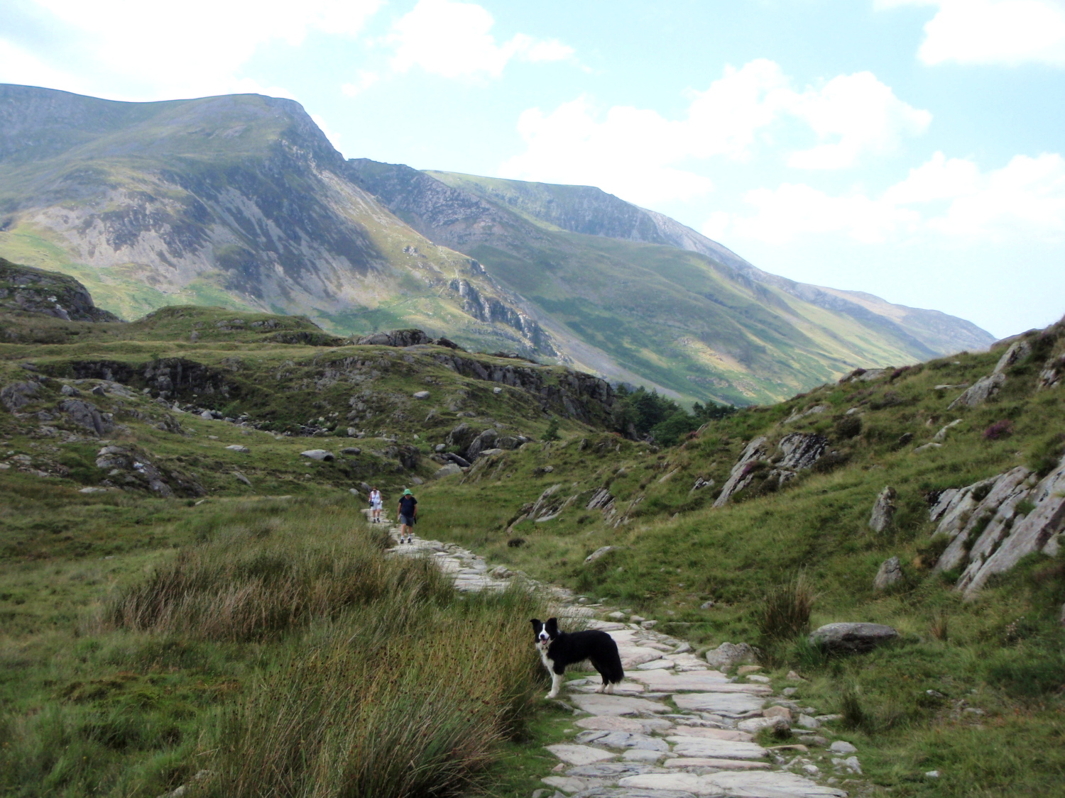
Many a good day out on the hills of the Glyderau starts off from Ogwen Cottage, and this was no exception. I took the east side of Llyn Idwal, passing under the rock climbers’ crag of Idwal Slabs (see post #87) before heading up towards Twll Du (‘The Black Hole’ but usually called ‘The Devil’s Kitchen’ by we English). Although the ascent is fairly steep in places, the constantly changing views made it enjoyable.
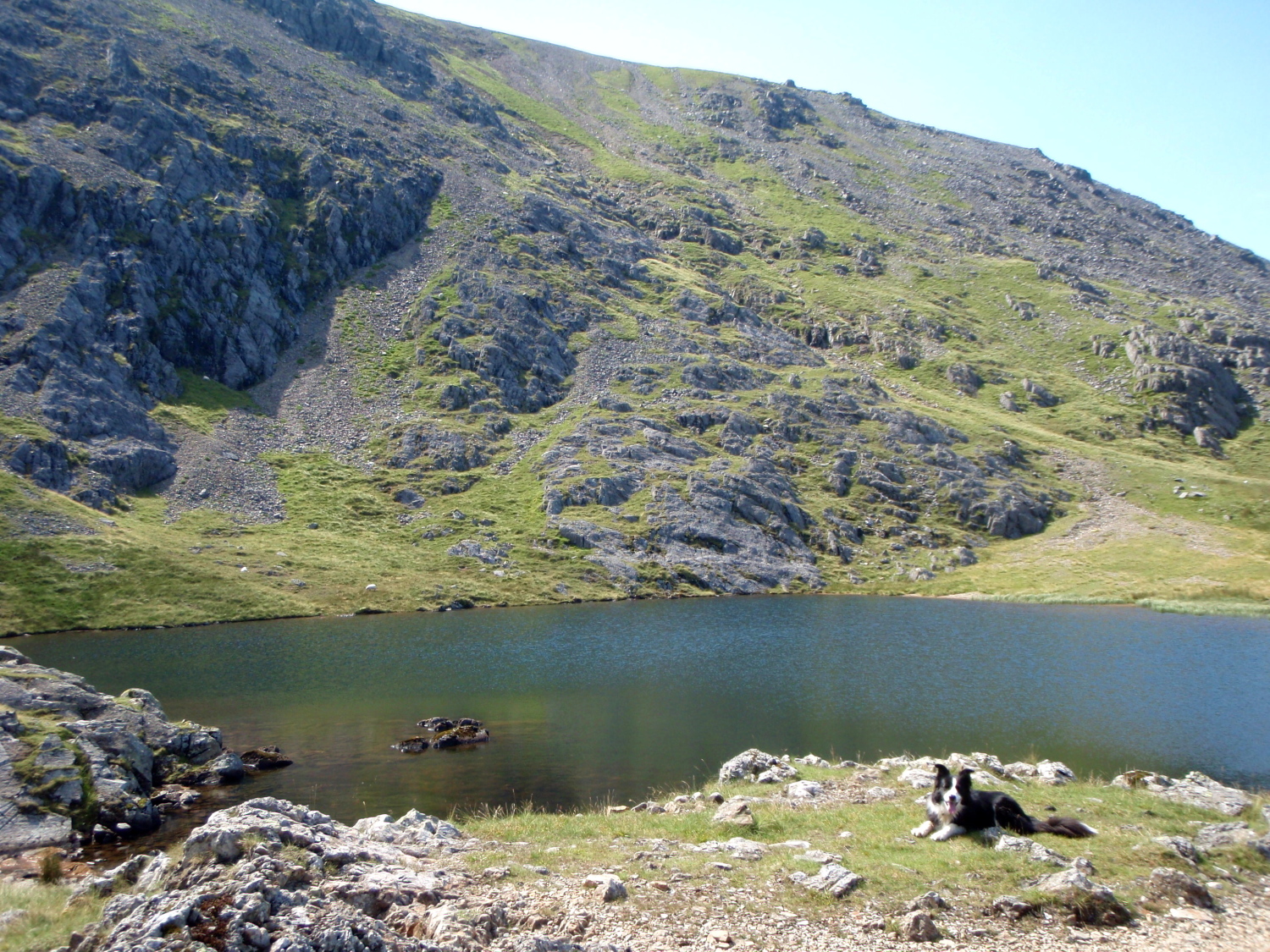
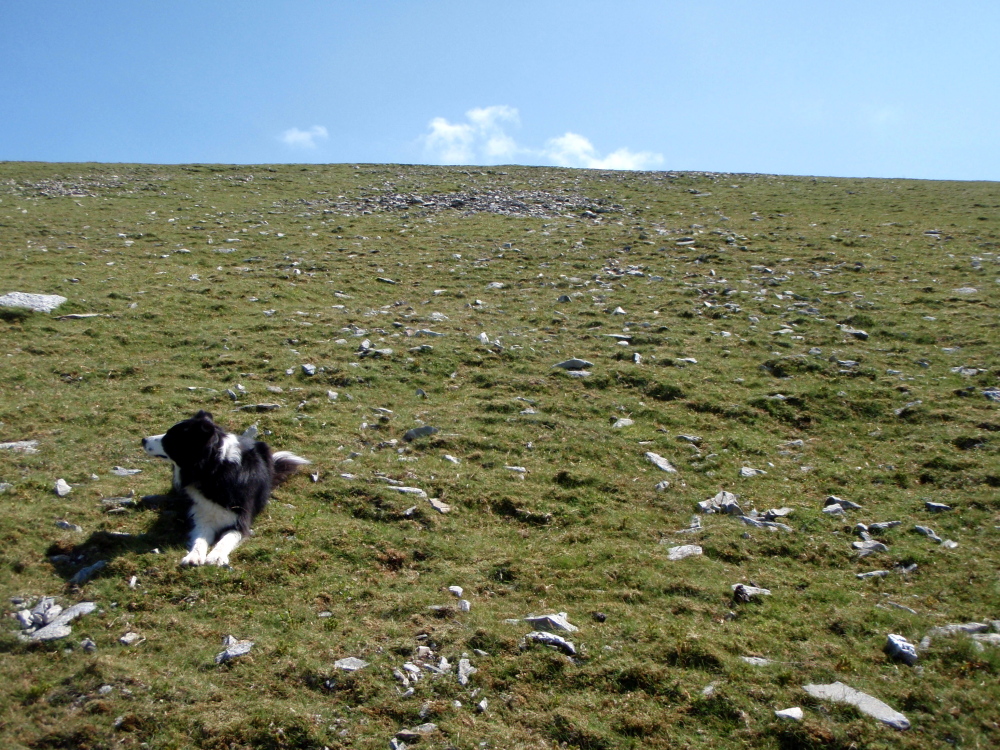
Border Collie ‘Mist’ at Llyn y Cwn
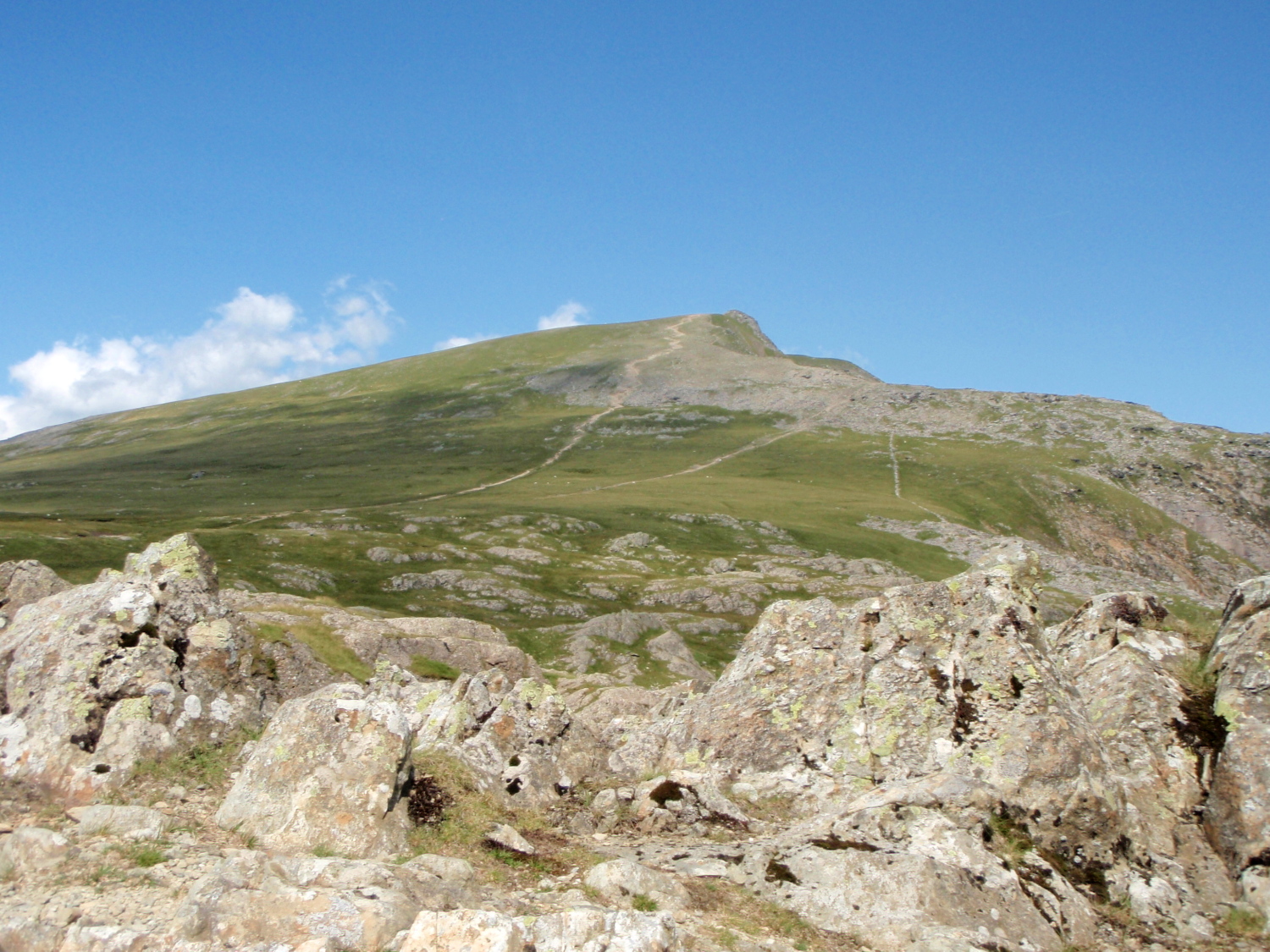
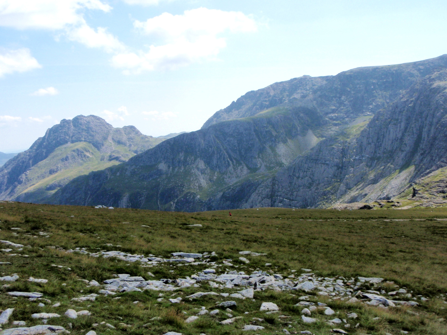
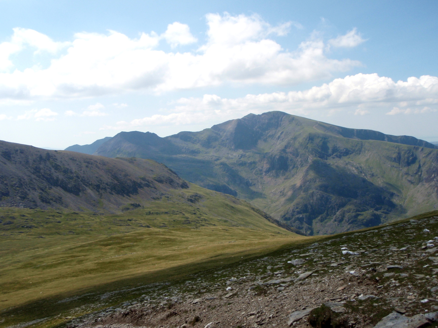
First view of Y Garn to the north
At the top of Twll Du I arrived at the small mountain lake of Llyn y Cwn (The Dogs Lake) but on this occasion I had to make do with just one dog, my constant hill-buddy, Border Collie ‘Mist’ – the great thing about walking in the hills with a dog is that they never complain, never ask for the map and never get bored posing for the camera. Keep an eye on your lunch though!
Looking back to Tryfan (left) and Bristly Ridge (centre skyline) on Glyder Fach
View of Crib Goch (left skyline) and Cwm Glas (just below centre skyline)
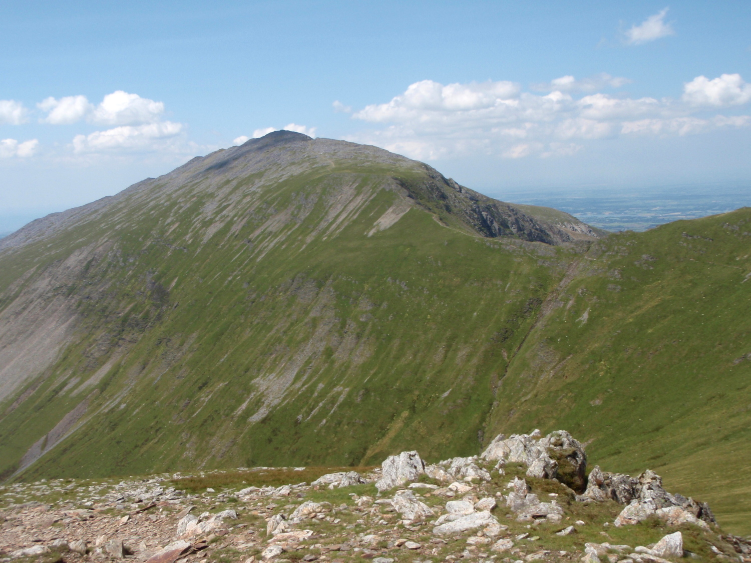
From the lake I had a good view of Y Garn (‘The Cairn’) to the north and equally good views of old friends Tryfan with nearby Bristly Ridge and a more distant view across to Cwm Glas near Yr Wyddfa (Snowdon) featured here in July (see post #154). Y Garn was the objective for today though, and on the easy walk up towards the summit my thoughts were on the tragic accident that occurred here in February 1945.
* * *
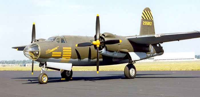
B-26 Martin Marauder
In January 1945, sixteen B-26 Martin ‘Marauder’ Bombers set off on a long flight from Florida to the USAAF base at Burtonwood in the Northwest of England. WW2 was drawing to a close, and there was little danger from enemy aircraft – the main danger was the winter weather in the North Atlantic, and the aircraft were routed via Trinidad, Brazil, Dakar and Marrakech to avoid the storms. Ironically, it was bad weather on the final leg from St Mawgan in Cornwall to Burtonwood that led to the accident on 1st February.
‘Mist’ at the approximate location of the first impact
Looking towards the top of the cliff where half of the wreckage ended up
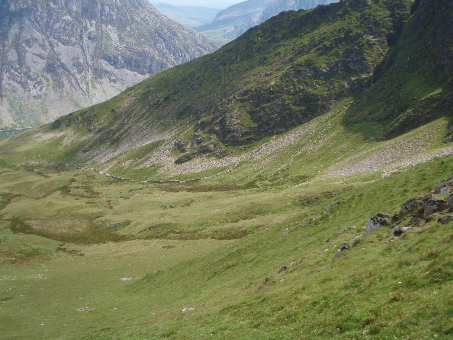
Looking down into Cwm Cywion where the remainder of the wreckage fell
Low cloud and bad visibility sowed the seeds for the disaster, added to strong winds that pushed the aircraft off course, and instead of taking up the approach for the airfield at Burtonwood, the aircraft crashed into Y Garn, just to the north of the summit – the aircraft was only 100 kms (62 miles) from its final destination. All five members of the crew were killed instantly, and the aircraft broke in two, with part of the wreckage lying at the top of the cliffs above Cwm Cywion, and the remainder lying in the cwm below.
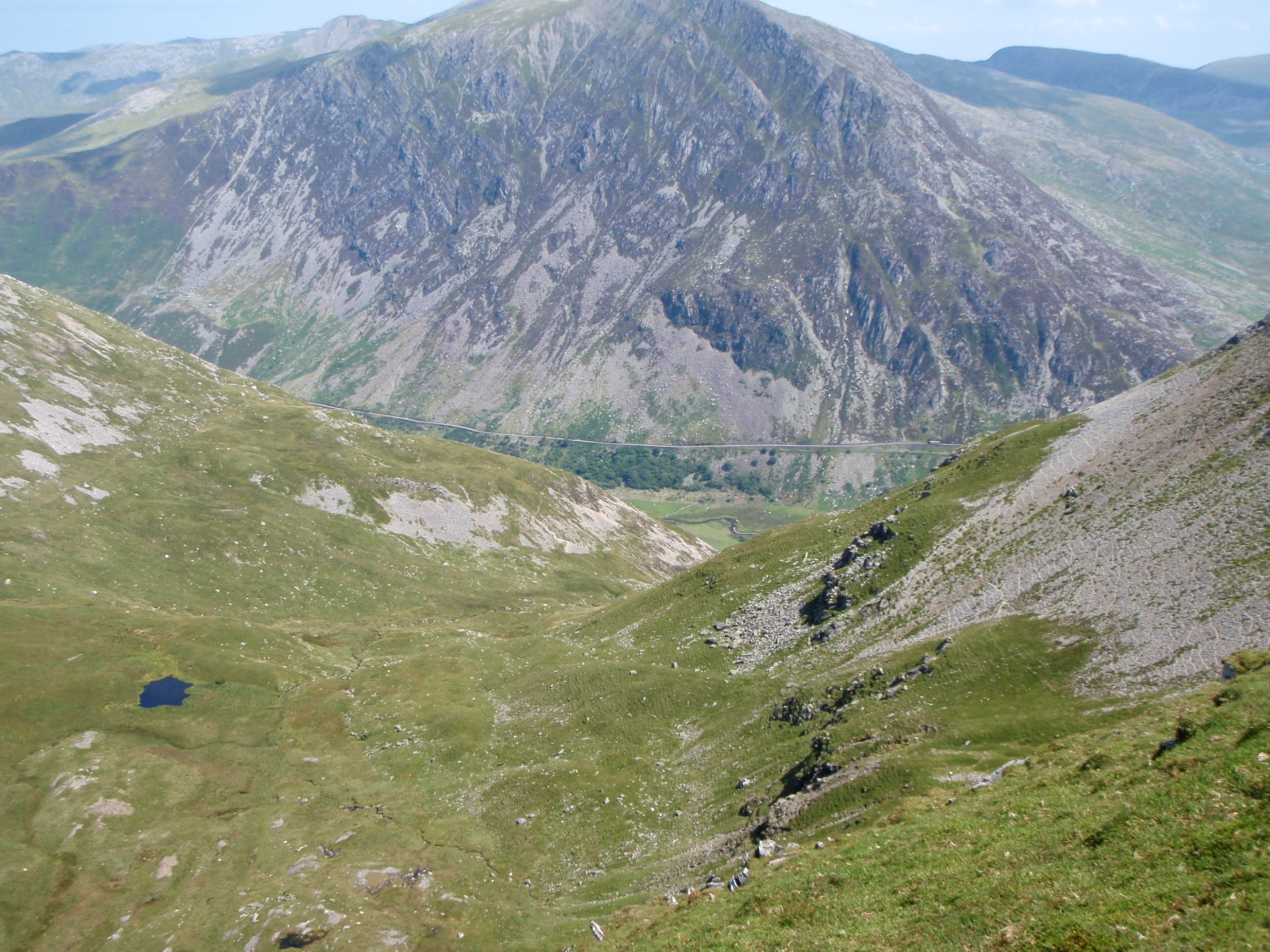
Another view of the cwm, with Tryfan and the lake of Llyn Ogwen beyond
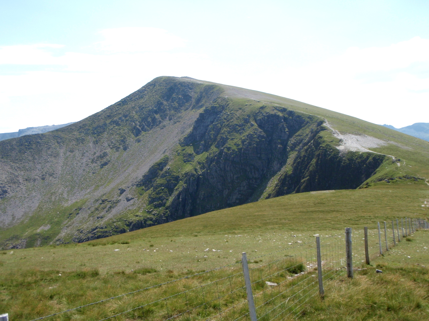
Y Garn from the north – the stony area above the cliff (right of centre) is the upper wreckage site
On 2nd February, the aircraft was posted as missing, and at 1445hrs the RAF Mountain Rescue Team at Llandwrog, near Caernarvon, was notified. Information had been received from a bus driver in the Llanberis Pass that a low flying aircraft had been heard in the area on 1st February, followed by the sound of an explosion. The rescue team found the wreckage at 1845hrs on 2nd February, but recovery of the bodies had to be delayed until the next day, due to atrocious weather conditions.
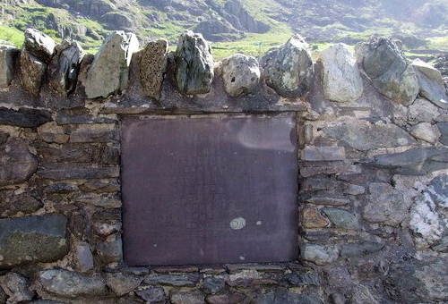
The memorial near Blaen y Nant in the Llanberis Pass
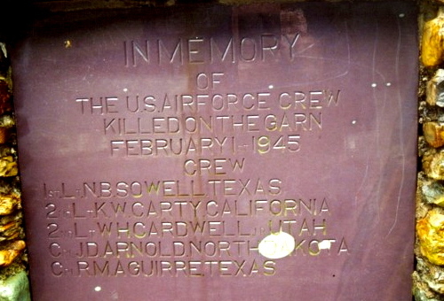
Close up of the memorial
The wreckage above the cliffs remained in place for many years, before being removed in the 1970’s, though some of the remains of the aircraft may still be found at the lower site in Cwm Cywion. In the mid-1980’s, Arthur Evans of the Snowdonia Aviation Historical Society arranged for the placing of a memorial to the lost airmen near Blaen y Nant in the Llanberis Pass.
* * *
The northern cliffs of Foel Goch
Looking northwest towards Elidir Fawr
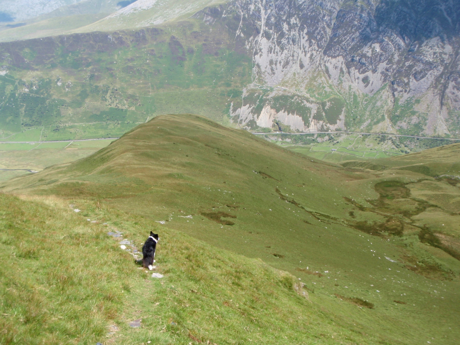
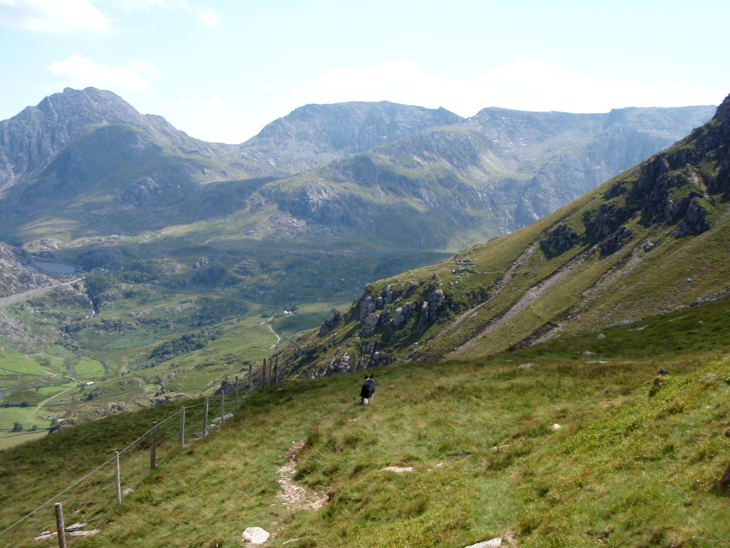
It was time for me to continue the route. The dog and I made good progress heading towards Foel Goch and Elidir Fawr (see post #90). I’d been here a couple of weeks earlier, helping with the marshalling of the Snowdon 7’s Race, where three of us had had a blustery and wet couple of hours on Foel Goch summit, but conditions today were brilliant. Elidir Fawr wasn’t on today’s menu though – I was looking for a path leaving the ridge, heading down to a high level path above the Nant Ffrancon valley.
The start of the descent ….
…. before heading towards the stone wall (dead centre in the photo)
The northeast cliffs of Mynydd Perfedd, site of two more air-crash sites
The start of the high level path back to Ogwen, with Nant Ffrancon below
Sure enough, the path turned up, exactly where it should have been. A short descent led to a right turn and a wander across the upper part of Cwm Bual to a stone wall that made a great navigational handrail; to the left lay the cliffs of Mynydd Perfedd, where there are two more aircrash sites, one from 1943 and the other 1944, both accidents involving Avro Ansons – a total of nine lives were lost in these two separate flying accidents.
The path just visible left of centre ….
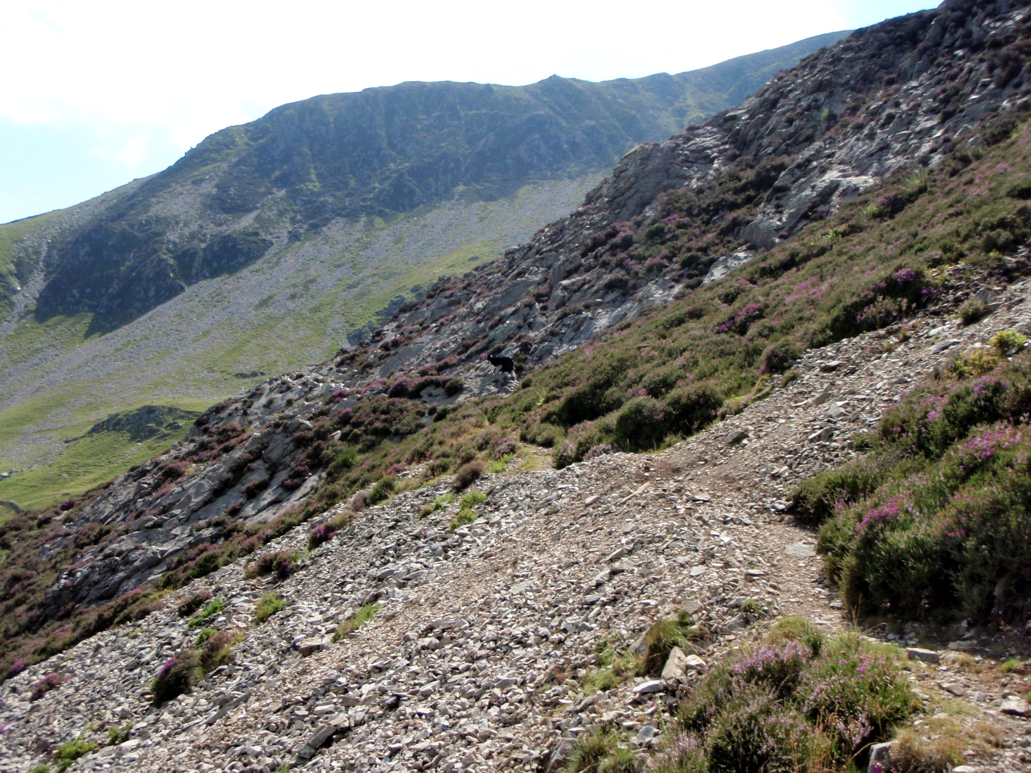
…. going on ….
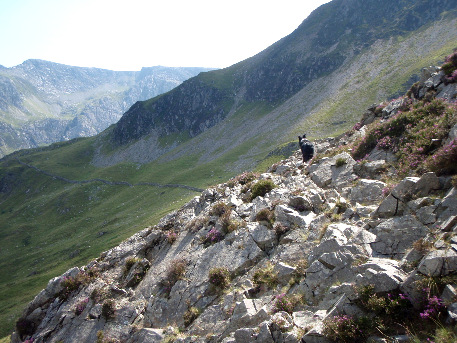
…. and on
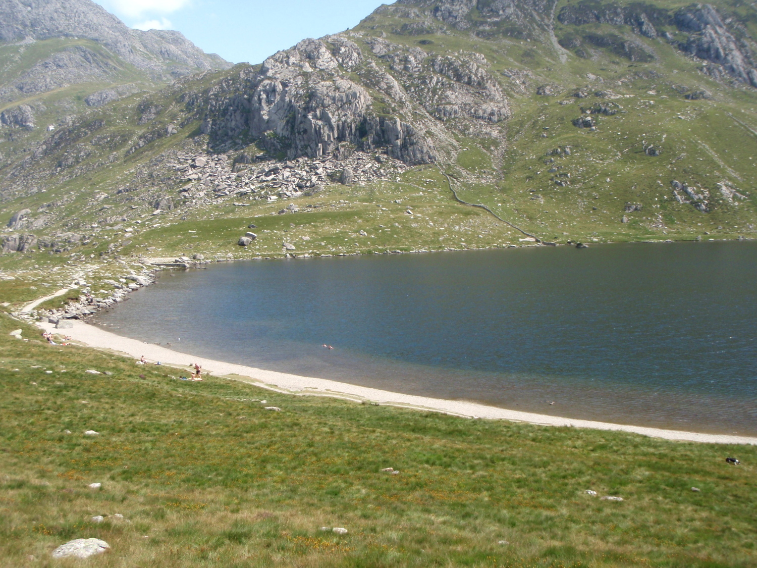
Back at Llyn Idwal, complete with beach
From Cwm Bual the high level path was easy to find and to follow, though lack of wear suggests that not many come this way. In places it was little more than a sheep track, and at times there were some nicely airy views down to Nant Ffrancon below. Before long I had picked up the worn path coming off the Northeast Ridge of Y Garn, leading the dog and I down to the shoreline of Llyn Idwal, where the warm weather had tempted several swimmers into the lake – the dog declined the offer of a swim, but settled for a paddle instead.
On the last leg for home
Text and images © Paul Shorrock

Beautiful photos and story as always!
I agree about taking dogs along, no complaints, no ‘are we there yet?’ Just a let’s go attitude! 😃
Thanks for the kind words MP Girl – I couldn’t imagine going into the hills without my dog 🙂
The sad story in the post was repeated too often in the war years, and many of your countrymen died in our hills following aircrashes – you will note from the memorial photo that there were five lives lost here – two from Texas, one from California, one from Utah and one from North Dakota. Very sad.
I always find aircrashes sad… I’ve been down into that cwm from Foel Goch and didn’t realise there was anything there.
Does that traverse path go anywhere near Atlantic Slab? or does it start after it? I haven’t done that path before but it looks interesting for a return to Cwm Idwal. I prefer to go up the front of Y Garn though – I like both the routes up the front 🙂
Carol.
Hi Carol, the path doesn’t go as far as Atlantic Slabs – it’s a really good way back towards Idwal, and is nicely airy in places without getting too ‘interesting’!
I have often wondered if there was a different way back to Ogwen from this ridge. As is so often the case, the maps don’t show clear evidence of one – but I’ve got used to the disconnect between ground and map! You had a great day for this walk, Paul. And thanks for the info – it might come in useful one day.
Cheer Andy