
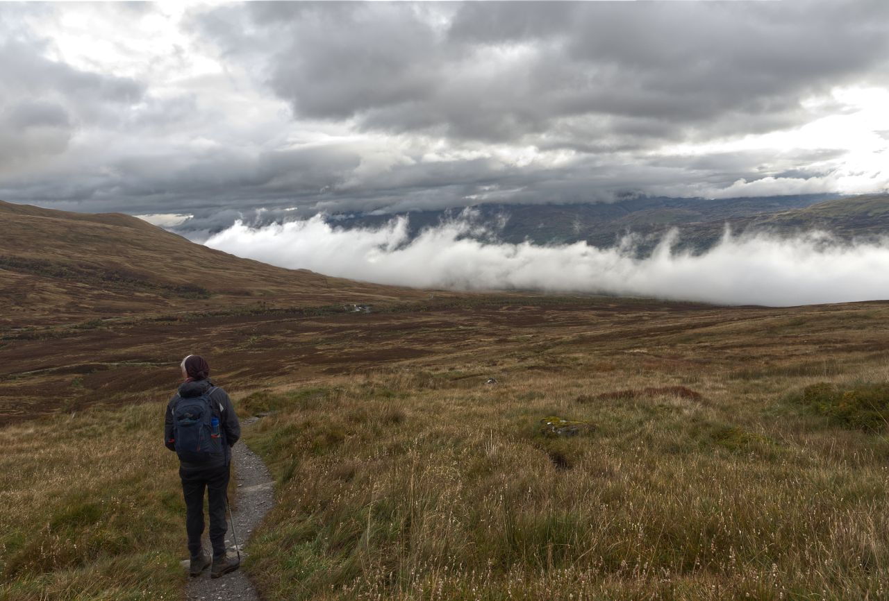
Soon after the start – Chris looking back to the cloudy Tay Valley
(For the best viewing experience, left-click the images and maps to zoom in, then use your browser return arrow to go back – go on, it really does work!)
Our September 2020 trip to Scotland was destined to extend into October. There was still no second Covid-19 lockdown in Scotland at the time, so we could move around freely, but back home in North Wales movement was restricted to the local area. If we went back, we would be stuck in Denbighshire, lovely though it is, whereas staying in Scotland meant that we were still free. It was a ‘no brainer’ as to what we should do!

The Tay Valley (centre) and the village of Killin
We had been on the West side of Scotland for a while, but I wanted to head for Glen Lyon for a photographic trip (more of that in a future post). Somewhere to park up with a mountain dog-walk, seemed to be a good plan, so we headed for the Ben Lawers car park above the pretty village of Killin in the Tay Valley.
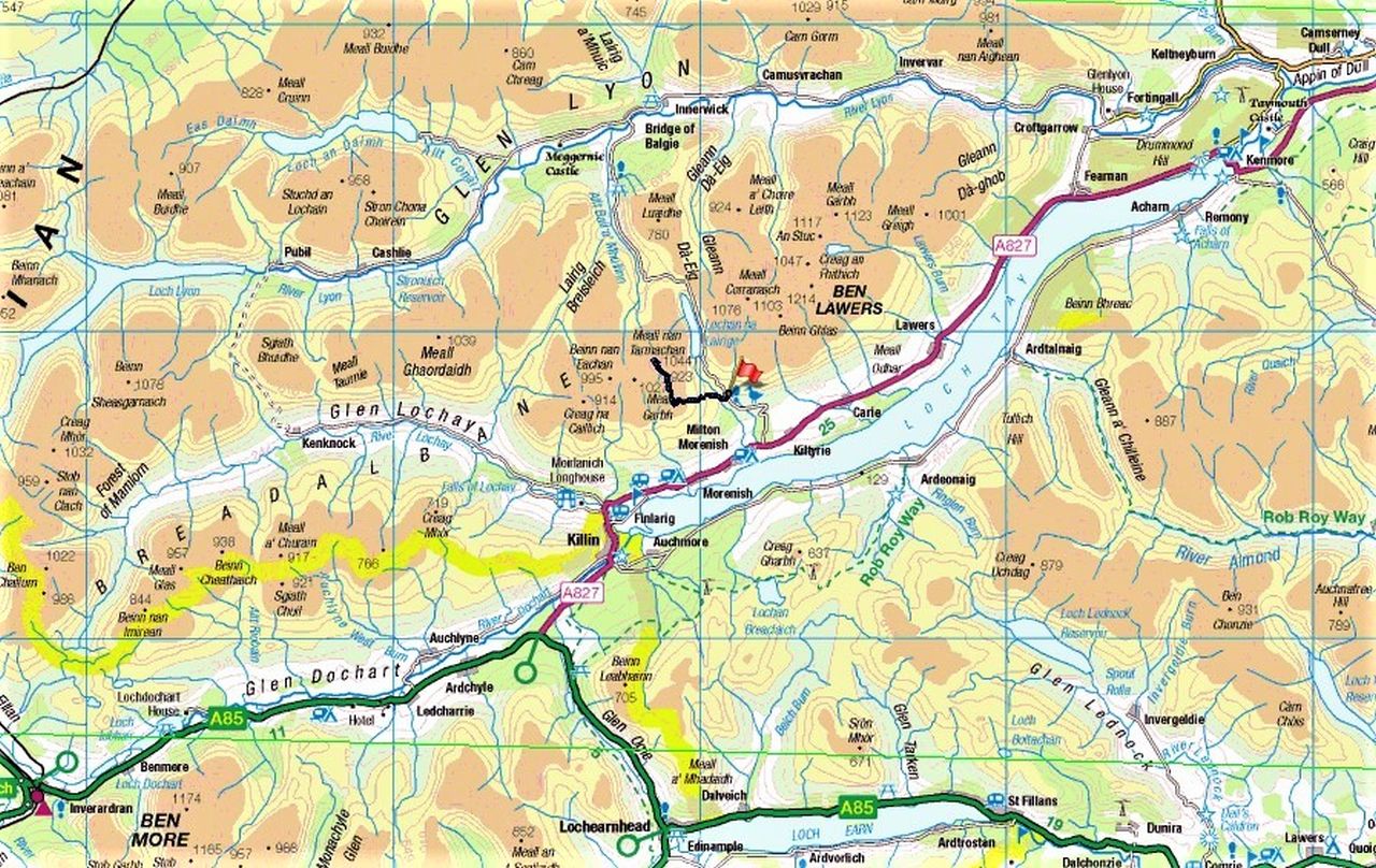
Loch Tay and the Meall nan Tarmachan route
The weather wasn’t what you might call bad, just a bit ‘iffy’! It looked as though things could go either way, so instead of the main attraction of the area (Ben Lawers) I suggested that we might do Meall nan Tarmachan. At an altitude of 1044 metres it wasn’t a tiddler, but our start point was at 420 metres, giving us a bit of a head start up one of the easiest of the Scottish Munros.

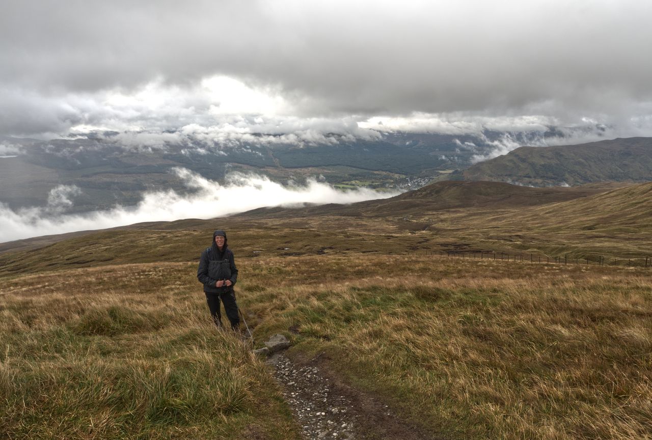
Closer view of the route – out and back
For those not familiar with the term, a ‘Munro’ is a mountain in the UK that is 3000 ft (915 metres) in height. The list of peaks over 3000 ft was first drawn up by Sir Hugh Munro (1856–1919) for no other reason than they were higher than 3000 ft (Sir Hugh’s other claim to fame was possibly one of the earliest known examples of Obsessive-Compulsive Disorder 😉). At the time of writing, there are 282 Munros in Scotland, six in England and fifteen in Wales. I say ‘at the time of writing’ because new surveys are constantly promoting or demoting Munros, a bit of a setback if you have just finished the list to find that a newbie has been upgraded.

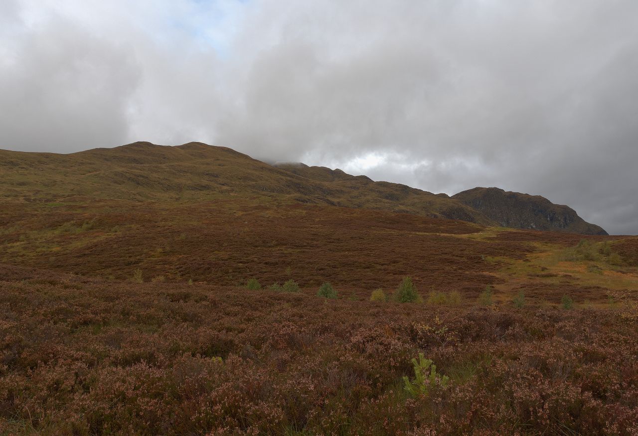
Just after leaving the car park – pioneer tree species hanging on in there
I don’t claim to be a Munro-ist, and Chris certainly isn’t. Although I have huge respect for those dedicated enough to hike over the highest of our British hills, I couldn’t bear to drive or walk past a superb mountain that just failed to reach 915 metres, in order to tick off a distant, but less interesting, Munro. One thing is certain though – a hiker who has completed all the Munros can claim to have an excellent knowledge of the mountains and wilderness areas of Scotland.

The ‘unlovely’ visitor centre (now demolished) and the old car park (replaced) © Dr Richard Murray

The old National Trust of Scotland visitor centre closed in 2009, later demolished © Gordon Brown
The last time I had been here was about 25 years earlier, when a climbing buddy and I were heading back from a big mountain weekend in Glencoe – we wanted an easy-ish hill day for the Sunday and went slightly off route on the way home to walk up Ben Lawers. The advantage of the high start point had been marred only by the unlovely National Trust of Scotland visitor centre and car park, so it was a pleasant surprise when Chris and I arrived to hike up Meall nan Tarmachan that the visitor centre and ugly car park were both gone.
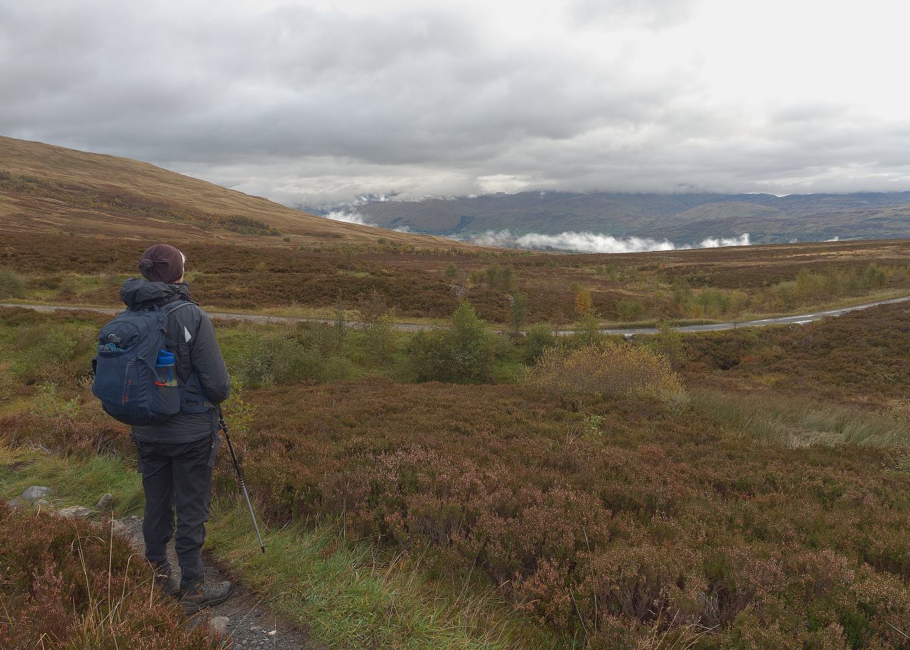
Looking back again to the Tay Valley ….
…. and Meall nan Tarmachan poking through on the right
Looking down towards Killin – starting to brighten up?
The skies were leaden and the breeze chilly as Chris and I set out with Border Collie ‘Mist’ for our Munro dog-walk. A combination of altitude and latitude means that only the hardy pioneer species of trees such as silver birch and rowan have much of a chance of surviving, and most of the ascent was over bleak moorland, made bleaker by the glowering clouds.

Border Collie ‘Mist’ below the small unnamed summit at 923 metres

The summit of Meall nan Tarmachan (1044 metres) on a good weather day © David Brown ….

….and what it looked like for us

Chris (and ‘Mist’) officially claim the summit!
A small false summit at 923 metres gave a vantage point of the final steep and rocky ascent of Meall nan Tarmachan – well, it would have done if the cloud base hadn’t dropped to obscure the last 100 metres of ascent. Apparently, the views down to the Tay Valley more than justify the ascent, but not today and not for us. The question was, where next?

Map 1 – Our out and back route in blue, with the continuation to Meall Garbh shown in red

Map 2 – From Meall Garbh, the first alternative could have been the Tarmachan Ridge circuit

Map 3 – The second alternative could have been the south Ridge of Meall Garbh
One option would have been to continue southwest from the summit to Meall Garbh (see the maps above) to continue on the first alternative, which was a traverse of the Tarmachan Ridge. There didn’t seem to be much point in that in the poor visibility, and I didn’t know at the time that there is another descent route down the South Ridge of Meall Garbh. That left one final option, to return the way we had come.

On the way back – our ‘stalker’ (type unknown) flying just left of centre
The poor visibility also prevented us from identifying the large bird that decided to check us out – I tried for a photograph, but by the time I had the camera ready, our ‘stalker’ was moving out of range. I claimed yet another eagle sighting, though Chris wasn’t convinced. We did agree though that the weather was starting to brighten up, at least for the good folks in Killin. Things were brightening up even more for Collie ‘Mist’ – heading down meant it was getting on towards dinner time.

On the direct descent from Meall nan Tarmachan with the weather definitely brightening ….

…. and it’s time to head for home
Text and images © Paul Shorrock except images tagged Dr Richard Murray, Gordon Brown and David Brown, which are taken from the Geograph Project and are reproduced under a Creative Commons Licence


So beautiful! Do these mountains get much snow?
LikeLike
As a general rule, yes! The Ben Lawers area, which is adjacent, was the first popular ski area in Scotland, but it didn’t have mechanised lifts. In most years you would find snow here and northwards from December till April though global warming is making this less reliable. The nearby Cairngorms have an Arctic climate over the winter months, despite only being around the 4000 ft mark.
LikeLiked by 1 person
Shame you didn’t get to do the full circuit – I found the Munro and first top fairly boring but the rest of the round is anything but! Quite exciting at times in fact and with stupendous scenery…
LikeLike
Shame indeed – I think we’ll be back 🙂
LikeLike
On a clear day, the round has the most stupendous scenery!
LikeLike
Pingback: #294 – The Praying Hands of Glen Lyon | Paul Shorrock – One Man's Mountains AKA One Pillock's Hillocks
Pingback: #310 – Beinn Ghlas & Ben Lawers | Paul Shorrock – One Man's Mountains AKA One Pillock's Hillocks
Thhis is awesome
LikeLike
Aww, thanks Shirley 🙂
LikeLike
Pingback: #334 – Creag Bhuidhe, Killin – first hill day for the boy! | Paul Shorrock – One Man's Mountains AKA One Pillock's Hillocks