

For the best viewing experience, left-click the images and maps to zoom in to a new window, then exit that window to go back – go on, it really does work!
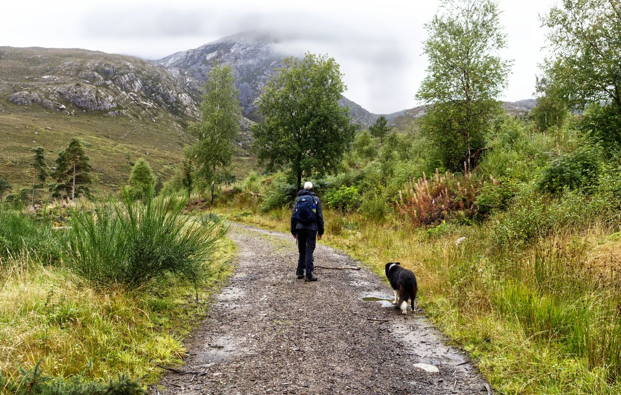
If you have been following recent blog posts, you might be excused for thinking that the Scottish Highlands are a sun trap, and the myths about rain and wind are just that – myths. Well, sadly that isn’t always the case, but whether it’s rain or shine we still have a Border Collie wanting to get out for a walk. We usually manage to find something interesting though, even if it doesn’t always involve heading up a mountain.
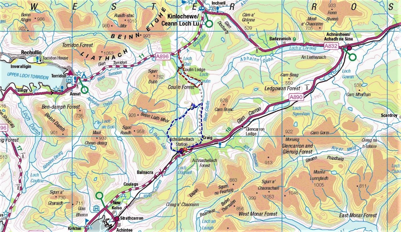
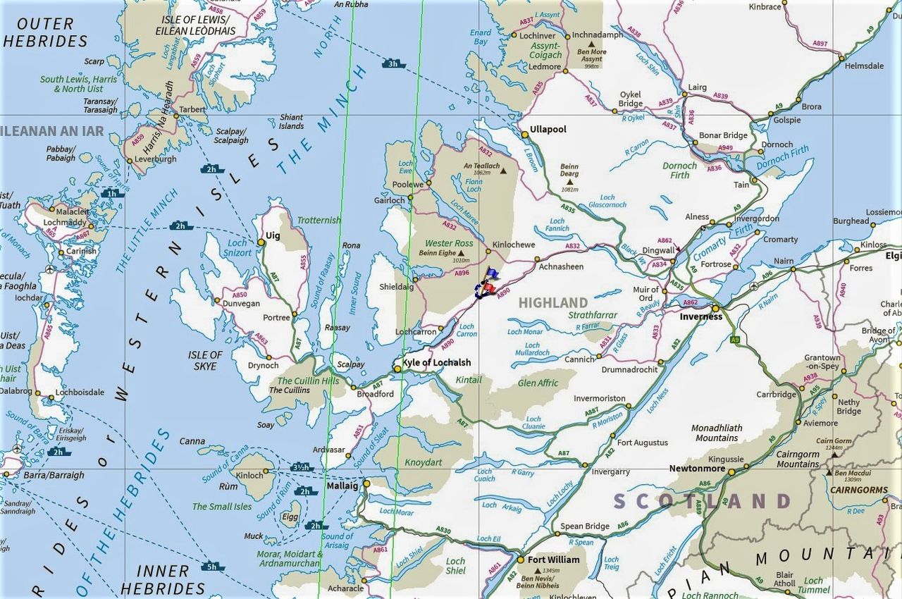
September is often a time of fine, settled weather in the Highlands, but in 2021 the middle of the month had a few rainy or blowy days. We were down in Wester Ross by now, which usually means a visit to Torridon – one of our standby low-level routes in Torridon is a circuit of Loch Coulin (shown in red on the map above) which although it doesn’t include heading up a mountain, it does pass through some interesting mountain country.

Looking at the map, it was obvious that the Loch Coulin circuit carries on over the Coulin Pass towards Glen Carron. A bit more research showed a bothy, that was easily accessible from the Glen Carron side – now, I’m a sucker for a bothy walk, and here was one off the beaten track in an area we don’t get to very often.
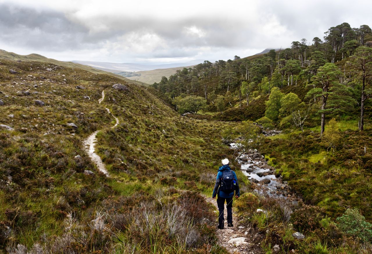
Over the past couple of years, I’ve started to add the occasional lower level walk to our mountain days. These often have the feel of being part of a journey, or sometimes even an exploration. The bothy route looked ideal for a day where the weather forecast wasn’t looking too good, and ‘Mist’ was happy to have a new area to sniff around. In addition, the bothy itself would be a dry spot for lunch if needed, so all the boxes were ticked.
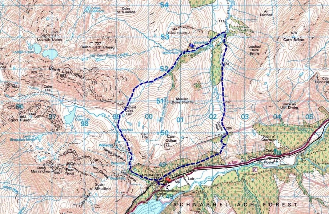
A good map makes route planning a doddle. There was an obvious circular route starting out from the railway halt at Achnashellach – from there, a 15 km circular route wandered through mountain terrain. The 15kms fitted neatly into four sections – a stalkers path cllmbing gradually to Drochaid Coire Lair to start with, followed by an equally gradual descent to the bothy and the Easan Dorcha stream. The third section was a good track over the Coulin Pass followed by a steady descent through woodland back to Achnashellach to finish – we had a route.
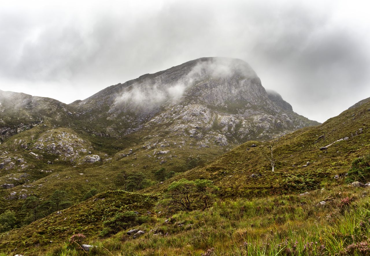


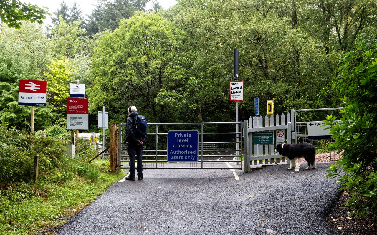
The railway station at Achnashellach is a bit on the pretentious side, with little more than a single platform, but it does give access to some magnificent mountain country. The path soon leaves the woods behind as it skirts below the 907 metre peak of Fuar Tholl. It then winds its way gradually upwards, in the easy way that stalkers paths usually do, before finally arriving at the bealach (pass) of Drochaid Coire Lair below the ridge of Beinn Liath Mhor.


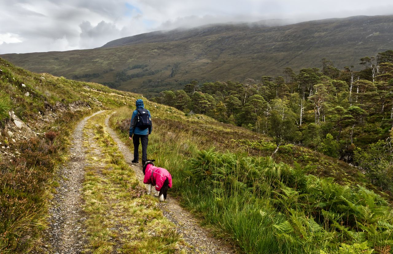
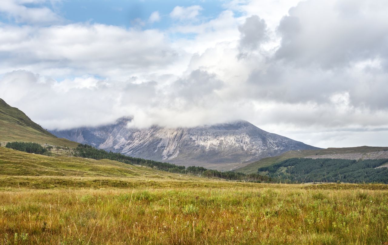
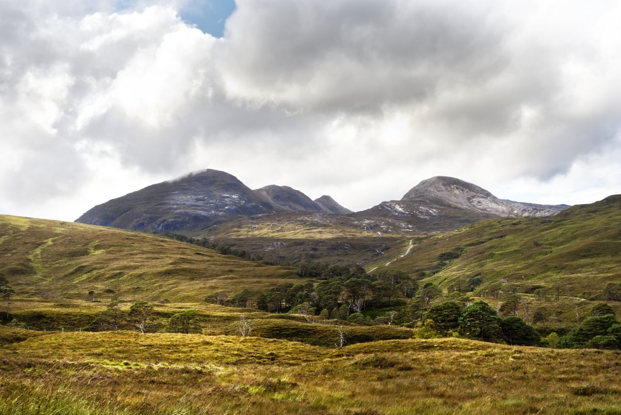
Our view of the Beinn Liath Mhor ridge was clouded out, hence the two images used above taken from the Geograph project – they reveal what looks like a classic Munro ascent, and I’m sure we will be back for that in better weather. Instead, we plodded on down the still excellent path towards the bothy, with waterproof tops eventually coming out of our packs. ‘Mist’ has her own smart dayglo pink jacket, more for our benefit than hers – collies have perfectly adequate fur coats, but once ‘Mist’ is wet, she is wet for the rest of the day!

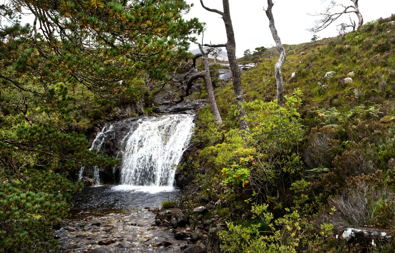
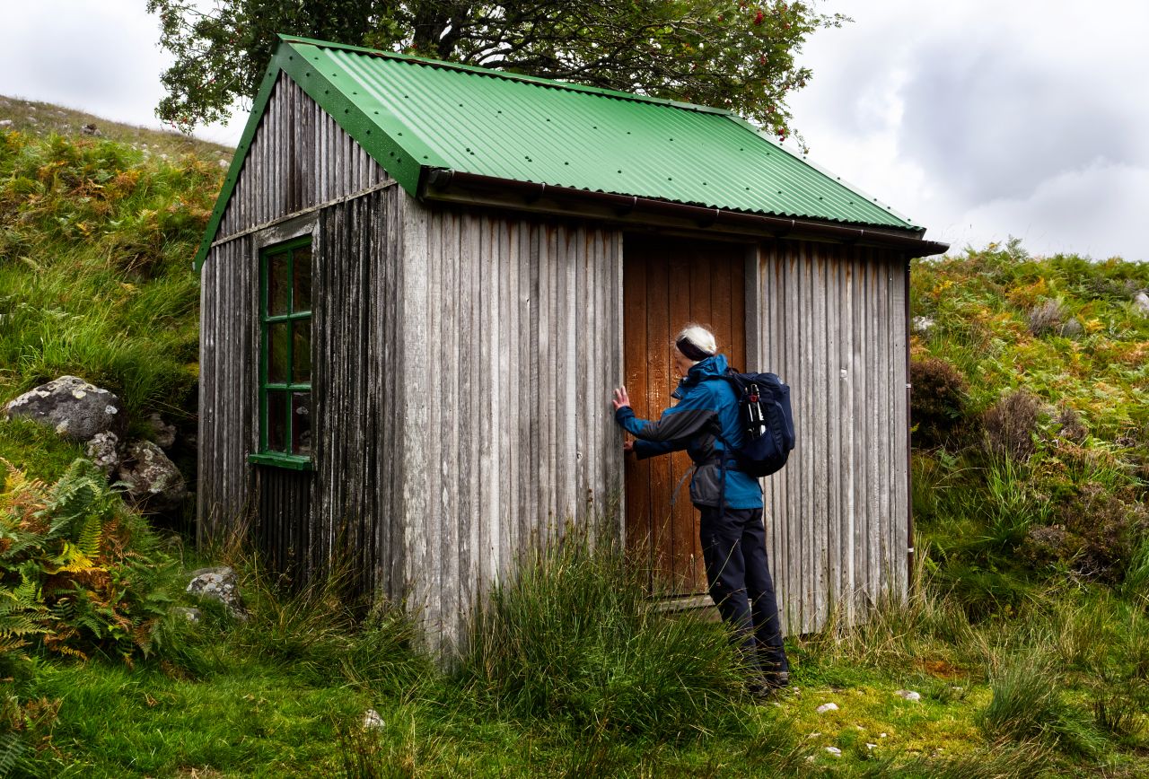

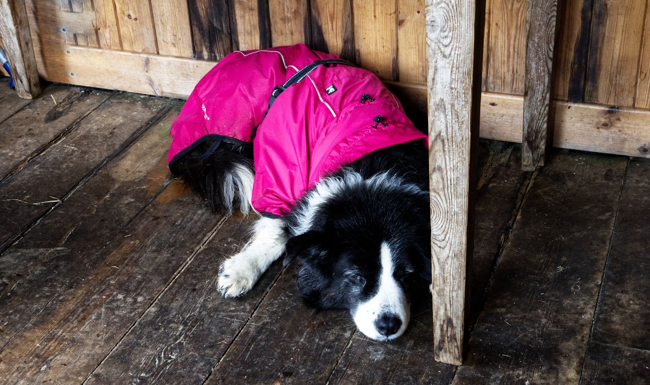
The route passes by native woodland before the bright green roof of the bothy comes into view. The two streams of Easan Dorcha (Dark Waterfall) and Easan Geal (Bright Waterfall) join just before reaching the bothy, which takes its Easan Dorcha name from the larger stream, though it is usually just known as ‘The Tea House’ – in reality, it’s a posh garden shed, though it could be used for sleeping at a push. Which is exactly what ‘Mist’ did, and she caught up on her beauty sleep whilst the humans had lunch in the dry.

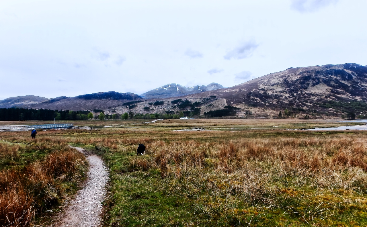
After the bothy, there was a further descent of 1 km to meet the Coulin Pass track. Views of Beinn Liath Mhor peeping out of the mist were replaced by an old favourite, Beinn Eighe (see posts #230 and #246) before we hit the track leading uphill to the Coulin Pass – an old photo shown above from May 2018 shows the start point of this track at the head of Loch Coulin, and although I didn’t know it at the time, it also includes yet another view of Beinn Liath Mhor.

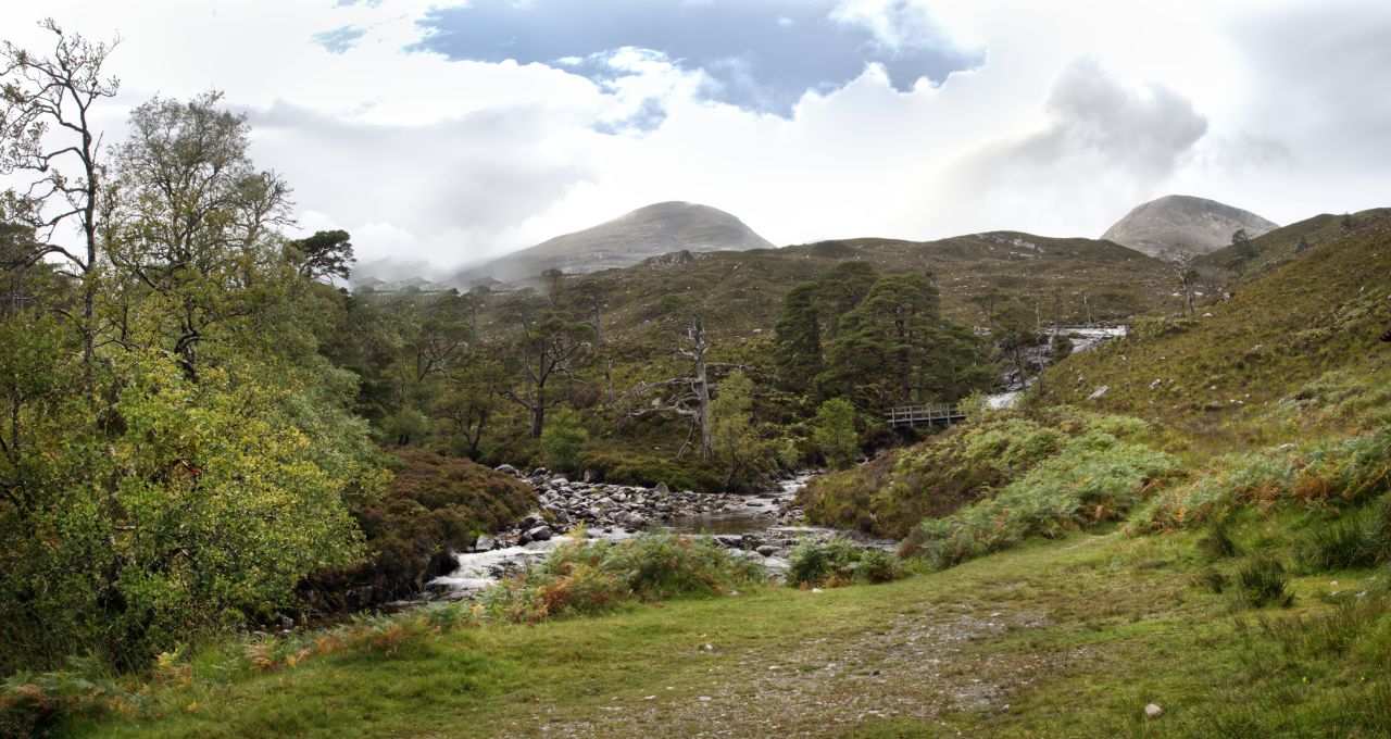
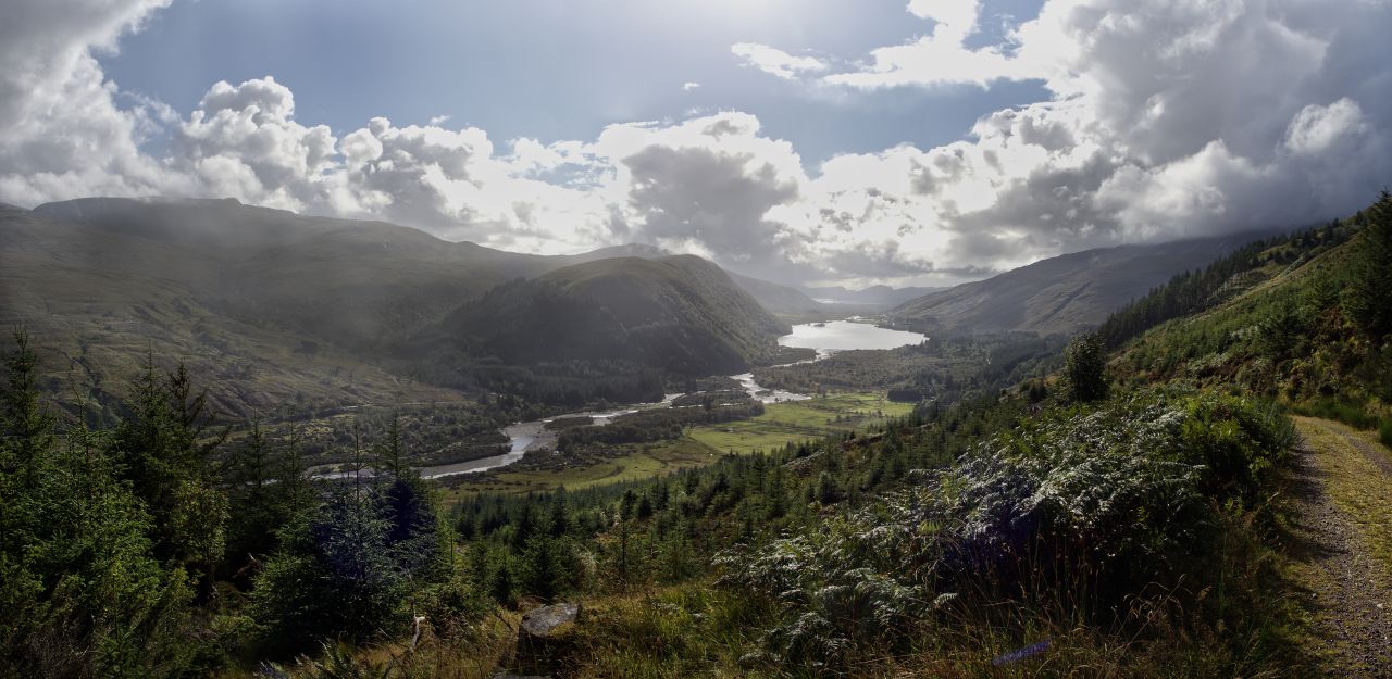
Beinn Liath Mhor continued to dominate the scene as we gradually gained height to the head of the pass, with a rainbow chasing us up the track. The height gain was gradual and civilised, and soon we were heading downhill on the final section of the route. Eventually, we reached the forest, and the scenery became boring endless green, but before that, we had a final panorama over Loch Dughaill in Glen Carron – it was time to head for home.
Text and images © Paul Shorrock, except where otherwise indicated, which are taken from the Geograph Project and are reproduced under a Creative Commons Licence.


Some great photos there. I think I prefer the look of the outward route best. I didn’t know that bothy was called that – we visited on a very wet day when it wasn’t fit to do the Torridonian hills from the other side as well as going round Loch Coulin/Clare.
I wouldn’t be able to pass below the ridge of Beinn Liath Mhor on that track though without bobbing up it and doing its ridge!
LikeLiked by 1 person
Yep, we will be back for the ridge!
LikeLike
give me a shout when you do – I missed the ridge last time on my round of Coire Lair as I wanted do go back down the actual corrie as it was so nice so I came back down the further end again.
LikeLike
Hi Paul,
I’m the Travel & Shop editor for The List magazine. For our May issue we’re looking to include a list of the best bothies in Scotland, including the Tea House Bothy. I was wondering if you’d allow us to use your pictures of the bothy (with credit of course)?
Best wishes,
Isy Santini
LikeLike
Hi Isy,
Yes I would be happy for you to use any images of the Tea House Bothy. Could you please let me know when you publish if you decide to use the images.
Best wishes, Paul
LikeLike