

For the best viewing experience, left-click the images and maps to zoom in to a new window, then exit that window to go back – go on, it really does work!
Over the space of forty years, I had nearly been up Wild Boar Fell twice. Both occasions were on training sessions with Penrith and Kirkby Stephen Mountain Rescue Teams, and both times the exercise incident was concluded before I got anywhere near the summit. The thing is, there isn’t much else on the west side of the Mallerstang valley other than Wild Boar Fell – if I wanted the summit, I was going to have to make a special trip. That special trip had to wait until August 2022.
Wild Boar Fell stands alone, refusing to be tied down to a popular area. The mountain is in Cumbria, but Cumbria is the Lake District National Park, isn’t it? Wild Boar Fell is actually part of the Yorkshire Dales National Park, but refuses to join in with being part of Yorkshire – if you really must tie things down, it’s at the very head of the Eden Valley, which starts in Mallerstang before taking a 100-kilometre wander through Kirkby Stephen, Appleby and Langwathby, before finally reaching the sea beyond Carlisle. That will do then – it’s in Eden.
Although alone, Wild Boar Fell does have notable neighbours, these being the Howgill Fells. For over sixty years, Wild Boar Fell and the Northern Howgills did not have National Park status – that changed in 2016, with a good bit of Cumbria becoming part of the Yorkshire Dales NP. It isn’t as daft as it sounds – the present county might be Cumbria, but until 1974 this was Westmorland. So, we’re in the Garden of Eden in the lost county of Westmorland.

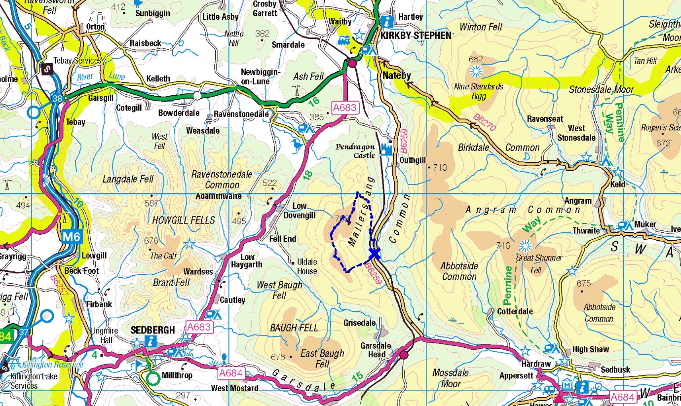
Our plan was to walk over the mass of Wild Boar Fell from north to south, starting in Mallerstang to make a circular route of around 11 kilometres (7 miles). One thing that was quite certain was that we wouldn’t see many other hikers – these hills don’t get a lot of pedestrian traffic, possibly because of their ambiguous location. There aren’t many bragging points in saying that you have been wandering in Eden. However, before heading for the Wild Boar, we had another visit in mind – we were going to visit red squirrels.

The red squirrel is native to the British Isles and for 10,000 years was widespread here. In the 1800s, the grey squirrel was introduced from America as a ‘pretty’ addition to country estates. It wasn’t realised at the time that the greys are highly destructive to forestry, as well as out-competing the native reds. Reds are still to be found in Scotland, but in England and Wales they have barely clung on. There are several sanctuaries where reds can still be found, and the day before our meeting with the Wild Boar, we went to visit the Snaizeholme squirrels.
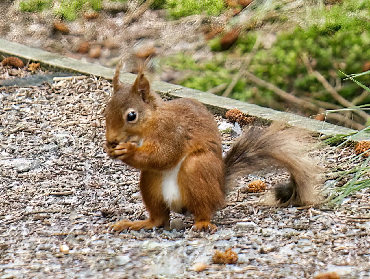
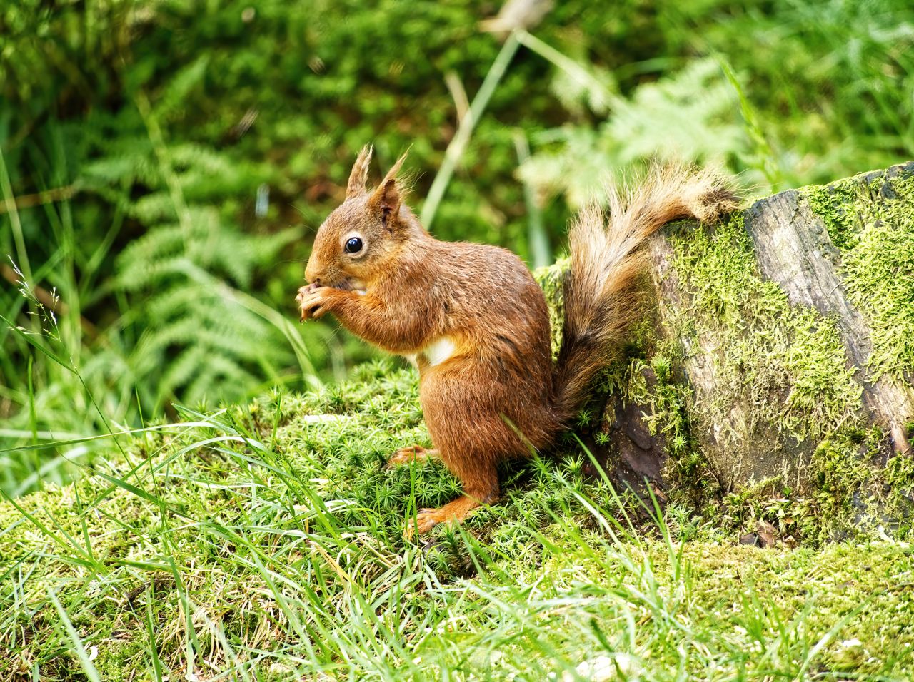
Snaizeholme is near to Hawes in Wensleydale, and the lack of forested hills in the area makes it more difficult for the greys to colonise – they simply don’t have the corridors of trees leading to the areas populated by the reds. The Yorkshire Dales NP and local landowners have co-operated to provide a sanctuary at Snaizeholme, where these normally shy creatures can be seen on a regular basis, and although you can’t rely on wild creatures turning up to order, there’s always a good chance of seeing reds here.
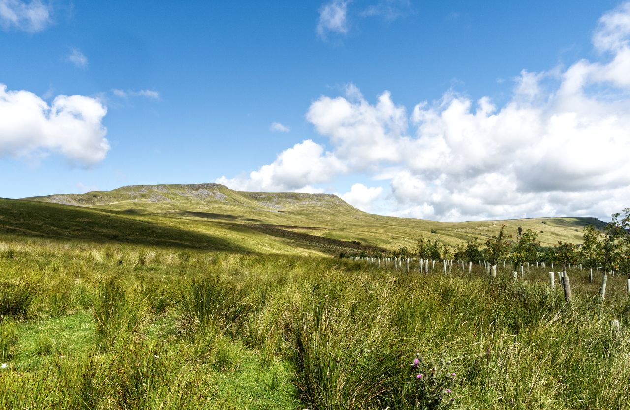


The next day found us parked up near Aisgill in Mallerstang. At 708 metres altitude (2323 ft), Wild Boar Fell is the fifth highest peak in the Yorkshire Dales NP after Whernside, Ingleborough, Great Shunner Fell and near neighbour High Seat, but as our start point was about 300 metres, we had a bit of height advantage. Before long we were exchanging views of the Settle-Carlisle railway for the eastern escarpment of Wild Boar Fell.

….


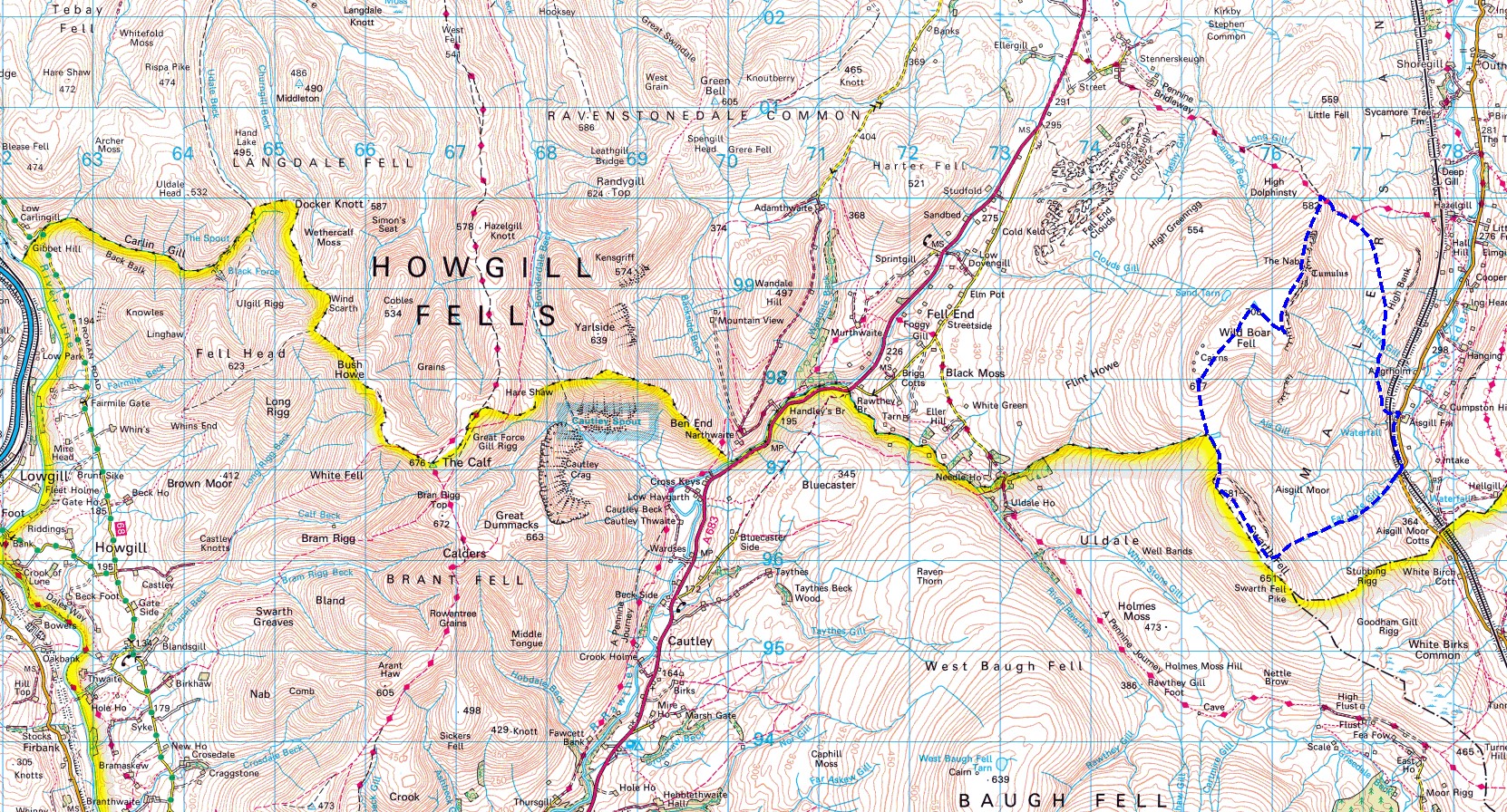
It is said that wild boar lived on the fell up to 500 years ago. It is also said that the wild boar tusk kept in the church at nearby Kirkby Stephen came from the last boar to be hunted and killed on the fell. Whatever, you won’t find wild boar there nowadays – what you will find though, is a collection of ‘stone men’, otherwise better known to UK hillwalkers as cairns.

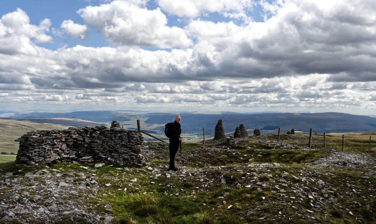


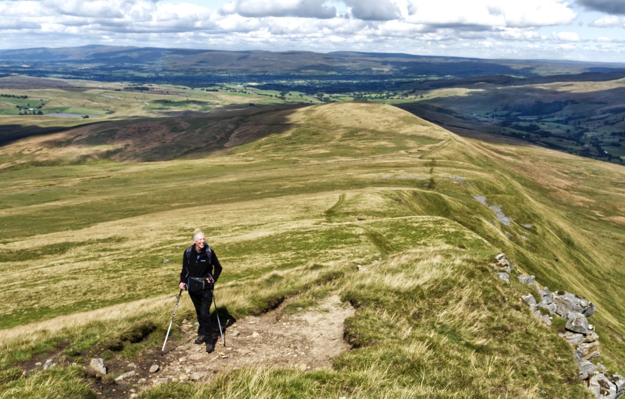
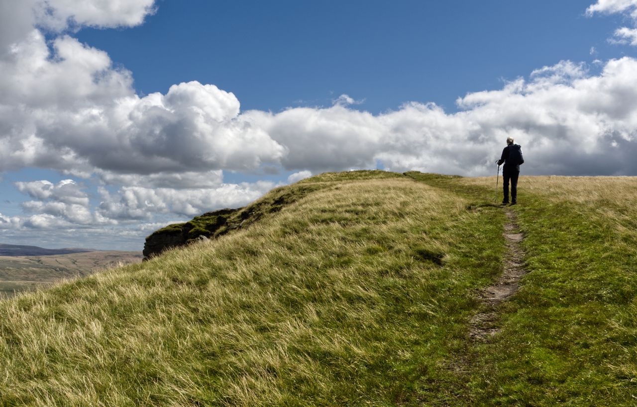
A visit to the cairns took us away from the path to the summit, but seeing that it had taken me forty years to get this far, I thought it a good idea to make a visit, as I might not be around in another forty years! That being done (and a fine collection of cairns they are), Chris and I wandered about 500 metres across to a neat stone shelter at the summit, with great views west to the Howgill Fells. Full zoom on the camera brought the impressive waterfalls of Cautley Spout into view (see post #16) though it does help if you know what you are looking for and where to look.


Clear visibility made the descent south from the summit easy to navigate, and after a little over 3 kms it was time to turn left to follow the line of Far Cote Gill back to the valley, and our start point. We had different views of Wild Boar Fell as we started down, but one of the best views of the day was the combination of the fell and the Mallerstang Valley seen in the afternoon sun. I’m still a bit surprised it took me forty years to get round to it.


Text and images © Paul Shorrock


This fell looks amazing for a climb 🙂
LikeLike
Thanks for visiting – we had long views and big skies on our trip, ideal!
LikeLiked by 1 person
Very welcome, sounds great 🙂
LikeLike
Nice one Paul. The great virtue of fells such as this is they tend to be quiet and not full of plebs. Must confess I fell in love with the Howgills when I ran a Karrimor there back in 1988.
LikeLiked by 2 people
Cheers Richard, and totally agree. I didn’t know you had done the Karrimor, well done you!
LikeLike
Oh Yes Ran 5 with my mate Martin Ball starting with Cheviots , Howgills etc. Worked with Martin on Outdoor Ed. South Ribble Youth Service back in the day. Loved them. Never top flight but always in top 50 on short Score class.
LikeLike
I’ve been after that fell for years now but never sure how to approach it. I guessed the best thing to do is park at Ais Gill Summit where I think there’s a one-car bit of parking – am I right? But then it looks like it will be a pathless and boggy slog (which I suspect is why more people won’t do it). I also thought about doing it from the train from Garsdale station but again wasn’t sure about a route.
Is the only bit of path that along the summit ridge or did you manage to find one for your descent? Are there any awkward ungated farmland walls to get over?
I have to say that Wild Boar Fell and Mallerstang Edge are my great excitements when I regularly pass between them travelling to my mother’s – Mallerstang Edge especially – at least that one looks accessible from quite a few places.
LikeLike
It’s well worth the walk. We parked up at Cotegill Bridge (parking for a couple or more cars) then road walked just past Aisgill Farm before taking the farm track under the railway. We then followed the fell wall heading north to Angerholme – from there it’s more or less a smidge east of north through Angerholme Pots – no path on the map, but faint paths on the ground. That leads to the Pennine Bridleway near to Little Wold, then onto the ridge via the bridleway. It had been dry for a while when we went, but the ground seemed pretty well drained, so I think it would take some amount of rain to make it clarty.
The path along the ridge is easy to follow – we went down by Flue Scarth Nick then Far Cote Gill. Flue Scarth Nick is a bit scrabbly, but no problem. Lower down some nursery trees have been planted, right across the line of descent, but again not a problem. There are some fairly recent wire and post fences at this point, but I can’t remember them being a problem (Chris would have had something to say about fence climbing!) so I guess we found a gate. After the fence we followed the left bank of the beck looking downstream – lower down, what faint paths that were there moved further away left from the beck. I can’t remember it in much detail, which suggests to me that it must have been fairly obvious to route find – probably much less easy in poor vis. Pick a sunny day then 🙂
LikeLiked by 1 person
Great – thanks Paul. I’ll have a follow of all that on my maps. I’m pretty sure I’ll try to pick a fine and clear day for it as it’s not a great area to bumble about in the mist.
Have you done Mallerstang Edge yet?
My next post is around that area but not the Edge 🙂
LikeLike
No, I’ve not done the Edge – another reason to head back I think 🙂
The map shown in the blog is digi-mapping from MermoryMap and is 2016 or earlier. I checked on the current OS app (yes, I know – multiple mapping apps, a bit of mapping geek coming out!) and that is maintained bang up to date – it shows the fence I mentioned on the 1.25k map and on the aerial view. If you have access to that, you might find it useful.
LikeLike
I don’t have any kind of ‘apps’ as my mobile is just a phone. I do have the 1:25000 map of the area though I think.
When you go to do the Edge, give me a shout if you want any company – I’m not that far away and can easily drive down to meet you somewhere. So long as it’s not a Saturday, Sunday or Monday as I work then. Well, come April I’ll be back at work…
LikeLiked by 1 person
👍
LikeLike