


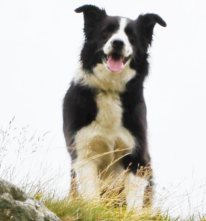
At this time of the year (January), I’m usually sat in Greg’s Hut Bothy on Cross Fell, working on one of the safety teams for the Montane Spine Race. This year I’m not – along with human companion John Bamber, Border Collie ‘Mist’ has always accompanied me, but at fourteen years old she is getting a bit old for the Greg’s Hut malarky.
Being a Border Collie, she would have got there and back, whatever it cost her in discomfort and effort, but to struggle back after a big fall of snow as in previous years would have been too big an ask. Leaving her behind wasn’t an option either – I would have come home to one miserable dog!
So this year my Spine Race involvement has been watching the dots of the racers trackers. For the sake of nostalgia, I thought I would resurrect this post, previously published in 2013. I enjoyed reading it again, I hope you do
“Do you fancy a couple of days up at Greg’s Hut in January?”

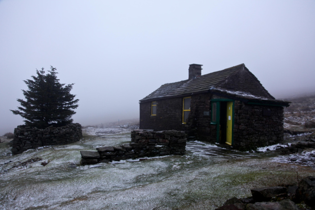
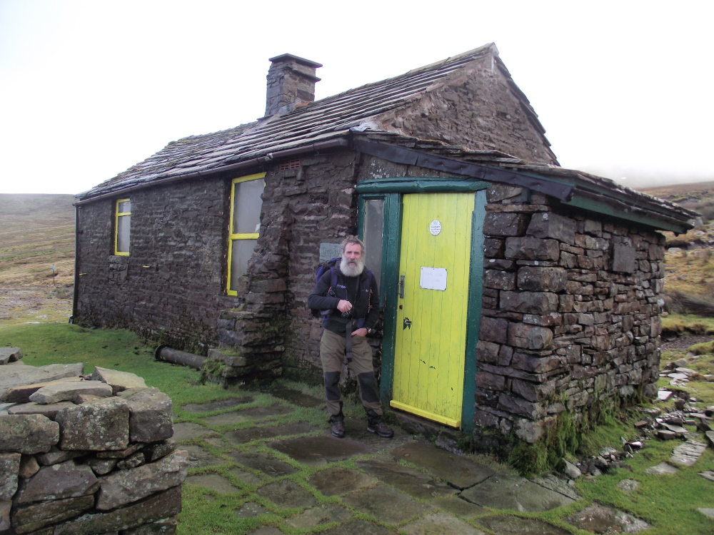
If anyone other than John Bamber had asked the question, I would probably have answered with a reply that included sex and travel! For those who don’t know it, Greg’s Hut is a bothy, high on the flanks of Cross Fell in the Pennines. At 700 metres altitude, it can be cold and cheerless in summer, so the prospect of staying there in a Pennine winter was not on my short list of ‘Fun Things To Do’. Why did I say, “Sounds like a good idea” ? … Ask the dog ….


Mist – “I’m getting used to the boss and his daft schemes, but I know there’s something going on when his mate John (the bloke with the big beard) turns up. Don’t get me wrong, John is a lot of fun, and I’ve had some great hill days with him, but it’s never going to be just an ordinary day out. I suppose that’s why the boss said yes to the Greg’s Hut trip – those two are both as daft as each other! Mind you, when they said I could go as well, I was packed and ready before them!”

It was autumn 2011, and John had signed up as one of the Support Team for the first ‘Spine Race’ to be held in January 2012 – not having anything better to do, I said that I would join him. We decided that it might be a good idea to do a recce beforehand – I hadn’t been to the bothy in over twenty years, and John hadn’t seen it at all, so a check on luxuries such as a functioning roof seemed to be a good idea.

Mist – “Haha … I still remember that walk! I always think that the boss carries too much when we are in the hills – a bag of dog biscuits is all you really need if you think about it – but John turned up with this stuff called ‘coal’ in his rucksack. It certainly looked heavy, and I was laughing all the way to the hut. Humans never cease to amaze me ….!”


Yes, it’s true, John carried about 10 kilos of coal in on that trip. Just over a week later we were back again, with John setting up what was probably the highest ‘Coffee and Noodle’ bar in the UK – if it wasn’t the highest, it was certainly the most difficult to get to. We had four visitors out of sixteen original starters, with the Hall of Fame including joint 2012 winners Gary Morrison and Steve Thompson, followed later by Mark Caldwell and Andy Collister. Those guys had to work to get their noodles!


In November 2012, a training weekend was organised for those taking part in the 2013 race. There was quite a lot of interest for this (optional) event, and all who attended seemed to have a good time – well, that’s if your idea of a good time is running round 72 kms (45 miles) of Pennine hill and moor. At least it didn’t snow – we saved that up for the 2nd Spine Race in January 2013.


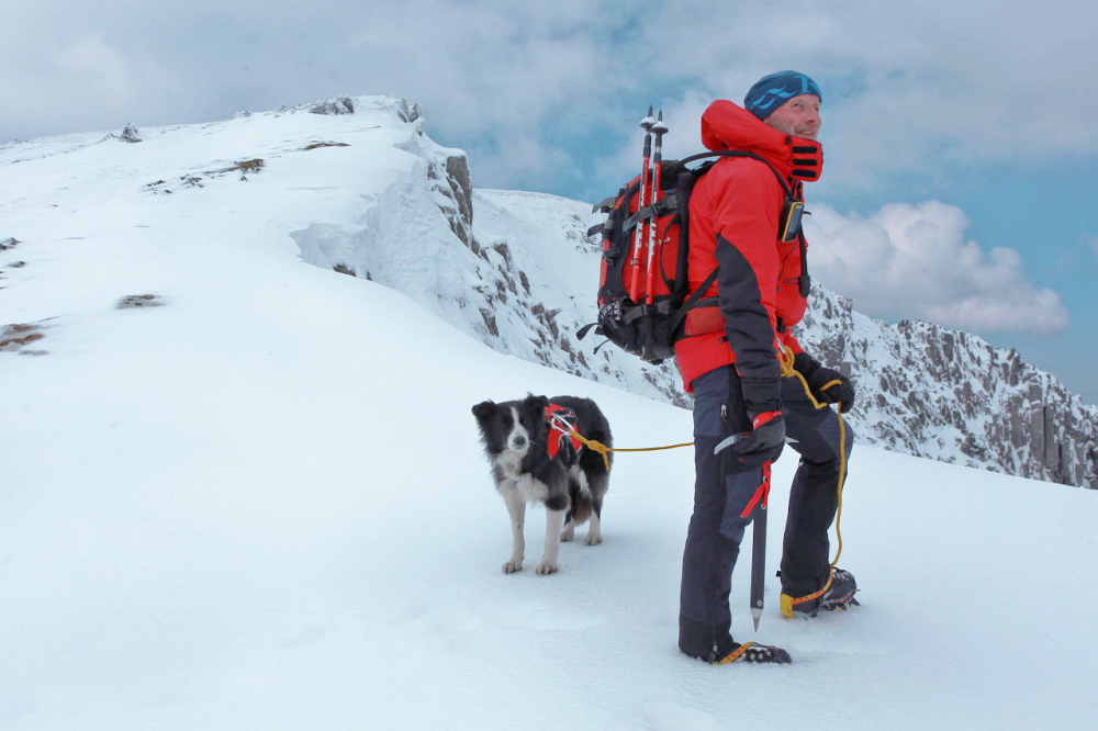
‘Mist’ and I were not at the start line for the 2013 event – we had a race of our own to run. Whilst 47 elite athletes were starting the race at Edale, ‘Mist’ was completing her obedience and stock safety tests to begin training as a search and rescue dog with SARDA (Search And Rescue Dog Association). The two of us made the grade and were accepted as a trainee search team, and on Sunday evening we set off from North Wales to catch the race up at CP 1.5 at Malham Tarn.


Mist – “Laugh!! I nearly wet meself! John (the one with the big beard, remember – pay attention at the back!) – John had brought this huge kennel along (I think he called it a tent, but I know what a kennel looks like – I AM a dog, after all). Anyway, it snowed all night, and I had a great time chasing snowballs around, but it didn’t look like a lot of fun in that kennel, what with loads of cold, wet humans in there. John was having fun, though”


Yet again, John showed the world that an extremely large dump of snow was not going to interrupt his new career of ‘extreme noodle chef’. Having sent all the happy customers on their way, we then set our sights on our old friend, Greg’s Hut. The previous year we had to backpack all our gear in, assisted by a group of porters who didn’t hide quickly enough when we went looking for help – this time we had a ride up the hill track in Phil’s 4X4.

Mist – “Yes, that was quite a trip – just as well we had the help, ‘cos I didn’t fancy carrying in two days worth of dog biscuits! John must have had a brainstorm, ‘cos the week before he carried up twice as much of that black stuff (coal, isn’t it?!) to the hut – didn’t we all fall about laughing when we arrived and found that it had all gone!!”


It’s true – over the space of a week, someone had either used or pinched 20 kilos of coal from one of the most deserted places south of the Scottish border. If they burned it in the stove, they must have inaugurated the highest sauna in the UK – if it was pinched, I hope they suffered a hundred bad backs carrying it away! A re-supply carried us through, and ‘Johnnie’s Noodle Bar’ was open for business once again.

All good things have to come to an end though, and in less than two days the surviving athletes had passed through ‘Greg’s’ – time to hit the road again. After a day at Bellingham we set off for the finish line at Kirk Yetholm. However, there was a cloud on the horizon – in fact there were lots of clouds, accompanied by a storm warning from the Met Office. Our little corner of the UK was about to get a visit from Mr Snow!
Mist – “Snow? I should say so! Some of the time you couldn’t see your paw in front of your face!”


People who say that they have been in a blizzard in the UK are usually mistaken – a heavy snow fall with a bit of wind ‘doth not a blizzard make’. However, having been in a couple of blizzards over the years, I can confirm that THIS was a blizzard! What’s more, we still had two teams out on the final ridge of the Cheviots. These are ‘little’ hills, around 500-700 metres in altitude, but sometimes latitude means as much as altitude, with the latitude of the Cheviots being about the same as that of Moscow.

The next day the storm had passed. The two groups had done exactly the right thing, and had gone to ground in two different mountain refuges on the ridge (the term ‘refuge’ is used loosely – think more along the lines of garden sheds). During the night Stu and Joe from the support team had gone up on the ridge for a welfare check, with John and I as backup, and found themselves looking out for their own welfare instead! The ‘garden sheds’ were life savers though, and the next day the two groups mustered themselves and walked off the ridge with heads held high.

There’s a narrow line between adventure and misadventure, and these athletes know all about that – their performances are frequently heroic, often inspirational. They make the week of the Spine Race an event to look forward to each year, and being a member of the Spine ‘Mountain & Medic’ Support Team is very special to me – that and my part time job as sous chef at the highest noodle bar in the UK.
Mist – “Couldn’t have put it better meself – any noodles left, John?”

Text and images © Paul Shorrock. Images tagged (JB) © John Bamber, and (DH) © David Higgs – For permission to use any images, please contact the blog author.


