It seemed like a good idea. Six weeks earlier Chris and I had walked Rhinog Fawr (post #95) and after being seduced by a forecast of fine weather, I had gone out two days later and walked a much longer route based on Rhinog Fach (post #96). Then, six weeks later we had another good day on Arenig Fawr (post #101) and again a favourable weather forecast tempted me to ‘go for it’ and to return the day after for Arenig Fach.
The route was one of the series being researched for the Discovery Walking Guides project, and ‘Plan A’ had been a walk of 11 kms (7miles) and 550m (1800 ft) height gain, a route that Chris would join me on. However, the more I looked at the map, the more the terrain reminded me of the moors of the Pennines, the moors of my youth where I first started my walking and mountaineering. A little voice kept saying “Chris wouldn’t enjoy this” – fortunately I listened to what the little voice was saying.
Unbeknown to me at the time, the little voice probably prevented a divorce! ‘Plan B’ was formed – a solo walk (with the dog, of course), but as Arenig Fach was almost 200 metres (650 ft) lower than Arenig Fawr, I decided that I would make things more ‘interesting’, and increased the walk to 20kms (12 ½ miles) and 900 metres (2950ft) height gain. I fully expected this to be fairly rough walking, but the early part of this was on what appeared on the map to be a well-defined track.
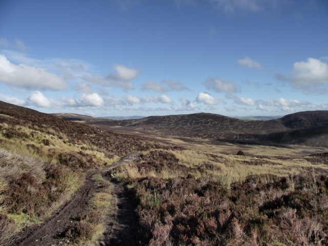
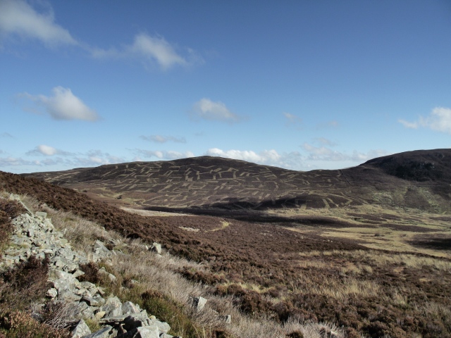
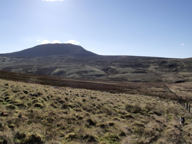
Well-defined wasn’t the half of it! I could have driven our Landrover Freelander all the way to the first peak of Carnedd y Filiast (“Cairn of the Greyhound Bitch”) but that would have been cheating. The track did allow rapid progress and height gain however, and although at one stage I lost the panorama of the final objective of Arenig Fach, I was treated instead to the almost surreal view of Craig yr Hafod (“Crag of the Summer Dwelling”) with its weird haircut resulting from heather management.
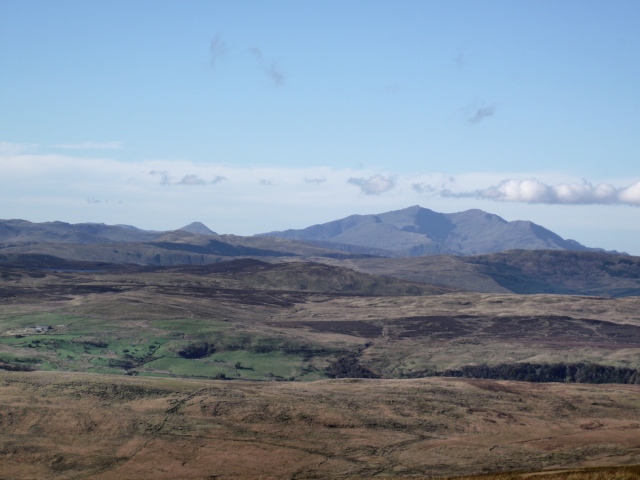
From Carnedd y Filiast it looked a long way to Arenig Fach (‘Little Big Ground’). ‘Mist’ had a giddy five minutes, running round the hillside at full speed, as if in hunting mode, whilst I had my fun taking photos of the Snowdon Range and Tryfan, about 25 kms away. Arenig Fawr still looked a long way off, however.
A long and gradual descent brought me down to the Afon Gelyn (River Holly). This became increasingly more wet, though the worst of it could be avoided. The crossing of the stream was easy enough, and on the other side my boots were still just damp rather than wet – that was about to change though!
Arenig Fach lay ahead, but with 2 kms of gradual upwards slope ahead before the final ascent. Unfortunately that 2 kms was either wet sphagnum moss or dense heather, occasionally both together. Although the heather was tiring, it was drier underfoot, but progress was slow, with the 2 kms taking about an hour – ‘Mist’ is at the upper end of Border Collie sizing at 19 kgs, and she made good use of her height and muscle to bulldoze through the thick vegetation.

Panorama of the hills of Snowdonia, from the Moelwyns (left) through the Snowdon Range, The Glyderau, The Carneddau, The Clwydian Hills and beyond (Click the image for a zoom view)
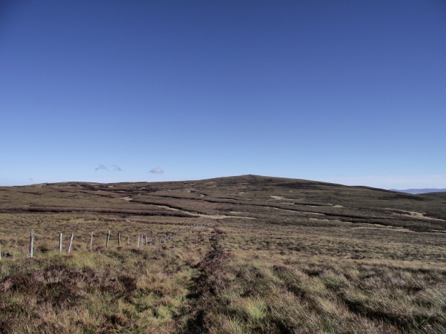
The heather slope finally flattened out to a broad col, with a fairly steep section on the left to the summit, whilst to the right a long heather moor stretched out towards the hills of Snowdonia from the Moelwyns to the Carneddau, and beyond to the Clwydian hills. So, left it was then. The ascent was untracked, but a wire fence pointed in the right direction so I followed that most of the way.
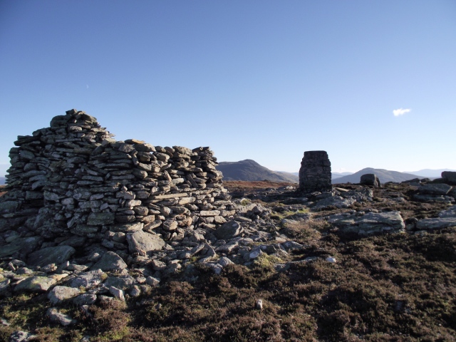
The summit shelter was impressive enough for a summit that appears to be visited infrequently – paths were just about non-existent. An ancient cairn named Carnedd y Bachgen (“Cairn of the Boy”) appears to have been plundered to build the shelter, and nearby a more recent cairn of the same name pointed the rough line of descent.
From there my old friend the fence gave a better line towards my start point at Llyn Celyn (“Holly Lake”) with a view back to the crags above Llyn Arenig Fach. The afternoon was getting late by now, and the view to the crag and small lake was already obscured by shadow as the sun dipped.
A lengthy descent took me down to the start point, after what had seemed like a long day. Arenig Fach might be the ‘small’ Arenig, but this gnarly little hill punches well above its weight! I’m glad I did it, in the way that it’s nice to have the full set, but it is probably a hill that I won’t be visiting a lot in the future. If you are after peace and solitude though, Arenig Fach is a little rough diamond near the gem of Arenig Fawr.
Text and images © Paul Shorrock except where indicated otherwise. The image by Peter Aylmer is taken from the Geograph project, and reproduced under a Creative Commons Licence. You will find more fine images by Peter here.










again, a superb post Paul. The terrain reminds me a bit of the high pennines, around Wild boar fell area…
LikeLike
Cheers SP – Your comment about Wild Boar Fell is spot on, except that I’ve never come across heather so dense in the North Pennines. Or perhaps I’ve led a sheltered life 😀
LikeLike
As soon as you mentioned Llyn Celyn I knew where you were! Visited that lake often in my youth on summer holidays, but have never walked in those hills. That boggy, heathery terrain certainly slows things down doesn’t it!
LikeLike
It’s either the terrain slowing things down, or ‘me age’ catching up with me. It didn’t slow the dog down much 🙂
LikeLike
That’s awful that they damaged that ancient cairn – it will have meant something! 😦
Isn’t Arenig Fach right next to the road opposite Fawr? You seemed to have had a very long approach your way. How far was your route?
LikeLike
Happens all the time with ancient cairns – a few stones get moved to make a shelter and the next thing you know there’s a bl**dy housing estate being built. North Wales seems to suffer more than most, probably because a lot of summits have Bronze Age cairns that provide ready building material.
Yep, Arenig Fach is just opposite Fawr, just by the junction with the B road that heads to Llan Ffestiniog, and a straight ‘up and down’ route from there would have been an easier option – there was even a faint (almost non-existent) descent path from the summit heading (roughly) that way.
For some daft reason I thought a circular route (20 kms BTW) would be a ‘wizard wheeze’ 🙂 You’ll be pleased to hear I’m now back on the the tablets 😀 😀
Joking apart, the circuit was interesting and gave me a visual on some great views, some familiar, others less so. In fact, it was only the final 2 kms in, followed by the steep bit by the fence, that ‘took the gloss off’ what was a really nice day 🙂
LikeLike
It would have been a nice bit of exploring right enough – but LOL to the bit about ‘back on the tablets’!
LikeLike
A longish day but good weather from those impressive views. The Moelwyns make a fantastic silhouette don’t they – instantly recognizable. You can’t go far in Snowdonia without getting wet feet! I guess this Autumn they are worse than usual.
LikeLike
A good freeze would sort it all out! At least it makes for rapid progress over the wet bits – must dig out my Kahtoola Micro Spikes, just the thing for frozen bogs 🙂
LikeLike
It might have been hard going but Chris would have missed out on some stupendous views if you hadn’t taken those stunning photos. Thanks for another entertaining armchair (or should I say computer chair) walk. Maybe one of these days we should join you on one of your shorter walks – but don’t expect us to keep up, especially with Mist.
LikeLike
I think it’s me that would have to problem keeping up – we don’t all go running round orienteering courses tha’ knows 😀
LikeLike
The theory: orienteering is a fast sport (cunning running). The reality: some of us struggle to read the map even when standing still!
LikeLike
😀 😀 😀
LikeLike
That looks great. A part of the world I don’t know that well. Must remedy this situation immediately!
LikeLike
Enjoy 🙂
LikeLike