

For the best viewing experience, left-click the images and maps to zoom in to a new window, then exit that window to go back – go on, it really does work!


Just 2½ days after our Foel Fras outing (see previous post #296) we were back in the Carneddau again, this time for a bit of unfinished business. Back in December 2020, in one of the brief breaks from Covid lockdown in North Wales, Chris and I (plus Border Collie ‘Mist’) had set out for the summit of Foel Grach – Mr Snow decided to pay a visit on that trip and it hadn’t been a hard decision to bail out early!


In post #284 I wrote, “The main problems came with the frozen sections – several metres of good, hard snow would help us pick up the pace a bit, but just as we came to trust the frozen crust, it would collapse. Time was slipping away, so it wasn’t a difficult decision to miss out Foel Grach, and to head straight to the descent to upper Cwm Eigiau”. Our April 2021 trip was to be a bit different.

The initial plan was to follow the blue route shown above out to Foel Grach then to backtrack to pick up the red route to return down Cwm Eigiau. As the walk progressed a glimmer of an idea was forming – the 1:25k OS map shows a Right of Way (RoW) descending across the flank of Foel Fras. These Rights of Way sometimes exist in the mind of the cartographer but fail to appear on the ground. Did this path exist? There was only one way to find out.


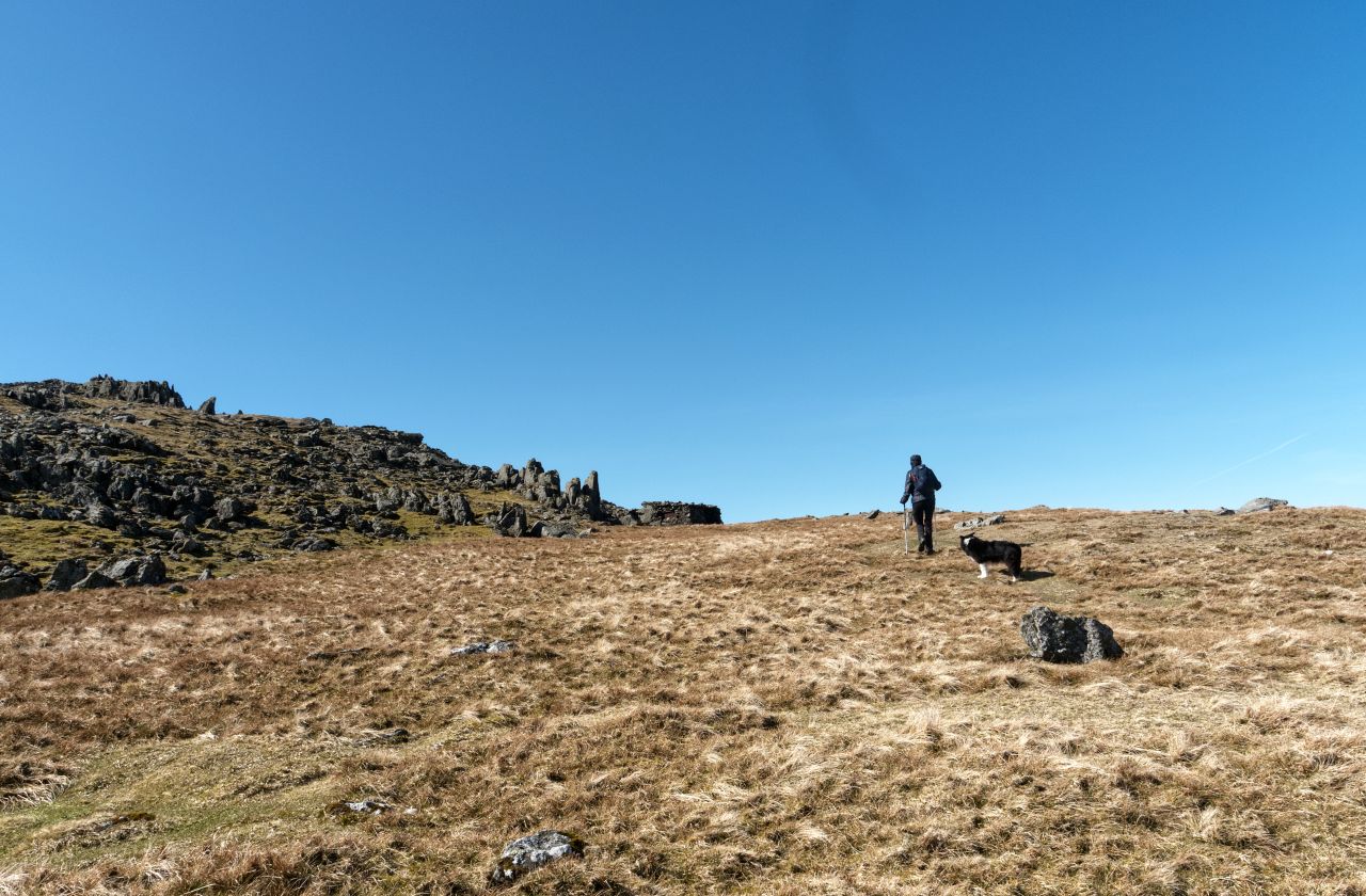
We bumped into (almost literally) a small herd of Carneddau wild ponies on our outward route to Foel Grach via Cefn Tal Llyn Eigiau and the plateau of Gledrffordd. These hardy animals live out on the Carneddau all year round and were amazingly confident even with Collie ‘Mist’ nearby. Leaving the ponies behind, we crossed Gledrffordd and headed up the long pull to Foel Grach.

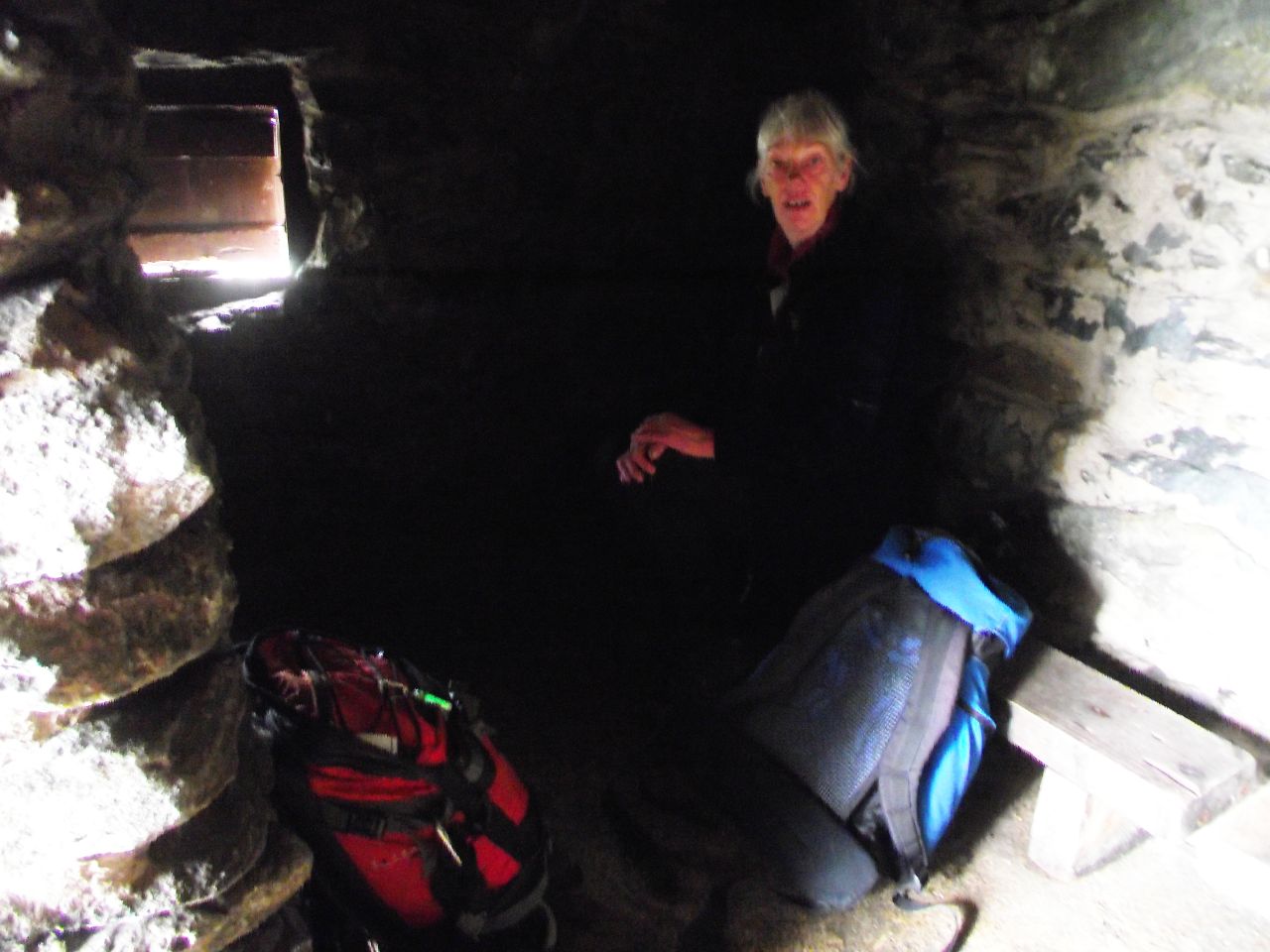

The refuge at the summit should not be compared with the Refuges found in the European Alps. This is a very basic stone hut on the summit of a hill that seems to collect more than its fair share of the snow in a hard winter – in bad weather it would potentially be a life saver but would struggle to get even one star in Trip Advisor! It’s a handy place for a brew and a bite though, and I used the opportunity to check out our alternative finish on the map.

The way back went via Carnedd Gwenllian, before heading on a steady descent along the side of Foel Fras. It was barely discernible on the ground, but followed a logical line, the way you would probably walk if you didn’t have a map. I checked the track log on GPS several times and we were always bang on course – so now we know, the RoW marked on the map does exist. Just as well, as it was getting near to dinner time for ‘Mist’, so time to head for home.

Text and images © Paul Shorrock


You’d be surprised what DOES get reviewed on ‘TripAdvisor’ – there’s reviews of Ben Nevis, summit shelters and all things between – mostly by non-walkers who’ve ventured up there and not enjoyed their day!
LikeLiked by 1 person
I know – it’s such a load of nonsense really. I sometimes wonder if the stupid reviews like the Ben Nevis one are just another form of attention seeking by folk who have nowt of any importance to say.
LikeLike
probably – but then most of their posts will be just that!
LikeLike
👍🙂
LikeLike
Love the shelter, it has saved my bacon in the past (1982) had to hole up there for five hours one New year’s night, weather closed on me
LikeLike