Cadair Bronwen in the Berwyns
The Berwyn mountains are the Cinderella hills of North Wales. These rough and lonely hills feel like they should be part of the Snowdonia National Park, but on the day that the guy drew the Park boundary, he must have been having a bad day at the office, leaving the Berwyns in a ‘No Man’s Land’ between the Aran Ridge and the Arenigs on one side and the Limestone hills of the Clwydian and Llangollen hills on the other.

The Berwyns – between Bala and Llangollen

The route – anti-clockwise from Llandrillo
It’s only recently that I started exploring these hills (see posts #85, #162 and #163) but the Berwyns are everything that the honeypot areas such as The Snowdon Range and the Glyderau are not – OK, they don’t have the jagged rocky peaks and the technical scrambling and climbing routes, but they don’t have the crowds either, and a day out here doesn’t disappoint. Which is why Chris and I, plus Border Collie ‘Mist’ recently set out from Llandrillo on a Berwyn day.

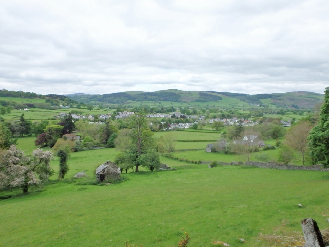
Looking down to the start point, Llandrillo

A wander through the woods ….

…. then on to open moorland
We set out from the attractive village of Llandrillo. The approaches to the main Berwyn Ridge usually involve a bit of a walk in, and this trip was no exception. Leaving the village behind, we passed through woodland, but for a change it was all native broadleaf woods instead of conifer plantations. It wasn’t long before we reached open moorland, and wide open spaces.

Wide open spaces

The route past the plantation

Looking back down Clochnant towards the wood ….

…. and looking forwards towards the Berwyn Ridge
The moor was mainly bog, but most of it was avoidable. There was a path of sorts, heading towards our target for the day, Cadair Bronwen, or Bronwen’s Chair. One incongruous landmark was a small plantation of fir trees, which probably wasn’t of any commercial value, but which provided us with a good navigational feature on an otherwise empty moor.

The path finally reaches the ridge at the bwlch ….

…. but it’s still more uphill to Cadair Bronwen

In fact, there’s quite a bit of uphill ….

…. before things finally level out (Cadair Berwyn behind)
The ascent was fairly steady, with things only getting steeper as we approached the bwlch (pass) between Cadair Bronwen (784 metres/2,572 ft) and Cadair Berwyn (830 metres/2,723 ft). The idle chatter died down for a bit, but it was only a short pull before the summit came into view. We had picked a good day for the trip, and the views extended right across to most of the mountains of North Wales – just as impressive were the views of the rest of the Berwyn range.

The summit of Cadair Bronwen ahead ….

…. With good views back towards Cadair Bronwen ….

…. in fact good views whichever way you look
Although lacking the drama of the peaks to the north, the Berwyns are quite an obstacle – in 1165 the English King Henry II decided to fill in a bit of ‘down-time’ by invading Wales, but instead of following the usual easy route by the North Coast, he decided instead on a full-frontal invasion over the Berwyns. A combination of days of rain and the rough Berwyn terrain ended in an English retreat.

On the descent towards Moel Pearce

Final view back to the main Berwyn Ridge ….

…. and a good view out towards the Rhinog mountains
What goes up must come down, and the walk out was as long as the approach route had been. It was all steady walking though, with no drama. If that sounds dull it certainly wasn’t, with a combination of big skies and long views to the distant higher mountains. The only problem was that every view of a familiar group of hills made me think about how long it had been since my last visit – the ‘wish list’ keeps getting bigger and bigger!

Time to head for home
Text and images © Paul Shorrock


That just looks such a fabulous walk Paul. I haven’t been to Wales for ages, about time I changed that 🙂
LikeLike
The Berwyns are well off the beaten track SP, but they are great hills.
LikeLiked by 1 person
I always think I’ve never been to the Berwyns, but then when I look on a map I realise that as a child, we drove through that area often, on our way to Abersoch for the summer holidays. In fact, we often used to wild camp in the van around the area, splitting the journey. Always did look nice walking country!
LikeLike
I bet the hills are still as quiet as when you passed through as a child.
LikeLike
Pingback: #205 – Rhobell Fawr and Dduallt | Paul Shorrock – One Man's Mountains AKA One Pillock's Hillocks
Pingback: #215 – A dogs life! (in 2016) | Paul Shorrock – One Man's Mountains AKA One Pillock's Hillocks
Pingback: #266 – Moel Ty Mawr | Paul Shorrock – One Man's Mountains AKA One Pillock's Hillocks