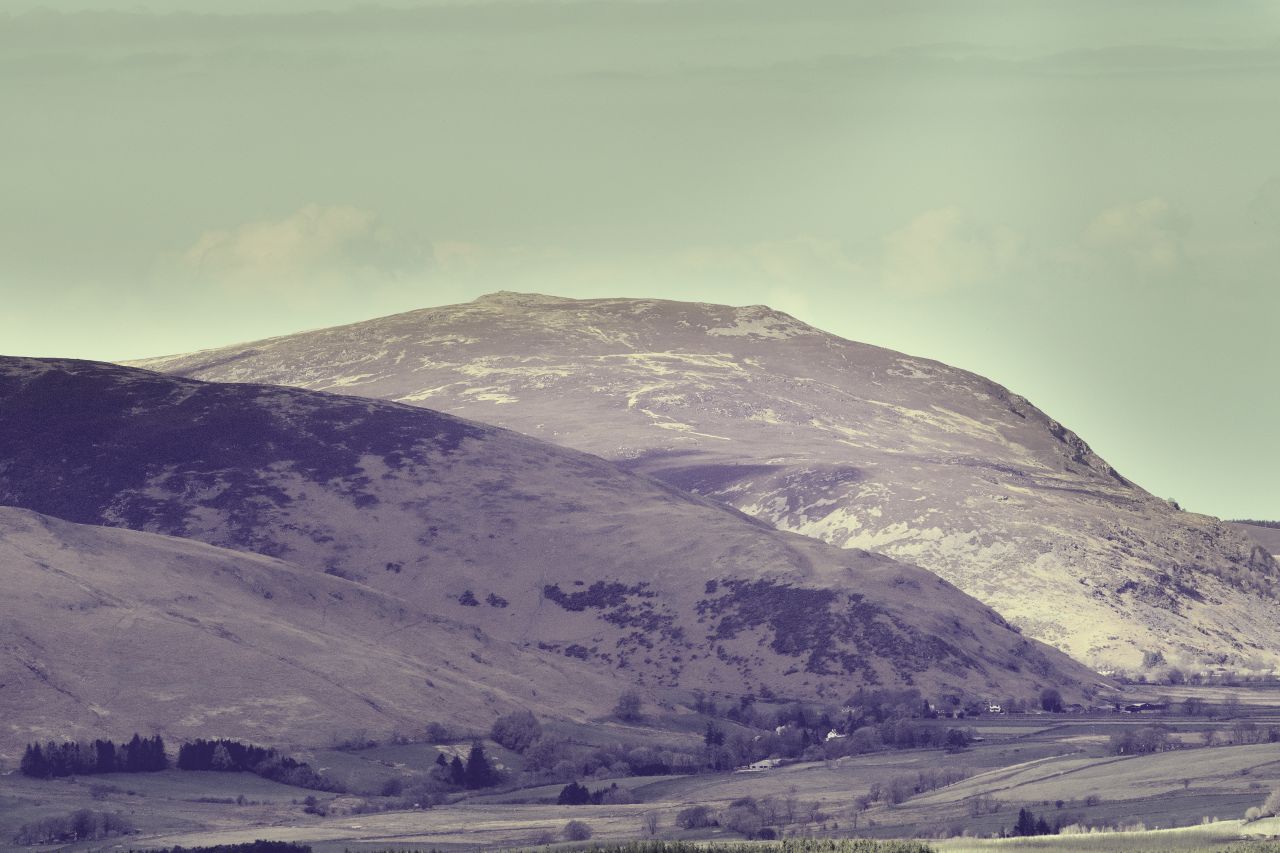
Eildon Mid Hill (left) and Eildon Hill North, seen from Eildon Wester Hill
For the best viewing experience, left-click the images and maps to zoom in to a new window, then exit that window to go back – go on, it really does work!
Selkirk and Melrose in the Scottish Borders (Eildon Hills in the centre)Melrose and the Eildon Hills
It’s rare that we visit the Scottish Borders area, other than driving through on the way to the Highlands and real mountains, though occasionally we take a diversion as we did to the Grey Mare’s Tail in April 2021 (see blog post #304). We weren’t going as far as the Highlands on this trip though, as it was just a continuation of the short shake-down cruise for the new campervan. I’d previously read about the Eildon Hills but never been there – time for a visit then.
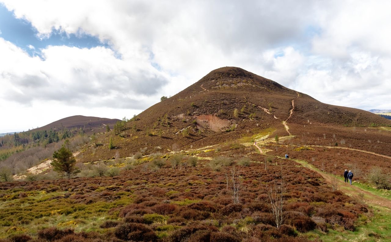
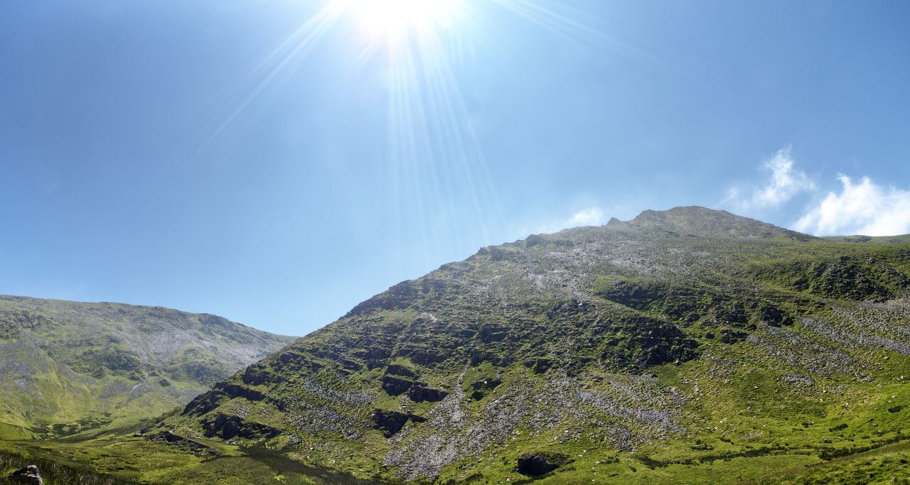
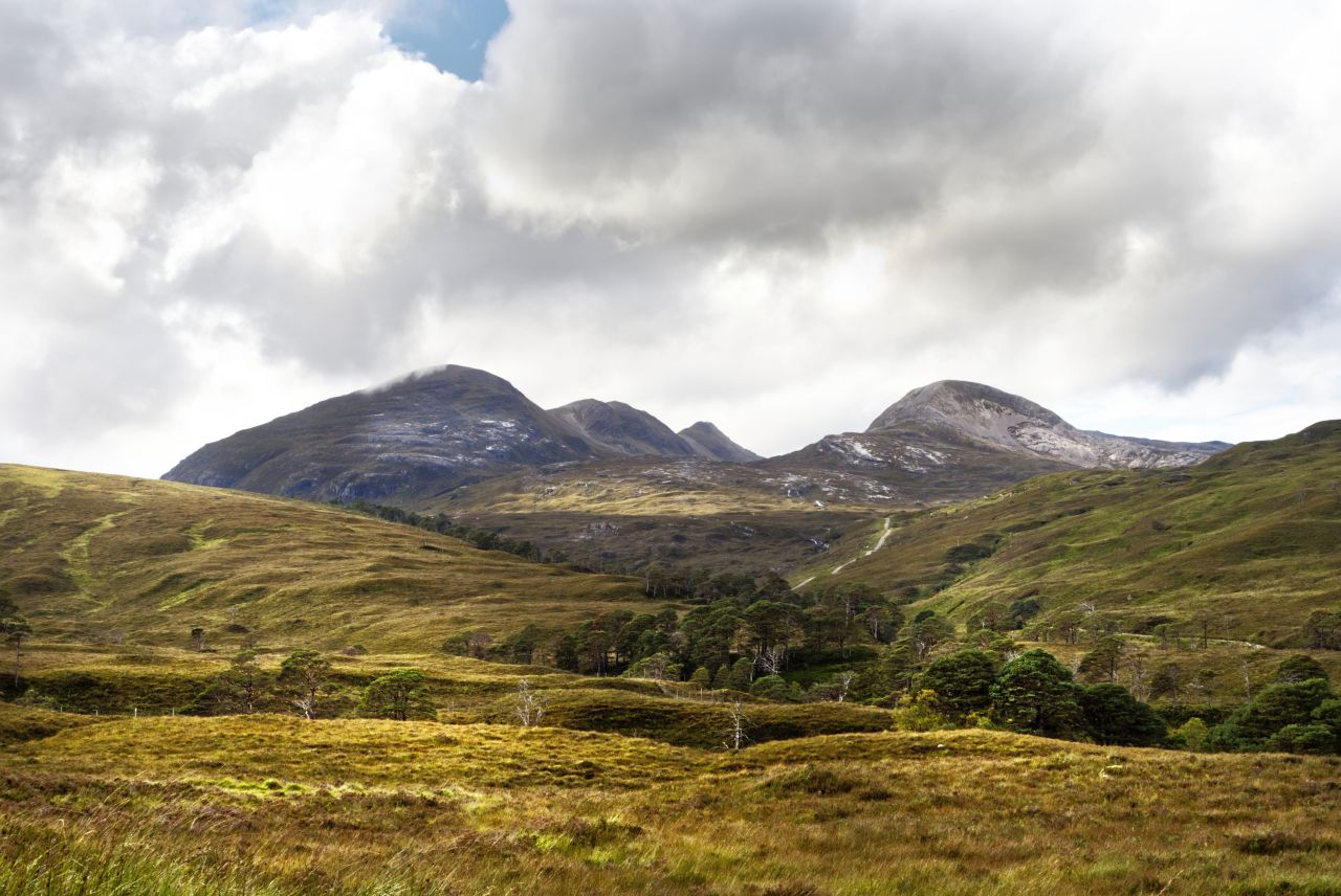
The Eildon Hills looking northwest from the A68
One of the best views of the Eildons is heading north on the A68, where three shapely hills come into view. The scientists will explain that the three hills are the eroded and weathered remains of volcanic lava flows, but there is another explanation – it is said in legend that Michael Scot, a local 13th Century ‘wizard’, split one existing Eildon hill into the three hills you see today. Scot was big on civil engineering projects, as he also altered the course of the River Tweed. Or so it is said.
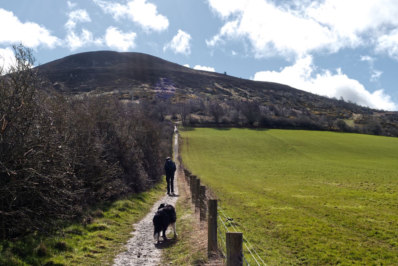
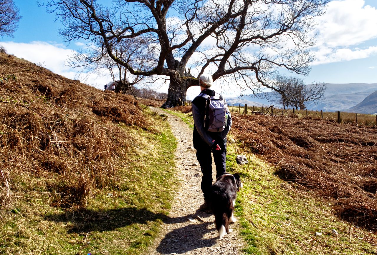
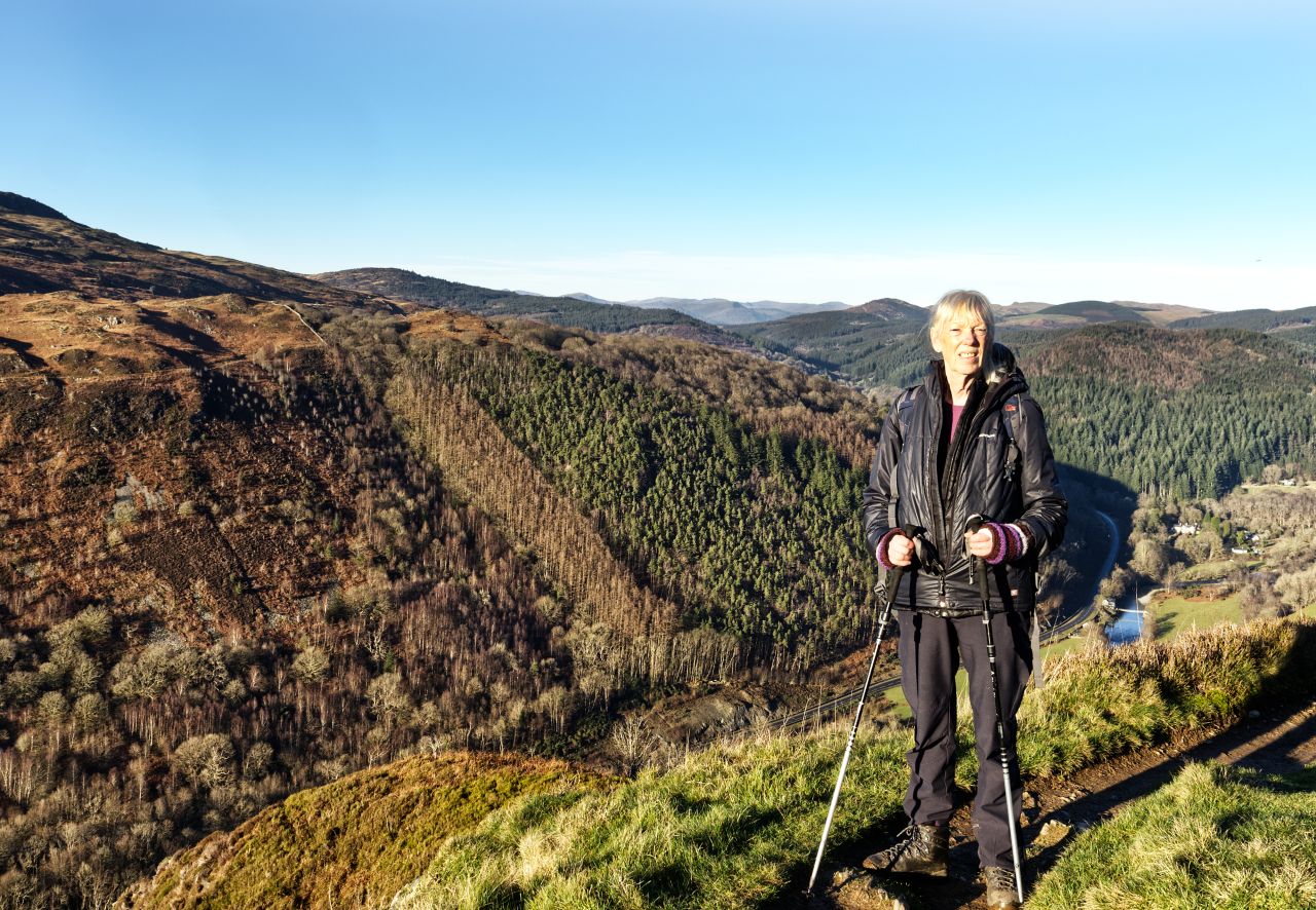
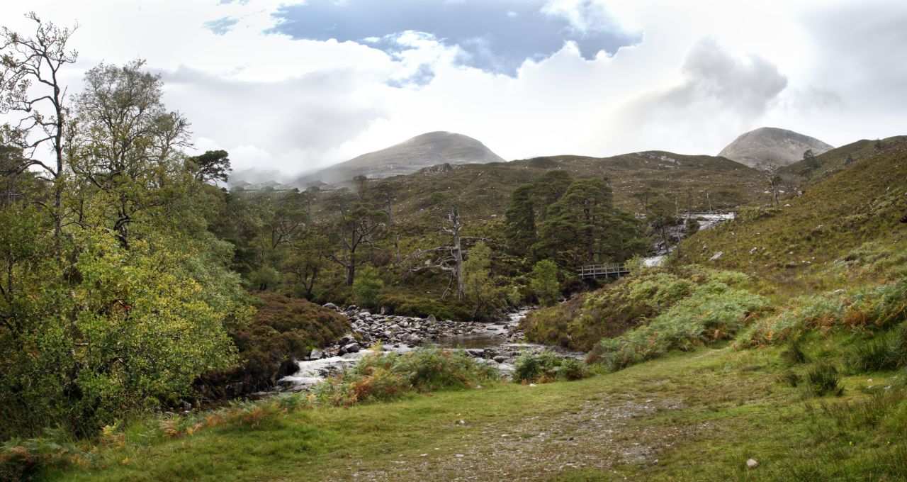
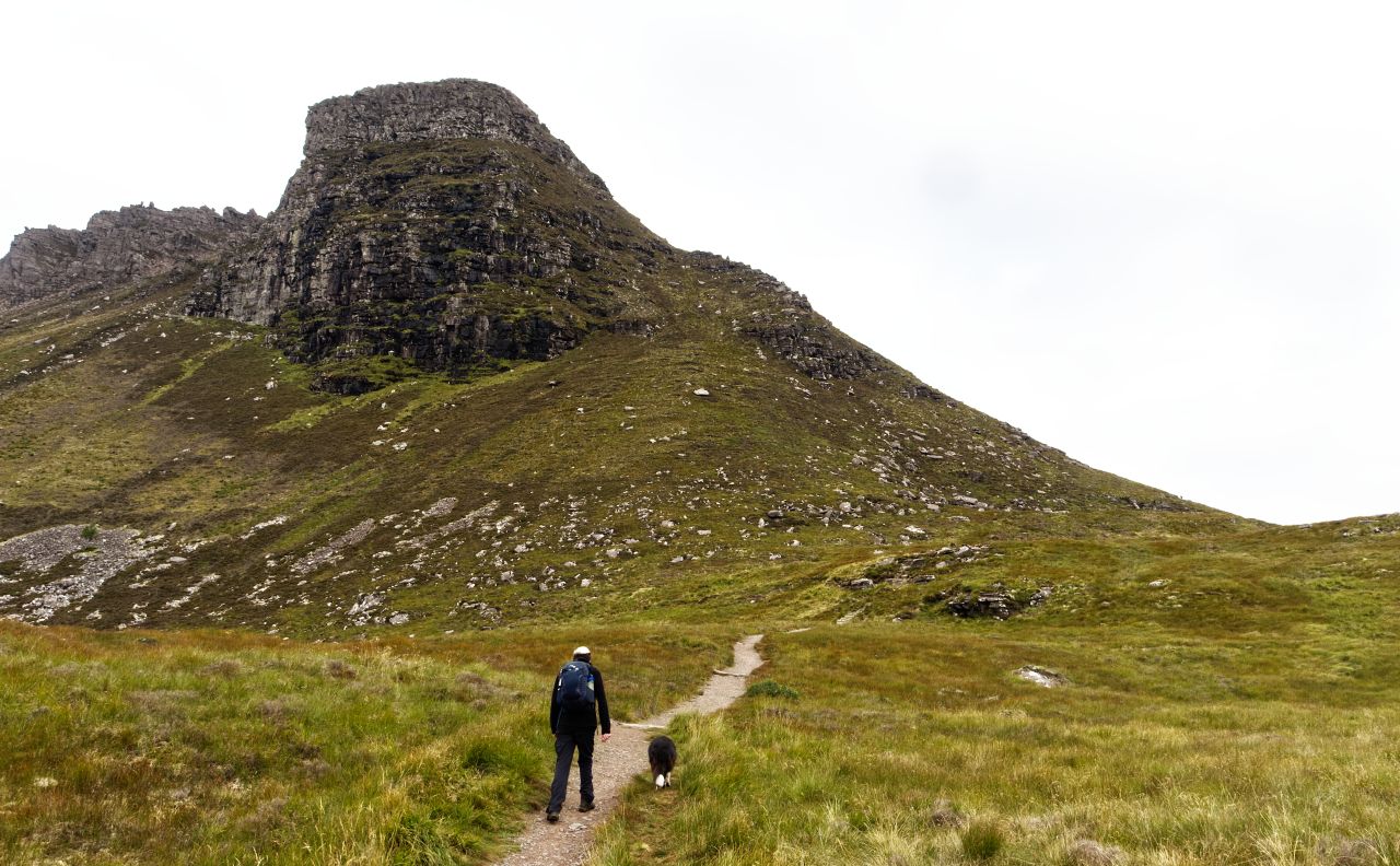
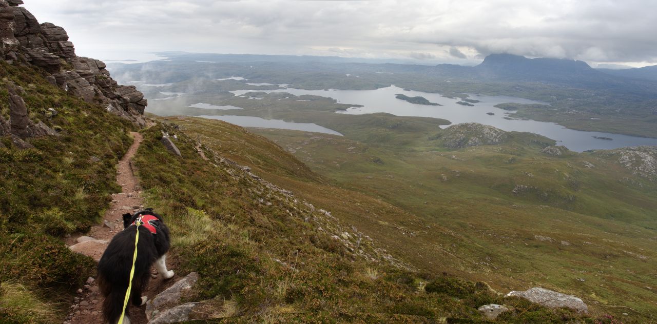
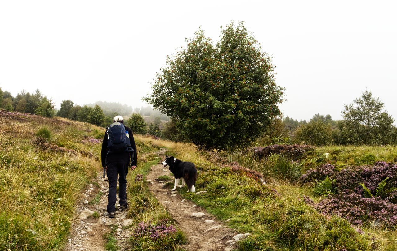
The route – Eildon Hill North (1), Eildon Wester Hill (2) and Eildon Mid Hill (3)Heading up from Melrose with Eildon North Hill rising above ….…. and looking across to Eildon Mid HillApproaching the col, the hub of the routes on Eildon
Our plan was much less ambitious and didn’t involve any hill splitting, river diversions or other wizardry. We set off from the old Borders town of Melrose by a steadily rising path that leads to a col at an altitude of about 320 metres, and which forms a natural hub for the routes up to the three Eildon summits. From there we followed the paths to the summits in turn, returning to the col each time.
Our first ‘Eildon’ – Eildon Hill North (shown as 1 on the map)The path up number 1, Eildon Hill North ….…. with ‘Mist’ at the summit
Eildon #1 was Eildon Hill North, standing tall(ish) at an altitude of 404 metres (1325 ft). In many ways it is the most interesting of the three – it was occupied as a hill fort in the late Bronze Age (about 1000 BC) by the Segovia tribe, who ruled and lived in upper Tweeddale until the arrival of the Romans. By 100 AD the Romans had started doing what the Romans did best, building stuff (see post #318), and a signal station took over the site of the ancient hill fort.
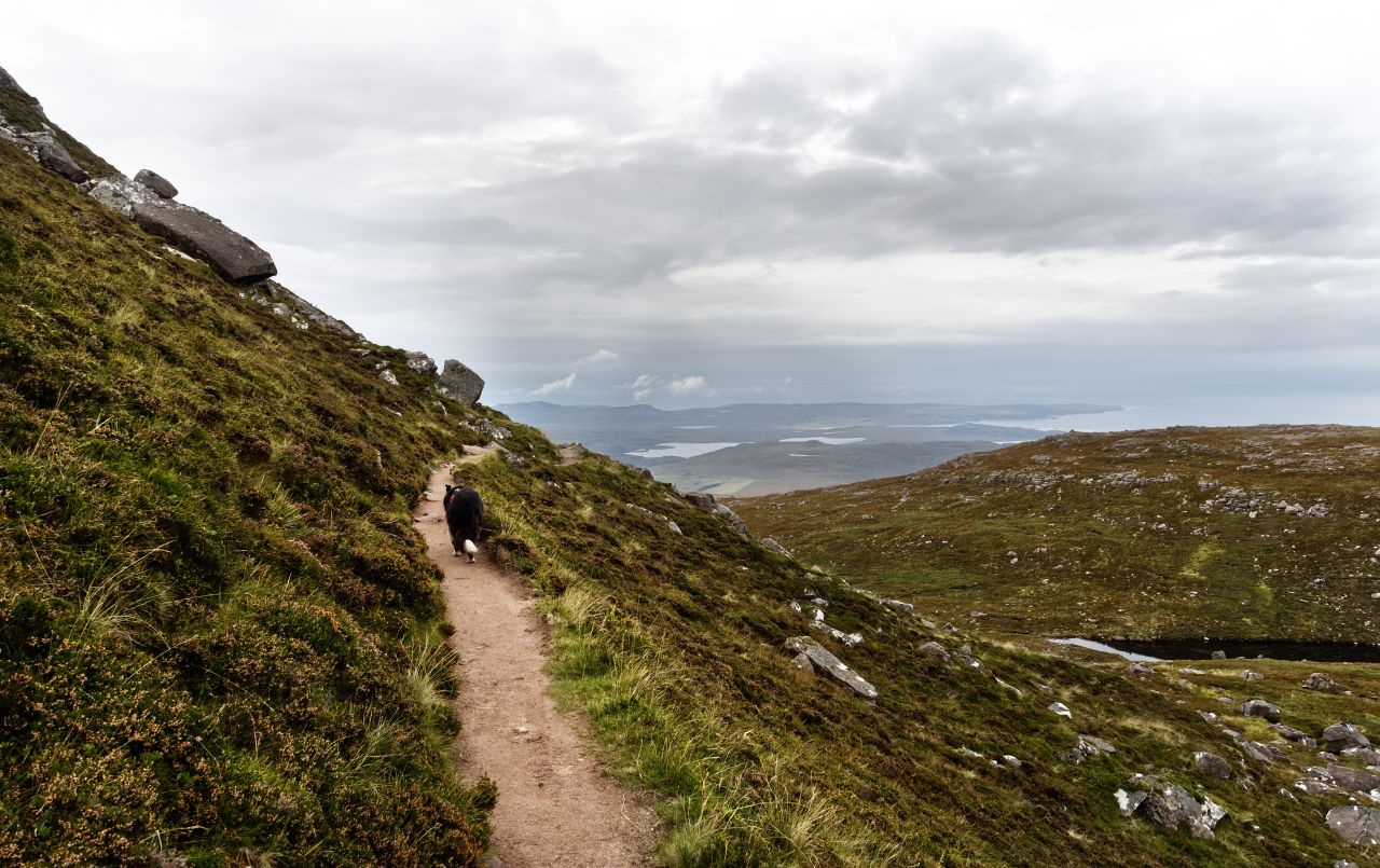
Looking back to the other two – Eildon Wester Hill (left) and Eildon Mid Hill (rightMelrose below us on the way back down to the col
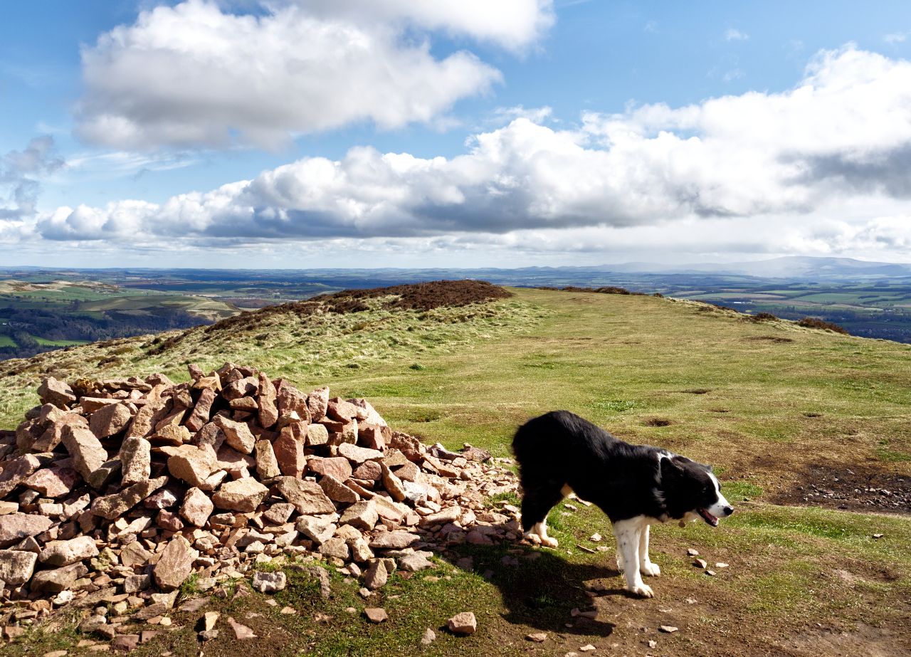
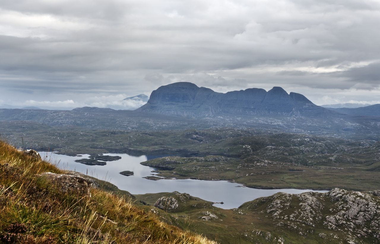
The summit of Eildon Hill North gave good views of the other two Eildons as well as our starting point at Melrose. Also below us, but not in view, was the portal to Elfland, or so ‘tis said – a 13th Century tale describes how Thomas the Rhymer was enticed by the Elf Queen to enter her domain; when he returned seven years later, it is said that he was incapable of telling a lie, which obviously ruled out any chance of a career in politics. It must be getting a bit crowded in there by now because the Eildon Hills are hollow, and King Arthur and his knights lie there sleeping, ready to emerge at times of peril.
The path contouring round Eildon Mid Hill, with Eildon Hill North behindOn the way to Eildon Wester Hill (#2) looking back to Eildon Mid Hill (left) and Eildon North Hill (right)Summit number 2, Eildon Wester Hill
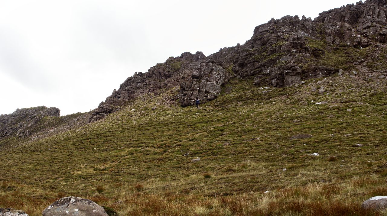
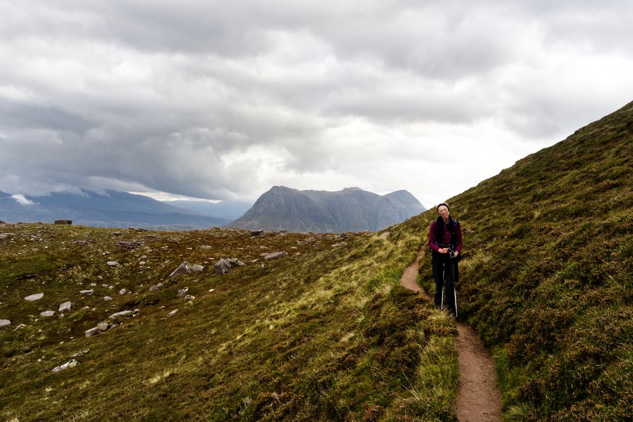
Meanwhile, back at the col, it was time for hill #2, Eildon Wester Hill. We abandoned a wide track to follow a narrow path contouring around what would be our hill #3. The path scarcely gained or lost a metre in height, pointing us straight at Eildon Wester Hill, which was the lowest of the three at 371 metres (1217 ft) and probably the least interesting. We didn’t hang around long before heading back to the col, ready to take on Eildon Mid Hill (#3)
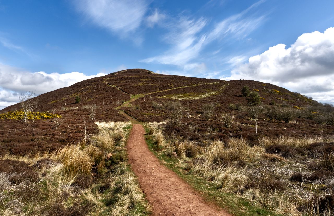
Eildon Mid Hill (3 on the map)Reaching the summit of number 3, Eildon Mid HillChecking out the summit
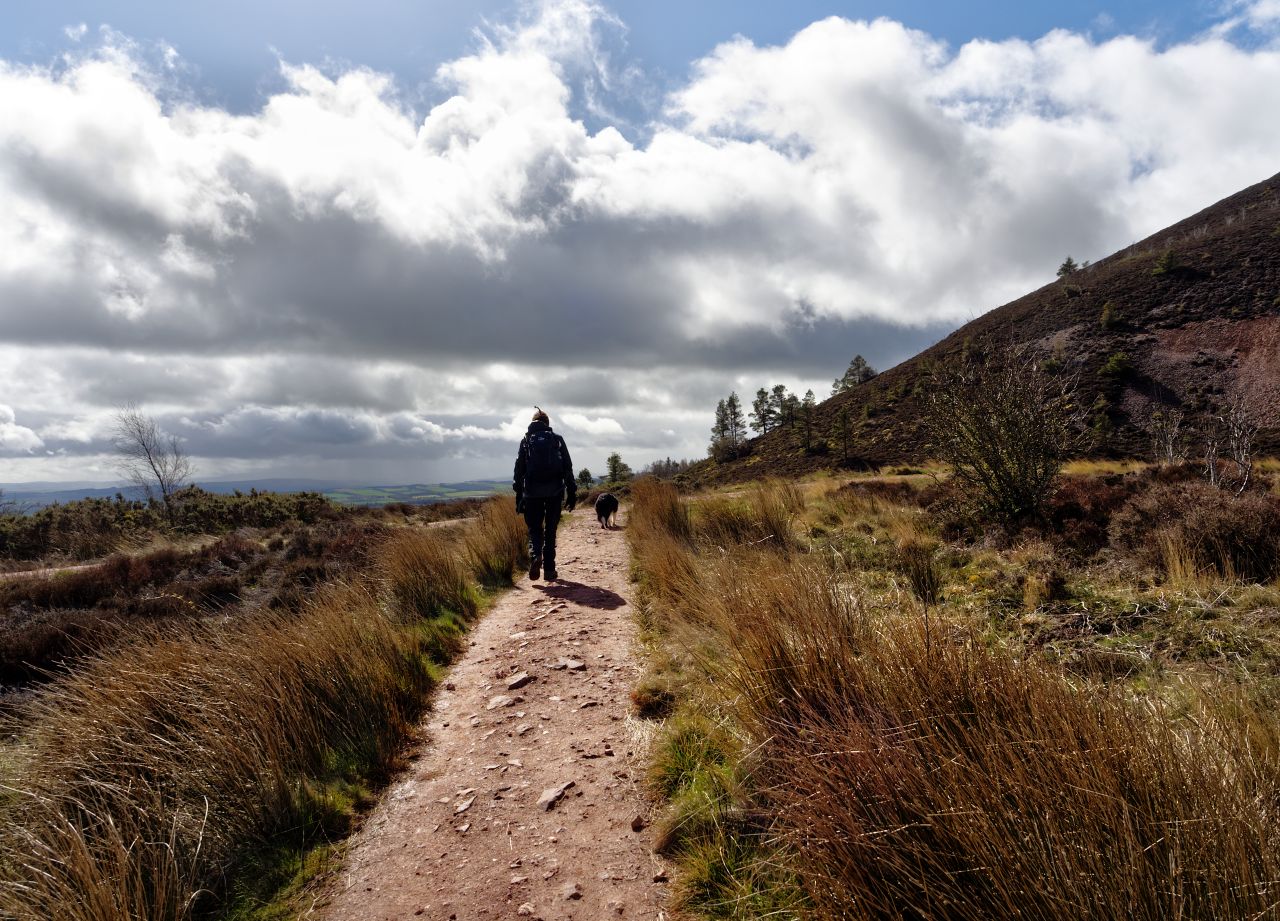
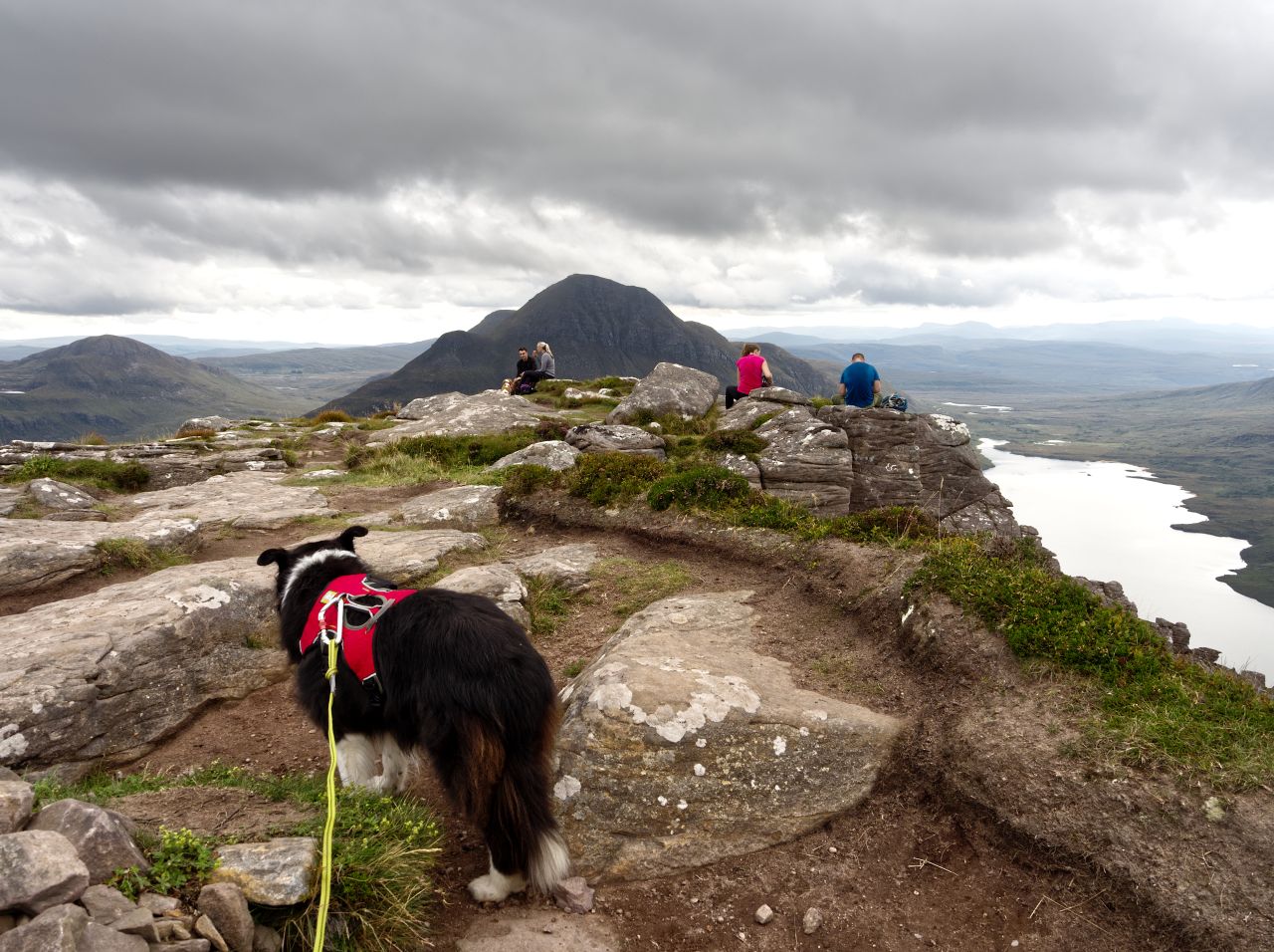
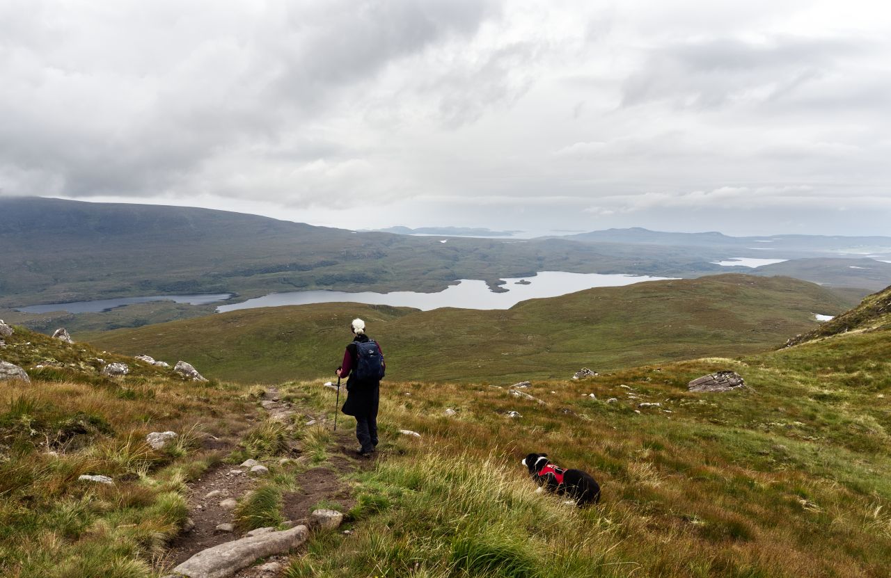
We had saved #3, the highest hill, until last, though at 422 metres altitude it wasn’t likely to cause any difficulty, and nor did it – a survey trig point and a view indicator marked the summit, but as with the other two hills, the most interesting views were of the neighbouring Eildons. The weather started mucking about a bit at this point, and our Gore-Tex jackets probably looked like overkill to the family group dressed in T-shirts who were heading up as we went down to the col for the last time.
21 Rain moving in over Melrose (on the left) on the descent
From the col, the weather still looked as if it could change at any minute, with showers moving in over Melrose, but as we took the final turn downhill, it looked as though we would get away without a soaking. The whole route, with its three branches came out at 8 kms (5 miles) with a total height gain of 470 metres (1542 ft). Hardly earth shattering in its ambition but ideal for our aging Border Collie ‘Mist’ – although 14+ years old, a walk up a hill or two was still the highlight of her day.
The shower missed us, giving a fair-weather finish – heading down to Melrose
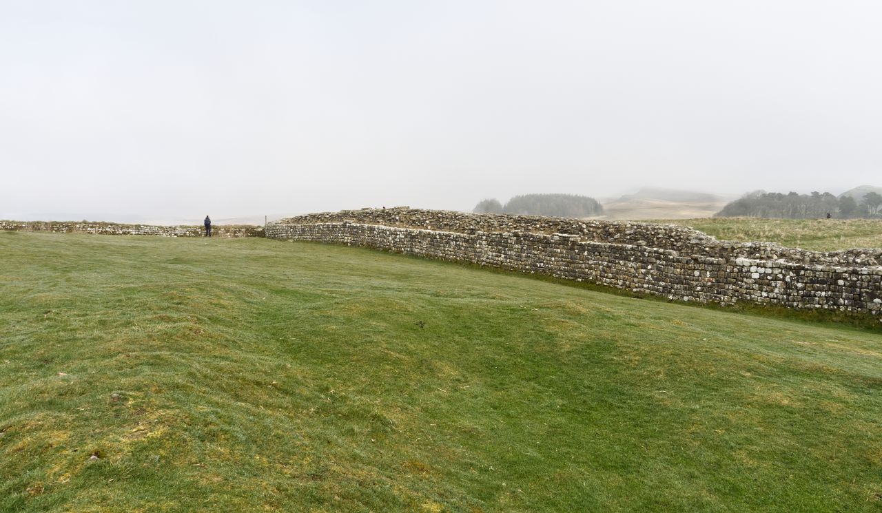
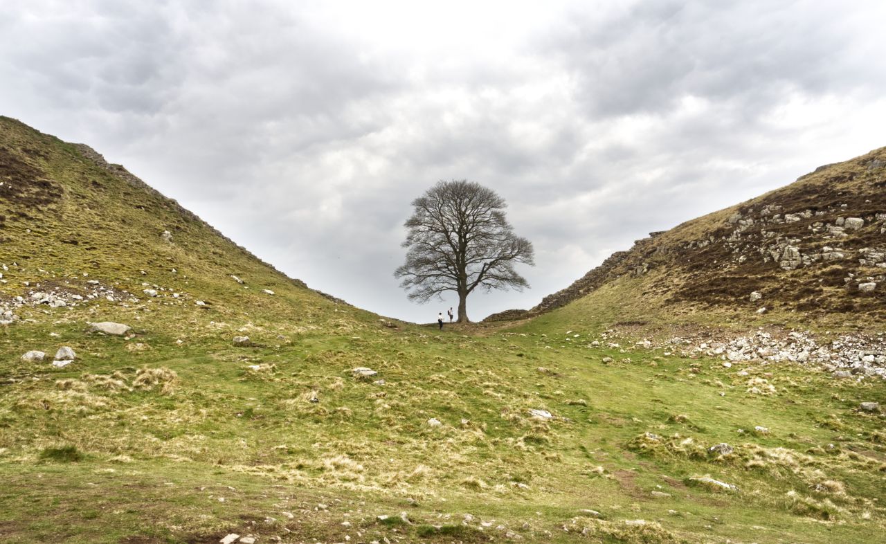
Hadrian’s Wall – Peel Crags (nearest) with Highshield Crags and the lake of Crag Lough in the distance
For the best viewing experience, left-click the images and maps to zoom in to a new window, then exit that window to go back – go on, it really does work!
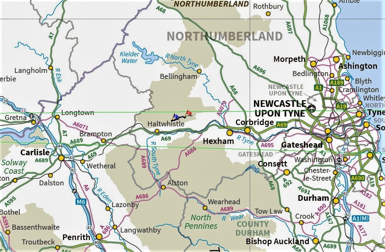
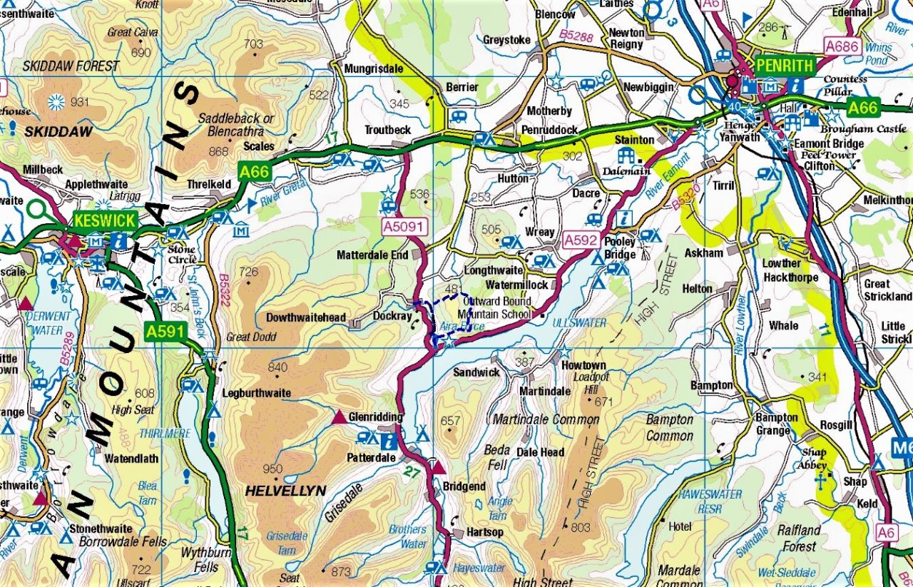
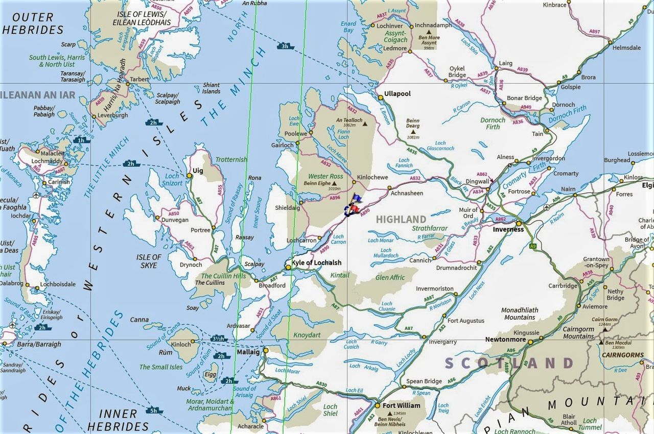
The Hadrian’s Wall area running from Carlisle to Newcastle
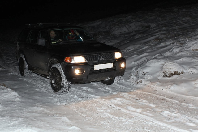
It was April 2022, and we were heading for Northumbria and the Scottish Border on our ‘shake-down’ trip with the new camper van. If the van was new, Border Collie ‘Mist’ was starting to show her age at last (14+ years) but she was still capable of walking around 10kms, as long as there wasn’t too much steep up-and-down. Our last walk out a couple of days earlier had been over Gowbarrow in the Lake District (see post #317) and had been just right for the old dog.
The central section of Hadrian’s Wall near Haltwhistle / Haydon Bridge
The plan was to increase the distance slightly but reduce the height gain, to work out what ‘Mist’ was capable of. Neither Chris nor I, or the dog for that matter, had walked any of Hadrian’s Wall, but it was on the way to the Northumbrian coast where we were heading, so that became the plan. Although the line of the wall does go up and down quite a lot, it’s easy to avoid much of the height gain and loss by following a parallel route. So, that’s what we did.
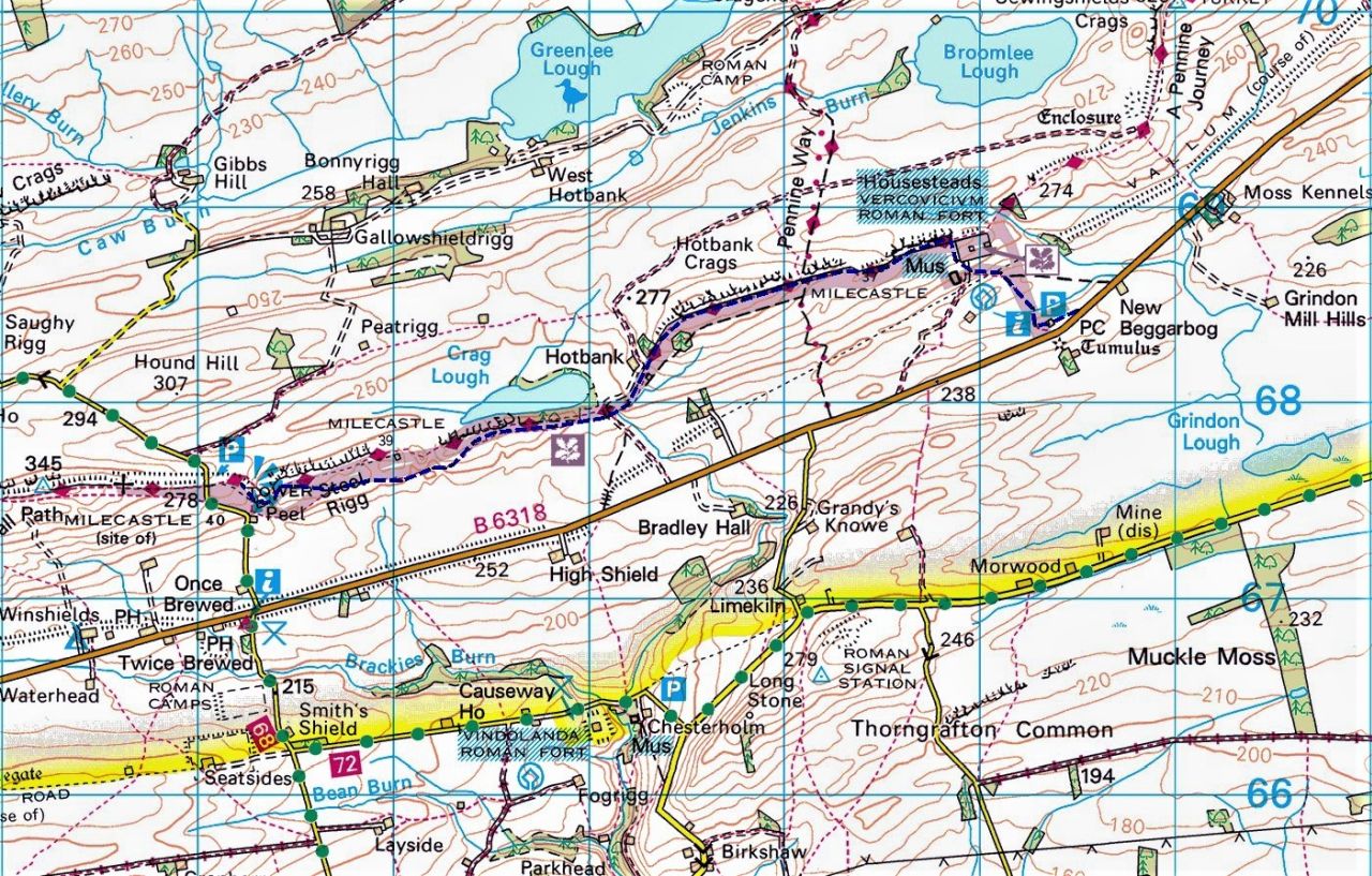
The route (in blue) from Housesteads to Peel and return
If you’re British, you probably know a bit about the history of the wall, but for those who come from a different part of the world, or skipped school on the day that Hadrian’s Wall was taught, here’s a quick rundown. In 500 BC, Rome was a mere city-state, but over the next 500 years, that city-state expanded to conquer the lands surrounding the Mediterranean before continuing to take modern-day France, Belgium and Holland. In 55 BC, Julius Caesar (yes, that one!) set his sights on the island just off the French coast, known to the Romans as Britannia.
Setting out to Vercovicium Roman Fort (AKA Housesteads) on a misty, moisty morning
Things didn’t go well for Caesar, as the British tribes who inhabited that offshore island were not too keen on becoming part of the Roman Empire. Caesar gave the project up as a bad job, and the Brits were left alone until 43 AD when the Emperor Claudius decided to have a go. The British were still an uppity lot and around 122 AD Emperor Hadrian decided on a substantial wall to mark the northern extent of Roman Britain.
Border Collie ‘Mist’ checking out the remains of the fort, almost 2000 years old (the fort that is, not the dog!)
The wall that bears Hadrian’s name was built from Wallsend on the River Tyne in the east, to Bowness-on-Solway near Carlisle in the west – we know this because (1) the winners write the history books and (2) an amazing amount of the 73 mile wall and its forts are still clearly visible, almost 2000 years later.
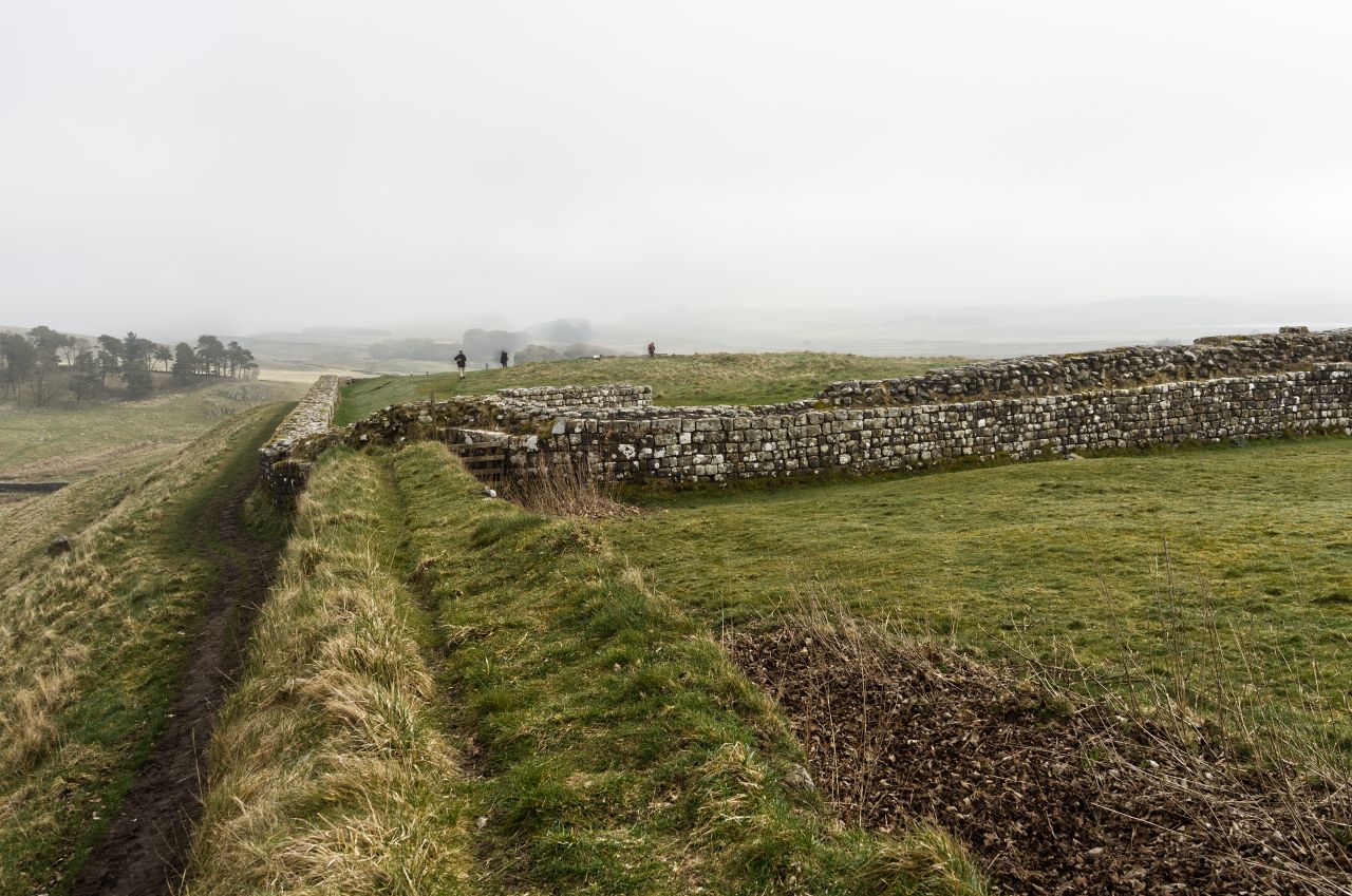
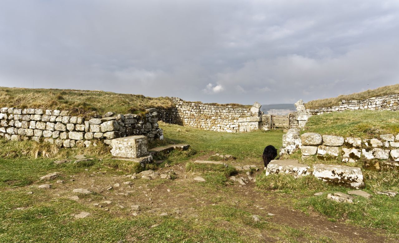
The west walls of the fort of Vercovicium Fort, now known as Housesteads ….…. still in a remarkably well-preserved state after almost 2000 years ….…. and which will probably still be standing there in another 2000 years
Construction of the fort known as Vercovicium by the Romans, but later named Housteads after the nearby 19th Century farmhouse, started around the same time that work started on the wall. It is the best-preserved Roman fort in the UK, and was part of a network of forts, mile castles and turrets along the length of the wall. The wall and forts were more than defensive locations though, they were also a statement – “We’re here and we’re staying here”! And stay they did, for the next 300 years or so.
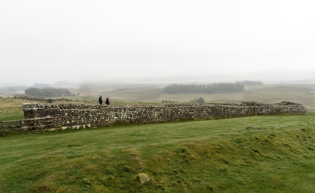
Looking north from the fort into ‘barbarian’ lands, with the mist just starting to lift in the distanceA section of Hadrian’s Wall, heading west from HousesteadsOne of the best-preserved sections of Hadrian’s Wall, at one time the northern frontier of Roman Britain
At this point in this blog post, some readers will already be viewing with glazed eyes, so time to start walking! The scenery around the wall is pleasant rather than dramatic, and if it wasn’t for the Roman ruins there probably wouldn’t be as many visitors to the area. Looking north into what were once barbarian lands, the views are of rolling countryside with forests in the distance – the main interest remains the wall.
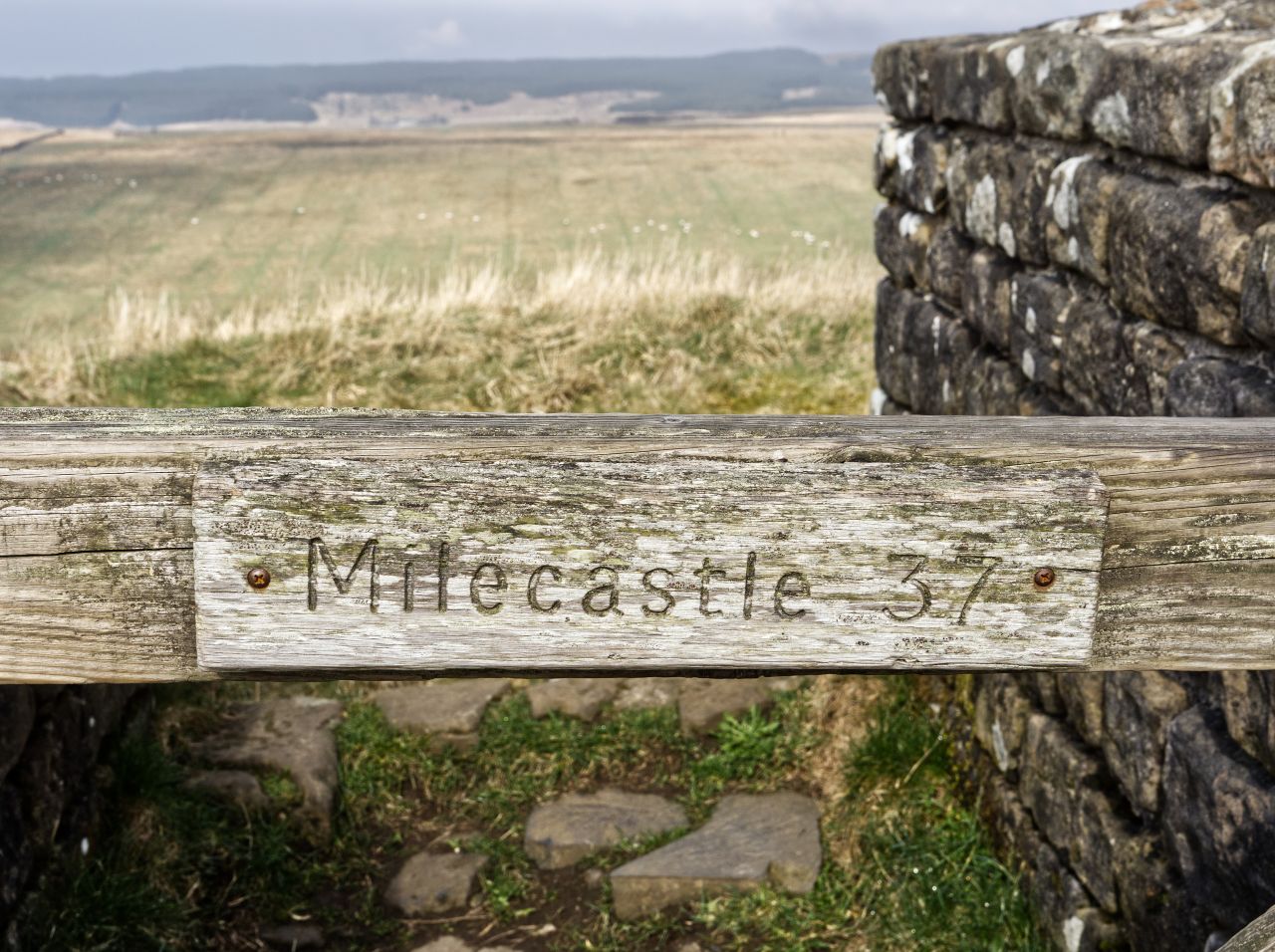
A helpful sign, just in case we forget where we areMilecastle 37, one of the 80 milecastles built along the wallA Roman’s view of the barbarian lands beyond the Roman-controlled wallA final look into the milecastle
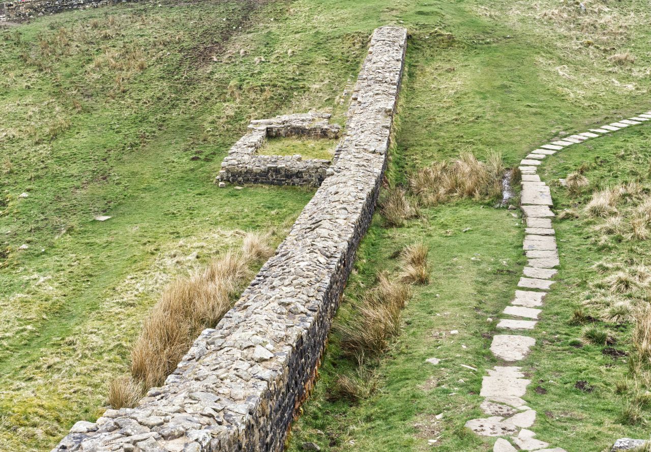
Fifteen minutes of easy walking brought us to Milecastle 37, one of 80 or so milecastles along the wall. 16-32 soldiers would have been lodged here, probably changing watches on a rota system with the 800 men based at Vercovicium. The milecastles controlled movement from the badlands in the north to the civilised Roman-controlled lands south of the wall, and the milecastle is in pretty good nick for a building almost 2000 years old, as is Vercovicium.
The wall continues to the west ….…. following the line of the high groundThe more recent farmhouse at Hotbank, adjacent to Milecastle 38The wall continues over the bumps and dips …. …. including the famous Sycamore Gap
Beyond Milecastle 37, the wall follows the line of high ground, using that high ground as a natural line of defence. The wall and ridge line would probably have given us better views, but in deference to the old collie, we followed a good green path running below and parallel to the wall, passing Hotbank Farm and Milecastle 38 before arriving at one of the best known sites for photographs, the famous Sycamore Gap – I’ll let you work out how it got its name!
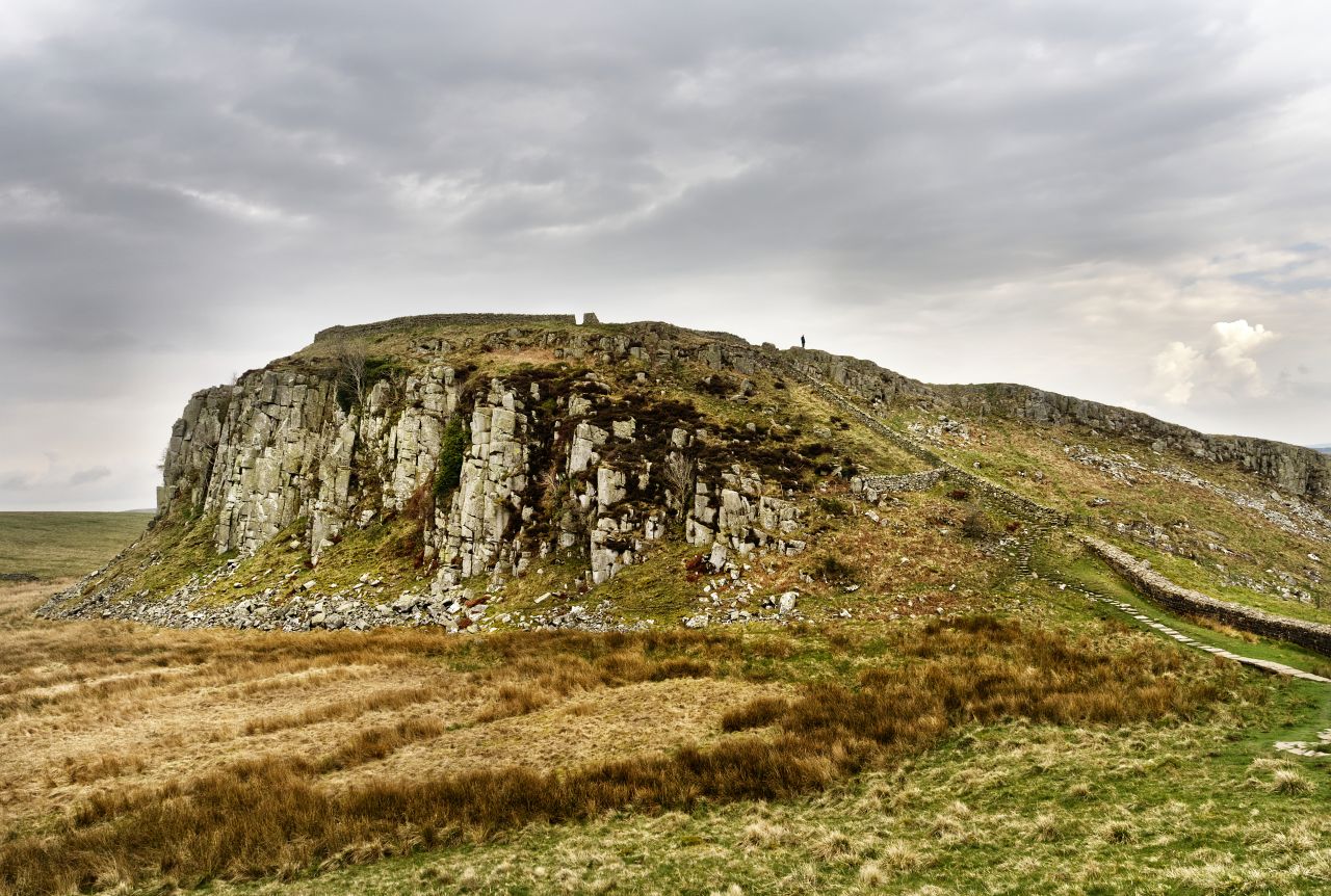
The wall beyond Sycamore gap …. …. with more ups and downsThe dramatic drop down at Peel ….…. with a view of the remains of one of the turrets on the wallLooking back to Peel Crags with its steep drop
So popular is Sycamore Gap, that I must have spent about fifteen minutes waiting to get people just where I wanted them for a photograph of the famous tree – I bet they didn’t have that problem when they used the tree as a location in ‘Robin Hood Prince of Thieves’ starring Kevin Costner. Once I had the shot I wanted, it was more ups and downs before we arrived at the dramatic drop down to Peel Farm.
The classic view along the wall looking east, with Peel Crags, Highshield Crags and Crag Lough
We carried on for a short distance to get the classic view along the wall featuring Peel Crags, Highshield Crags and Crag Lough – a bit of a photographic cliché, but still a good view. Then it was time to turn round and retrace our steps – as you might have guessed, a walk along a wall is always going to be, err …linear?! It had been a gentle trip out for ‘Mist’ and after 10 kms she was still looking good. That’s the thing with dogs though, they’re just glad to be having a wander out with new strange smells to check out.
Heading back to Housesteads, with a final view of that tree
For the best viewing experience, left-click the images and maps to zoom in to a new window, then exit that window to go back – go on, it really does work!
The north-eastern Lake District, with Ullswater in the centre
It was mid-February 2022, and we were looking at changing our campervan for something more up-to-date. Soon, the deed was done and we needed a couple of ‘shake-down’ trips before launching off on our annual May trip to the Scottish Highlands. Where better to start than the Lake District.
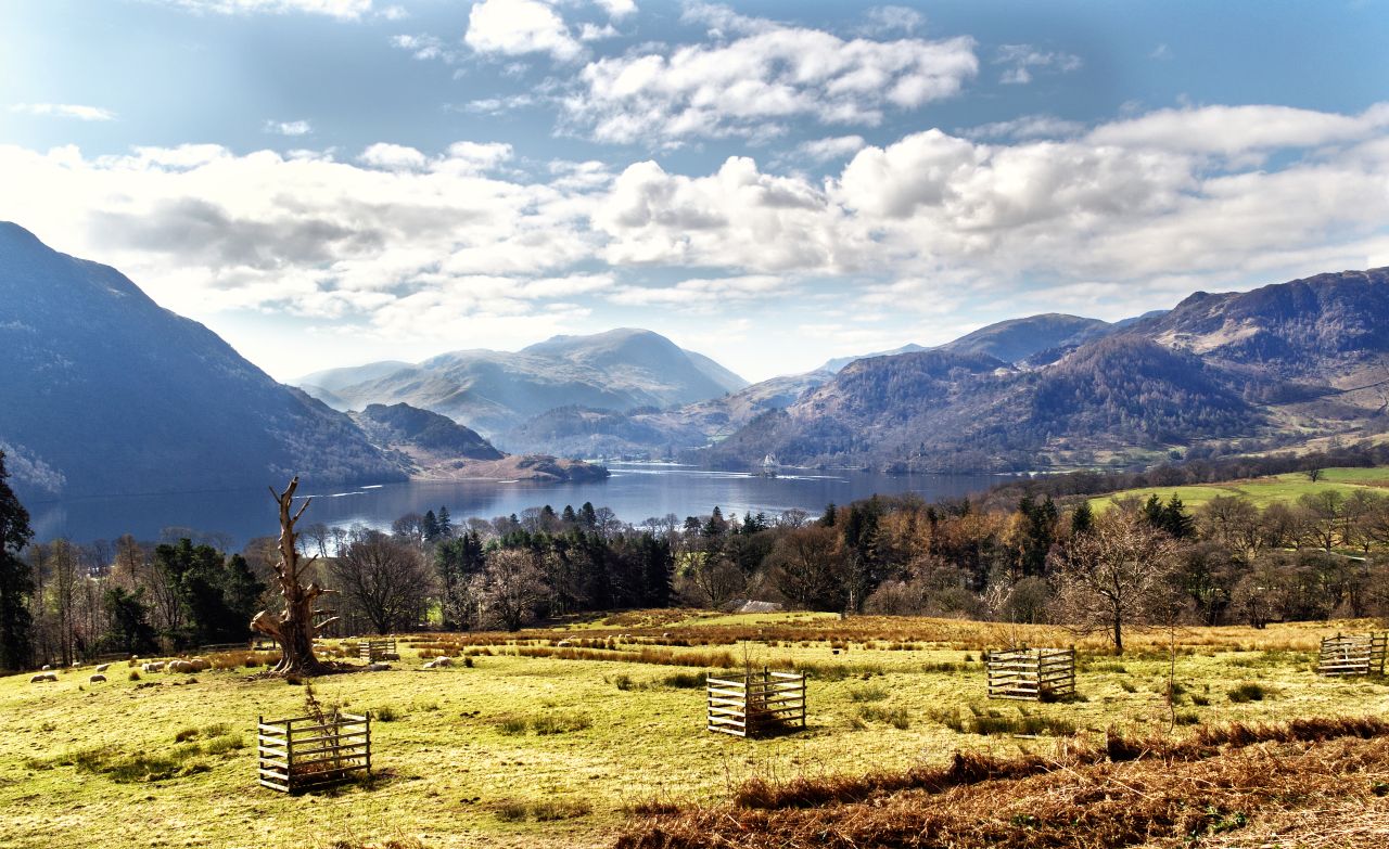
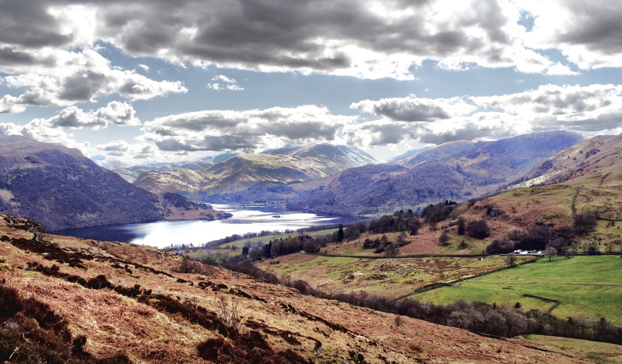
Ullswater and the surrounding area
A couple of days in Langdale at the beginning of March was a good start to the shake-down process, followed a week later by four days at Threlkeld near Keswick. The next trip was to be a fortnight in Northumbria and the Scottish Borders, but we just couldn’t keep away from Lakeland – Ullswater and Aira Force are just a short hop from the M6 Motorway, so a couple more days there seemed like a good move.
The route – anticlockwise starting near Aira Force (bottom left)
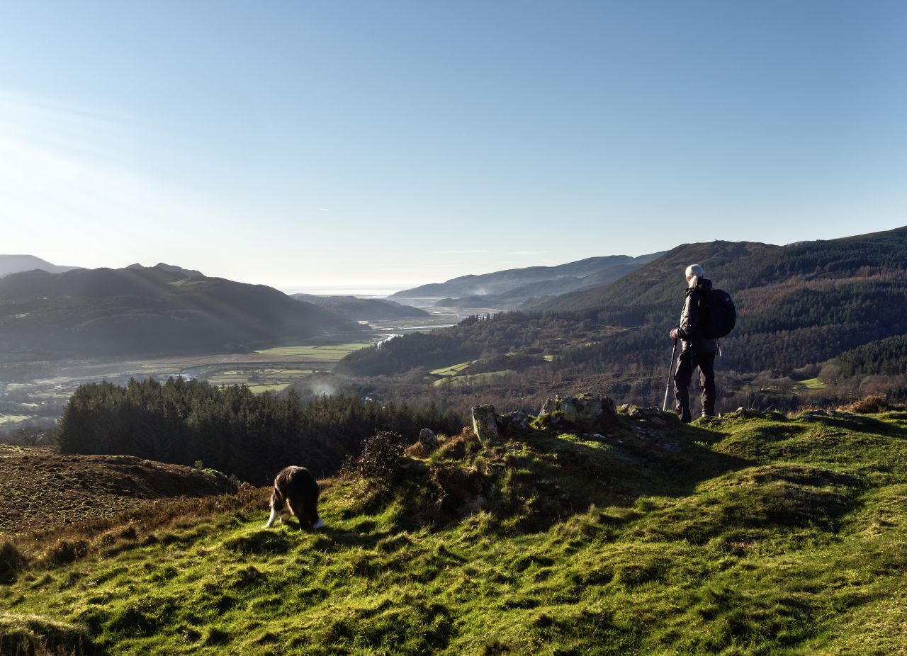
I lived at Patterdale at the south end of Ullswater in the 1980s, and I know the area well. In fact, I got to know the mountains surrounding the lake very well but spent little time exploring some of the lower hills in the area. So, the plan for this trip was to put that to rights by taking a circular route from Aira Force around and over Gowbarrow.
Setting out on the circular route around Gowbarrow Fell
When it comes to ‘lower hills’, Gowbarrow is definitely on the shortlist at a mere 481 metres (1578 ft) height. It’s thought that the name comes from Old Norse and probably means ‘Windy Hill’ – the area has other Old Norse names dating back to the 9th Century onwards, when the Vikings first started to settle, so you will come across beck (bekr) for stream, Force (foss) for waterfall, Tarn (tjorn) for a small lake and Fell (fjall) for mountain.
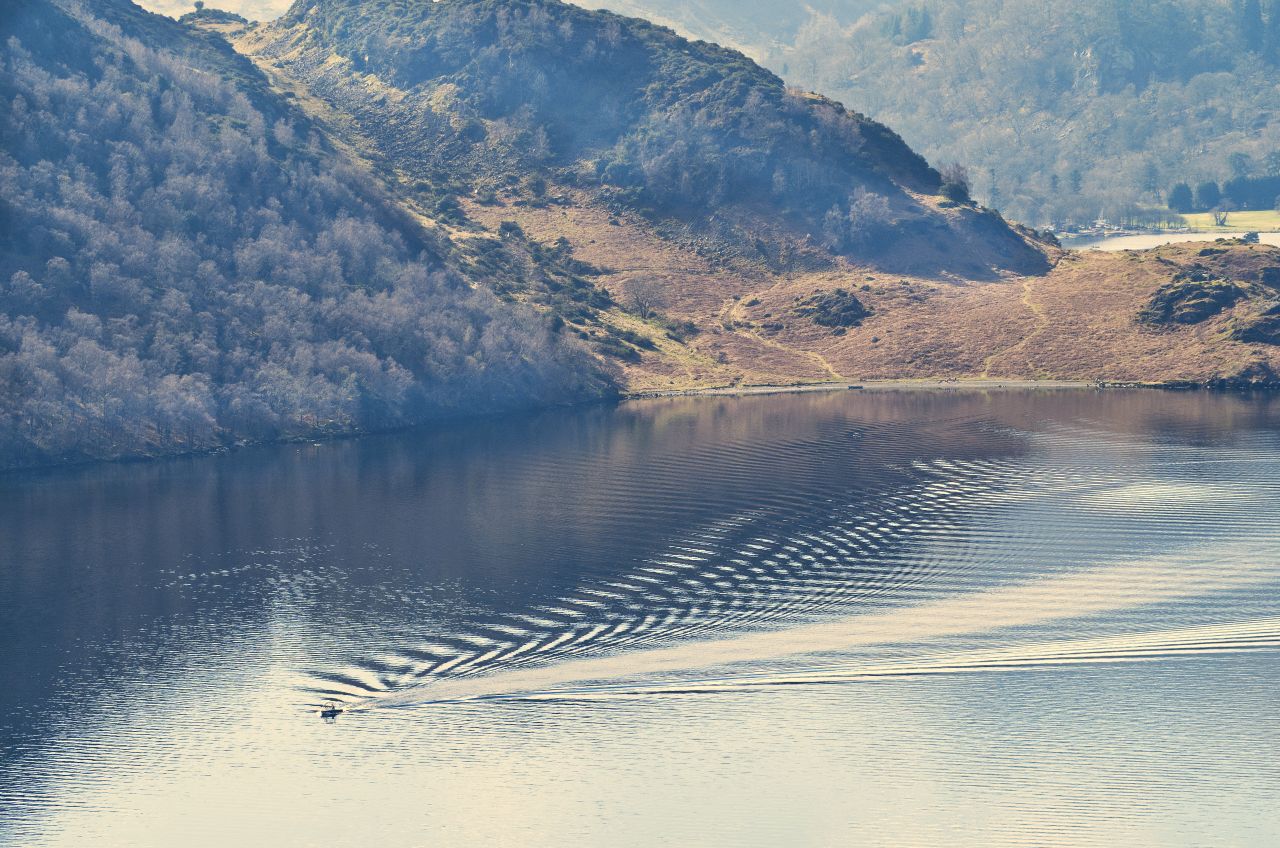
Looking back to UllswaterA popular lake for boatingThe gradually rising narrow path above Ullswater ….…. winding its way around the hillsideLooking east to Hallin Fell and the High Street mountains ….…. and looking to the west, with Aira Point just left of centre
Our route took us east from Aira Force (more of which later) on a gradually rising narrow path. Gowbarrow isn’t going to get you into a sweat, either through exertion or excitement, but like many lowly hills, it’s a great place to view the surrounding country, and the views of Ullswater and the surrounding fells compare well with the views from Hallin Fell, just a couple of kilometres away on the opposite side of the lake.
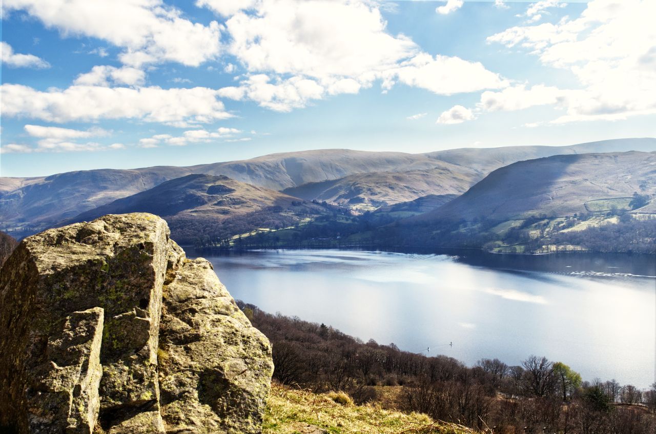
The path continues ….…. with the views opening up to the southwestNot exactly crowdedThe summit of Gowbarrow Fell, and the view towards Glenridding to the southwest ….…. and looking northeast towards Pooley BridgeThe view north with Blencathra (left) and Carrock Fell (further away right)Closer zoom view of the southern side of Blencathra, 12 kms away …. …. and the distant Carrock Fell, 14 km
The narrow path continues for a while before taking a turn to the north, followed by a second turn, this time to the west, to the small summit of Gowbarrow with its stone cairn – the views of the Ullswater area included much of the lake, and further away to the northwest, the northern hills of Blencathra and Carrock Fell were also visible. I had taken two cameras (Olympus) on this hike, one with an equivalent 35mm lens and the other with an equivalent 200-600mm lens – the longer lens was included in the hope of getting some red squirrel images but ended up being used for long landscape shots due to a ‘no show’ by the squirrels.
Round the far side of Carrock Fell, with Ullswater coming back into viewThe descent towards Dockray, with a badly eroded path to deal with ….…. but path repairs are in hand (Dockray to the right, at the very top of the image)‘The Royal’ at Dockray – it would have been rude not to visit!
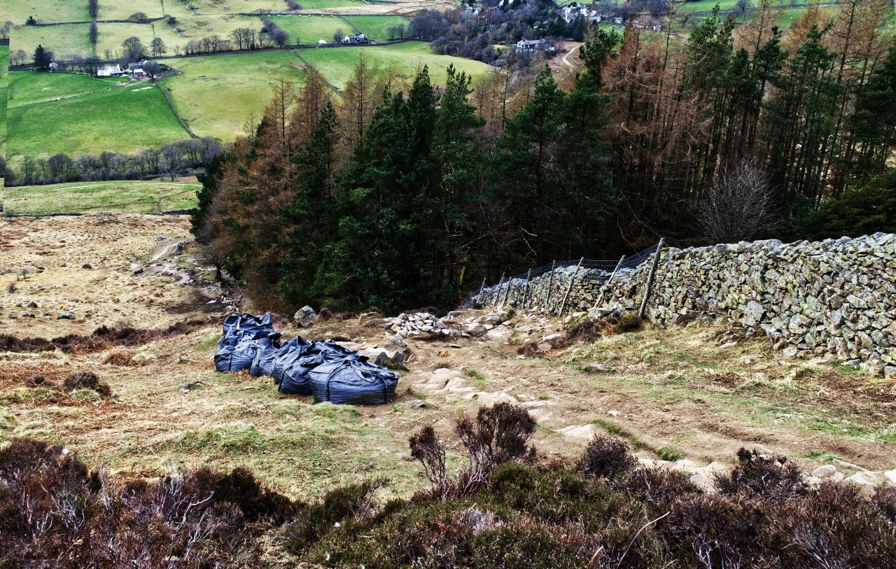
Our next port of call was a short diversion to the hamlet of Dockray, but before that, we had to negotiate a badly eroded section of path. Our route had been deserted, but this was March and I guess that hundreds of boots must pound along here in summer – a bit lower down we found helicopter drop bags full of stones to repair the path. Once past the worn section, we were soon at ‘The Royal’ at Dockray for a cool cider – well, it would have been rude not to!
A distant view of Aira Force, with the bridge at the top of the waterfall just visibleNext to the bridge ….…. and looking back to the bridge
Our route back to the van went via the 20 metre (65 ft) waterfall of Aira Force, one of the best-known waterfalls in the Lake District, if only for its connection with Romantic poet William Wordsworth. It’s a favourite on the tourist circuit, but the best views are out of reach at the moment, due to damage caused by fallen trees – I did the best I could to get a decent photograph from the accessible viewpoints before heading back to the van to top up my cider levels.
p.s. It was T-shirt weather for the Gowbarrow hike, but three days later we nearly found ourselves marooned up near Simonside in Northumbria – it snowed overnight, then froze in the early hours, making the steep road out like a skating rink. I’d decided that there was no way I was launching a 3-tonne camper van down a steep icy slope, but by the time we had taken Border Collie ‘Mist’ for her morning walk, the road was thawing out – one consolation would have been that getting cold cider would not have been a problem!
Helm Crag (centre) in the late-afternoon sun, February 2007
For the best viewing experience, left-click the images and maps to zoom in to a new window, then exit that window to go back – go on, it really does work!
Helm Crag at Grasmere near Ambleside, in the English Lake District
“The journey of a thousand miles, starts with a single step” – Lao Tzu
“I would walk five hundred miles, and I would walk five hundred more…..” – The Proclaimers
Writing a blog is sometimes like taking that first step in a journey of a thousand miles. All sorts of things can get in the way of that first step, but the reason I haven’t posted anything for almost three months is quite simple – we’ve been away from home for over half of that time, visiting places new and old, and more importantly getting more material for the blog. In fact, I’m still sorting and editing photos from the trips! Oh, and we covered quite a bit more than a thousand miles.
The route – out along the north ridge and back down the Easedale valley
Three months is a long time to disappear though, so while I’m getting on with the admin and edits, here’s a story from 2007. I’ve written 72 walking routes for the Walking World website, mostly between 2007-10 (see – http://www.walkingworld.com/) but this one was the first – a classic Lake District walk including a busy, iconic peak and a lonely, deserted valley away from the crowds. This is ‘Helm Crag and Far Easedale’.
Setting out from Grasmere in February 2007 ….…. with Helm Crag rising aboveThe tarmac road ends …. …. giving access to the hill paths ….…. before reaching the edge of the open fellside
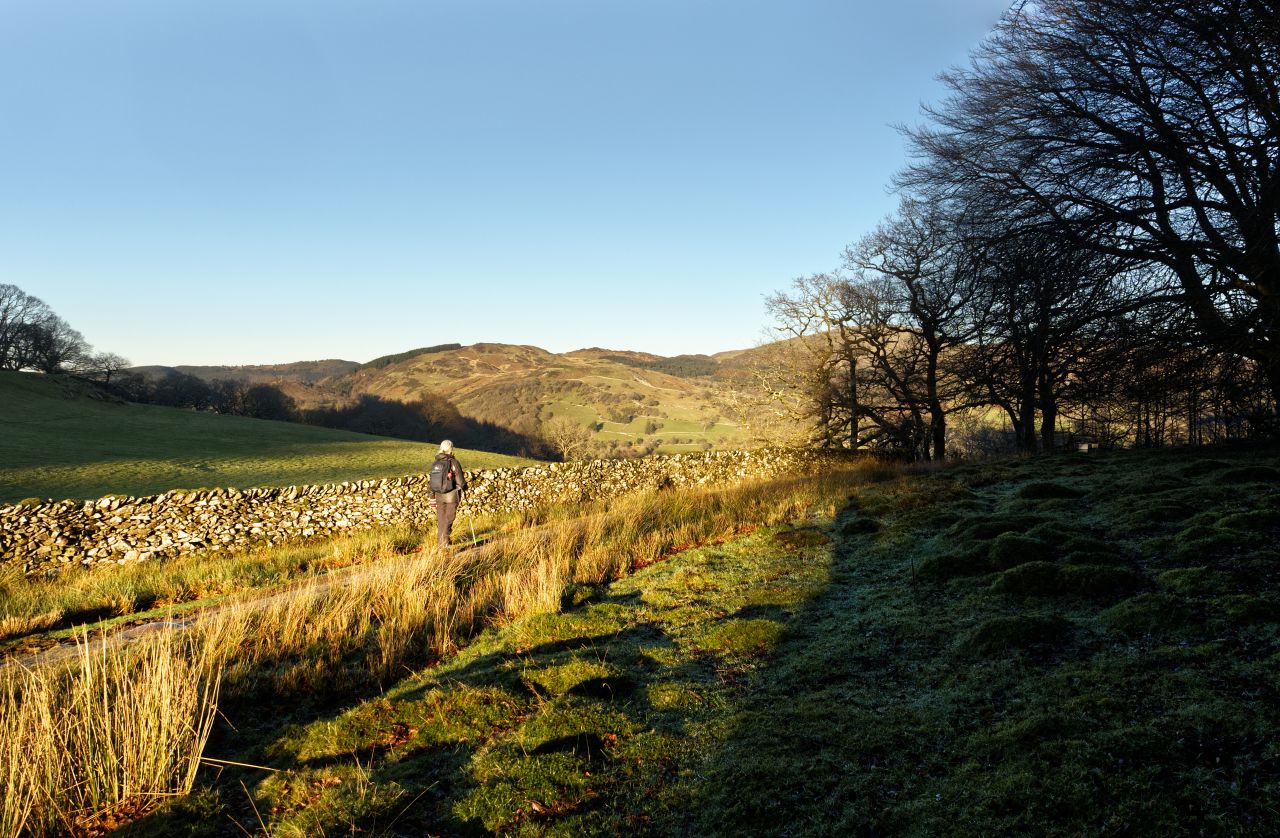
We set out at the beginning of February 2007, on a clear and almost cloudless day. I say ‘we’ but I mean just Chris and myself – Border Collie ‘Mist’ didn’t become part of our lives until December 2010 (see post #5). I must have been a pain in the arse to walk with back then because I took loads of photos to act as a prompt when I came to write up the route, instead of writing notes (I later used a digital voice recorder, which speeded things up a bit!). The initial; part of the walk is along a quiet tarmac road, but tarmac is tarmac and it was good to get out onto the hillside at last.
Early view of the ridge to Calf Crag, with Gibson Knott just right of centre …. …. and the view back to Grasmere with some late morning mist over the lake
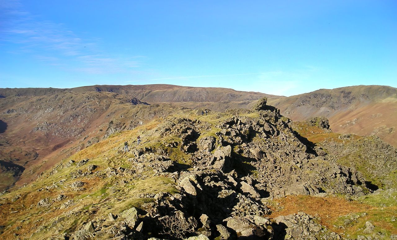
Helm Crag sits at the southeast end of a ridge running northwest to Calf Crag. Helm Crag is certainly no giant at 405 metres height (1329 ft), with Calf Crag not much higher at 537 metres (1762 ft) and most of the ridge joining them being around 400 metres. Despite the lack of height, the views of the surrounding country are impressive, with the main attraction being the first objective, Helm Crag.
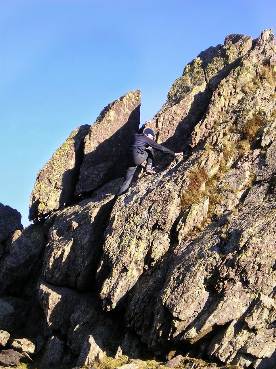
Approaching the South Summit …. …. with the North Summit just beyondThe North Summit, also known as ‘The Howitzer’
It was the Victorians who started giving daft names to hill and mountain summits. Helm Crag is itself a short ridge with two summits, the south summit being known as ‘The Lion and the Lamb’, presumably because it looks like a lion and lamb from the valley at Grasmere (hmm, sorry but I don’t get that one!). The north summit is also known as ‘The Lion and the Lamb’ (yes, confusing isn’t it) or ‘The Old Woman Playing the Organ’ (really?) or ‘The Howitzer’ (a bit more plausible) depending on where they are viewed from. If a daft name is needed, ‘The Howitzer’ is the most appropriate, but ‘North Summit’ does it for me!
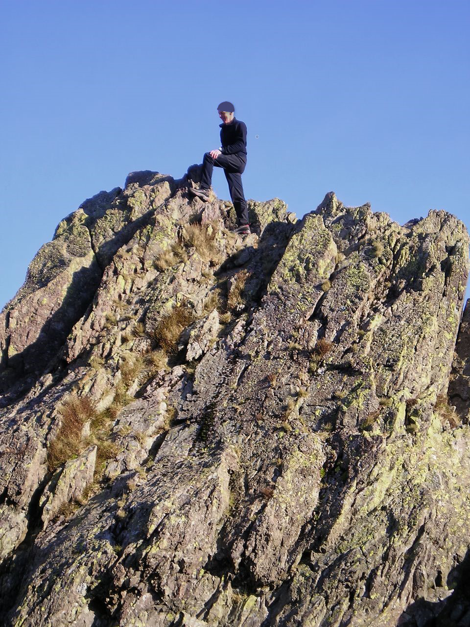
The author mucking about, going up to the summit, posing like a good ‘un before retreating – safely!
In fact, the North Summit is by far the most interesting feature of the hill (well, to me anyway) because it has the distinction of being one of the few summits in the Lakes where you have to rock-climb to get to the summit. It’s a short climb and not particularly difficult by rock-climbing standards, but it would hurt if you fell off (a lot!) or would be downright embarrassing if you had to be rescued from the top. The famous English guidebook writer Alfred Wainwright chickened out on the summit bid, but he lived to be 84 – watch and learn.
From the North Summit – Gibson Knott in the middle distanceHeading up to Gibson Knott with the ridge beyondLooking back along the ridge to Helm CragLooking down to Brownrigg Moss from Calf Crag, at the end of the ridge
For those who survive the scramble to the summit (or sensibly do a Wainwright), the view to Gibson Knott indicates the way forward. The Gibson Knott-Calf Crag ridge is one big grassy frolic, giving easy, pleasant walking – in my hill running days, I ran the ridge several times, and it’s one of those gently undulating ridges that doesn’t ask much from the runner but which gives loads back. On this trip Chris and I walked, gradually gaining height to Calf Crag before starting the descent to Far Easedale.
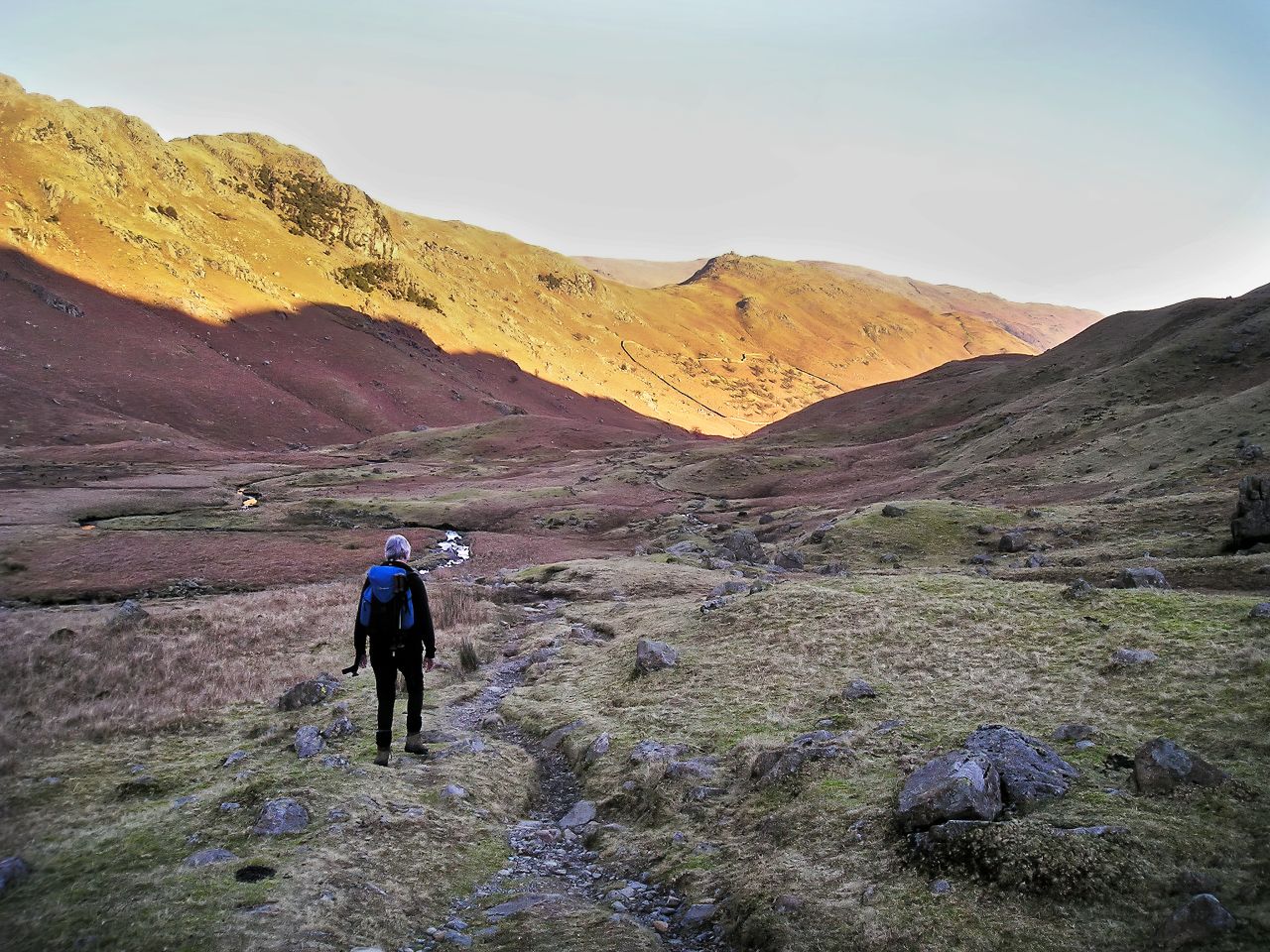
The view down to Far Easedale with the winter sun starting to setDown in the shadows in Far Easedale, with the sun still lighting up the ridge
Far Easedale is a delight, being deserted and quiet, though the fact that the nearest car park or bus stop is over 5 kms away contributes to that. If you seek solitude, this is where you will find it. We found it as the February sun was starting to dip behind the hills – as the valley is narrow, it doesn’t take long before the shadows start to take over from the sunshine, leaving only the high ridge and Helm Crag in the sun. Possibly the best way to finish a short but rewarding day out on the fells of the Lake District.
Final view of Helm Crag basking in the late-afternoon sun
p.s. Apologies to those of you who have been hanging around waiting for a new post – I’ll try to keep up!
p.p.s. Apologies also for some of the colours in the images – digital photography has come on leaps and bounds since the photos were taken (15 years) but there’s only so much that can be done in editing.
A cliff with a vertical, nearly vertical, or overhanging face.
A situation of great peril.
The Precipice Walk – yep, looks like a precipice!
For the best viewing experience, left-click the images and maps to zoom in to a new window, then exit that window to go back – go on, it really does work!
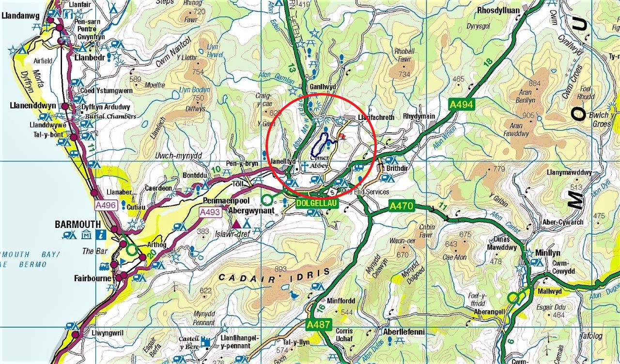
North Wales – the Precipice Walk is at the small flag, near the bottom of the mapMap showing the surrounding terrain – route in the middle
The Precipice Walk had been on the ‘to do’ list for a couple of years. It sounded like an interesting little route, but the ‘little’ part of it was the problem – a drive of nearly two hours for a walk of 5½ kms. We do more than that at home on the daily dog walk! However, we hadn’t been out for a hill day for several weeks and the short hours of daylight in January wouldn’t allow time for a long hike, so perhaps it was time to visit the Precipice Walk.
The Precipice Walk – anti-clockwise from the start point
There was a time when mentioning a walk with a precipice would have been an instant no-no from Chris – our day on Crib Goch back in 2002 had done nothing to encourage her to try another precipice, but this precipice walk sounded more benign. A bit of research even found a 5-Star review on TripAdvisor, with not a single ‘Terrible’ comment; in fact, the punters seemed to love it! It had to be worth a two-hour drive.
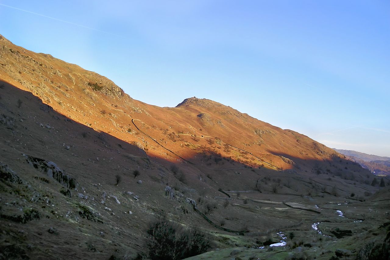
Setting out on a sunny morningLlyn Cynwch with Cadair Idris beyond in the distanceThings start to get steeper
We arrived on a cold, crisp January morning, with frost still lying on the grass in places, a result of the clear skies overnight. I’m usually moaning in this blog about dull, flat light for photography, but not today – in fact, the day was sunny and bright, but the low January sun was to cause different problems for photos on the way round, with the sun often shining right into the lens. Ho hum, another challenge then.
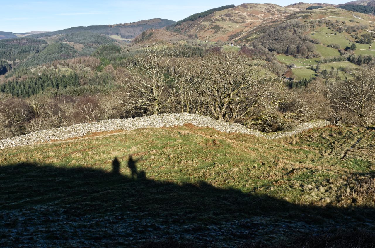
The view across to Rhobell FawrHeading out towards The Precipice ….…. accompanied by ‘shadow people’
The route passed near to the small lake of Llyn Cynwch on the way out, but that would have to wait until our return. Although the route isn’t especially high, it gave some great views out onto surrounding hills including Cadair Idris (see posts #150 and #300) and Rhobell Fawr (see post #205) and the low sun gave us a bit of company in the shape of two humans and a dog – our own shadows!
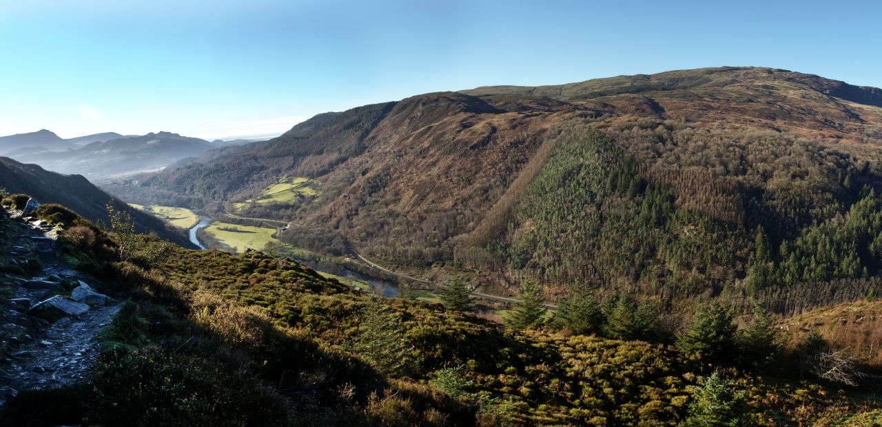
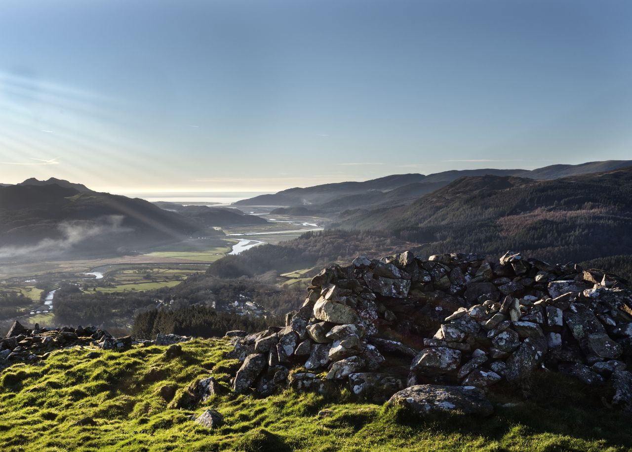
About to turn the corner ….…. to look down to the Afon Mawddach, over 200 metres belowAfon Mawddach and the A470 road (the small white dot in the centre is a motorhome!)Into the shade, with the big drop still belowOut into the sun again – big drop still thereChris on the precipice section with the valley over 200 metres below
We soon turned the northern corner of the route to head south along the ‘precipice’ bit, with the Afon Mawddach and the A470 road 200 metres below us in the valley. We also had the sun directly in our eyes, apart from the short sections where bends in the path put us back in the shade. Sun or shade, the drop to the valley was ever present, adding a bit more interest and drama.
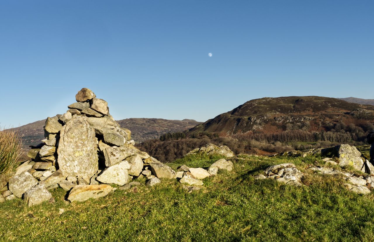
Off the steep ground, looking out to the Mawddach EstuaryFoel Faner aheadThe small summit cairn of Foel Faner with the moon risingThe view to the Mawddach Estuary from the summit of Foel Faner ….….and the view in the other direction, with Rhobell Fawr (far left) and the Aran Mountains (far right)
The precipice didn’t last for long though and soon we were off the steep ground, looking out to the Mawddach estuary. We briefly abandoned the return section of the Precipice Walk to include the short climb up to the small summit of Foel Faner, an ancient hill fort. The 360° view was enhanced by the bright sun, but the moon rising to the east reminded us that the day would soon be slipping away.
Heading back by the shore of Llyn CynwchReflections across the lake
Llyn Cynwch was included on the way back, with hardly a ripple on the water, but the lengthening shadows told us that it was time to head back to the car, and our two-hour return drive. It was time to head for home.
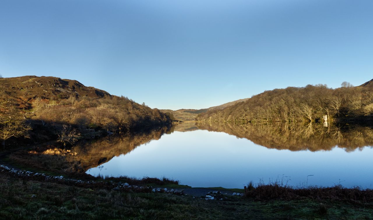
Yr Elen, seen from Carnedd Llewelyn (Photo from 2015)
For the best viewing experience, left-click the images and maps to zoom in to a new window, then exit that window to go back – go on, it really does work!
Yr Elen from Foel Grach (2014)
Readers of this blog might well think that I have moved to live in Scotland, based on the number of posts on Scottish mountain trips over recent months (10 out of 12 to be exact) so time to redress that with a post featuring a Welsh mountain. We did this route in July 2021, and on the timeline, this should have been published between post #304 and #306, but finally it’s time for the lovely Yr Elen to step forward into the light of day.
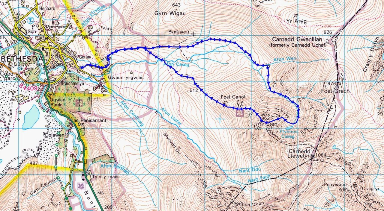
North Wales, with the Yr Elen route on blue at the centreThe mountains of the Carneddau, with the Yr Elen route in the centre in blueThe Yr Elen route, clockwise starting from Gerlan near Bethesda
The mountain is often approached from Carnedd Llewelyn on the north-south ridge of the Carneddau – as Yr Elen is one of the fifteen 3000 ft peaks (915 metres) of Wales, hikers following the Welsh 3000’s Challenge route have to divert out and back to tick it off, adding 2.5 kms and 250 metres of height loss and gain. Not for us on this trip though – our route for the day was the quiet, lonely ascent from Gerlan, near Bethesda.
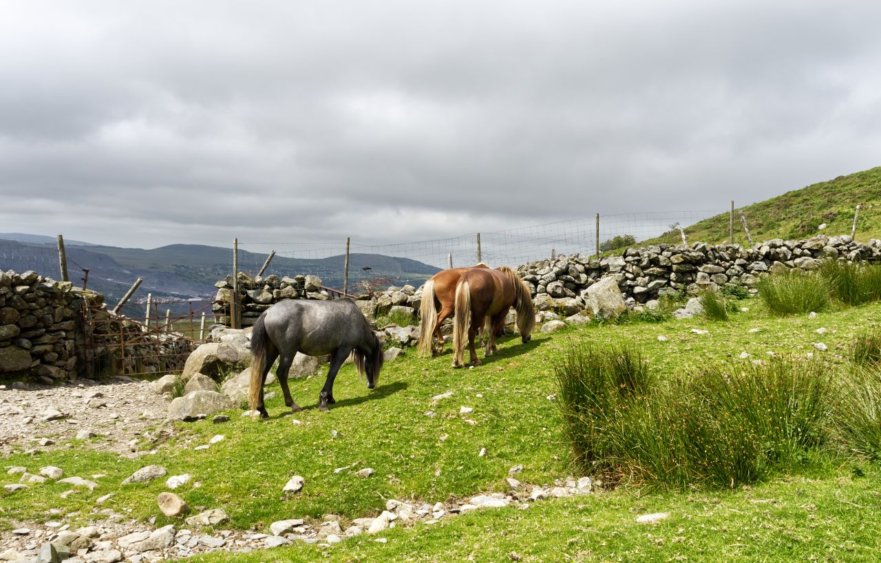
Setting off up the valley of the Afon Caseg, with the clouds down on the CarneddauCarneddau ponies, not worried at all by clouds, humans, or Border ColliesThe clouds lifting a little, but still brushing the top of Yr Elen …. …. but clearing more as we headed up the wide valleyThe valley narrows ahead
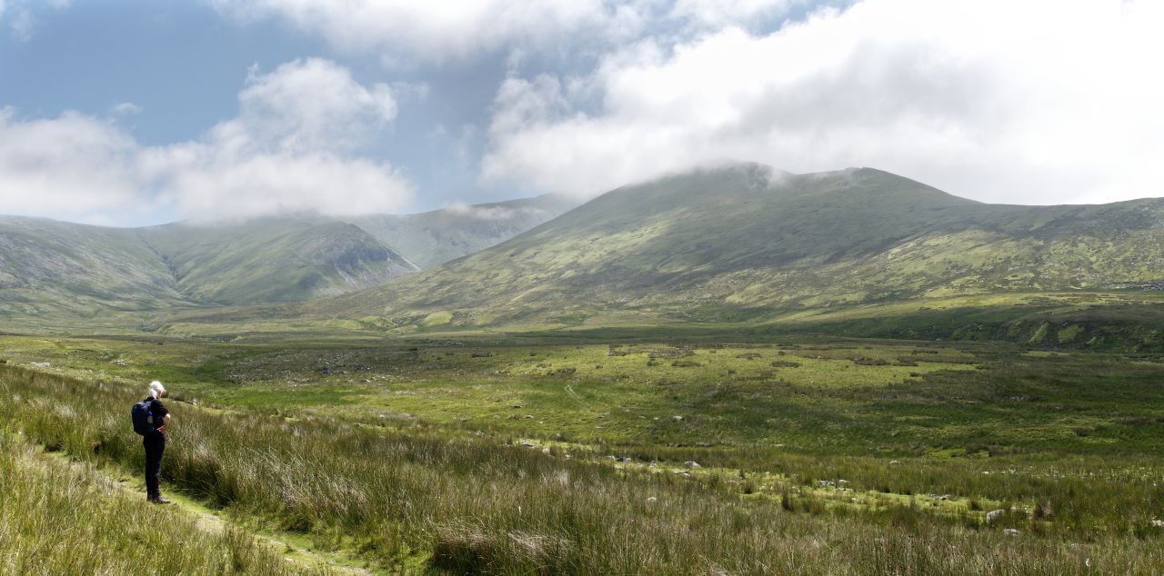
We set out heading east up the wide valley of the Afon Caseg, which translates as ‘the Mare’s River’. Clouds were covering the tops of the Carneddau, which didn’t seem to bother a small group of Carneddau ponies, who live on the mountains here all year round. The valley stays wide for about 5 kms, at which point it starts to narrow – by the time we reached the narrows, the cloud was almost burned off the hills by the warm sun.
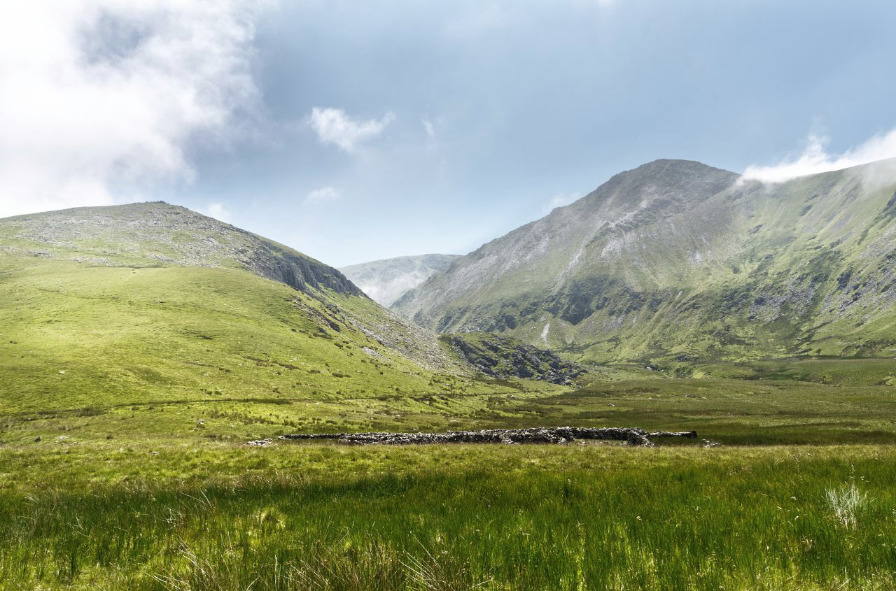
Looking up towards the Northeast Ridge of Yr Elen (the ‘Dragons Teeth Ridge’)Wet, mossy hollow by the Afon CasegThe entrance to the hanging valley of Cwm Caseg, our route over on the left, just to the right of the streamLooking down to the small lake of Ffynnon Caseg (The Mare’s Well)
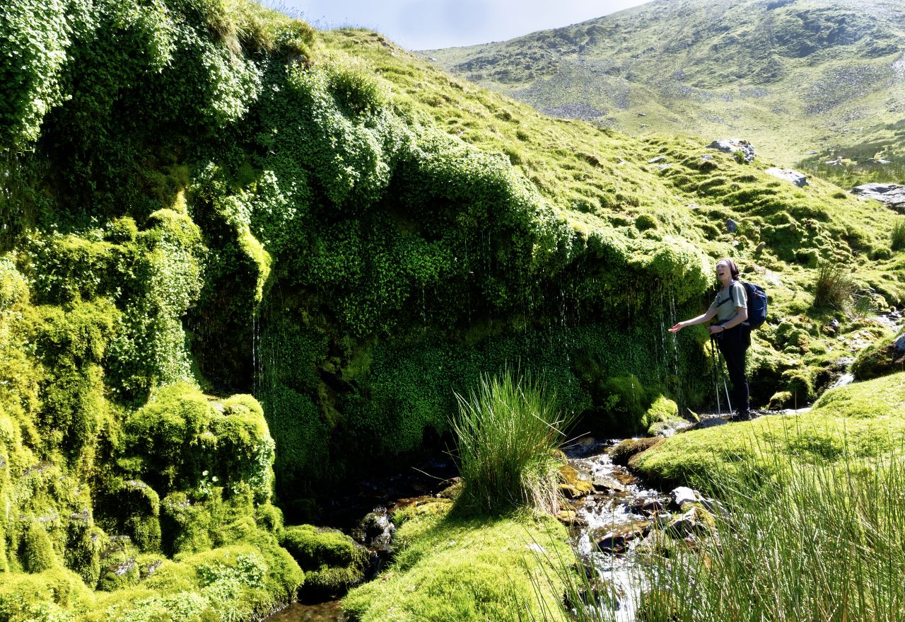
Our route was to the small hanging valley of Cwm Caseg, then up the Northeast Ridge of Yr Elen, also known as the Dragons Teeth Ridge, a route that I had followed before with Border Collie ‘Mist’ (see posts #159 and #186). On the way, we passed a wet, mossy hollow that I had not seen of previous visits, probably because this time I had taken a slightly easier line of ascent for Chris and for a Border Collie who is now officially an old girl – the upshot was that we arrived in the cwm above the tiny lake of Ffynnon Caseg (the Mare’s Well) instead of next to it.
What we missed on this trip – Ffynnon Caseg …. (as seen in 2015)…. and the small, ruined hafod (2015)Heading up the steep slope. Beware, dragons teeth ahead! (as seen in 2015)
It is said that Ffynnon Caseg is where Carneddau ponies go to give birth to their foals. It is one of the loneliest and quietest places in Wales, with the only sign of human activity being the ruins of a tiny hafod (summer dwelling). Above the lake, the slope heads steeply upwards to gain the crest of the Dragons Teeth Ridge – once on the crest of the ridge, the drop on the other side of the ridge suddenly becomes obvious.
‘…. the drop on the other side of the ridge suddenly becomes obvious’ – looking down to the valley we had walked upThere’s quite a drop below as well (image from 2014)More teeth to come (2014)
The ‘obvious drop’ was straight down to the valley we had walked up, and Chris was a less than happy bunny about the amount of fresh air below us – the views up and down the ridge were equally airy. Chris would normally have had my undivided attention on steep ground, but as mentioned earlier, we had an old, though enthusiastic, Border Collie along as well.
A younger Border Collie ‘Mist’, waiting for me to catch up on an earlier trip (2014)Higher up the ridge, but still waiting for the human (2014)
Collies are a bit like some humans, and ‘Mist’ isn’t ready to accept yet that she doesn’t have the physical strength of a young dog. That usually isn’t a problem – on difficult ground I now attach a long leash to her harness and stop her before she tries to climb awkward steps, followed by a shove up the bum to clear the obstacle. This is exactly what we did, then having got ‘Mist’ through the rocky section, I returned for my other ‘client’, who was waiting patiently below.
On the summit of Yr Elen, with Foel Grach (left) and Carnedd Llewelyn (right) beyond on the skylineTeam pic #1 – Chris, with Carnedd Llewelyn behindTeam Pic #2 – Rare shot of the author plus dogTeam Pic #3 – ‘Mist’ at the start of the descent route
Without too many dramas, we all regrouped and followed the last easy section of ridge to the summit, and there was time for ‘Team Pics’ in the sun before we prepared for the descent down to Gerlan.
Looking down towards Foel Ganol, with Gerlan and Bethesda in the valley below
The way down was steady and a complete contrast to the drama of the Dragons’ Teeth. A faint path crosses Foel Ganol (‘Bare Hill in the Middle’) and a lower un-named peak, before heading down to a crossing of the Afon Caseg to get back to the outward path. Stream crossings can have their moments, but the water level on this occasion was low. I spent a couple of minutes looking for an easy crossing point for ‘Mist’, and having done so I looked across the stream to see the old dog already across and grinning back at me – she has a few more miles in her yet!
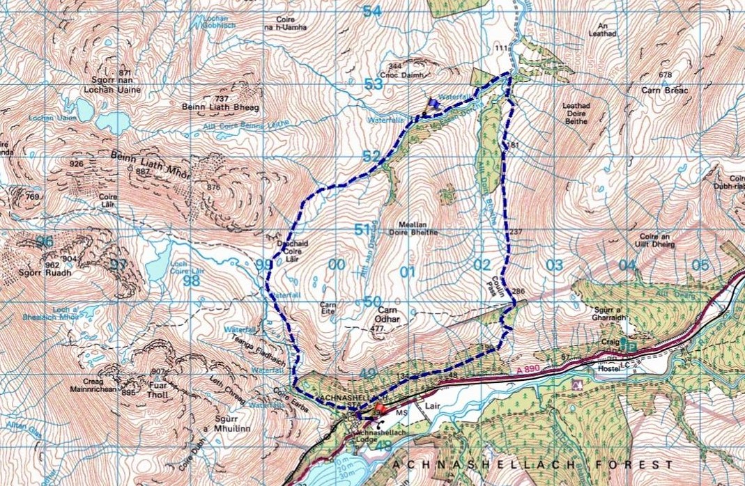
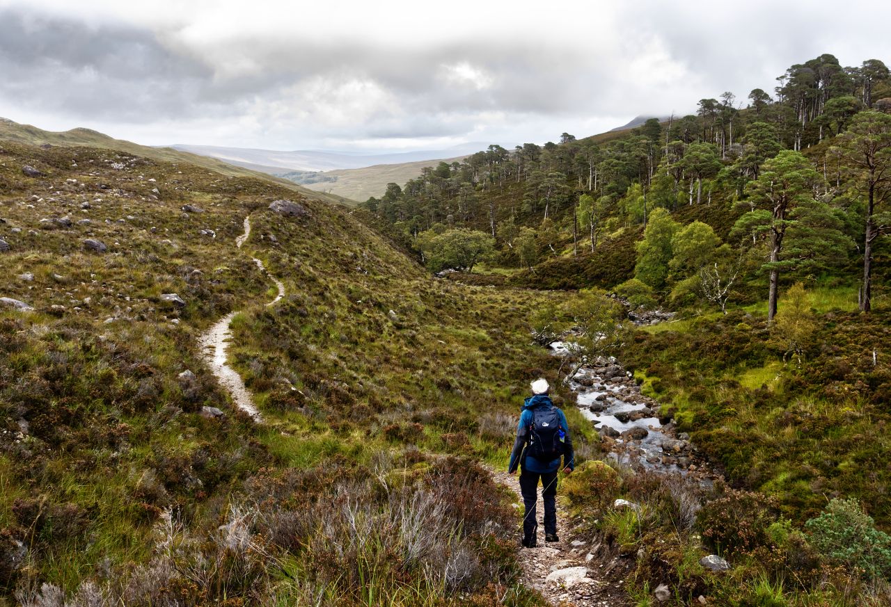
The path from Coire Lair to Easan Dorcha and the Tea House Bothy
For the best viewing experience, left-click the images and maps to zoom in to a new window, then exit that window to go back – go on, it really does work!
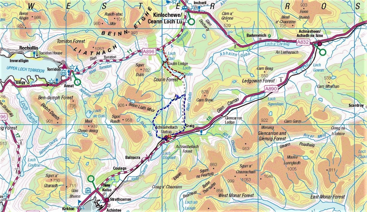
The Northwest Highlands showing the Easan Dorcha/Tea House Bothy route in the centre
If you have been following recent blog posts, you might be excused for thinking that the Scottish Highlands are a sun trap, and the myths about rain and wind are just that – myths. Well, sadly that isn’t always the case, but whether it’s rain or shine we still have a Border Collie wanting to get out for a walk. We usually manage to find something interesting though, even if it doesn’t always involve heading up a mountain.
The Tea House Bothy route (in blue) and the loch Coulin route from Glen Torridon (in red)
September is often a time of fine, settled weather in the Highlands, but in 2021 the middle of the month had a few rainy or blowy days. We were down in Wester Ross by now, which usually means a visit to Torridon – one of our standby low-level routes in Torridon is a circuit of Loch Coulin (shown in red on the map above) which although it doesn’t include heading up a mountain, it does pass through some interesting mountain country.
Map view showing the two routes, with the Tea House route in blue, Loch Coulin circuit in red
Looking at the map, it was obvious that the Loch Coulin circuit carries on over the Coulin Pass towards Glen Carron. A bit more research showed a bothy, that was easily accessible from the Glen Carron side – now, I’m a sucker for a bothy walk, and here was one off the beaten track in an area we don’t get to very often.
Closer view of the route – clockwise starting at the red flag, with the bothy at the blue flag
Over the past couple of years, I’ve started to add the occasional lower level walk to our mountain days. These often have the feel of being part of a journey, or sometimes even an exploration. The bothy route looked ideal for a day where the weather forecast wasn’t looking too good, and ‘Mist’ was happy to have a new area to sniff around. In addition, the bothy itself would be a dry spot for lunch if needed, so all the boxes were ticked.
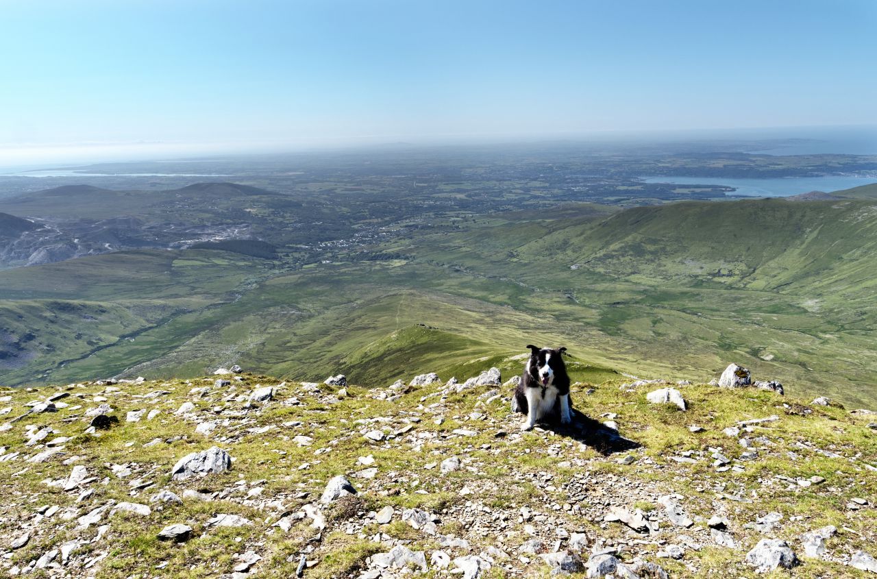
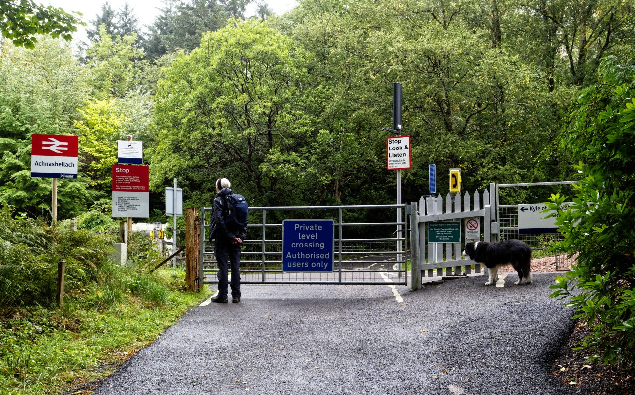
Achnashellach railway station in all its glory
A good map makes route planning a doddle. There was an obvious circular route starting out from the railway halt at Achnashellach – from there, a 15 km circular route wandered through mountain terrain. The 15kms fitted neatly into four sections – a stalkers path cllmbing gradually to Drochaid Coire Lair to start with, followed by an equally gradual descent to the bothy and the Easan Dorcha stream. The third section was a good track over the Coulin Pass followed by a steady descent through woodland back to Achnashellach to finish – we had a route.
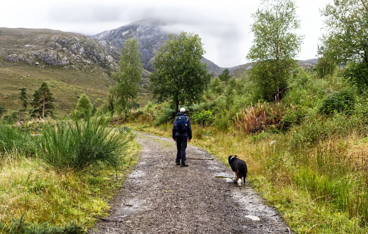
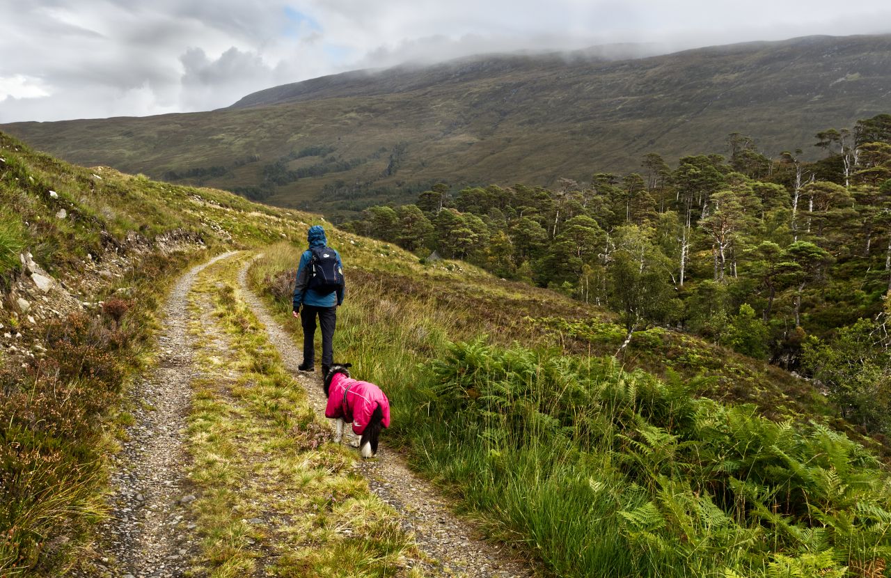
Setting out beyond the woods….…. with the 907 metre peak of Fuar Tholl above1 The stalkers path leading up towards the bealach (pass) of Drochaid Coire LairThe upper part of the stalkers path
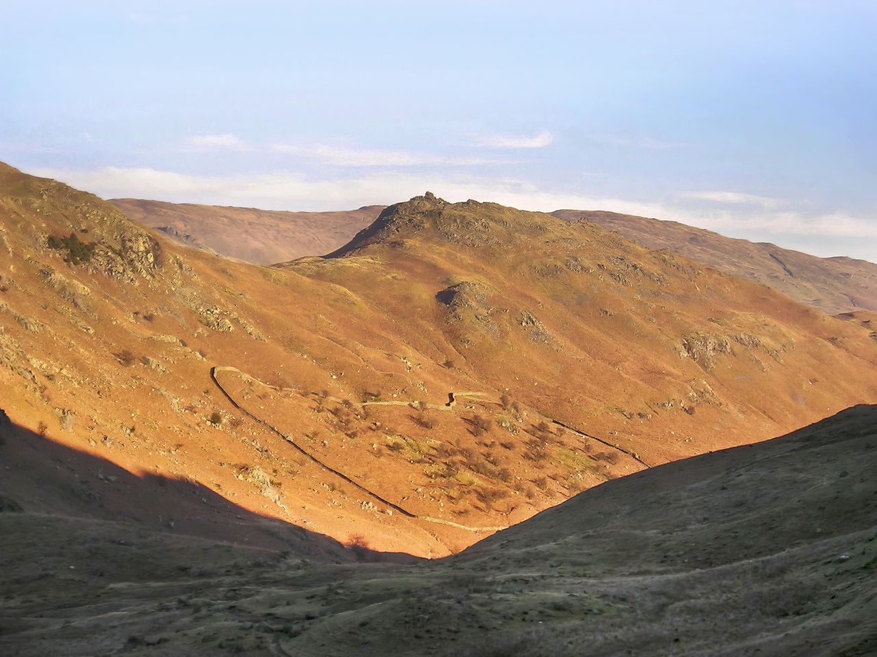
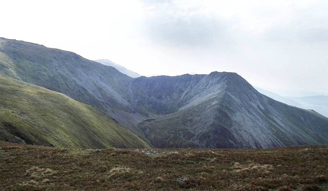
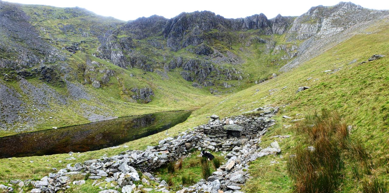
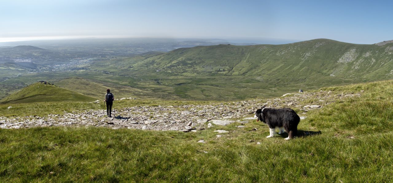
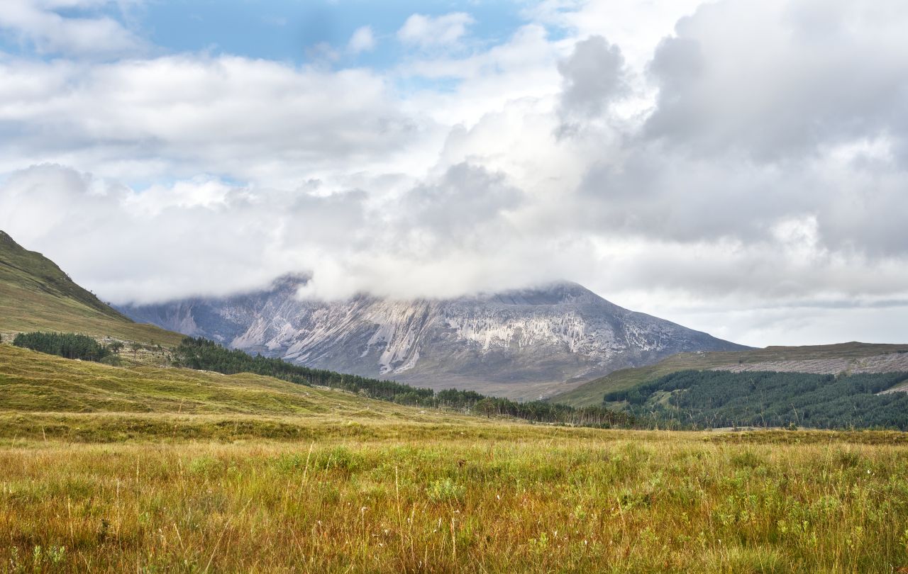
The railway station at Achnashellach is a bit on the pretentious side, with little more than a single platform, but it does give access to some magnificent mountain country. The path soon leaves the woods behind as it skirts below the 907 metre peak of Fuar Tholl. It then winds its way gradually upwards, in the easy way that stalkers paths usually do, before finally arriving at the bealach (pass) of Drochaid Coire Lair below the ridge of Beinn Liath Mhor.
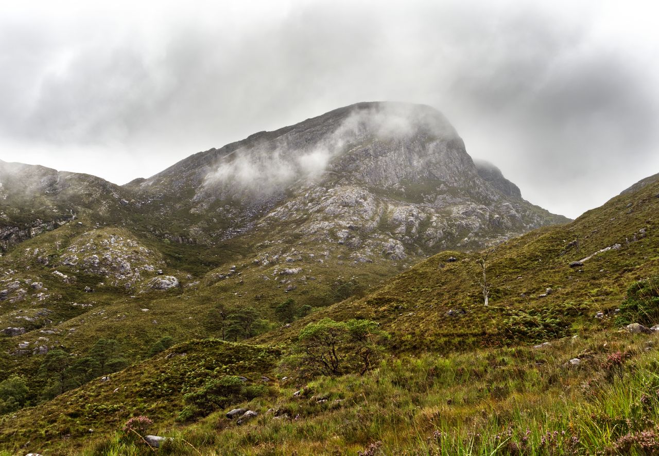
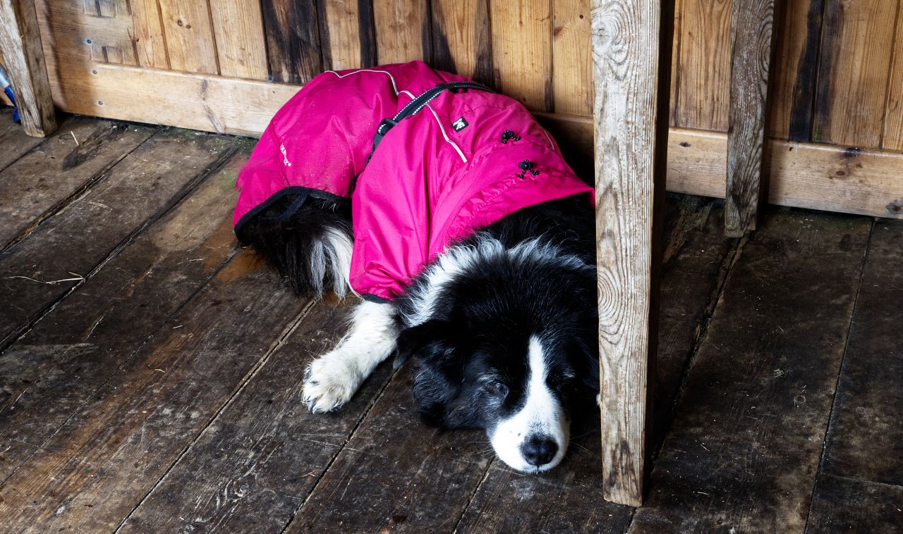
Our view of the Beinn Liath Mhor ridge was clouded out, hence the two images used above taken from the Geograph project – they reveal what looks like a classic Munro ascent, and I’m sure we will be back for that in better weather. Instead, we plodded on down the still excellent path towards the bothy, with waterproof tops eventually coming out of our packs. ‘Mist’ has her own smart dayglo pink jacket, more for our benefit than hers – collies have perfectly adequate fur coats, but once ‘Mist’ is wet, she is wet for the rest of the day!
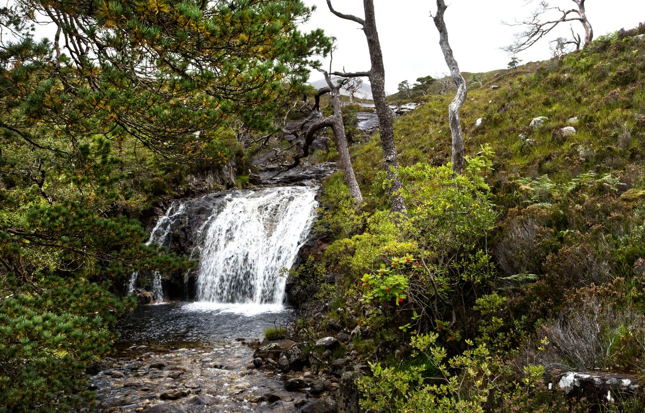
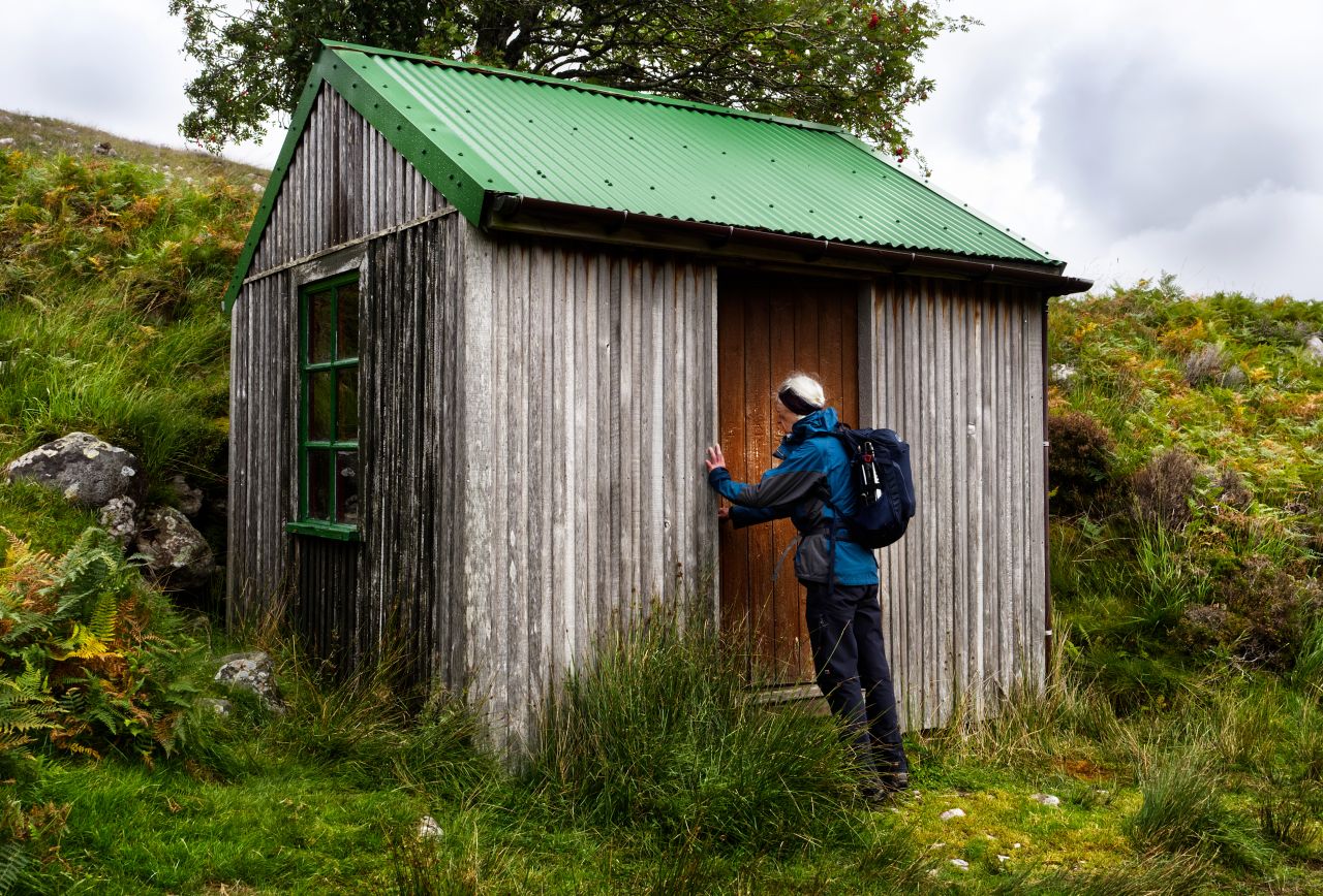
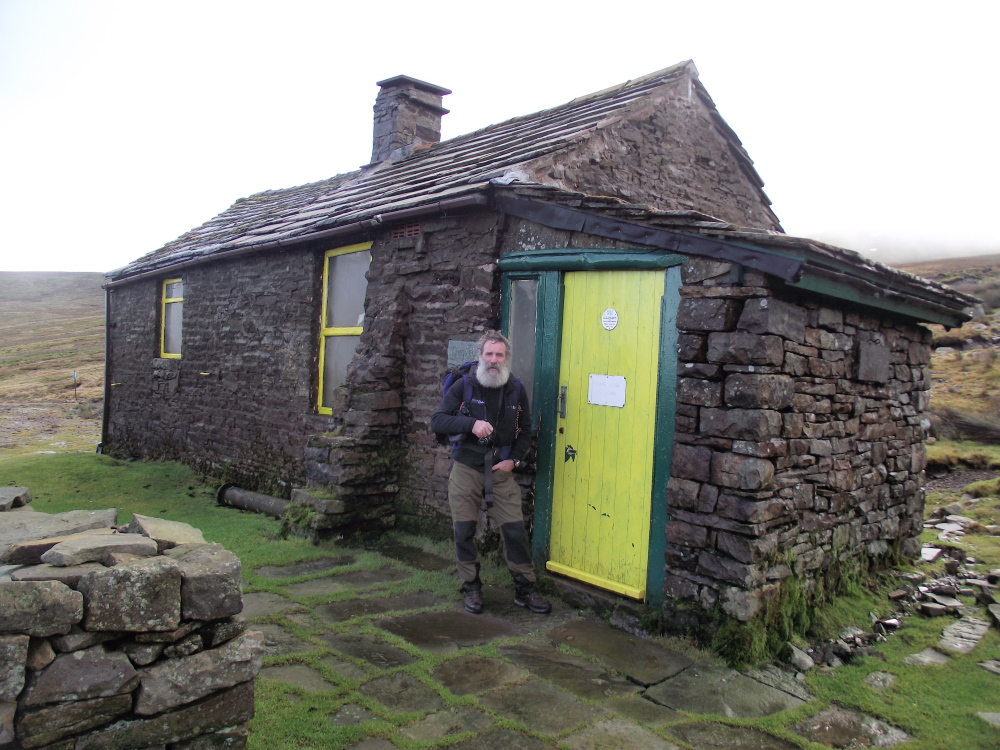
The Tea House Bothy finally comes into viewWaterfall near the bothy, on the Easan Geal streamThe bothy – a bit like a posh garden shed!Cosy enough inside ….…. in fact, cosy enough for Border Collie ‘Mist’ to have forty winks!
The route passes by native woodland before the bright green roof of the bothy comes into view. The two streams of Easan Dorcha (Dark Waterfall) and Easan Geal (Bright Waterfall) join just before reaching the bothy, which takes its Easan Dorcha name from the larger stream, though it is usually just known as ‘The Tea House’ – in reality, it’s a posh garden shed, though it could be used for sleeping at a push. Which is exactly what ‘Mist’ did, and she caught up on her beauty sleep whilst the humans had lunch in the dry.
Looking back towards the waterfall with Beinn Liath Mhor beyond, as we set off to return to Glen CarronOne last view of the Easan Geal stream joining the Easan Dorcha stream ….…. before heading down towards the River CoulinBeinn Eighe hiding in the cloud to the northOn the Loch Coulin route in May 2018, with Beinn Liath Mhor peeping out in the centre
After the bothy, there was a further descent of 1 km to meet the Coulin Pass track. Views of Beinn Liath Mhor peeping out of the mist were replaced by an old favourite, Beinn Eighe (see posts #230 and #246) before we hit the track leading uphill to the Coulin Pass – an old photo shown above from May 2018 shows the start point of this track at the head of Loch Coulin, and although I didn’t know it at the time, it also includes yet another view of Beinn Liath Mhor.
Heading up to the Coulin Pass in September 2021, the ridge of Beinn Liath Mhor left of centreRainbow above the head of Loch Coulin chasing us up the track as we head up to the Coulin Pass
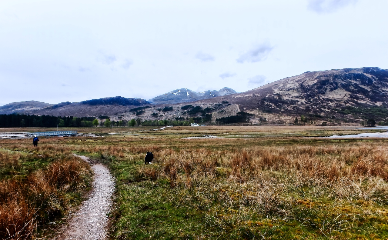
Beinn Liath Mhor continued to dominate the scene as we gradually gained height to the head of the pass, with a rainbow chasing us up the track. The height gain was gradual and civilised, and soon we were heading downhill on the final section of the route. Eventually, we reached the forest, and the scenery became boring endless green, but before that, we had a final panorama over Loch Dughaill in Glen Carron – it was time to head for home.
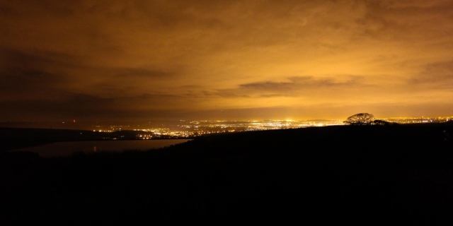
Two men and a dog ….…. and the highest noodle bar in the UK (JB)
At this time of the year (January), I’m usually sat in Greg’s Hut Bothy on Cross Fell, working on one of the safety teams for the Montane Spine Race. This year I’m not – along with human companion John Bamber, Border Collie ‘Mist’ has always accompanied me, but at fourteen years old she is getting a bit old for the Greg’s Hut malarky.
Being a Border Collie, she would have got there and back, whatever it cost her in discomfort and effort, but to struggle back after a big fall of snow as in previous years would have been too big an ask. Leaving her behind wasn’t an option either – I would have come home to one miserable dog!
So this year my Spine Race involvement has been watching the dots of the racers trackers. For the sake of nostalgia, I thought I would resurrect this post, previously published in 2013. I enjoyed reading it again, I hope you do
* * * * *
“Do you fancy a couple of days up at Greg’s Hut in January?”
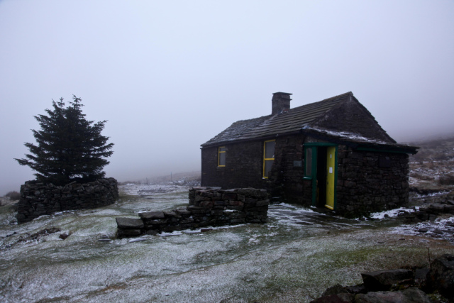
Greg’s Hut in January, altitude 700 metres – outlook bleak!
If anyone other than John Bamber had asked the question, I would probably have answered with a reply that included sex and travel! For those who don’t know it, Greg’s Hut is a bothy, high on the flanks of Cross Fell in the Pennines. At 700 metres altitude, it can be cold and cheerless in summer, so the prospect of staying there in a Pennine winter was not on my short list of ‘Fun Things To Do’. Why did I say, “Sounds like a good idea” ? … Ask the dog ….
Ask the dog ….Having fun in Snowdonia …. (JB)…. with the man with the beard
Never just an ordinary day out! (JB)
Mist – “I’m getting used to the boss and his daft schemes, but I know there’s something going on when his mate John (the bloke with the big beard) turns up. Don’t get me wrong, John is a lot of fun, and I’ve had some great hill days with him, but it’s never going to be just an ordinary day out. I suppose that’s why the boss said yes to the Greg’s Hut trip – those two are both as daft as each other! Mind you, when they said I could go as well, I was packed and ready before them!”
Setting out on the Greg’s Hut recce for the first Spine Race 2012
It was autumn 2011, and John had signed up as one of the Support Team for the first ‘Spine Race’ to be held in January 2012 – not having anything better to do, I said that I would join him. We decided that it might be a good idea to do a recce beforehand – I hadn’t been to the bothy in over twenty years, and John hadn’t seen it at all, so a check on luxuries such as a functioning roof seemed to be a good idea.
Greg’s Hut – roof intact!
Mist – “Haha … I still remember that walk! I always think that the boss carries too much when we are in the hills – a bag of dog biscuits is all you really need if you think about it – but John turned up with this stuff called ‘coal’ in his rucksack. It certainly looked heavy, and I was laughing all the way to the hut. Humans never cease to amaze me ….!”
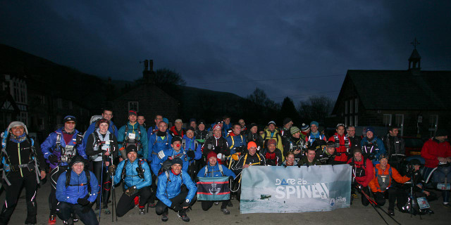
Spine Race start line 2012John sets up the highest Noodle Bar in the UKTwo happy customers – 2012 winners Gary Morrison and Steve Thompson
Yes, it’s true, John carried about 10 kilos of coal in on that trip. Just over a week later we were back again, with John setting up what was probably the highest ‘Coffee and Noodle’ bar in the UK – if it wasn’t the highest, it was certainly the most difficult to get to. We had four visitors out of sixteen original starters, with the Hall of Fame including joint 2012 winners Gary Morrison and Steve Thompson, followed later by Mark Caldwell and Andy Collister. Those guys had to work to get their noodles!
Having fun on the 2012 Training Weekend (JB)What the runners see on the training event – Rochdale by night (JB)
In November 2012, a training weekend was organised for those taking part in the 2013 race. There was quite a lot of interest for this (optional) event, and all who attended seemed to have a good time – well, that’s if your idea of a good time is running round 72 kms (45 miles) of Pennine hill and moor. At least it didn’t snow – we saved that up for the 2nd Spine Race in January 2013.
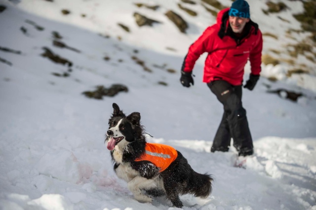
Spine Race start line 2013‘Mist’ search training (DH)
‘Mist’ and I were not at the start line for the 2013 event – we had a race of our own to run. Whilst 47 elite athletes were starting the race at Edale, ‘Mist’ was completing her obedience and stock safety tests to begin training as a search and rescue dog with SARDA (Search And Rescue Dog Association). The two of us made the grade and were accepted as a trainee search team, and on Sunday evening we set off from North Wales to catch the race up at CP 1.5 at Malham Tarn.
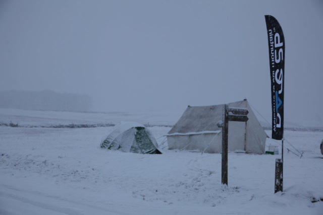
CP 1.5 at Malham Tarn (JB)Life in the big dog kennel (JB)
Mist – “Laugh!! I nearly wet meself! John (the one with the big beard, remember – pay attention at the back!) – John had brought this huge kennel along (I think he called it a tent, but I know what a kennel looks like – I AM a dog, after all). Anyway, it snowed all night, and I had a great time chasing snowballs around, but it didn’t look like a lot of fun in that kennel, what with loads of cold, wet humans in there. John was having fun, though”
2012 – backpacking the gear to Greg’s Hut2013 – travelling in style (JB)
Yet again, John showed the world that an extremely large dump of snow was not going to interrupt his new career of ‘extreme noodle chef’. Having sent all the happy customers on their way, we then set our sights on our old friend, Greg’s Hut. The previous year we had to backpack all our gear in, assisted by a group of porters who didn’t hide quickly enough when we went looking for help – this time we had a ride up the hill track in Phil’s 4X4.
‘Johnnie’s Noodle Bar’ open and ready for business (JB)
Mist – “Yes, that was quite a trip – just as well we had the help, ‘cos I didn’t fancy carrying in two days worth of dog biscuits! John must have had a brainstorm, ‘cos the week before he carried up twice as much of that black stuff (coal, isn’t it?!) to the hut – didn’t we all fall about laughing when we arrived and found that it had all gone!!”
Racers leaving Greg’s Hut …. (JB)…. with a long, cold run ahead (JB)
It’s true – over the space of a week, someone had either used or pinched 20 kilos of coal from one of the most deserted places south of the Scottish border. If they burned it in the stove, they must have inaugurated the highest sauna in the UK – if it was pinched, I hope they suffered a hundred bad backs carrying it away! A re-supply carried us through, and ‘Johnnie’s Noodle Bar’ was open for business once again.
A busy night at ‘Johnnie’s Noodle Bar’ (JB)
All good things have to come to an end though, and in less than two days the surviving athletes had passed through ‘Greg’s’ – time to hit the road again. After a day at Bellingham we set off for the finish line at Kirk Yetholm. However, there was a cloud on the horizon – in fact there were lots of clouds, accompanied by a storm warning from the Met Office. Our little corner of the UK was about to get a visit from Mr Snow!
Mist – “Snow? I should say so! Some of the time you couldn’t see your paw in front of your face!”
Just before the blizzard arrived (JB)Heading for the finish (JB)
People who say that they have been in a blizzard in the UK are usually mistaken – a heavy snow fall with a bit of wind ‘doth not a blizzard make’. However, having been in a couple of blizzards over the years, I can confirm that THIS was a blizzard! What’s more, we still had two teams out on the final ridge of the Cheviots. These are ‘little’ hills, around 500-700 metres in altitude, but sometimes latitude means as much as altitude, with the latitude of the Cheviots being about the same as that of Moscow.
Last group to finish, heads held high (JB)
The next day the storm had passed. The two groups had done exactly the right thing, and had gone to ground in two different mountain refuges on the ridge (the term ‘refuge’ is used loosely – think more along the lines of garden sheds). During the night Stu and Joe from the support team had gone up on the ridge for a welfare check, with John and I as backup, and found themselves looking out for their own welfare instead! The ‘garden sheds’ were life savers though, and the next day the two groups mustered themselves and walked off the ridge with heads held high.
The loneliness of the Pennines in winter (JB)
There’s a narrow line between adventure and misadventure, and these athletes know all about that – their performances are frequently heroic, often inspirational. They make the week of the Spine Race an event to look forward to each year, and being a member of the Spine ‘Mountain & Medic’ Support Team is very special to me – that and my part time job as sous chef at the highest noodle bar in the UK.
Mist – “Couldn’t have put it better meself – any noodles left, John?”
(JB – assisted by Naomi Dodds and Olivia Cheetham)
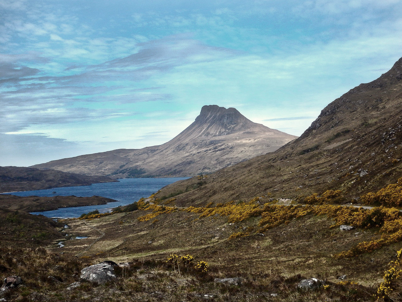
Stac Pollaidh as seen from the minor road into Coigach (May 2017)
For the best viewing experience, left-click the images and maps to zoom in to a new window, then exit that window to go back – go on, it really does work!
Some of the mountains of Assynt and Coigach – Cul Beag (L) and Stac Pollaidh (R) viewed from Cul Mor
Assynt and neighbouring Coigach make up one of the most remarkable landscapes in the Scottish Highlands. The mountains are like something out of a fairy tale – although not particularly high, they rise up steeply, straight out of the surrounding moorland, and are like nothing else in the UK. Add an equally amazing coastline with cliffs, sea stacks and hidden sandy beaches and you have just found the perfect destination for hiking and mountain walking.
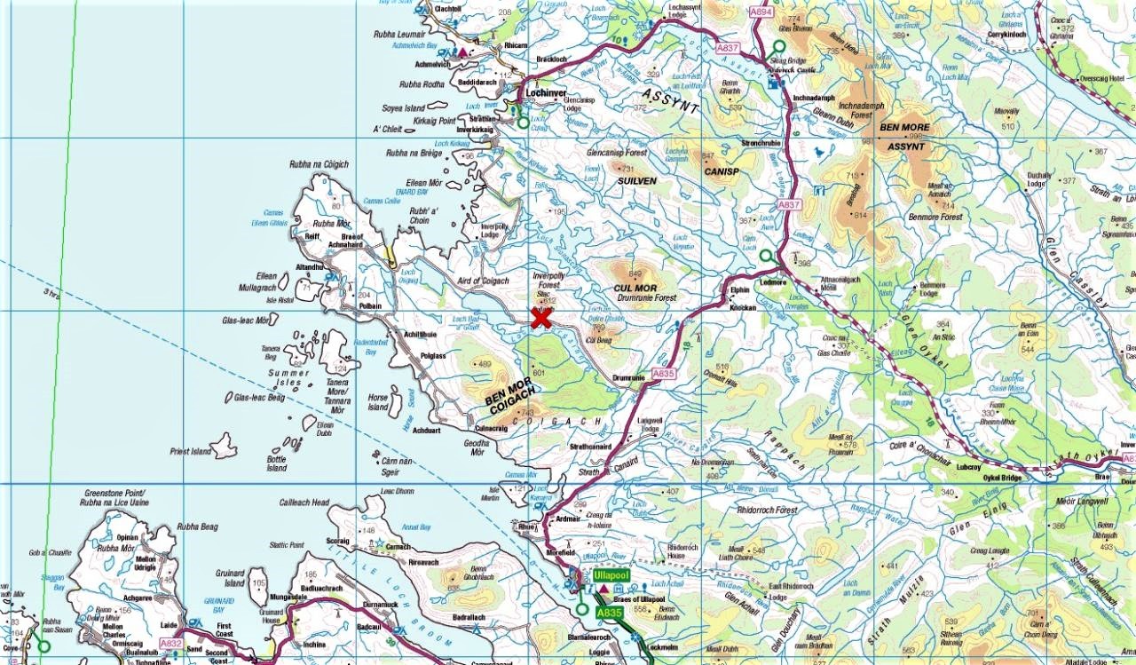
The Northern Highlands of Scotland showing Assynt-Coigach with Stac Pollaidh (red cross) in the centreCloser view of Assynt-Coigach
Stac Pollaidh is one of the iconic peaks of Assynt, which seems strange for such a small hill that only just scrapes in to be classed as a UK mountain, at a lowly altitude of 612 metres (2008 ft). Height isn’t the only criteria to become an iconic peak though – character counts for a lot, and Stac Pollaidh has character in buckets!
The Stac Pollaidh route, anti-clockwise from the car park (shown in greater detail below)
That character makes Stac Pollaidh one of the most recognisable and popular hills in the Highlands. There are two summits, connected by a rocky crest – the lower one (551 metres/1808 ft) on the eastern end of the ridge and easily accessible to hikers, with the higher 612 metre summit to the west and accessible only by a precarious scramble, making it one of the most inaccessible summits on the British mainland.
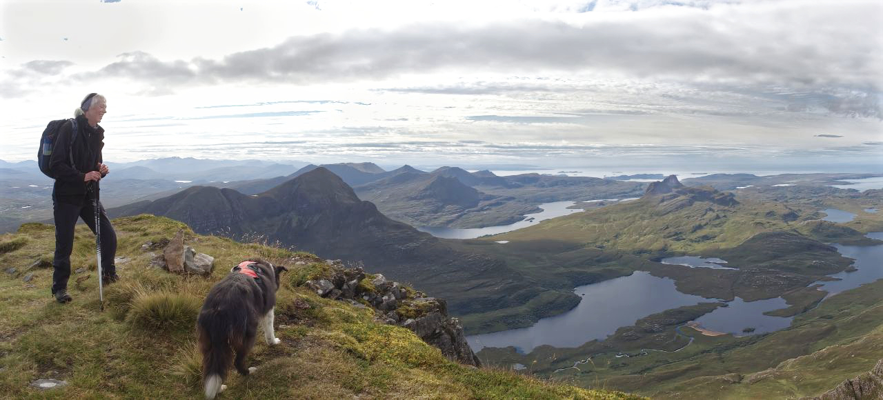
A murky, misty day ‘somewhere’ on Stac Pollaidh – May 2017Back again in September 2021, with the mist coming and going – nothing new there then!
We first came here in May 2017 (see post #229) but missed out on the ‘iconic peak with buckets of character’ thing – the summit was clouded over, and we ended up having a walk round the mountain instead. It remained on the ‘to do’ list though, and we were back again in September 2021 – low cloud and mist swirled over and round the jagged crest, but we decided to give it a go.
Setting out, with Loch Lurgainn and Sgorr Tuath (the nearer peak) behindLoch Lurgainn panoramaBelow the East shoulder of Stac PollaidhRound the corner now, with Cul Beag in the background ….…. and Suilven coming into view
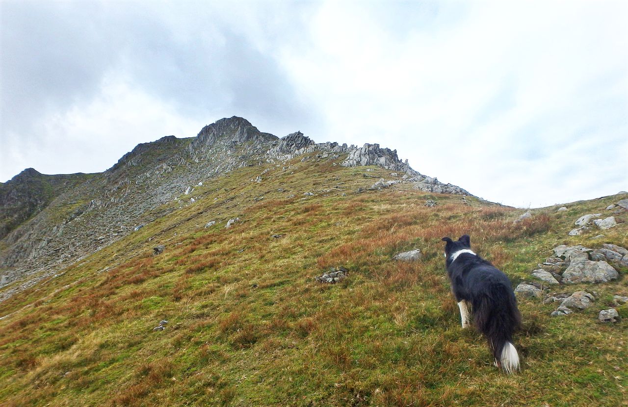
The surrounding peaks were cloud-free as we set out from Loch Lurgainn, with the sky overcast but with occasional breaks, allowing the sun through. The route doesn’t waste any time in gaining height and before long we were passing under the east shoulder of Stac Pollaidh, with Cul Beag now behind us and Suilven coming into view.
Close up of the route – the ‘normal’ route in red, our route in blueThe approach to the east summit, straight up to the gap in the centre and left of the fenceOur approach route with the gap and East Summit on the leftBorder Collie ‘Mist’ on the traverse pathChris on the traverse path, with a steep drop belowThe final rocks to the East Summit
The ‘normal’ approach to the East Summit takes a direct line up the steep hillside (shown in red on the map above). I had read that sections of this path were quite eroded, so we carried on heading round the hill until we reached another path that doubles back and traverses in at an easier angle (shown in blue). The diversion dropped us in nicely below the final rocks of the East Summit.
A rocky section on the final bit of ascent ….…. before the summit pops into view‘Mist’ on the summit, possibly checking for sandwich opportunities
From below, the final rocky section to the top looked as though it might be ‘a bit interesting’ for Chris, who doesn’t like big drops, but once started, it was quite easy, and the summit soon popped into view. As Border Collie ‘Mist’ gets older, I often clip a leash into her hill-harness for safety when on potentially hazardous ground, but the Collie was more interested in checking out sandwich scrounging opportunities.
The view down to the gap – the other paths heading to the left are rising towards the West summit‘Mist’ heading back along the traverse path ….…. with the dog leash finally off on safer groundChris back on the main path round Stac Pollaidh
The summit was a good a place as any for a food and coffee break. On the descent to the gap in the ridge, we could see the other route heading for the West Summit, but this was probably going to be a bit too exciting for Chris and ‘Mist’, so we followed the traverse route back to the main path.
Turning the corner round the western side of the mountain ….…. and passing below the West SummitThe dot spotted on the skyline ….…. which turned out to be one of the locals
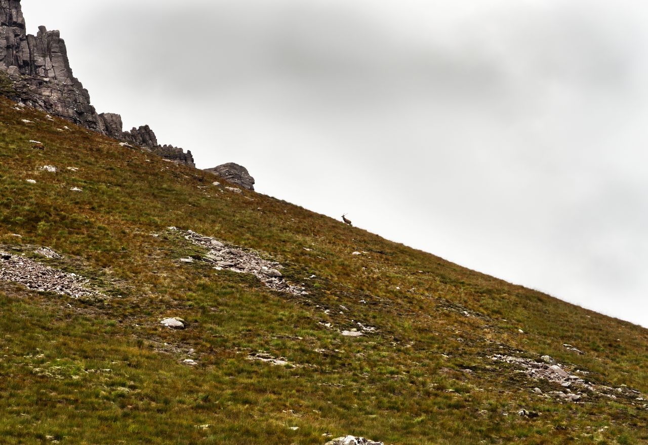
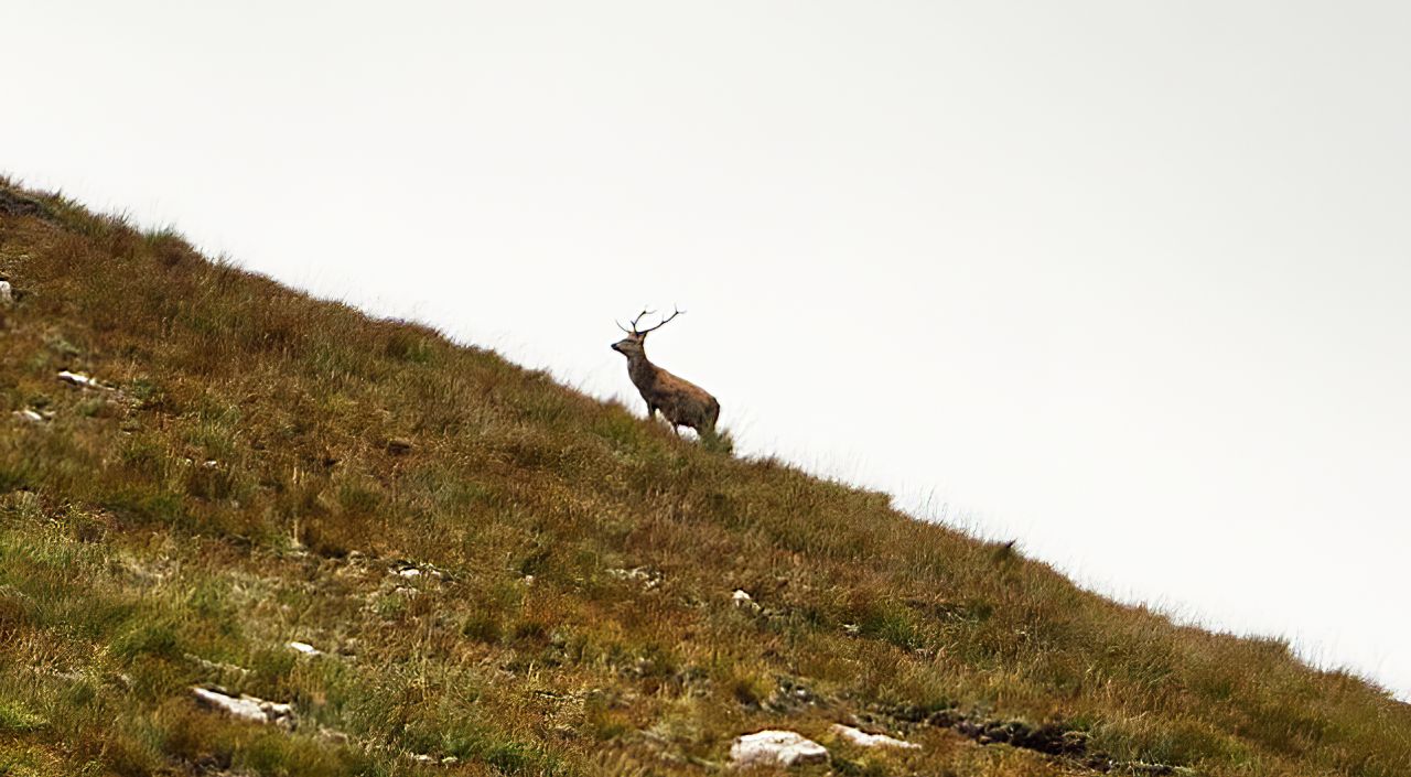
Back on familiar ground, we turned the corner round the western side of the mountain, before starting to lose height down to the car park. It always pays to stay alert, and on the skyline I could see a dot in the distance. It was a long way off, but I thought I could pick out antlers. It wasn’t until I downloaded the images later that I got a proper look – a young red deer stag.
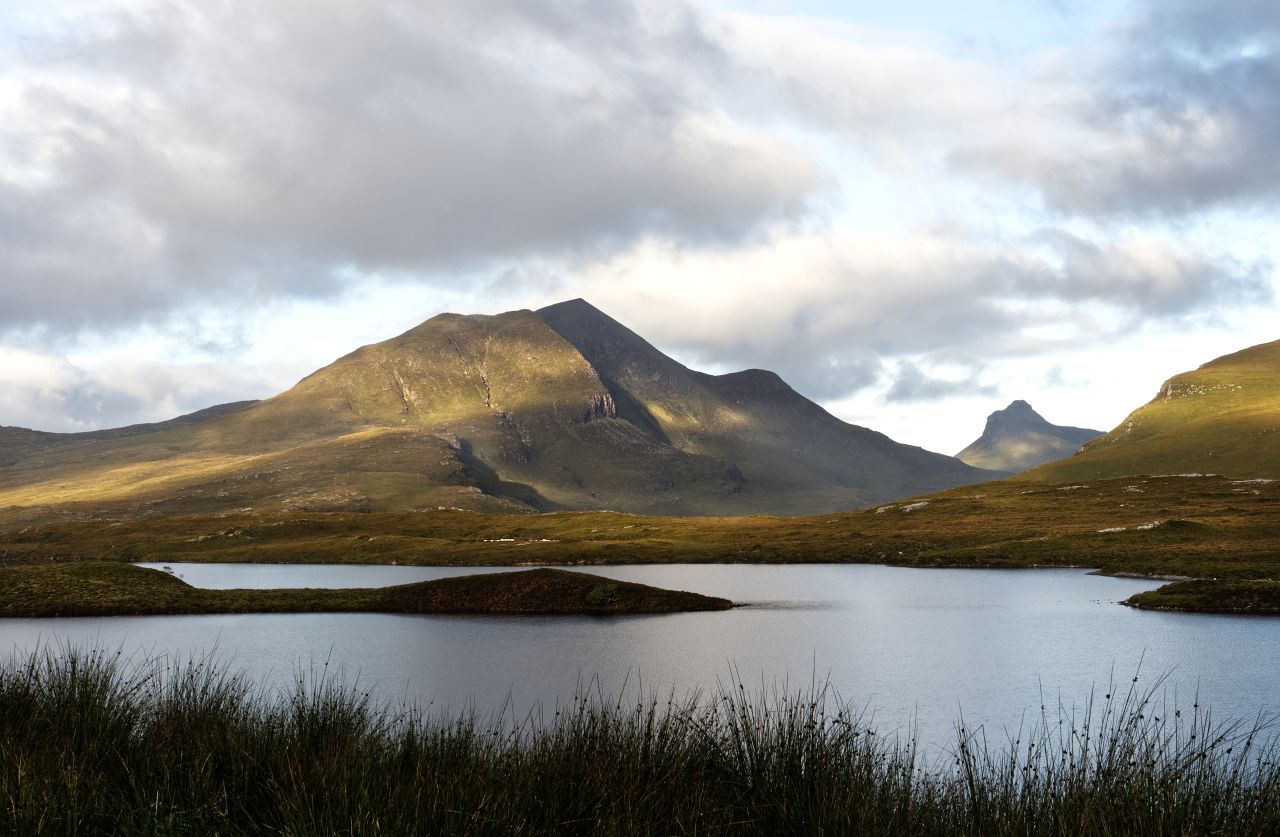
Stac Pollaidh in the distance, seen from Knockan Crag on the A835 (The nearer peak on the left is Cul Beag)
We parked up near Knockan Crag on the A835, and as the evening came on, we had a great view of Stac Pollaidh through the gap between Cul Beag and the lower hill of An Laogh – once again, the zoom lens was put to good use, giving a close-up view of the East Summit of Stac Pollaidh. It had been four years since our aborted misty trip, but the return had been well worthwhile.
Zoom view of Stac Pollaidh from the same Knockan Crag location
For the best viewing experience, left-click the images and maps to zoom in to a new window, then exit that window to go back – go on, it really does work!
The Scottish Highlands with Ben Lawers and the Southern Highlands in the centre of the map
The August 2021 Scottish trip had gone to plan – by sticking to the Southern Highlands and the Cairngorms we had mostly avoided the dreaded Highland midge, and had enjoyed some good hill days in great weather conditions (see posts #306, #307 and #308) We were due to head south at the end of the month to welcome a new grandchild and to get our second Covid vaccinations, but there was still time for an extra couple of hill days. Ben Lawers would do nicely!
Ben Lawers and the surrounding mountains, including our route
We had been in the Ben Lawers area in October in the previous year, but the weather hadn’t been kind and Meall nan Tarmachan had been a good consolation prize (see post #292). What’s more, Chris was starting to get the taste for bigger hills and longer days, so a trip up Beinn Ghlas and Ben Lawers fitted the bill nicely.
The route – outbound over Beinn Ghlas, return via Upper Coire Odhar
The two hills make a great day out if done together. The path leaves the car park and heads through a conservation project, where deer and sheep have been fenced out, allowing the native woodland to regenerate. Beyond the trees, the route gets much steeper and suddenly becomes real mountain walking.
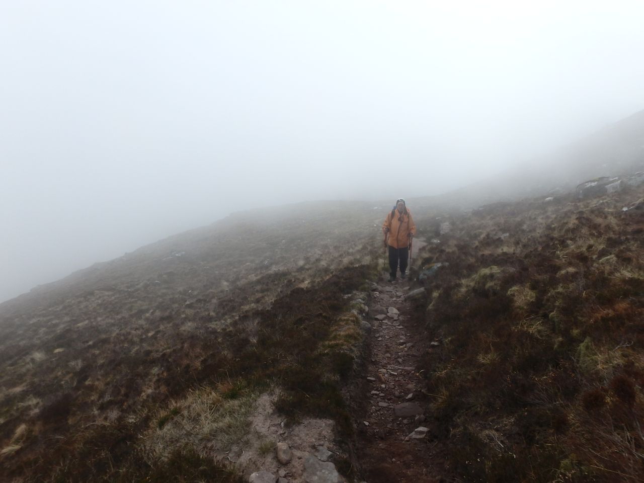
Setting out on a misty, moisty morningOutside the fenced conservation area, with the start of the broad ridge leading to Beinn GhlasLooking back to Coire Odhar with the trees of the fenced area just visible in the mistThe start of the height gain ….…. but still being chased by the mist
The start didn’t bode well. Our ascent through the conservation area was a misty, moisty walk that brought back memories of Meall nan Tarmachan the year before, but as we left the trees behind the mist started to lift. From there, it was a constant companion, drifting in and out as we gained height – it did give us constantly changing views though.
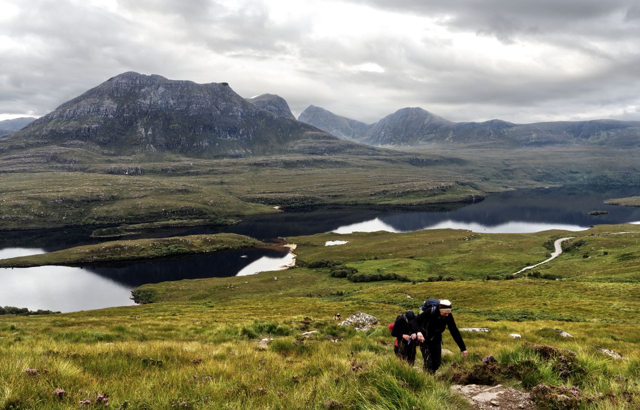
The start of the final section of ascent on Beinn GhlasThe view back to Meall nan Tarmachan, just left of centre (see post #292)Meall Corranaich – near, but we decided not to botherNearly there on our first summit – Beinn Ghlas summit ahead, just in the mistMeall nan Tarmachan with the mist cleared from the summitCloser view of Meall nan Tarmachan, with the small pointy summit of Meall Garbh more obviousThe final section to the summit of Beinn Ghlas
The constantly changing views included a distant Meall nan Tarmachan, and it’s true to say that we saw more of the hill from the slopes of Beinn Ghlas than we had when actually hiking up it ten months earlier. Longer views included the mountains over by Crianlarich to the west, while nearby we had Meall Corranaich as a companion. This was a contender for a third top, which could be collected more easily from our return route, with an additional 600 metres horizontal distance and 180 metres of ascent. (Spoiler alert – we didn’t!)
The view west from Beinn Ghlas ….…. with Ben Lawers ahead of us to the northeastLooking back to Beinn Ghlas ….…. and looking ahead again to Ben Lawers
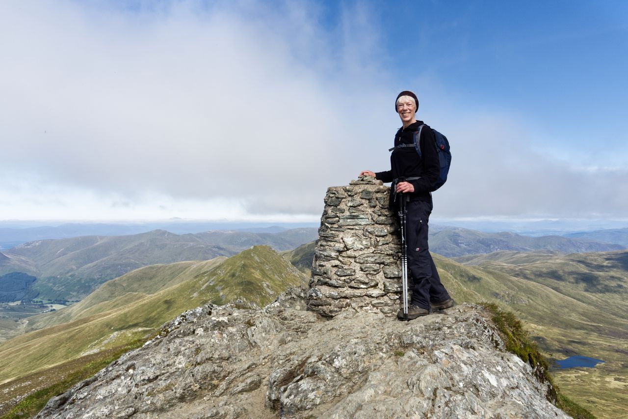
From the summit of Beinn Ghlas, we had our first real view of Ben Lawers, the star of the show. The height gain from the upper edge of the conservation area to the summit of Beinn Ghlas was almost 500 metres, on top of the initial 200 metres through the woodland from the car park. Beinn Ghlas is 1103 metres (3619 ft) in altitude, but we had to lose 100 metres down to a col before getting to grips with the 1214 metre (3983 ft) summit of Ben Lawers.
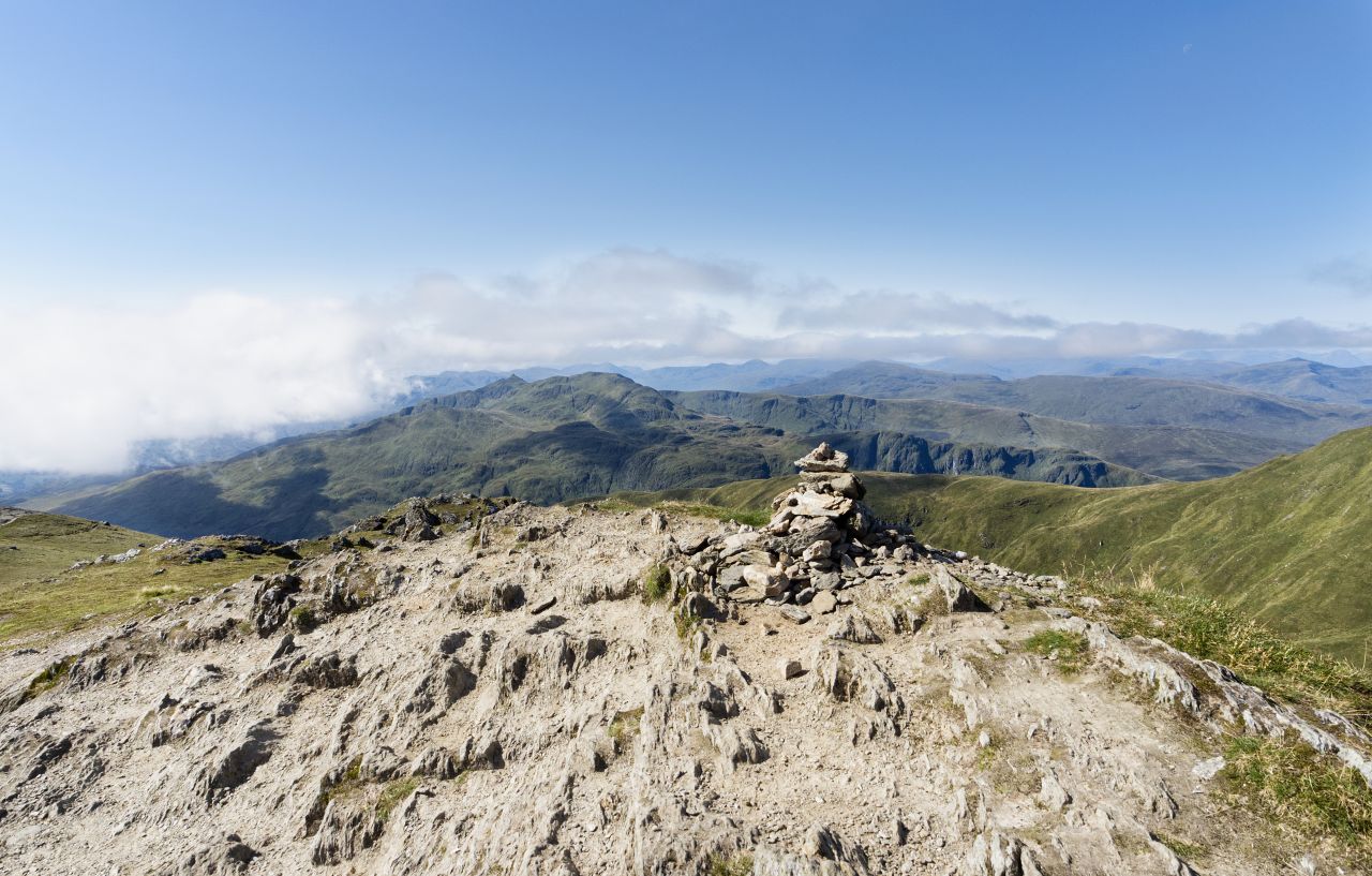
Almost at the summitThe last few metres, showing the survey triangulation columnThe view to the east, out to Loch TayThe summit cairn at 1214 metres altitude
The final 200 metres of ascent from the col below Ben Lawers wasn’t a big deal, just a steady plod being required. No mistaking the summit in this case, with a rather tatty survey triangulation column and a much more attractive summit cairn. Lawers is the tenth highest mountain in Scotland, but the fact that it misses being a 4000 ft mountain by just 27 ft does nothing to diminish its popularity.
The return route ….…. heading down to the col, with our return route to the right and Beinn Ghlas above
Having taken in the views, it was time to turn round and head back. We had a variation return route that avoided crossing Beinn Ghlas a second time by going round the mountain on its northern slopes. It was this route that gave the best approach to Meall Corranaich, but the day was drawing on and we decided that our two summits were enough for the day – it was time to head for home.


